After my trek on Kilimanjaro I had to attend the MobiSys conference in Singapore, so I sent my trekking gear westward with Ken while I headed east. While planning the trip I realized that Cambodia and the famous ruins of Angkor Wat were a short hop away, so I extended the trip with a quick visit there. What a contrast with Kilimanjaro and Tanzania – but what a great opportunity!
Author: dfkotz
David Kotz is an outdoor enthusiast, traveller, husband, and father of three.
He is also a Professor of Computer Science at Dartmouth College.
Kilimanjaro

With the rising of the equatorial sun, the undercast clouds climbed the slopes of Kilimanjaro and slowly enveloped us in an eery mist. We had begun our summit push about an hour before dawn, a line of bobbing headlamps weaving through the sleeping camp at Barafu, 15,200′ above sea level. Now, as we ascended past 17,000′, pole pole (slowly, slowly), I was beginning to really feel the altitude. Despite six days of acclimatization and hiking along the Lemosho Route, all five of us were quietly focused on each slow step along the steep and winding switchbacks up toward the rim of Kilimanjaro’s volcanic crater; step, breathe, step, breathe. A few trekkers were already descending – those who rose at midnight to make their entire summit push during the moonlit night, jubilant from reaching the summit – and those who looked quite pale and were gingerly being led down by a guide holding each elbow. The altitude affects everyone differently, and the sick have to descend quickly. We pushed on, hoping for clear skies at the summit and for weather good enough to stay overnight in the crater as planned.
But I get ahead of myself. This 11-day trip, including 9 days on the mountain, is a long story. As you read the trip description below, be sure to check out the photo galleries of the trek, of our two days pre-trek, of the flora and fauna, and of night skies on the mountain.
Cape Cod getaway
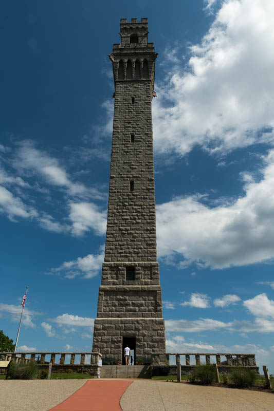
We spent our 25th wedding anniversary on Cape Cod, mostly in Provincetown. Beautiful weather, a nice bike ride, and a chance to explore the town. Plus a stop at the historic Marconi wireless telegraph station; see the photo gallery.
Franconia Ridge traverse
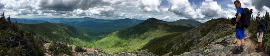
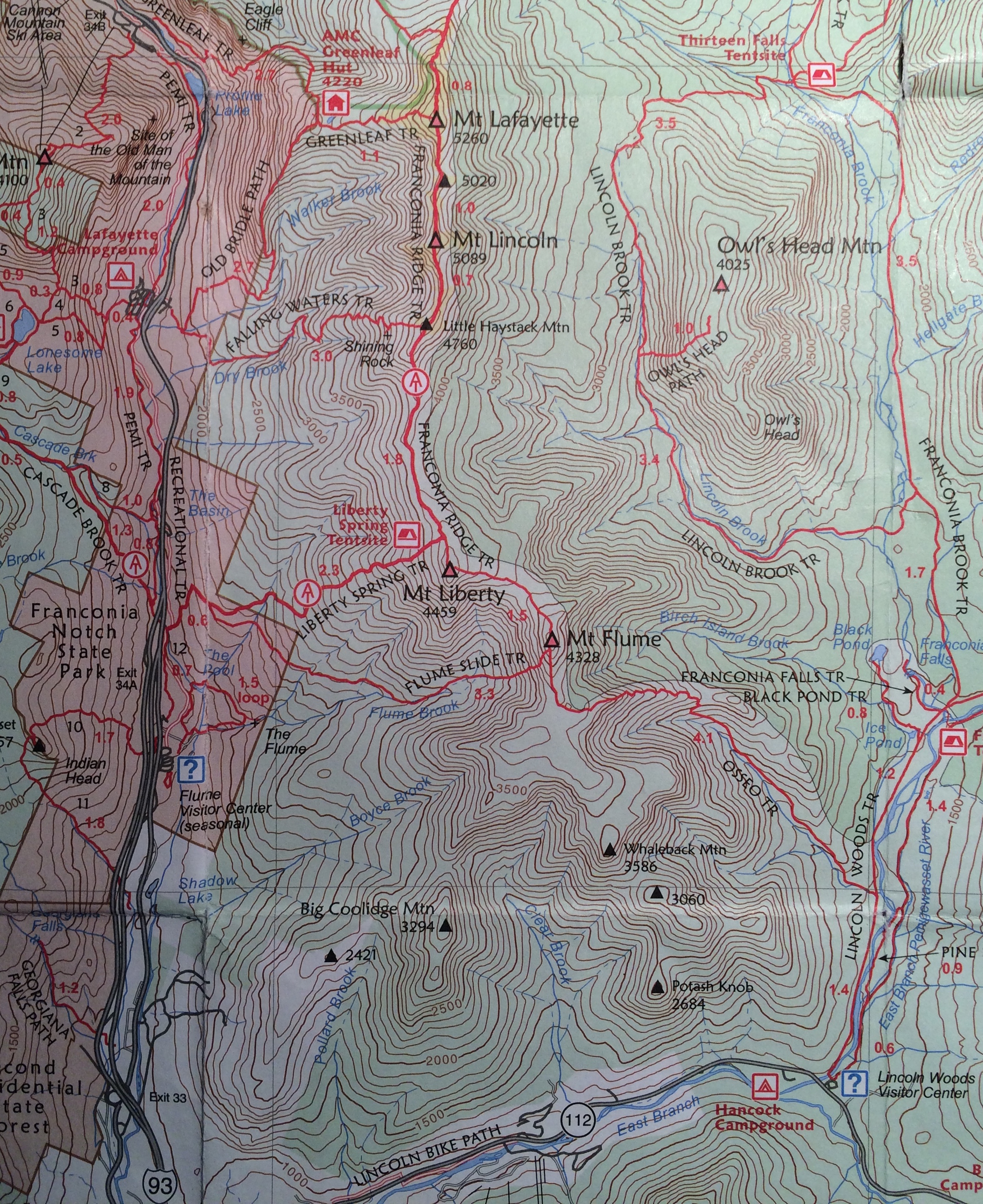 On a warm day in early June, I joined Aarathi and Shrirang for a traverse of Franconia Ridge from Lincoln Woods to Lafayette Place, summiting Flume, Liberty, Little Haystack, Lincoln, and Lafayette. Total 14.5 miles, 5325′ of vertical gain, 10.5 hours, 258 photos. A beautiful day! The alpine flowers were blooming, the sun was shining, and the wind was cool. The only downside is that several hundred other hikers also realized it was a great day to hike Franconia Ridge!
Check out the photo gallery on SmugMug.
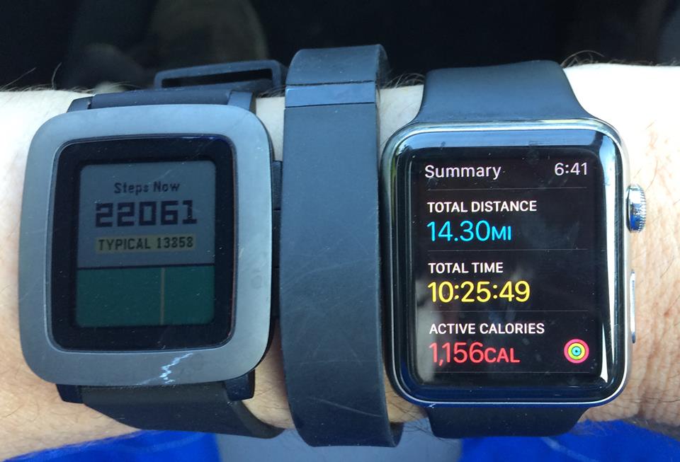
I also decided to test four activity trackers on this hike: iPhone 5s (i.e., Apple Health app), Fitbit Flex, Pebble Time, and Apple Watch 42mm.
Test conditions:
- I left all four devices in their charger overnight.
- As I left the house, I put all three trackers on my left arm.
- I did almost no walking until reaching the trailhead.
- At the trailhead, I put the iPhone in Airplane mode, enabled Bluetooth, and stored it in a shoulder-pad holster (thus attached to torso).
- All three trackers had Bluetooth enabled.
- At the end of the hike, I checked status of each device.
Results:
- Fitbit Flex: 30,572 steps, 14.04 miles, 3394 cals, 5h5m active; battery 100%.
- Pebble Time: 22,073 steps, 12.4 miles, 2233 cals, 3h35m active; battery 90%.
- Apple Watch 42mm: 32,449 steps, 14.30 miles, 1156 active cals, battery 7%.
- Apple Health (iPhone 5s): 32,354 steps, 14.71 miles, battery < 20%.
Summary:
Apple Health (via Watch? I’m not sure) counted more steps, but close to the Fitbit. Watch and Fitbit had the best distance estimate. Fitbit had best battery life, followed by Pebble.
Spring hiking
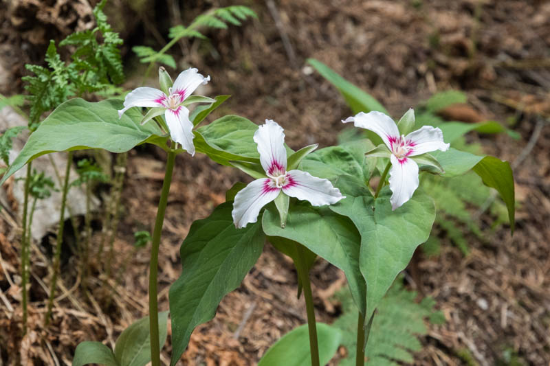
David took a series of springtime hikes – many with Ken and Karen – to train for a summer trek. He climbed Mount Cube, Mount Ascutney, Black Mountain, Moose Mountain, and Mount Moosilauke. Springtime flowers brought color to the otherwise drab forest at this time of year – check out the photo gallery.
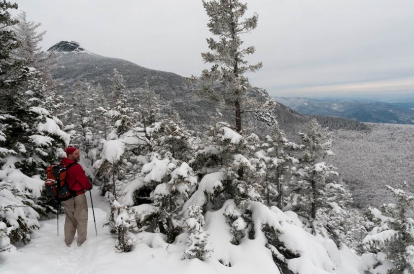
Mount Carr
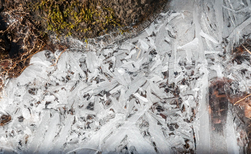
A lovely day for a hike up Mount Carr, an unassuming 3,400′ bump to the southeast of Mount Moosilauke. I had never visited this peak, so when a friend suggested we try it out I was ready to hit the trail. The lower slopes were bare of snow but it is, after all, still “winter” so none of the trees or undergrowth have started to leaf out. The overnight cold formed a skim of ice across all the puddles and many of the smaller streams, their fascinating patterns glinting in today’s bright sunshine. (See photos!) The upper slopes held a crusty but shallow snowpack, and rippled ice floes.
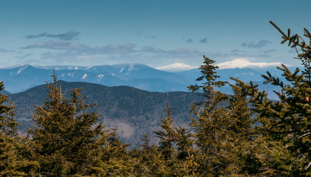
At the rocky summit we could climb on the footings of the long-since-removed fire tower and see the white-capped Mount Moosilauke, Franconia Range, and Presidential Range. I hope to return to the neighborhood and explore the other peaks in the Wentworth-Rumney area!
Mount Mansfield
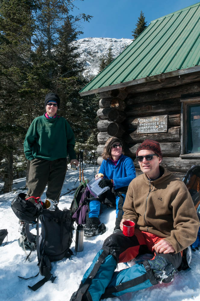
Over the past week I was beginning to think that winter was a bust – with just a handful of great winter outings to show for it. Today proved me wrong. With Mount Mansfield as our goal, Lelia and I set out for Stowe, Vermont and soon met up with Jen and Lars. The parking lot was nearly full of hikers, backcountry skiers, ice climbers, and others eyeing the pure-blue sky and crisp views of the snowy peaks. Heading south on the Long Trail, we climbed steeply up a well-packed treadway smoothed by several groups of skiers skinning their way up ahead of us, and criss-crossed by the carved turns of skiers and snowboarders who left the groomed trails of Stowe for the hardwood glades of the Long Trail. The snow was fairly fresh, with perhaps six inches of powder on top of a firm but not icy base. We reached Taft Lodge for lunch, basking in the startlingly warm March sunshine with a group of three younger skiers, another group of four older Quebecois, all sharing the happiness that comes from bright sunshine, blue skies, soft powder, and fresh air. More below the break.
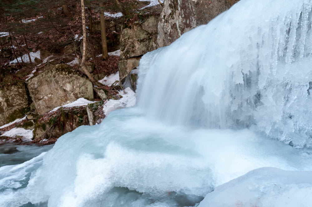
Ascutney and Gerry Falls
This winter has, so far, been pretty much a bust. Virtually no snowfall, with plenty of warm weather and rain to ensure that the little snow doesn’t stick around. I decided to head for one our closest big-mountain neighbors, Mount Ascutney, an hour down the Connecticut River, because the trail passes some nice waterfalls. If there’s no snow, at least there will be ice. I spent about an hour at the falls, enjoying the indirect lighting as the rising sun illuminated the open woods to one side of the stream. One nice feature of an icy stream, I discovered, is that you can stand on the ice in mid-stream and explore many angles you might find to be too wet in summer. Got some nice photos! More to say below.
Sandstone Peak
I was in LA for business all week, in a high-rise office with a great view of the distant mountains. I stayed an extra day and headed out through the Simi Valley to the Santa Monica mountains to hike Sandstone Peak. A thoroughly enjoyable 6.5-mile loop, open to views most of the way! The views to the south passed over the foothills and into the Pacific Ocean, so I drove the winding road down from the trailhead, came around a bend, and ended right at the beachfront! Drove back along the coast through Malibu. A great day for a hike and drive through pretty countryside! Check out the photos.

Camel’s Hump
I was itching to get above treeline this weekend, to enjoy the fresh snow the hills received this week and, hopefully, some long-range views. I recruited an old friend and we headed for Camel’s Hump in Vermont. David spent two summers working there as a ranger, and yet had not been back to this impressive peak and its myriad trails in over 20 years.
We were the first to arrive at the Couching Lion parking area on the east side of the mountain, and planned an 8.4-mile loop (up the Dean Trail, along the Long Trail following the ridgeline, and down the Monroe Trail). We made first tracks through several inches of fresh powder on the Dean Trail and Long Trail, enjoying vast views of the Adirondacks and glimpses of Moosilauke and Washington in New Hampshire. We saw nobody else until we hit the summit cone, where we met two hikers and their chilly dog. On the way down, though, we encounters dozens of hikers who had come up Burrows or Monroe trail, and had an easy glide down that latter trail. Check out the photo gallery.
Needless to say, when one is woofed from a big hike, and passing within 5 miles of the Ben & Jerry’s factory, one just has to stop in for some ice cream. Indeed, I think there is an obscure code in Vermont State Law to that effect.
Thanks, David, for a fine outing!