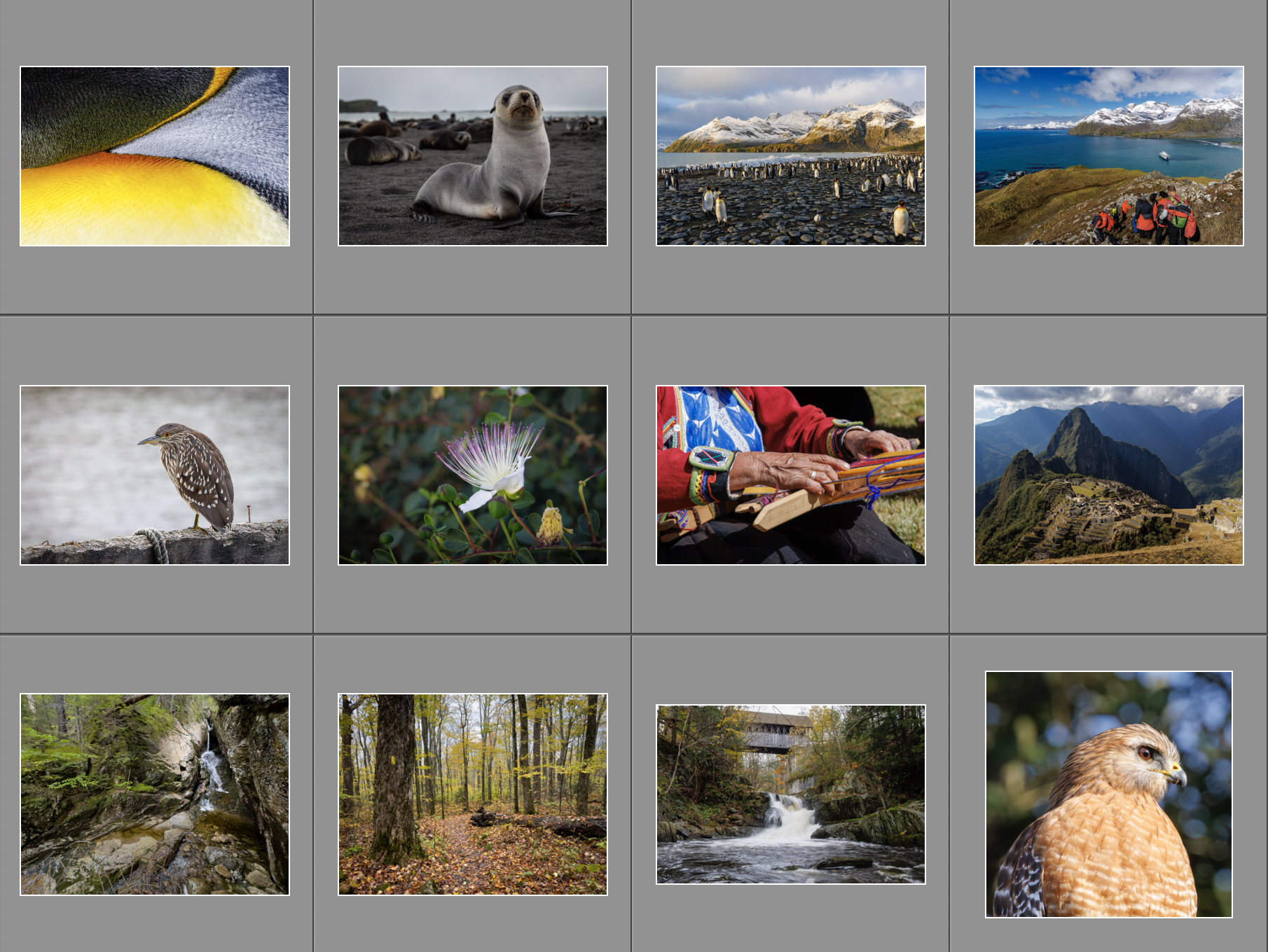
I enjoyed photography in 2023 and decided to share my pick of favorites. It was not easy! 12 photos for 12 months – not one per month, but just the twelve that I felt were especially beautiful or interesting. See the full gallery – where I recommend clicking the “play” button to see them as a slideshow – and read on for some commentary about each one.
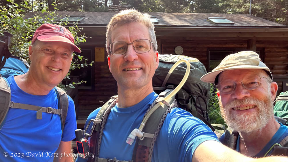
An abbreviated but beautiful overnight hiking trip.
We had planned this outing for months, and I was jealously guarding these dates on my calendar. Alex and Jeff and I were determined to make a four-day, three-night backpacking trip in the White Mountain National Forest (WMNF), here in New Hampshire. The weather had other plans, with heavy rain and strong thunderstorms in the forecast. We squeezed our trip into two days, and it all turned out well; read on!
Well, that about wraps it up folks. I’ve just finished blogging about our February-March trip to South Georgia Island and the Falkland Islands. (It’s now mid-June, and I’ve been backdating the posts to keep them in chronological sequence with the trip.) If you’ve landed on this post and want to read the whole story in order, start here.
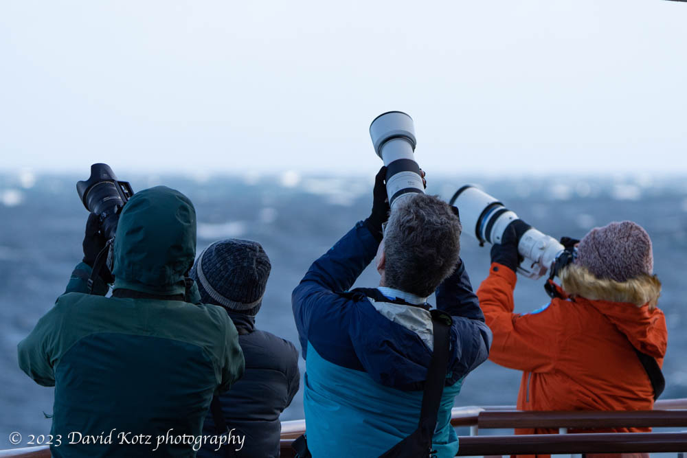
Jack and David (at center) trying to photograph seabirds.
During the trip I snapped over 10,000 photos and videos. I kept about 2,900, and posted about 400 in the galleries associated with this blog. Four percent – not bad. But I have one final gallery for you: my 40 favorite photographs. Enjoy!
Walking in the footsteps of Shackleton’s famous walk to survival.
I’ve been enthralled by the story of explorer Ernest Shackleton and his ill-fated expedition to Antarctica ever since I read the incredible story in the book Endurance: Shackleton’s Incredible Voyage by Alfred Lansing. You can imagine, then, how exciting it was for me to be able to walk in his footsteps on the final leg of his incredible trek for survival in 1916. Read on!
A hike from Maiviken to Grytviken, and a toast to Shackleton!
Before breakfast on the misty morning of 7 March, I was among a hardy group that was shuttled via Zodiac to the shore in Maiviken, a small bay in the center of South Georgia’s eastern coastline. We sloshed our way up through the soggy hillside to the rocky height of land on the Thatcher peninsula, and down into the storied whaling village of Grytviken. This tiny settlement encapsulates, in a few small acres, every important aspect of South Georgia human history – sealers, whalers, explorers, soldiers, governors, researchers, and even tourists. Read on and check out the gallery!
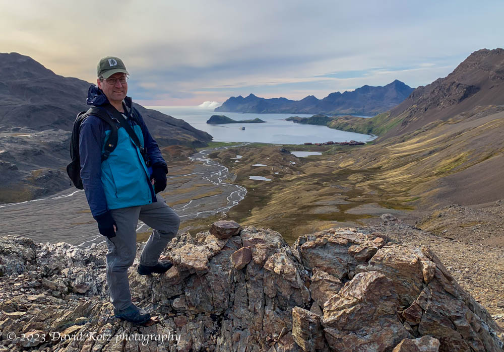
A sunrise visit shows why Gold Harbour got its name.
It was 4:30am on 6 March as a hardy group of guests quietly stopped by the top-deck café, looking for coffee, tea, and pastries. The Endurance was resting calmly in the middle of Gold Harbour, so named by the early sealers because the morning’s first rays of sun tend to paint the surrounding cliffs with a golden glow. The weather was calm but a bit misty; nonetheless we soon climbed down to the bottom deck to don our waterproofs and were launching the Zodiacs by 5:30 as the horizon behind us hinted at the coming day. Each Zodiac had a lighted pillar to aid the ship in tracking us in the morning gloom; the penguins on shore seemed nonplussed by this early wake-up call.
Landing in Gold Harbour, South Georgia.
The mist later rose, leading to a spectacular morning on the beaches of Gold Harbour; after a return to the ship for a hearty breakfast, we made a second trip on which I joined a group for a hike up to the headlands – and sweeping views of the harbour, its glaciers, and tens of thousands of penguins.
King penguins – Gold Harbour, South Georgia.
Read on, and be sure to check out the two galleries of photos and videos: sunrise and hike.
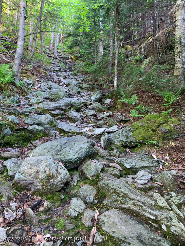
Rugged trail, straight up the fall line, on Worcester Mountain.
“It sure does look different in the winter”, said the hiker I met on this trail back in January. He had lost the trail just a couple hundred meters shy of the summit of Worcester Mountain, despite having climbed this trail “dozens” of times. After thanking him for his advice, I pressed on and experienced the most exhilarating hike of the season [read that story].
So today, a warm and muggy day in early June with the trees and shrubs almost fully leafed out for summer, and nary a snowflake left anywhere in New England, I decided to head back and see if Worcester Mountain really is “different in summer”. I got an early start, reaching the trailhead by 7:30am, but there were already three cars in the lot. Read on, to see what I found!
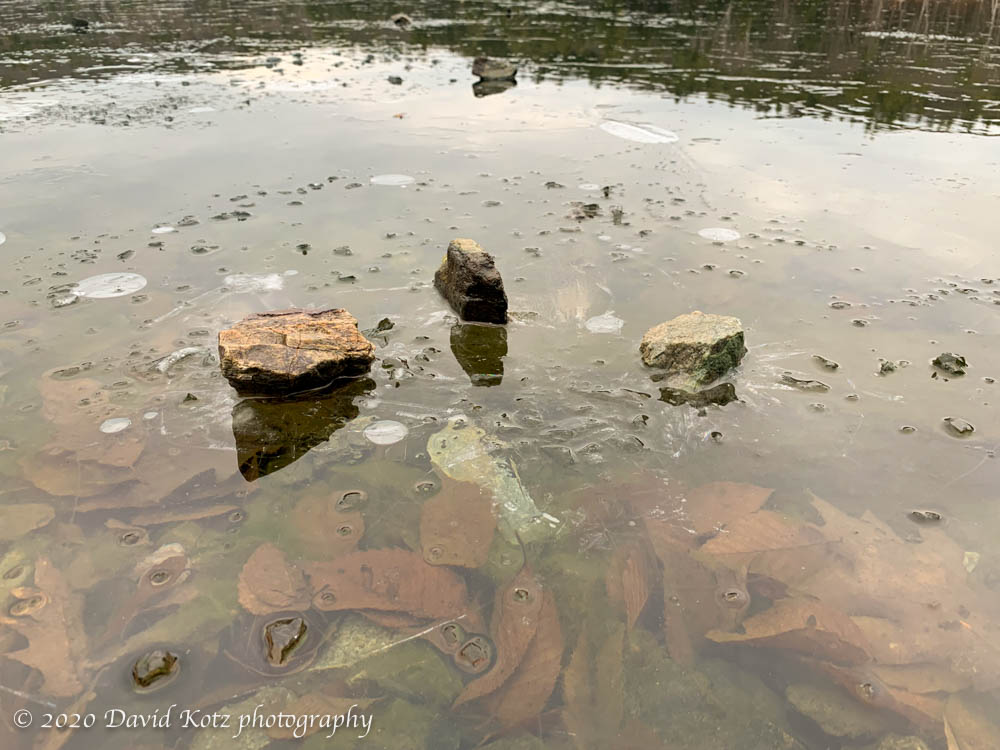
One of the upsides of the current situation is that I’ve tended to look closer to home for outdoor opportunities, and that means I’m returning to some of the local gems I’ve not visited in a decade or more. Yesterday I took a walk around Boston Lot Lake, a small pond in West Lebanon not far from the river at Wilder Dam. Its network of walking and biking trails are popular with local runners and bikers, even on this gray Saturday morning.
Ice and reflections on Boston Lot Lake, NH.
The lake was skimmed with ice., though the temperatures were beginning to rise above freezing, so it would not last long.
Ice and reflections on Boston Lot Lake, NH.
In one spot, some kids had been clearly been tossing rocks at the ice – some of which went through, and some of which were trapped in the ice.
Mount Allen is another one of those remote, viewless summits that people really only climb because it’s on the 46er list of Adirondack peaks over 4,000′. It’s an 18-mile round-trip day-hike climb from the trailhead, so I decided to break up the hiking (and the driving) over two days. I drove over on Friday afternoon and headed into the woods around 4:30pm, planning to follow the marked trail to the point where the herd path begins, then a bit further to where the map shows it crosses a brook and where I hoped I might find a spot to camp. I queried the outbound hikers for clues about where they may have seen campsites along the way, and got a few tips. I reached my intended location only to find that a pair of other hikers had had the same idea and were camped in exactly that spot.
I’ve been hiking in the Adirondacks for well over forty years – or so I like to think. Actually, I can count on one hand the number of Adirondack peaks I have summited in the past quarter century – all but one of which are small viewpoints outside the classic canon of the ADK 46, the elite group of peaks over four-thousand feet in elevation. (A historical curiosity, three of the peaks on the list of 46 have since been re-surveyed and found to be shy of 4000′ elevation, but remain on the list for ol’ times sake.) I spent the summers of the 1970s hiking these peaks with my family, and the winters of the 1980s exploring the snowy backcountry with my high-school and college buddies. My last backpacking trip here was in 1990. Recently, I found myself drawn back to these ancient peaks – for they are far older than the Appalachians, and reside deeper in my own past – with an eye toward notching off the final dozen peaks on my own list of 46. I set aside three days on my calendar and struck out at dawn on Friday, with three specific summits in mind, and was rewarded with breathtaking scenery, fond memories of trips long past, a rekindled appreciation for this beautiful wilderness, and lovely photos. More after the break.