
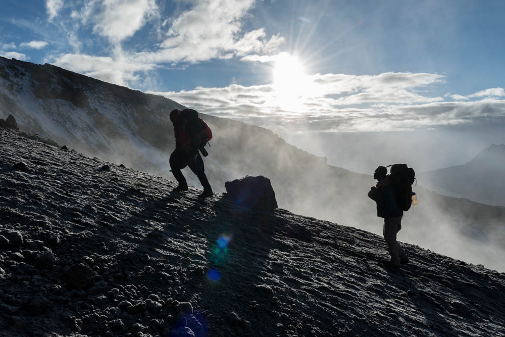
With the rising of the equatorial sun, the undercast clouds climbed the slopes of Kilimanjaro and slowly enveloped us in an eery mist. We had begun our summit push about an hour before dawn, a line of bobbing headlamps weaving through the sleeping camp at Barafu, 15,200′ above sea level. Now, as we ascended past 17,000′, pole pole (slowly, slowly), I was beginning to really feel the altitude. Despite six days of acclimatization and hiking along the Lemosho Route, all five of us were quietly focused on each slow step along the steep and winding switchbacks up toward the rim of Kilimanjaro’s volcanic crater; step, breathe, step, breathe. A few trekkers were already descending – those who rose at midnight to make their entire summit push during the moonlit night, jubilant from reaching the summit – and those who looked quite pale and were gingerly being led down by a guide holding each elbow. The altitude affects everyone differently, and the sick have to descend quickly. We pushed on, hoping for clear skies at the summit and for weather good enough to stay overnight in the crater as planned.
But I get ahead of myself. This 11-day trip, including 9 days on the mountain, is a long story. As you read the trip description below, be sure to check out the photo galleries of the trek, of our two days pre-trek, of the flora and fauna, and of night skies on the mountain.

Day 1. Our little group of five began our journey eight days earlier, with an overnight in the cute bungalows of the Lodge at Kilimanjaro International Airport (~3000′). I spent a pleasant afternoon at the pool waiting for Kilimanjaro to peek out from behind the clouds.
See my note about elevations, at bottom.

Day 2. The next morning we met with James, our head guide from Thomson Safaris, to go over trek logistics. Soon after, we were back in the Land Rover with Mohamad, at first zipping along the Arushi-Moshi highway and then turning off onto a series of dusty back roads to reach Ndarwkai Ranch (~4,700′). Here, in cozy but luxurious “tent” bungalows, we enjoyed the chance to rest, watch Vervet Monkeys scampering along the paths, and prepare our gear for the trek. Toward sunset, a local guide and ranger took us on a stroll through the nearby meadows, where we were quickly treated to sightings of zebra, giraffe, eland, impala, baboon, wildebeest, and more; sadly, though we followed in the dusty footprints of an elephant, we never saw any elephants. A walking safari, surrounded by dozens of large wild animals is a truly special experience (and also the reason for bringing an armed park ranger). We concluded the walk by climbing Ndarkwai’s “treehouse” to watch the sunset over a small pond, as various animals came to drink. An excellent dinner in the lodge dining tent capped off an excellent day.

Day 3. After much rearranging, I managed to get my duffle bag down to 15kg (the maximum weight the porters can take) and my daypack to 15kg (camera gear, water, extra layers, and so forth). I’d later find this pack to be heavy, but manageable. Mohamad drove us to the Londorossi Gate, on the far west side of the mountain, to check in with the park rangers, meet our crew, and formally weigh in for the trek. We had three guides (James, George, and Polite), a head cook (Richard), a head waiter (Lucas), and 28 porters(!). Porters are limited by park rules to carry 20kg, in addition to their own personal gear, and the park carefully inspected and weighed each porter’s load.
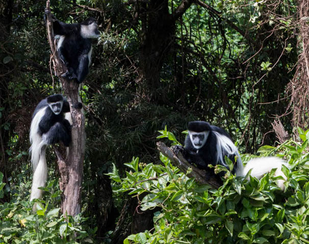
We then drove to the Lemosho gate, a nearby trailhead; on the way we were treated to a roadside show by a troupe of a dozen or more Colobus Monkeys, jumping among the trees and wrestling playfully while we watched. After a quick but plentiful lunch at the trailhead (8,000′) we began our trek at through the lush forests. I was impressed by the quality of the trailwork – clearly, a substantial effort had been underway during the recent rainy season, building up turnpikes and installing water bars – and in some places, in-fill that must have been carried up from the trailhead.
We took our time. We had only four miles to go, and only 1,312′ of gain, to reach camp. But, the theme of trekking is pole pole (‘pole-ay, pole-ay’, that is, slowly slowly). At this altitude, it’s important to pace yourself.

We arrived at Forest Camp, also called Big Tree camp or Mti Mkubwa camp, to a big welcome from our trek staff – several songs and cheers to celebrate our arrival. We began to realize just how luxurious it can be to trek with Thomson Safaris. The porters who had bustled past us during the afternoon had set up the whole camp, including a cook tent, dining tent, two tents for porters, two tents for three guides, and three tents for the five of us. Each of our assigned porters – who carry our duffles – guides us to our tent, helps us with our daypacks, helps us remove hiking boots, and generally settles us in. Soon, Lucas and his helper bring a bowl of warm wash water, and alert us that tea will be ready soon. Refreshed, we head for the dining tent to enjoy afternoon tea – or coffee, or cocoa – with popcorn and cookies. In this tent, a dining table seats six and is spread with tablecloth and all the accouterments. Afterward, I explored the busy campsite – there were at least three other groups here, with at least 16 other sleeping tents. A blue monkey came by, clearly a regular; although he was eating leaves he was more than happy to accept a banana from one of the other groups.

James joined us for dinner, a multi-course affair with spaghetti, garlic bread, salad, and pound cake. In general, the meals were fantastically delicious and plentiful – I ate far more than usual, three big meals per day, and yet managed to lose some weight during the trek. After dinner, George and Polite would join us and brief us about the plans for the next day. They used a pulse-ox to record our pulse and blood-oxygen level every night, watching for anomalies that might forecast trouble.

Day 4. After a huge breakfast of eggs, toast, sausage, fresh fruit, and oatmeal, we headed up the trail. Today we would transition from the Forest zone to the Heather zone, encounter numerous beautiful wildflowers, and get some of our first views of the peak. (Kilimanjaro is really three peaks – Kibo, the main peak, is our destination, but Shira is a lesser peak on the west side and Mawenzi is a spectacular craggy peak on the east side.)

After hiking for a few hours we reached the top of a ridge and stopped for lunch. Lucas and his team had passed us earlier, and now settled us in to our chairs around the dining table – no tent needed on this beautiful sunny day – and we enjoyed hot soup and a plentiful meal prepared by Richard earlier in the morning.
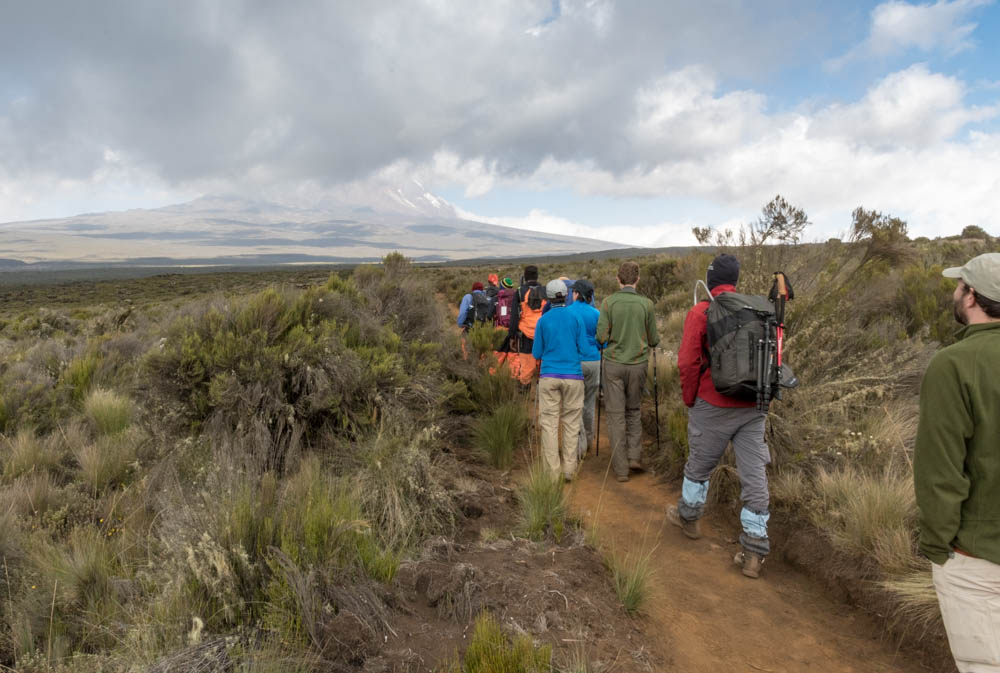
Over the next ridge and down onto the Shira Plateau, now in the Moorland zone. The tall shrubby heather disappears, and we can see far across the scrub and small rocks that dot the landscape. Kibo looms overhead, shrouded in cloud. The porters come back to greet us, having finished their preparations in camp, and offer to carry our daypacks the final half mile to camp.
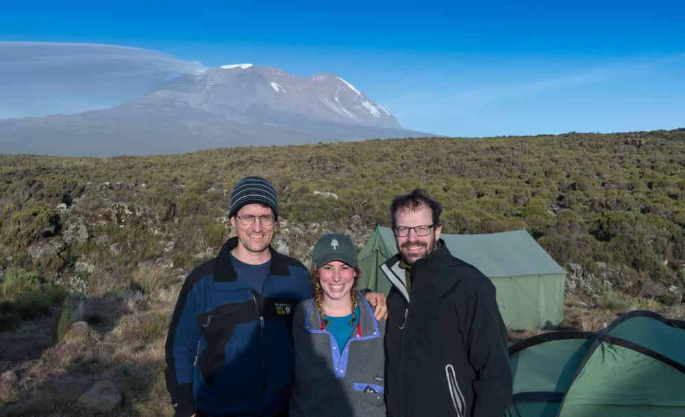
Shira I campsite (11,499′) is smack in the middle of the plateau. As with all the camps, there is a permanent ranger station surrounded by numerous tent sites. I spent the warm, waning hours of sunlight photographing the ubiquitous White-necked Ravens, keeping an eye on Kibo as the clouds dissipated, and chatting with another group – a Dartmouth ’14 and her brother and father. (It seems I manage to run into Dartmouth everywhere I go!)

This close to the equator (3º south), the days (and nights) last about 12 hours – sunset at about 6:30pm and sunrise at about 6:30am, even though we were here on the June solstice (technically the winter solstice, I guess, because it is the southern hemisphere after all). So nights are long; although I thought perhaps I might read every night, I mostly found myself falling asleep early. At higher altitude, sleeping is fitful, so the long nights are welcome. Still, I generally rose around 5am for some pre-dawn photography. The stars are brilliant in the clear mountain air.

Day 5. Today was a short day, from Shira I to Shira II. Eli was not feeling well so Karen and Eli went with Polite on the direct route to Shira II, arriving at lunchtime. Ken and Leah and I went with George and James to the head of the plateau to climb a rocky bump called The Cathedral. It was a beautiful sunny morning, but the wisps of morning mist assembled into a solid deck of clouds as the sun’s warmth brought the undercast up to our level; by the time we reached the foot of the Cathedral we were socked in. We reached the summit anyway, and enjoyed the eeriness of the rocky landscape as we descended the other side toward our next camp.

We stopped for lunch near a helipad. Kilimanjaro receives tens of thousands of visitors per year, and some of them run into trouble. (Helicopters can’t fly over about 12,000′ so ill or injured climbers must make their way down here for evacuation.) A light rain began to fall; fortunately the dining tent sheltered us for lunch and allowed us to organize our packs and raingear before heading out.
Shira II camp (12,795′) is on the slopes above the plateau, and was socked into the mist when we arrived. The rain fell on and off during the afternoon, heavy at times; without the sun, it was chilly (39º at 6pm) and we spent the afternoon snuggled in our tents.

Day 6. I rose at 5am to find the sky clear above with some clouds below, temperature about 27º and frost on the tents. Another great morning for star photography. As the sun rose, Kibo loomed overhead and the frost began to melt. We headed out around 8:20am, pole pole, grateful that the rain and clouds had left us alone today. We reached our next camp, Lava Tower (15,213′), at about 2pm in time for a late lunch of fried chicken, french fries, soup and vegies. Lava Tower is an impressive monolith – but too unstable for us to climb – and the views here are impressive. We now felt close to the summit, eyeing the glaciers on its upper slopes. Ken reflected on his prior Kili climb, from 32 years earlier, in which he camped at Arrow Glacier (now in view for us) and scrambled up the Western Breach (now considered by many to be too dangerous to ascend). In that 1984 trip, Ken’s group reached the rim but had to turn back because his two partners were both having altitude trouble. Ken now had the opportunity to return and complete that 32-year-old goal.
By this time, Ken had earned the nickname of Bwana Kubwa, or “big man”, which the guides and porters used with a smile and with deep respect. My nickname was “Daudi”, Swahili for David, although Lucas always seemed to call me Davdi.

We spent a lazy afternoon in the warm sunshine, watching as each of the other trekking groups packed up their lunch tents and headed on down the trail. We were the only trek to overnight here, which is an opportunity for us to acclimatize a bit. Eli was feeling crummy, due to altitude, so it was good the next night would be at a lower altitude.

Day 7. As we retired the night before, the full moon rose directly over the summit of Kibo. I knew that, just before dawn, the setting moon would illuminate Kibo nicely and so I rose early to see what photos might be possible. It was incredibly bright, and indeed my photos look like daylight but with stars in the sky. A very cool undercast was illuminated by the rising sun, but our little camp was in Kibo’s shadow until just before we left at 9am. We trekked eastward, downhill, descending into the Barranco Valley. The beautiful sunny morning disappeared as we descended into the misty undercast, and soon we were pulling out our raingear because the mist was so heavy it was sprinkling. We reached the Barranco ranger station/campsite at lunchtime, in a mist so dense we could see only a few meters in front of us. During lunch a steady rain began – thanks again for that dining tent!

We suited up and faced one of the most notorious and challenging parts of the trail, the Barranco Wall. This mile-long stretch involves a lot of scrambling over boulders and along narrow cliffside trails. In the mist, some sections seemed to be exposed to a bottomless dropoff. In the rain, the trail and rocks were all slick. In sunny/dry conditions I would find this section to be fun and interesting, but not particularly challenging. In the rain, well, it was a bit hairy. I just kept wondering about those porters(!) who had to navigate this terrain while balancing a 20kg load on their head. Gosh!

With the infamous Wall behind us, the trail wandered up and down through a series of drainages, the mist and rain blocking what seemed likely to be nice views and pleasant terrain. After a particularly slick descent into the Karanga Valley, and slippery ascent up the other side, we reached Karanga camp (13,231′) – and the sun came out! Wet gear was quickly distributed to every flat rock, by both trekkers and porters alike. Well after sunset, the mist settled back into the valleys and I got some lovely photos of the mountain with stars behind and illuminated tents. The altitude, two thousand feet lower than the prior night, enabled us all to recover and prepare for the ascent over the next two days.

Day 8 – solstice! The next day was intentionally short, from Karanga to Barafu Camp (15,331′), a pleasant morning climb through alpine desert, swirls of mist, and even a brief period of sleet. We regained all the altitude we lost the day before, by lunchtime, settling in for an afternoon of rest before the big day tomorrow. At tea, we discussed the plans for tomorrow’s summit ascent. A key question was whether to proceed with the planned itinerary and camp in the crater after reaching the summit. James recommended against, because of the condition of the weather and some of our party. In the end, we decided to split: Ken and Leah and I would camp in the crater, and Karen and Eli would descend to Barafu after summiting; the guides and porters and gear were carefully divided. After spending the afternoon in mist, I was glad that it settled below us as the sun set, and we had some beautiful views of Kibo and the stars.

Day 9, to the summit. The big day finally arrives! Woken at 4am for a quick breakfast and last-minute packing, we hit the trail at 5:15am wearing headlights to navigate the rough boulders on the trail through Barafu camp. A few light snow flurries drifted around us. Slowly, the sky brightened to our right, and the peak of Kibo’s little partner, Mawenzi, started to take shape above the undercast in the east. Slowly, pole pole, we made our way upward. When the sun burst forth over the undercast, we shed headlamps and warm clothes and started thinking about a sunny ascent and the need for sunscreen. We made slow but solid progress uphill, encountering one or two other groups also making a daytime ascent. (A few climbers passed us on their way downhill – most people start their ascent at midnight, summit a bit after dawn, and wink at Barafu as they descend even further by the end of a very long summit day.)
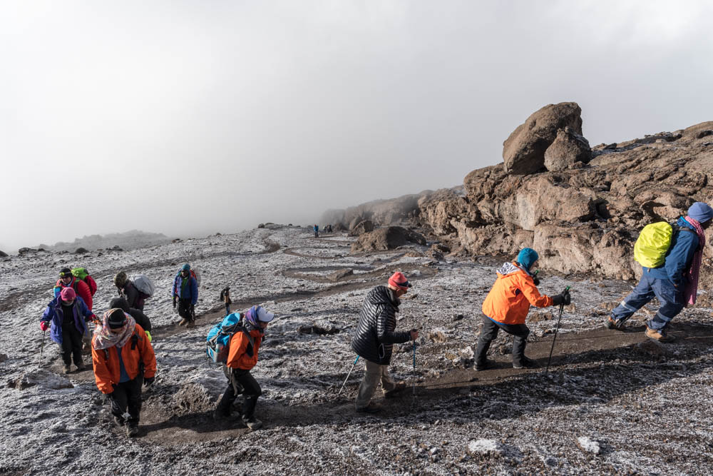
The rising mist climbed the slopes faster than we, so our views mostly disappeared. Occasionally we’d glimpse the ridgeline to the right, or a glacier to the left, or perhaps a patch of blue sky above. I don’t know whether this seemingly endless climb is any easier when blind or when you can see just how far there is still to go. I was really starting to feel the altitude and wondering, really, whether I had the strength to finish. It’s a remarkably short climb, actually – just a few miles – but very steep, with a total gain of 4,265′, about twice as much gain as a typical peak in New Hampshire.

We split the group for two different paces, with Ken, Leah, Eli and myself going ahead with George, while Karen followed with James and Polite. We fell into a routine, stepping slowly in rhythm, winding up through switchbacks on an open slope of gravel and the occasional rocky outcrop. It was hard to tell how far we’d come, or how far we had to go, when the mist cleared a bit and we looked up and saw the ridgeline, not far ahead. Ten slow minutes later, we reached Stella Point at 11:15am – two miles and six hours after leaving camp. Standing on the rim of Kibo’s enormous crater at 18,885′, the mists cleared and the sun shone; we could see around the rim to the summit, and down onto the crater floor. Lucas and his band of porters had arrived earlier and served bowls of soup, mugs of tea, and plates with a plentiful selection of lunch food. We rested in the nook of a rocky outcrop, where the sunshine was melting the night’s rime ice and cheering our own misty dispositions.

While waiting for Karen to arrive, George spoke with Ken and Leah and I about our condition, and about our plans for staying in the crater that night. Leah and I had mild headaches — nothing serious, but I wasn’t yet sure whether they might dissipate or become worse. The weather looked iffy – sunny at the moment, but with undercast mists threatening to return to the summit. It appeared we would likely spend the night in a cloudbank. Considering all this, I told George we’d return to Barafu that night. He quickly told the porters, many of whom had just carried our camp up thirty-five hundred feet, and they were jubilant; despite all that wasted effort, they were happy to be returning to a lower altitude and warmer camp for the night.

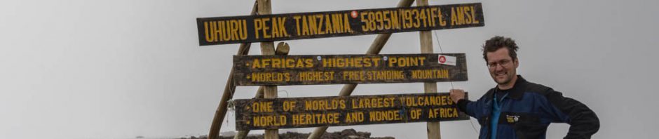
Karen arrived, to much cheering and singing from the crew, and hugs from all around. After a quick group photo, we split the group again. Ken and I wanted to explore the crater before returning to Barafu, so we and George pressed on to the summit while the kids rested while Karen had lunch. The final stretch is less than one mile, and relatively flat, gaining only about five hundred feet, but it took us nearly an hour. At 19,000 feet, it takes a lot of energy to take each step. The clouds had risen over the summit during the past hour, but it was it was a beautiful walk nonetheless, with the Rebmann glacier close to our left, and a seasonal snowfield lining the trail. The mists alternately blocked and exposed the ridgeline ahead, and gave us tantalizing peeks at blue sky. At 1:15pm we reached the Uhuru summit (as noted before, Kilimanjaro has several peaks, Kibo being the largest and tallest; Kibo is a volcano, so it has a rim around its crater; Uhuru is the name given to the highest point on the rim).
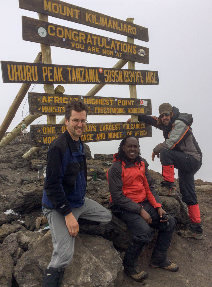
Now totally socked in by clouds, we nonetheless took many photos. I was pleased to share a Dartmouth Outing Club (DOC) banner with Ken Kaliski, honoring our joint past with that venerable organization; I snapped a photo with a logo from Crossroads Academy, my kids’ school; and I proudly held the Dudley flags from my father and grandfather. And, despite there being almost zero wind, I managed to fly my colorful kite, a personal tradition on summits. (I was shocked that the summit had no wind; indeed, we had very little wind at any time during the trek.)

I wished we could wait for Karen and the kids (and sunshine!) to arrive, but we hurried back down to Stella Point, picking off James from the other group, and descended into the crater. It’s remarkably flat and smooth, mostly gravel. With a few boulders strewn about in the mist, it was an eery place to explore. Despite few landmarks and poor visibility, George and James knew exactly where to go, and we were soon climbing the slopes of the Ash Pit. This cone within the cone, if you will, is surprisingly tall. I’d seen it from Stella Point and was skeptical about making that climb, perhaps five hundred feet. It doesn’t sound like much, but in this altitude, and after the huge effort to reach the summit, I could tell my own batteries were getting low. George and James had dropped their packs; my pack felt heavier than ever. Amos, the medical porter, had the essentials. It started to sleet, and the mist made visibility poor. We eventually reached the rim of the Ash Pit, though the mist made it difficult to see the bottom and we never could see all the way across. The odor of sulfur hung in the air, and it was difficult to tell whether any of the misty fog was steam from this active bit of Kilimanjaro’s dormant crater, or from the clouds that surrounded us. Indeed, we momentarily lost Amos in the mist – the clouds were so dense and the landscape so disorienting – but fortunately in earshot so he was able to track us down.

We turned back at about 3:15 and headed back across the crater, encountering chunks of the disappearing Furtwangler Glacier. George and James easily found their way back across the crater floor and we climbed (again!) the rim of the main crater to Stella Point. After a brief rest, we headed back down to Barafu and camp. The descent was fast – bypassing the switchbacks, we could almost boot-ski the gravel slope down, down, sliding as much as stepping, until we reached the rockier lower slopes. We reached Barafu at 6pm, bone tired and happy, 13 hours after we’d left camp that morning. Lucas, always cheerful, met us with two chairs and two glasses of juice, and it was all Ken and I could do to later get up and change before dinner. Karen and the kids had returned to camp a few hours earlier. Everyone made the summit! A great day.
Another Thomson group had arrived and set up their tents next to ours. I was far too tired to even step over and say hello – past experience has led me to expect Dartmouth groups to show up next to me – and then they left at midnight for the summit, so I never met them. We later learned that at least one member of their group did not make the summit, sorry to say.

Day 10. Morning broke with sunrise behind Mawenzi’s shoulder and with crisp blue skies above us. Indeed, the cloud deck was lower than it had been in several days, perhaps down at 14,000′. As I looked up at Kibo, I must say I felt some regret that we were not waking in the crater on such a beautiful day. It would have been a fine, fine opportunity for photographs, and perhaps maybe even a chance to summit again for nice summit photos.

Last night we had discussed whether to descend to Mweka Millenium camp, our original destination if we had been starting at the crater, or to skip over it and head down further to Mweka camp, closer to the exit. We decided to push on down to Mweka (9,900′), despite our tired state and the prospect of dropping over five thousand feet in one day. We had pleasant sunshine nearly all the way, with many wistful glances back over our shoulder to our last views of Kibo. We dropped from the alpine desert into moorland and then the heather zone, reaching a foggy camp by 1pm in time for lunch and a restful afternoon.
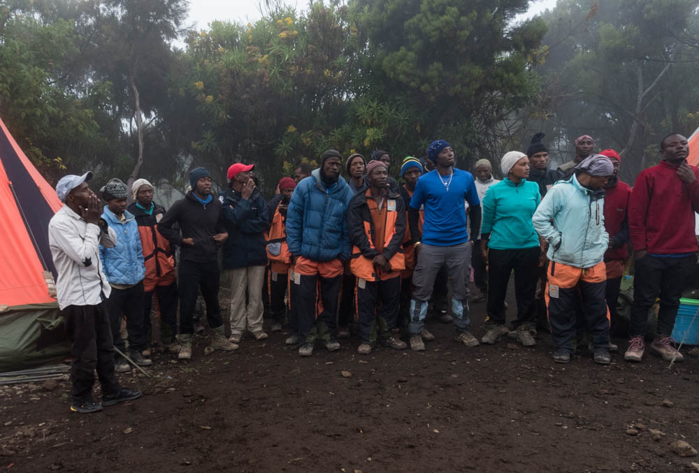
This camp was the least pleasant, by far – it was foggy, and crowded, and we camped next to the ranger station that kept its exterior lights on all night and, it seemed, some groups of porters or rangers talking well into the night. Still, it was a fun afternoon as we prepared for the tipping ceremony. The camp was abuzz with anticipation, and at the designated time all of us and the whole trek staff gathered for the ceremony. The porters sang a few songs, and then each of us presented an envelope with a cash tip: one large envelope for the 28 porters, one for the cook and waiter, and one each for the three guides. The first was the most interesting, as Eli read a prepared statement, written in Swahili with help from Ken and James, declaring for all to hear the total amount of the tip and the size of each porter’s share. The porter’s representative, Jackson, received the envelope, and soon after the ceremony the porters watched carefully as he counted and distributed the tips equally among the team. This process of transparency has developed over the years, after instances of fraud and unfair behavior among some trek operators and their guides, and (as I understand it) is now standard practice. We had received these instructions from a porter welfare officer who had accompanied our trip for the first day; his role was to ensure porters were treated fairly and adequately outfitted for this difficult journey.
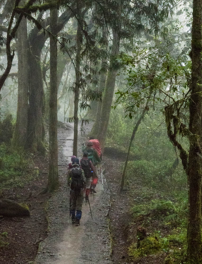
Day 11. Our final day began in dense mist, so dense that it became a steady drizzle as we descended quickly through the forest on wet trails to the gate at 6,000′. In the few openings without a canopy above, I noticed it was not raining – what seemed like a steady drizzle was simply the leafy and lichen-draped canopy dripping steadily as it raked moisture from the mist. We had woken early, departing at 7:30, and hiking fast as everyone (especially the porters) seemed eager to go home. We reached the gate at ~9:45am, and I paused to take a photo at the official sign. In the process, I left my brand-new trekking poles at the sign, and (by the time I realized their absence 10 minutes later) they were gone. Sigh.
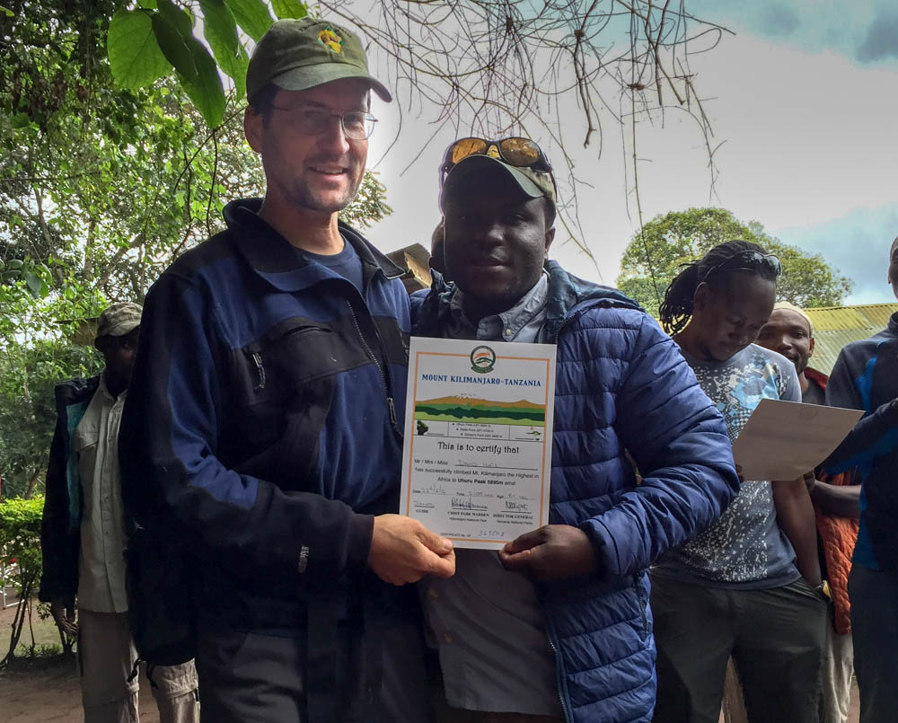
We signed out, and settled in for an early lunch behind the ranger station. Two local women, entrepreneurs, offered to wash our muddy boots and gaiters for $2. Thinking of my need to pack them in luggage just a few hours later, I gladly accepted. In a happy ceremony, James presented each of us an official Kilimanjaro summit certificate, proudly indicating that we had made it to the summit.

With some sadness for the trek being over, we took our final group photos and bundled into the LandRover for the trip back to town. We passed many small farms and banana fields, then into the outskirts of Moshi, before stopping at a crafts/gift shop downtown for a few souvenirs. We headed back to the KIA Lodge, our starting point, for a welcome shower and a chance to clean and pack for the trip home that evening. After a last meal at the lodge, Thomson delivered us to the nearby airport and we boarded flights in opposite directions: mine toward Singapore, and the others’ toward Vermont.
Summary. An absolutely wonderful trip! Stunning terrain and beautiful wildlife, physically challenging and yet relaxing and well paced. I was very happy we had chosen this 9-day route, the Lemosho Route, because it gave us plenty of time to acclimatize and because we walked a third of the way around Kibo and thus had an interesting range of viewpoints. Thomson was great – superb organization, outstanding guides, friendly and hard-working staff, excellent food. The weather – well, it would have been nice to had less mist and rain, but it was never cold and always interesting. Who knows, maybe I need to go back to that summit on a sunny day for some more photos…
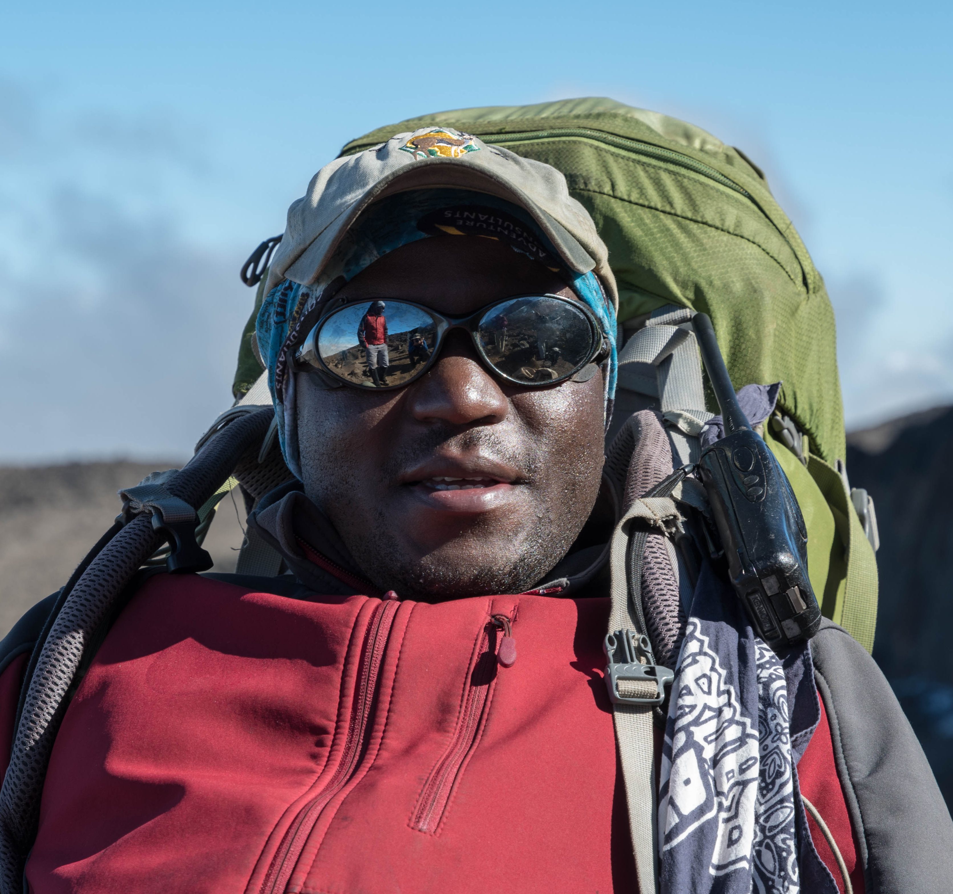
Photos. Be sure to check out the photo galleries of the trek, of our two days pre-trek, of the flora and fauna, and of night skies on the mountain. I also highly recommend the David Breshears IMAX movie (40 minutes). Here are our great guides:


PS. A note about the elevations: I found it remarkably difficult to obtain a single authoritative source for the elevation of trailheads and campsites – the guides would say one thing, the signposts another, the topo map another, and the guidebook yet another. (And, according to the guidebook, there is even some disagreement about the elevation of the summit.) For this post I’ve done the best I can to assemble a consistent set of elevation numbers, based largely on the Thomson brochure below.


Fascinating travelog! It really helped me to comprehend a climb of this magnitude.