
Sometimes I just need to get in a few miles of post-holing. And when the view is this good, why not? After completing a major deadline yesterday, I really needed to get away from the computer and out into the Real World for a while. Given the rapid onset of spring in Zürich, I wanted one last taste of winter. Switzerland closed all the ski areas (early) on Monday, so none of those facilities was an option. But our walk in Braunwald, two weeks ago, left me wishing to go back. I found a longer walk, from the same starting point, and so I jumped a train back to Braunwald.* Read on, and check out the photo gallery.
It was another gloriously sunny day in a week of sunshine, albeit with some growing haze. So as I climbed through the zigzagging streets of Braunwald I stripped to a t-shirt and put on sunglasses as the snowfields deepened beside the road. This is spring hiking at its best! I eventually reached the point where the trail leaves the road, stepped onto the snowpack – and immediately sank to my shins. I pondered giving up, because I had no snowshoes, but I put on my gaiters and decided to give it a go.

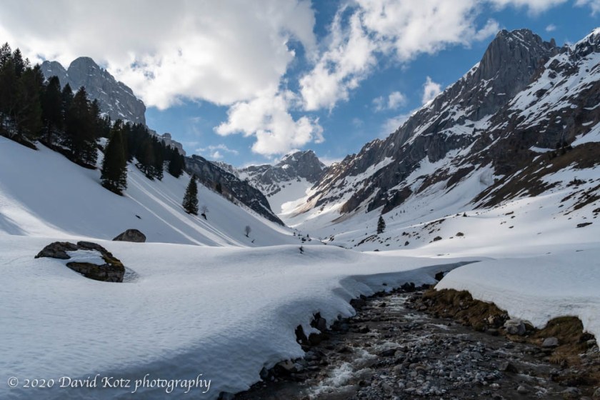
The snow was deep – at least a meter. Although other hikers had followed this route, not today but in recent days, there was no packed trail. I sank to my shins, mostly, but occasionally left behind a surprising knee-deep or even thigh-deep posthole. The sun was brilliant on the open fields, and the Alpine scenery provided a constant distraction, so I didn’t mind the workout. This route largely follows the contours of the ridge north from Braunwald, into the beautiful Bösbächi valley, then slopes gently down through the forest into the verdant village of Schwanden.
I passed a few trail junctions offering an easy way out – down, steeply, to the valley floor where I could get a train back home. But I pressed on, eager to see the mountains around the corner, and the promised lake Oberblegisee that might be oh so pretty.
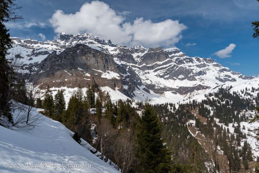
When I came around that corner, steep mountains loomed above the Bösbächi valley. Though a gorgeous scene, to be sure, the sight of numerous fresh (though small) avalanches on the opposite side made me pause. The sound of three new avalanches, heard but not seen, made me pause a bit longer. I studied the terrain, and the map. It was clear the route to Oberblegisee passed directly across a steep snowfield where avalanches had already occurred – and could again; that was no longer an option. But the map showed an alternate route, taking a gravel road down the valley and avoiding the lake, then rejoining the route later. This alternate route was not much different in length, but way safer. Easy choice.
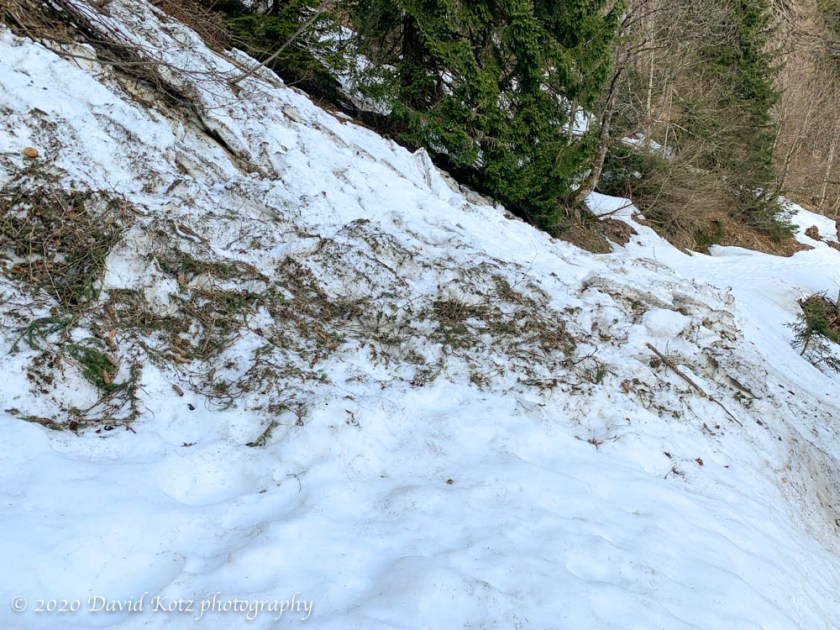
I soon crossed the alliteratively named Bösbächibach brook, passed the boarded-up restaurant and hotel at Mittelstafel, and headed down the alternate route. My boots had long since soaked through, I was now walking in the shade, and my feet were cold. I was looking forward to the end of the post-holing and the re-entry into spring below. The snow on the road was still deep, but a few km later I was starting to cross open patches. I encountered a few old, tiny avalanches where that had crossed the road, puzzling about why and how the snow had decided to slide, at that spot, some weeks ago.
 Once beyond the snow line I was following a gravel road that connected valley farms to their summer pastures. I started encountering locals – a man loading equipment onto a small cargo zipline (these are common in farming country, and are used to carry supplies to high-altitude fields), an older couple walking their dog, a tradesman working a field. Each offered a polite Grüezi (greeting) as I passed, carefully maintaining our distance. Spring wildflowers began to appear. I skittered down through a farm pasture, as the cows mooed and the goats bleated their own form of Grüezi, and entered the outskirts of Schwanden.
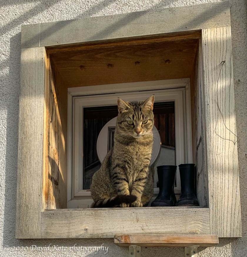
The village of Schwanden is a pretty place, with well-kept houses, numerous public fountains, and flowers blooming in every yard. I paused to scratch the ears of a cat, who deigned to come down from his sunny perch for me. I greeted a family out for a bike ride. I settled onto a bench at the station, to await my train, one of only three or four passengers on the platform. All in all, a fine day for a hike. Check out the photo gallery! If you want to hear about our next adventure, click “Follow” at above right.
*And just in case you are wondering – and I know you are – how I could go hiking while also enforcing my ‘social distance’, it was no trouble. Indeed, I encountered fewer people on this entire outing than I normally encounter on my morning walk on the outskirts of Zürich. Here’s how:
- I traveled at off-peak times of the day.
- I stood apart from others while waiting for the train.
- I invested twenty bucks in a first-class upgrade on the train, and had an entire train car to myself for most of the journey.
- On the Braunwald funicular I let the elderly passengers sit in their own compartments, while I used another one.
- I sanitized my hands before and after each train ride.
- I sanitized the chair arms, and mini table, before seating.
- I never used the handle bars in trains.
- I never saw another soul along the trail.
- I briskly walked past others I saw on the approach roads, just as I would in town, passing more than two meters from each.
Hike stats:
- distance 14.75km
- time 4h36
- elevation gain 290m, loss 1050m
- max altitude ~1490m (about the height of Mt. Moosilauke)
- original trail reference: website
map:


2 thoughts on “Braunwald to Schwanden”