
After a week spent exploring Scotland’s mainland – if one can refer to the ‘mainland’ of what is, after all, part of an island – we boarded a large ferry in Aberdeen for an overnight cruise to the Shetland Islands. Located around 60º North latitude (more than 100 miles north of the mainland), this windswept archipelago in the North Sea is well-known for its stunning scenery and its hardy residents. We had three days to explore and found that was barely enough to experience the main island, and its hub settlement of Lerwick, without hopping any of the short ferries to outlying islands. Once again we were incredibly lucky with the weather! Let me share a few highlights and a gallery of photos.
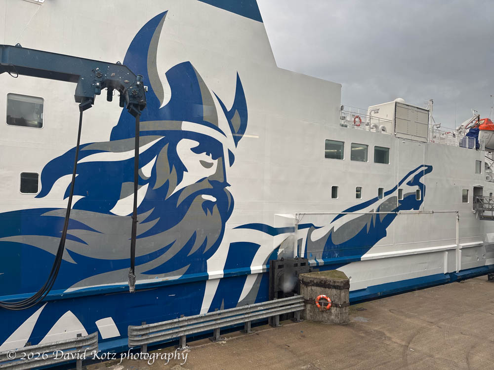
In Aberdeen, the first thing you notice as you board the Northlink Ferry – which is basically a floating hotel, restaurant, cinema, and bar – is the massive Viking logo emblazoned on the side of the ship. Although humans first settled in Shetland before 4,000 BC, little is known about these early settlers before the Norse (Vikings) arrived in the 8th or 9th centuries CE. Shetland became integrated into Norway and remained under Norwegian sovereignty throughout the medieval period. The Shetlands later became part of Scotland in 1468 as part of a dowry paid by the King of Denmark and Norway to King James III of Scotland – and the rest, they say, is history [Wikipedia]. The Viking heritage seems to be a source of pride to Shetlandians, today – where the local dialect is still sprinkled with Old Norse words and nearly all place names have Norse origin.
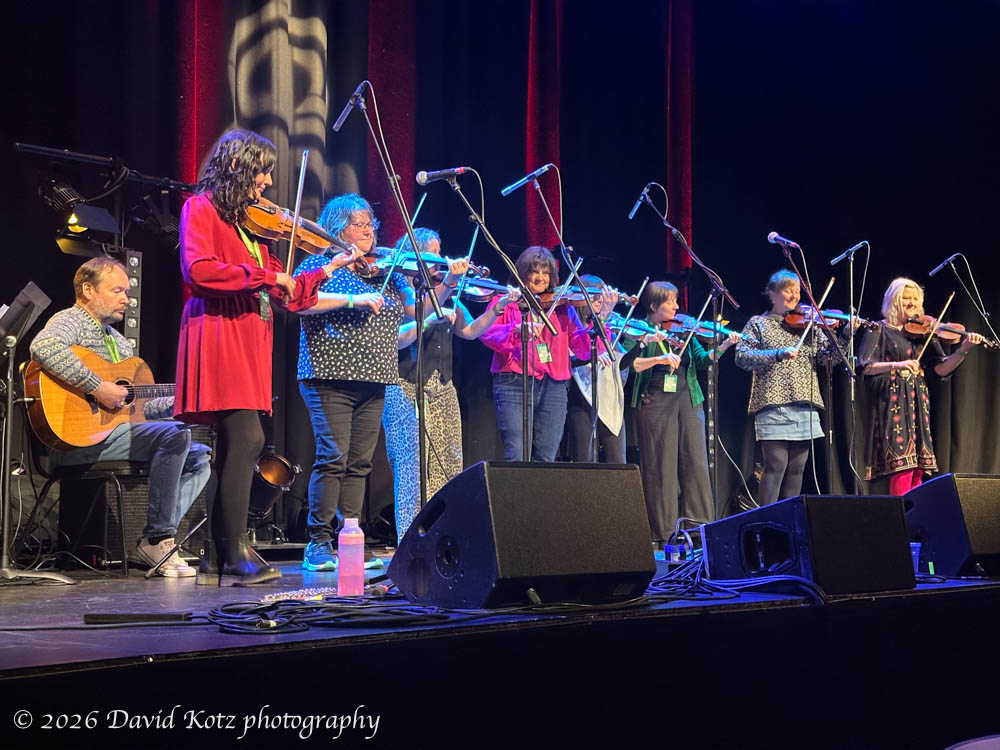
May 2: arrival. We awoke to the ferry slowing making its way into the harbor at Lerwick, after a smooth overnight sail from Aberdeen. We had rented a car, and a flat in Lerwick, and decided to spend the day exploring the town. Purely by coincidence, and to our great advantage, we arrived in town smack dab in the middle of the annual Shetland Folk Festival, so we quickly bought tickets for a concert that afternoon. (At this point I thought of my friend Pablo, who (1) is a fine folk musician himself, and (2) has a knack for showing up in the right place at the right time… a tendency he attributes to something he calls the Pabloverse. Follow his blog – you never know where in the world Pablo will appear next!) Anyway, the afternoon concert treated us to performances by three local bands – a mandolin band, a fiddle band, and an Appalachian-style bluegrass band. In their moments of commentary, I enjoyed listening to the musicians’ Shetlandic accents as much as the delightful music!
We experienced this dense local dialect earlier when we stopped in at a tiny local cafe for breakfast, shortly after arrival. As we nibbled our breakfast and studied our maps and guidebooks, a kindly man leaned over from the next table and struck up a conversation. His name was David (a fine name!) and he was soon rattling on enthusiastically about the many places we might visit. I was glad when he pointed his stubby fingers at those places on our map, because I could barely understand his English let alone his pronunciation of local place names. His enthusiasm caught the interest of another fellow at another neighboring table, who leaned his heavily tattoed arm on the bench beside me and gave us more advice, again in a thick local accent. We enjoyed chatting with these local men who, it seemed, were regulars at this cafe, and they seemed delighted to share their beautiful island with visitors like us. I wish I had a photo to share!
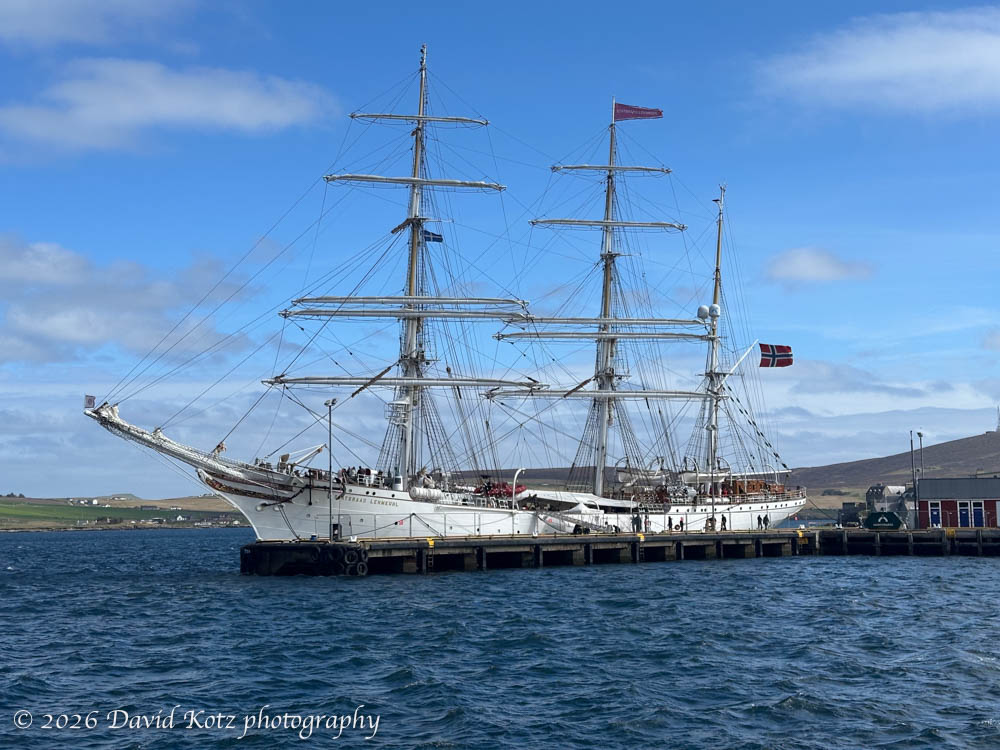
We also spent a few hours perusing the outstanding Shetland Museum, one of the best museums I’ve seen in a long time. It covers everything from the ancient geology of these islands, through the prehistoric and Norse settlements, through the Scottish integration and the modern era, all presented in an accessible, interesting fashion. It’s located next to the harbor, where there happened to be docked an exquisite three-masted sailing vessel visiting from Norway, echoing Lerwick’s Norwegian heritage.
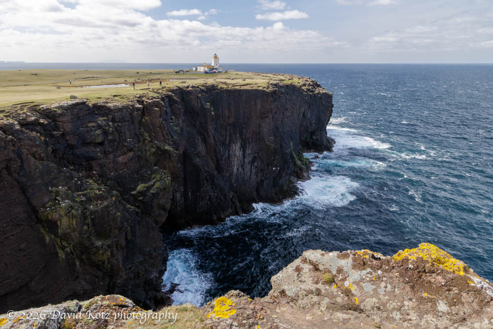
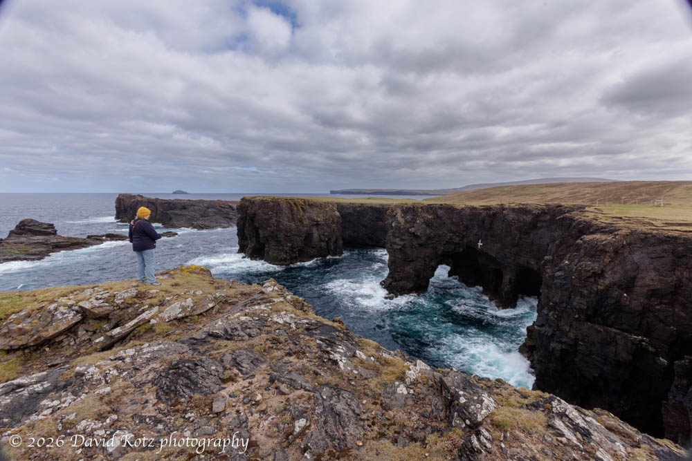
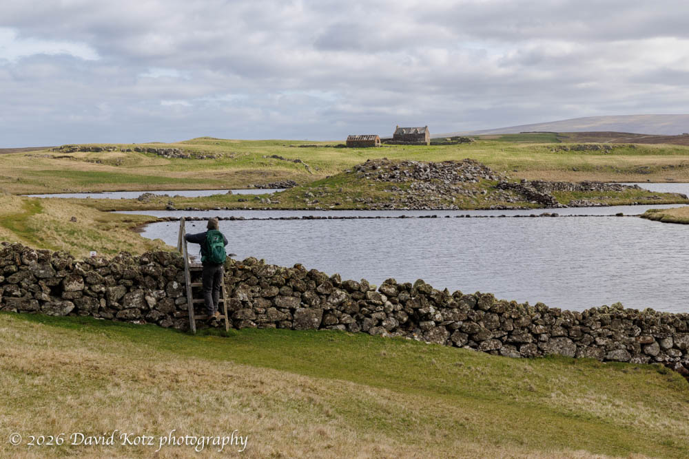
May 3: Esha Nessa, Muckle Roe, and Stanydale Temple. Early the next morning we drove north to Esha Ness, a promontory on the western coast. We planned a short loop hike along the cliffs of the coastline and through the adjacent sheep pastures. Because the Shetland landscape is virtually treeless – due to the high latitude, strong winds, and centuries of sheep farming – the landscape is wide open and the scenery is stunning.
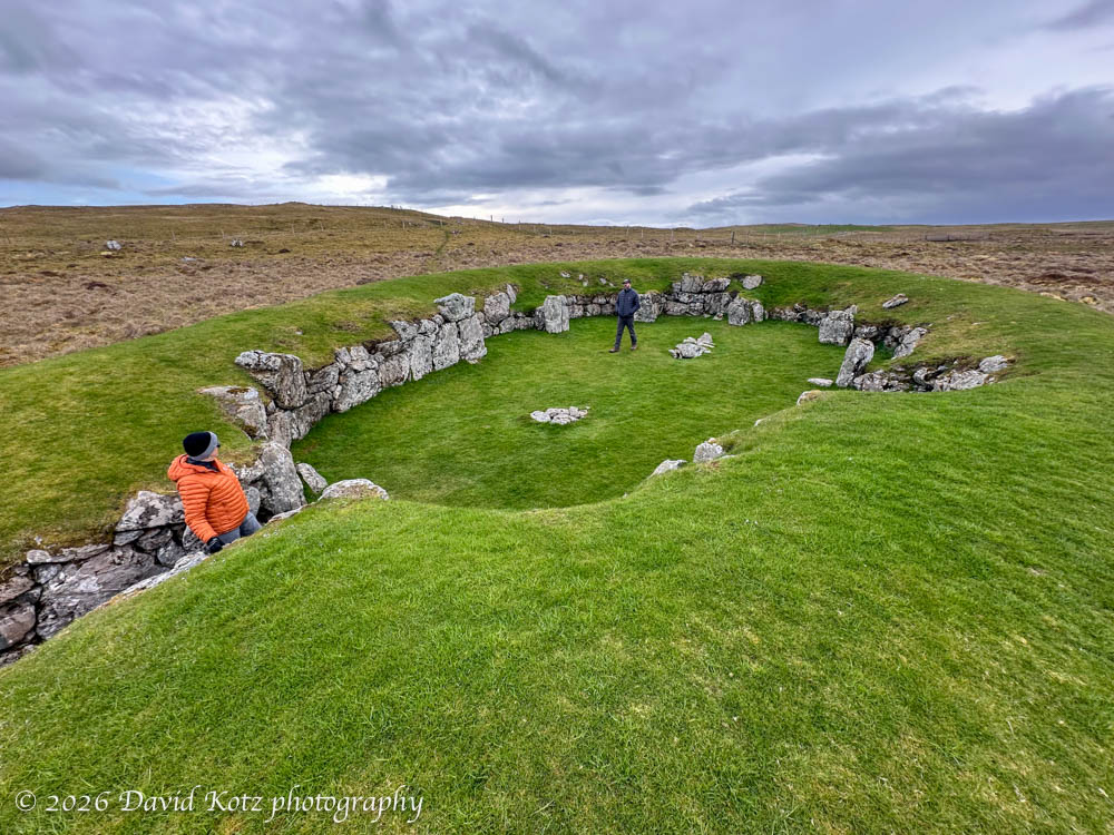
In addition to ever-changing views over the edge of rugged cliffs, with waves crashing below, our route took us past the ruins of the ancient Broch of Houlland on a large promontory on the Loch of Houlland.
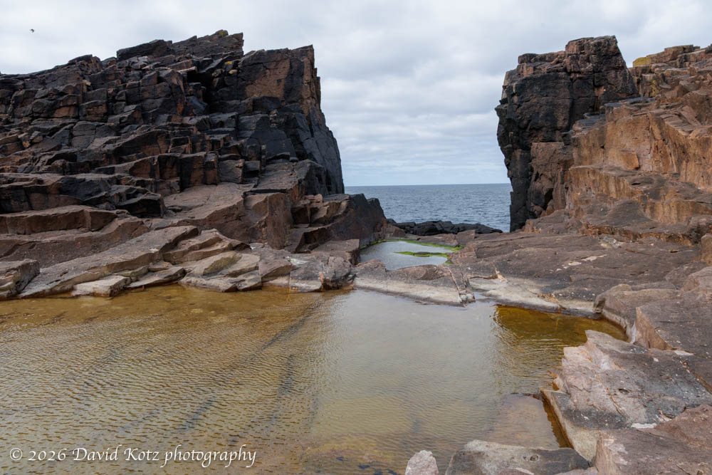
The seaside cliffs have been pounded by the ocean, for millennia, leading to interesting formations like the Holes of Scraada and the Grind o Da Navir (where the waves have thrown rocks of up to 3 meters high over 15 meters above the sea).
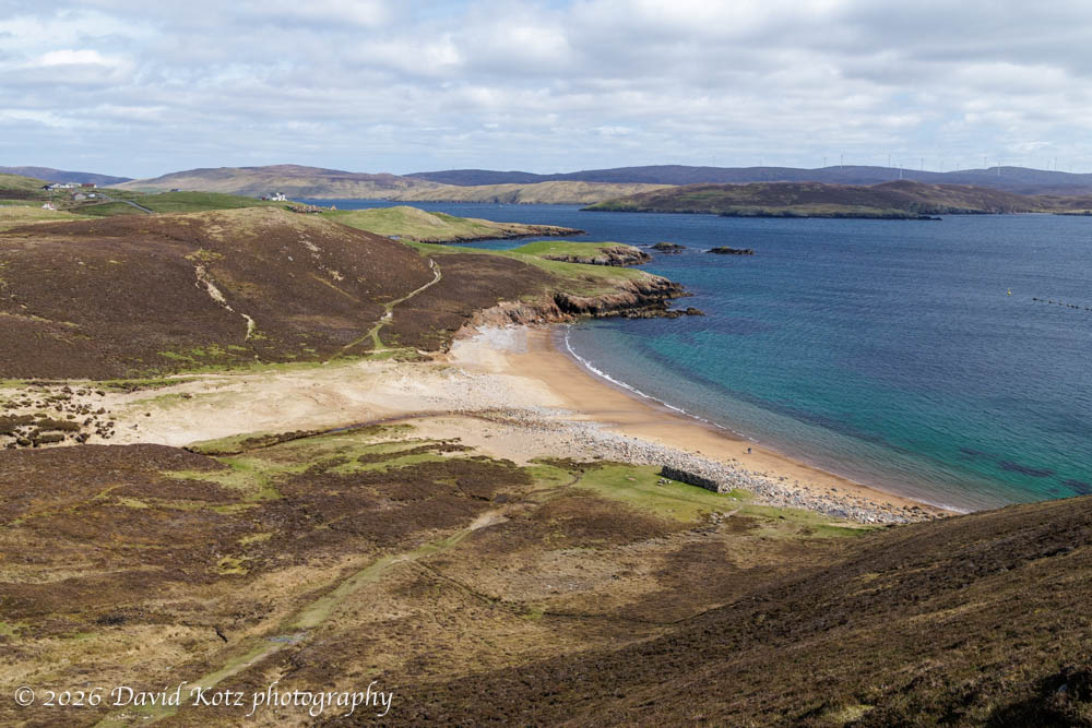
Later, after lunch, we headed for a small island called Muckle Roe, which is connected to the mainland by a narrow spit of land. “The island’s rock is red granite, which gives the island its name – a combination of Scots and Old Norse meaning ‘big red island’.” We enjoyed exploring its pretty beach, where we saw an otter catching and eating crabs (more on the otter in another post!).
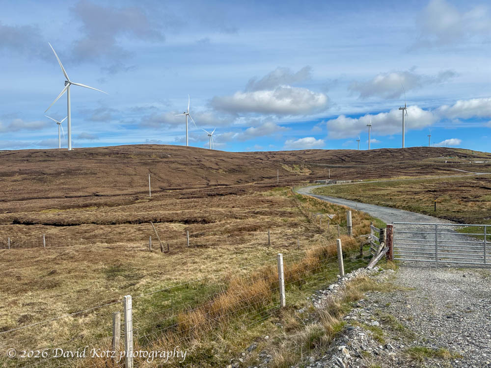
a wind farm is barely visible on the horizon.
Finally, we made the short walk across pastureland to the Stanydale Temple, a Neolithic site that “may well have been established in 2500–2000 BC, when Neolithic farmers first came to Shetland.” It is not a temple – its name derives from a mistake made by earlier arhaeologists – but rather a settlement. It is remarkably well preserved.
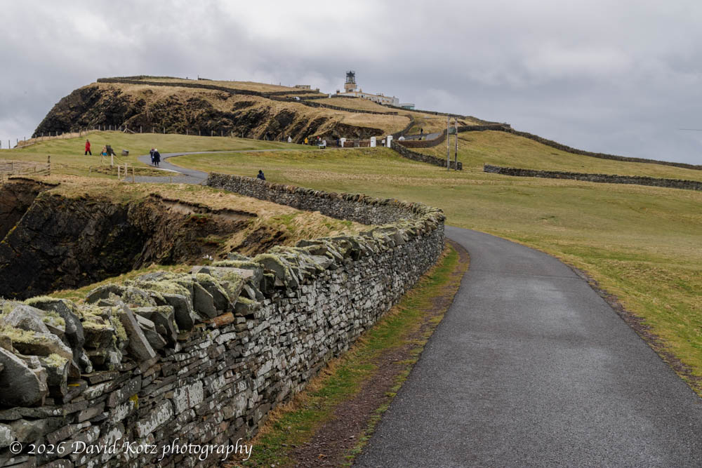
May 4: south to Sumburgh Head. On this day we drove south rather than north, beginning with a visit to Sumburgh Head Lighthouse. This historic lighthouse, now a museum, had been a critical infrastructure for mariners in the treacherous waters south of this southern tip of the Shetlands. In World War II, it housed an early radar facility that allowed the allies to monitor the North Sea and the approach to Great Britain. Today, as for centuries, its cliffs provide essential nesting grounds for hundreds, perhaps thousands, of seabirds.
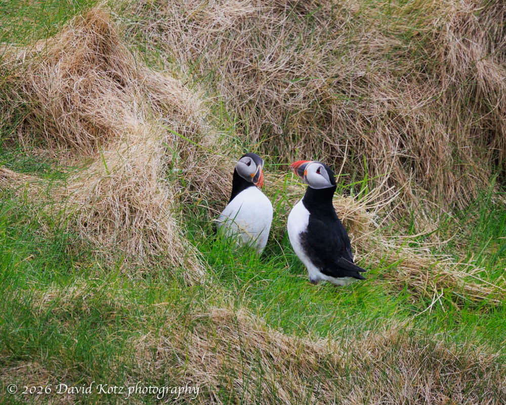
Although we’d heard the Shetlands are an amazing place to see puffins, people told us we were likely too early for puffin nesting season. We got lucky! We spotted three puffins, the literal ‘early birds’, scoping out the best nesting sites. We watched one couple in which the left puffin (below) went underground to inspect the potential nest and, on exit, watched the right puffin repeatedly raised its beak to the sky and chest-bumped the left puffin. Soon, they walked to the edge of the cliff and took flight over the waves crashing below. We were left to wonder what that meant!
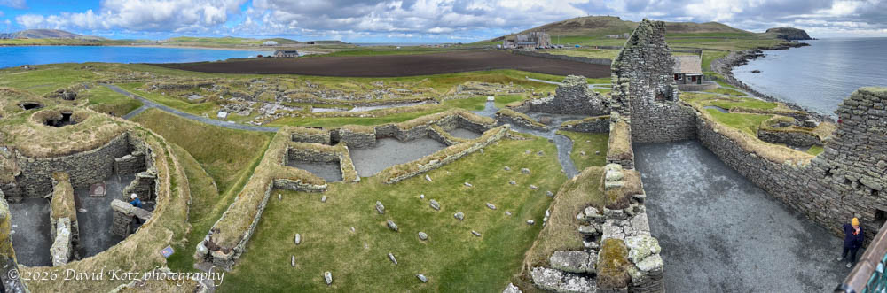
After lunch we took a tour of the nearby Jarlshof pre-historic site, described as “one of the most remarkable archaeological sites ever excavated in the British Isles” . Indeed, in this one location one can wander among a fascinating sequence of overlapping ruins from the Neolithic era to the Norse era to the 18th century.
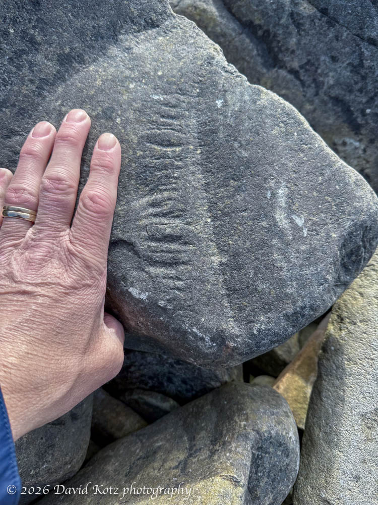
Near here, we’d heard there is a rocky beach where one can see fossilized fish, the remnants of an ancient sea that was later uplifted to form the Shetland Islands. We spent a lazy hour exploring the stony shoreline, examining every curious wrinkle in the stones. (When you’re looking for fish motifs, everything looks like a fish!) But only one stone held what seemed to be a definitive fossil – in this case, a fern. Cool!
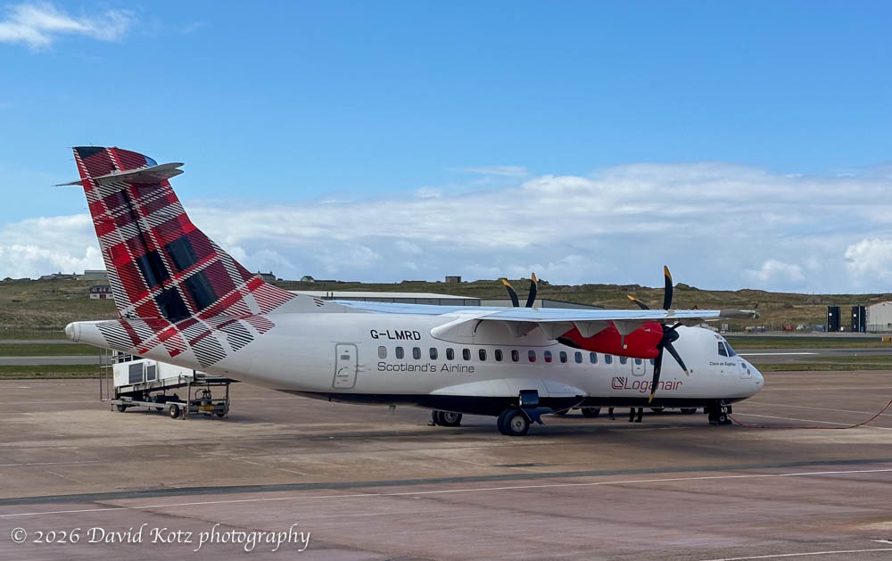
May 5: departure. Although the ferry from Aberdeen was a smooth way to arrive in the Shetlands from Scotland, on departure our destination was London… so we booked a flight to London via Dundee. The only airport is at Sumburgh, so we once again drove south. (The airport is tiny; indeed, it is so small that one must drive across the runway to reach the terminal! Much like crossing train tracks, there are lights to warn drivers when it is not safe to cross.)
Finally, it’s worth noting Shetlands connection to energy production. In the 1970s, when oil was discovered in the North Sea, the Shetlands were in an optimal location to receive the oil from North Sea drilling rigs, and Britain built a massive processing facility at Sullom Voe, “which has subsequently become one of the largest terminals in Europe” and a critical part of the Shetlands local economy. More recently, massive wind farms have been installed, leveraging another critical resource of these windswept islands. We often saw wind turbines as we roamed about the islands, interspersed among the sheep pastures. My sense is that local and national officials are starting to plan for the day when oil production ends and wind and other sources become more important.
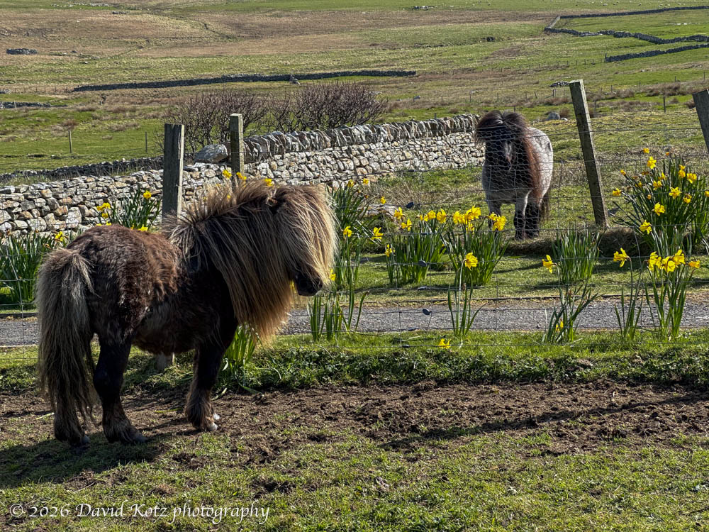
I heartily recommend the Shetland Islands, and would enjoy another chance to visit! I’ll conclude with a photo of Shetland Ponies because, well, who doesn’t like ponies! Check out the photo gallery (or 7-minute slideshow) for more, including some video of the cliffs at Esha Ness.

2 thoughts on “Shetland Islands”