
Since the impressive snowfall we received in mid-December, I’ve been dreaming about another opportunity to snowshoe in deep powder through a forest of snow-covered trees. Today my dreams came true, in an absolutely incredible hike on a mountain I’ve never visited before. Read on… and be sure to check out the photo gallery!

After hiking in this region for nearly four decades it feels like I’ve hiked all the major routes, and visited some peaks numerous times. So when I sat down last night with a book Snowshoeing in Vermont from the Green Mountain Club, I was eager to find some place new to explore. My aim was to go north and west, because the snowstorms of recent weeks have largely bypassed us here in the Connecticut River valley. I selected Worcester Mountain, north of Montpelier; wow, was that a great decision!
When I arrived in the parking lot a bit after 9:30am on this weekday morning, there was only one other car. (That’s why I hike mid-week.) Although there was not much snow – perhaps 2″ of fresh powder on top of a base of 2-3″ of crunchy old stuff – it was clear the earlier hiker had selected snowshoes. I did too, and it’s a darn good thing I did. I would never have completed the hike without them.
The trail ascends moderately along a brook for more than a mile, a pleasant route through an open hardwood forest. Older ski tracks crossing the trail demonstrated someone’s eagerness for off-trail glade skiing; I was happy to chug up the blue-blazed trail, following the fresh tracks of this morning’s snowshoer, along a route broken out by other hikers earlier this week.

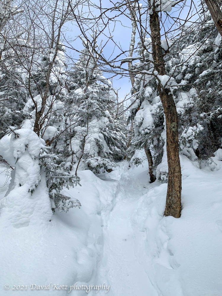
The trail left the brook and climbed steeply into a mixed forest. At this point I met the other hiker on his way down. “I didn’t make it to the summit,” he said, explaining that he’d reached a point where the old tracks went right where they should have gone left, and despite recognizing their mistake – and turning left – he eventually reached a point where he lost the trail. (“I’ve climbed this trail countless times”, he said, “but everything looks different in winter.”) Having never been here before, I was nervous about whether I could do any better, but I thanked him for the information and pressed ahead.
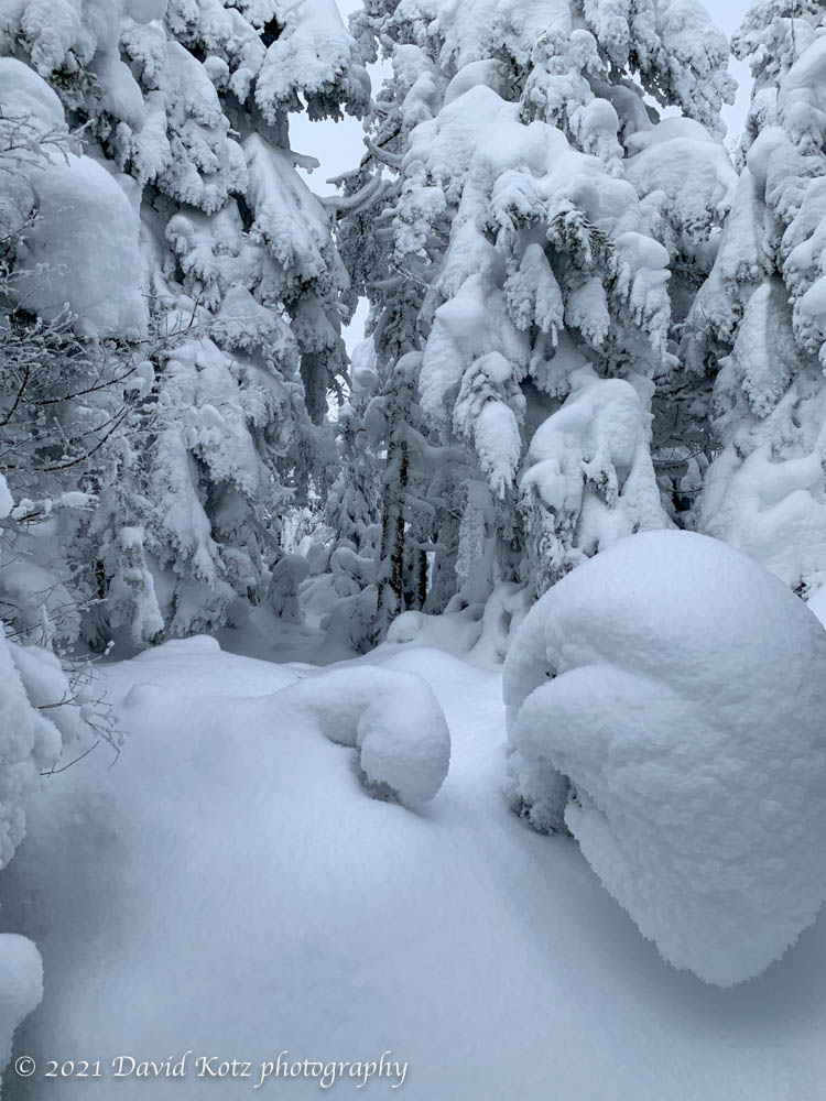
The snow was deep now, perhaps three to five feet deep, nearly all powder. The spruce and fir trees were heavy with their burden of new snow and I often had to duck under their bowing branches to follow the trail. I was grateful for this other fellow, in so many ways; in his passing he had knocked the snow off these overhanging boughs.

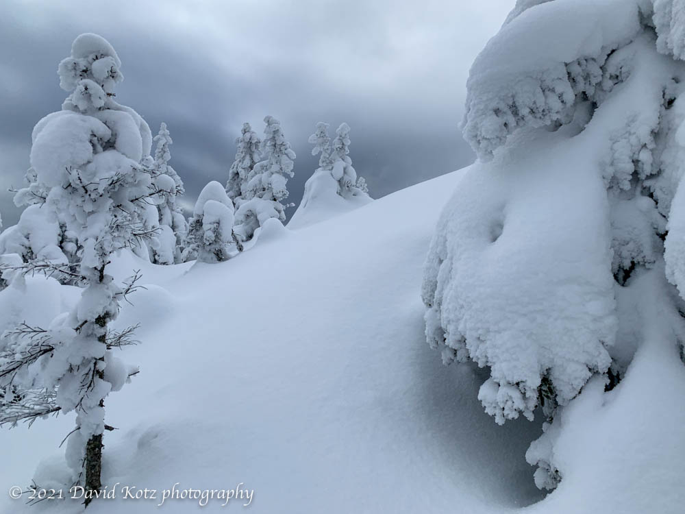
Soon after the trail broke into the open, with some views of the valley as the trail crossed what (in summer) must be granite ledges intermixed with the hardy spruce, two snowshoe trails diverged: one right, and one left. His earlier information saved me tremendous time, here, as I turned left and avoided the false trail to the right. (He said he’d followed the right-hand trail and found himself “walking on treetops” – spruce traps that can swallow a hiker whole – and backtracked to attempt to find the proper trail.) As I looked to the left, a bit of blue blaze peeked out where a rock emerged from a gap in the snow, apparently missed by the earlier groups. I pressed on to the left.
Now the trail was rough, broken only by my intrepid morning partner; as he had indicated, his trail reached a point where he stopped and turned around. Standing atop a ledgy boulder, examining the terrain he’d decided to abandon, and the end of the broken trail, I decided to cheat. I opened my phone and examined the map on GaiaGPS, which indicated I was close to – but just a bit to the east of – the proper trail. Stuffing the phone back in my pocket, I bounded down the boulder into untracked snow, following what appeared to be a plausible pathway.
Following my nose, I worked my way through deep snow among the trees. I found a tree with a blue blaze, and then a trail sign. I was back on the trail! I soon faced a near-vertical climb through deep powder. It’s an incredibly fun experience to be in fluffy fresh powder three or four feet deep – but also incredibly challenging to climb uphill.
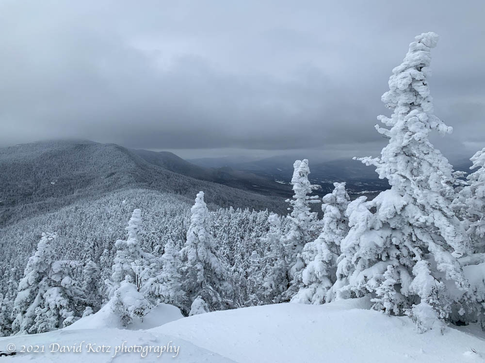
I set my ski poles horizontally across the trail above me and used them as a snow-anchor, giving me some traction to pull myself gently uphill. After another two dozen steps, I could climb no higher. Summit! Although this summit is only 3274′ (almost exactly 1000m), the views were impressive! I must say, though, I enjoyed the foreground scene of snow-covered trees more than the distant mountains under cloud cover.
From here the trail continues on to Mount Putnam… a route to consider for another day. Meanwhile, check out today’s photo gallery!
Hike stats:
Distance: 7.22km
Time: 2h41 round-trip; ~1h33 up, ~1h down.
Gain: 557m


Gorgeous, David. I was feeling a bit nervous for you, though. Glad you made it safely. 😄