Home woods

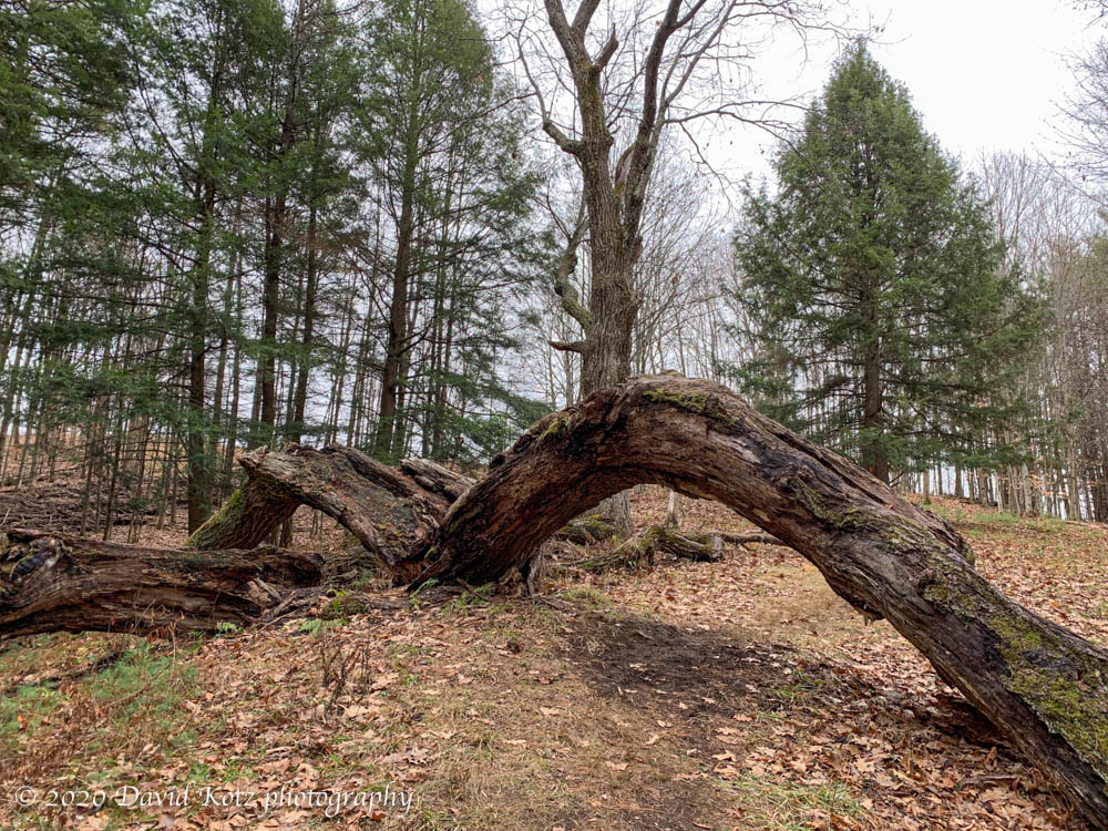
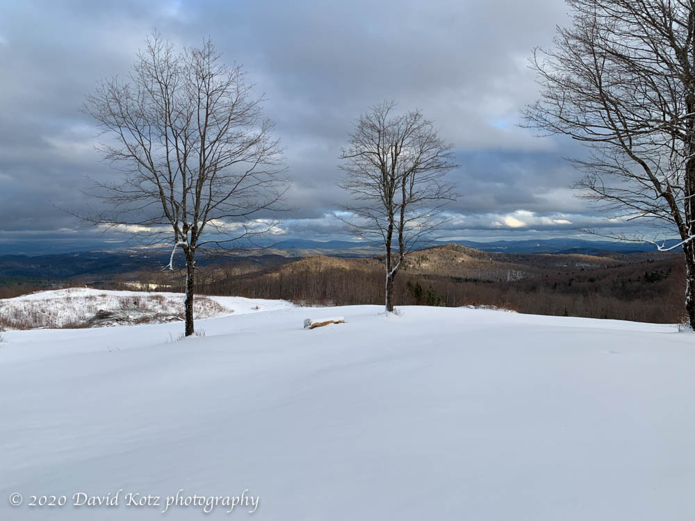
One of my favorite places to go when I have little time or ambition is just across the street. Between River Road and Route 10, between Hewes Brook and Grant Brook, is a sizeable block of roadless forest, with rolling hills, steep ravines, and a variety of forest regions ranging from firs to pines to maples and oaks. Most of it is managed for timber, so there is ample room to meander under the mature trees and there are skidder trails here and there that provide walkable paths – some even skiable. The hill rises steeply across from our house, giving one an immediate workout, but once up on the ridge, or down in the valley on the other side, it’s a magical place.

A hardwood forest – seen in black & white.

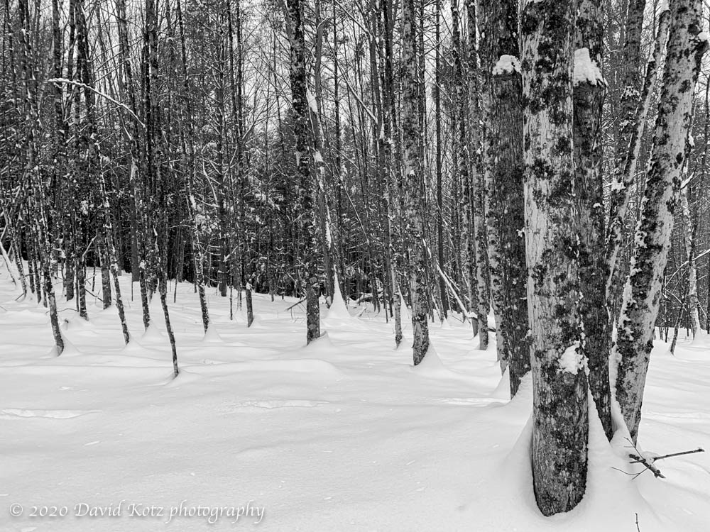
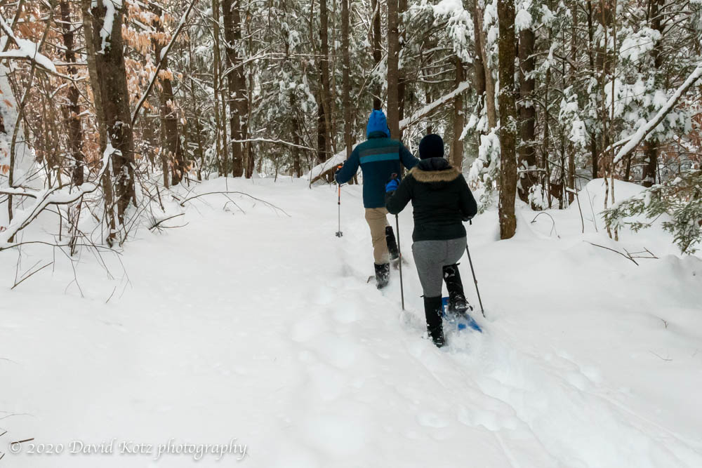
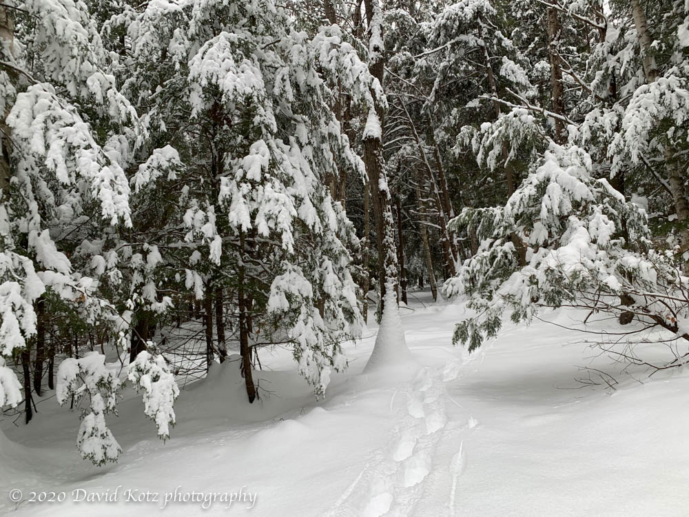
I mostly visit here in winter, on snowshoes or skis, traversing above the litter of the forest floor and pondering the many tracks animals leave behind. Deer tracks are never out of sight; mouse and squirrel tracks are common; bear and fox are an occasional treat. There were plenty of deer tracks criss-crossing my path today, as my snowshoes waded through the fresh powder laid down by that storm two days ago. I happened to look up at the right moment to see a huge owl gliding through the treetops ahead of me, totally soundless in this quiet snowscape. Someday I hope to have a chance to photograph these elusive neighbors.

Snowshoeing through an area dominated by firs and pines.

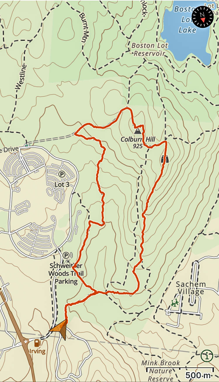
When I head into these woods I rarely have a plan or a particular goal; I follow my whims, noting landmarks familiar from two decades of wandering or exploring new directions to see what I might discover. Today I went further north than ever before, eventually popping out on the Lyme Hill – Grant Brook trail, as expected, giving me an easy exit down to River Road for the walk back home.

Enjoy the snow

The day after a snowstorm can be a wonderful thing. Today was bright and sunny, the trees were covered in snow, and the meadows glistened with fresh powder. I had a little time to explore the yard this morning, and I went out snowshoeing with the kids in late afternoon. I’ve added a few photos to the gallery, starting here. Here’s just one:

Andy and Mara snowshoe on the trail around Crossroads in Lyme.

We ended the day in the center of Lyme, outside the home of the Lyme Historians, where they had decorated an antique sleigh and invited families to stop by. It was a photo op not to be missed!

Mara and Andy in an antique sleigh in Lyme NH.

Holts Ledge

Sunset traverse of a local favorite.

Another local hike, a repeat of a fall-colors hike I did at the end of October. Today it was chilly, as a cold front blew in and the winds whipped through the leafless trees on the slopes of Holts Ledge as I climbed the Appalachian Trail toward its ledgy summit. There was a dusting of fresh snow on the leaf litter, which crunched slightly under my feet, following the footsteps of a few others who ventured up this trail since last night’s snow flurries.

I always smile when I pass the marker at the roadside, spiked into a small tree by some DOC students a decade or more ago, and slowly becoming one with the tree.

DOC trailsign at the A.T. trailhead to Holts Ledge.

At the top of the ridge – for this is really a ledgy ridge, not a hill with a summit – there were fine views north to Smarts Mountain and southwest to Goose Pond, as the sun nudged close to the horizon around 4pm.

View from Holts Ledge toward Smarts Mountain, with the main ledges in shadow at left..

Some older snow clung to the trail along the ridge, maybe an inch or two surviving the recent warm temperatures. Below you can see some snow in the brush to the right and the rocks below.

View from Holts Ledge toward Mt Cardigan and Goose Pond, with ledges close at right.

I descended via the Dartmouth Skiway “papoose” trail, with barely any snow cover, but as I walked past the base lodge I could see and hear the snow-making apparatus busily coating the trails on the Winslow side of the valley, hoping to be ready for skiers around Christmastime.

Snowmaking at the Skiway

ONE OTHER THING. I’ve been for three walks lately on trails in Hanover or Lyme, and every one of them – every one – has presented me with a disgusting and surprising trailside treat: a modern ‘doggie bag’. Today, it was hanging on a trailside twig; other times it is propped carefully on a tree stump. What is it with dog owners, who think it’s better to leave a plastic-wrapped pile of dogshit in the woods instead of just letting their dog shit in the woods? I mean, what do they think the animals do in the woods? We’re not in a city park here, and there’s not a park staff who might come along and remove this trash. sheesh.

Really folks? It’s far better to just leave the dogshit in the woods, where it will decay with everything else, than to wrap it in plastic that will last for decades.

Balch Hill

My outing for today was to re-visit Balch Hill, a bald round-topped hill in the middle of Hanover. I’d been there only once before, when the kids and I followed the mysterious Valley Quest instructions to find a hidden quest box near the summit. Today, a blustery and gray November day, I was the only person on the hill, it seemed. The lone maple tree that proudly guards the hill-top meadow seemed silent in its leafless state, awaiting a proper blanket of snow. Although I ascended by the Maple Trail (1.0 mile from car to summit) I found a map and decided to loop down via the Hemlock Trail and some residential streets. The summit kiosk mentioned a huge old oak tree to be seen along that path, and how they’d left in place the massive branch that “lost its battle with gravity”.

A huge fallen oak branch forms an arch over the Hemlock Trail on Balch Hill.

Indeed, the trail now passes under the natural arch formed by this decaying branch, adding a little novelty to today’s walk in the woods.

Boston Lot

Still life with ice.

One of the upsides of the current situation is that I’ve tended to look closer to home for outdoor opportunities, and that means I’m returning to some of the local gems I’ve not visited in a decade or more. Yesterday I took a walk around Boston Lot Lake, a small pond in West Lebanon not far from the river at Wilder Dam. Its network of walking and biking trails are popular with local runners and bikers, even on this gray Saturday morning.

Ice and reflections on Boston Lot Lake, NH.

The lake was skimmed with ice., though the temperatures were beginning to rise above freezing, so it would not last long.

Ice and reflections on Boston Lot Lake, NH.

In one spot, some kids had been clearly been tossing rocks at the ice – some of which went through, and some of which were trapped in the ice.

An interesting still life with rocks and ice.

Winter wonderland

An early winter outing.

I had a chance to walk to a prominent outlook in Vershire VT, with two of my oldest and bestest friends. While we’re still suffering from a near-total lack of snow down here in the river valley, Vershire’s hills were covered in several fluffy inches of the freshest snow Vermont can make.

Fresh snow draped on every twig and branch.

With the sun now setting shortly after 4pm, as the days tick closer to Solstice, the late-afternoon clouds added a bit of color to the quiet woodlands through which we walked.

The long-distance views from this hill – merely a hill, but with a clearcut view to the northeast – presented a fine opportunity to pause while our conversation wound around the topics of the day.

A walk through winter wonderland in Vershire, VT.

Indeed, though it was lovely to hike through some of the season’s first good snow, the real treat was the time it offered to catch up with good friends. Looking forward to more such outings to come…

Black Mountain

Grand views for a short hike.

Yesterday was a brilliant sunny day – a nice late-fall day when it should be an early winter day – so it seemed like another great opportunity to get outside. A short drive brought me to the small town of Benton, just west of Moosilauke, and the steep climb to the rocky ridge known as Black Mountain. From its granite ridgeline there is an expansive view across a nearly roadless wilderness to Mount Moosilauke. In the photo below, Moosilauke’s extended north-south ridge is at center, with the Kinsman range at far left and Mount Lafayette’s white-capped peak peeking out behind the Kinsmans.

Views of Mount Moosilauke from Black Mountain summit.

You’ll see it far better in a full-screen version, in the photo gallery… where I include three or four more photos.

Hike stats:
distance: 5.6 km
gain: 473m
time: 2h 0m

Map of my hike ot the summit of Black Mountain and return. Elevations in feet, distances in meters.

Moosilauke

A delightful ascent of Moosilauke in unseasonable conditions.

On this day, very nearly the last day of November, the forecast was for a purely sunny day with temperatures well above freezing – weather decidedly un-November-like – so I decided it was high time I went back to Moosilauke. Yesterday it rained much of the day, even at altitude, so I was concerned the Moosilauke summit may have been glazed with ice today. But I was pleasantly surprised, as I climbed the familiar Glencliff trail, to find the muddy conditions of the lower sections giving way to a dusting of snow and, higher up, nearly an inch of fresh snow on the ground and trees decorated with fresh powder and rime ice, backed by a deep blue sky. Read on, and check out the photo gallery.

The summit sign beckons in the distance while rock cairns hold rime-ice feathers.
Continue reading “Moosilauke”

Chilly November hike

The first day of winter?

Today is the first day of winter. Well, I suppose there are many ways to define “the first day of winter”: the first time snow falls, the first time snow falls and sticks, the first time you actually need to plow or shovel snow, or the astronomical date of the Winter Solstice. I’m going with a new definition: the first day the temperature never rises above freezing.

Although the higher NH mountains have already experienced some significant snowfall, and plenty of freezing temperatures, I’ve been staying close to home and enjoying the low-altitude hikes here in the Connecticut River valley – wearing lots of orange clothing, now that deer hunting season is fully underway.

Today I took advantage of a gap in my Zoom schedule to visit a trail network I’d never explored before – between the huge complex of Dartmouth Hitchcock Medical Center and the graduate-student housing over at Sachem Village. This big green spot fills the center of the triangle formed by the towns of Hanover, Lebanon, and West Lebanon. There’s an amazing variety of terrain, and a thorough network of trails used by walkers and mountain bikers.

For me it was a pleasant, if chilly, stroll through the quiet post-autumn forest, one that has laid down its blanket of leaves and is awaiting the big snows of winter. I enjoyed the opportunity to snap a few photos of the delightful details like the following. When mud freezes, the water expands and is pushed up through pores in the mud, leaving these fragile towers of crystalline ice. Check out the full-size photo, and three other scenes from the hike, in the photo gallery.

Extruded ice, which happens when mud freezes and the water in the mud expands.

Hike stats:
distance: 5km
time: 69 minutes
gain: 127m

A hike on the Indian Ridge trail, behind Dartmouth-Hitchcock Medical Center.

Mount Cube

The weather this week has been startlingly warm, almost as if summer has lasted into November. Yesterday’s high temperature here at home was 71ºF! It may have been the last ‘summer’ weather of the year – and also the last day before deer-hunting season fully opens – so I was eager to get out for a hike. I try to hike on weekdays to avoid the weekend crowds.

Despite a dense fog clinging to the Connecticut River in the early morning, I hopped into the Tesla for an all-electric drive to one of my favorite trailheads – the Rivendell Trail up Mount Cube, only 30 minutes away. I’ve been up this two-mile route many times, because it gives one all the features of a “real mountain climb” without the temporal overhead of a long drive or a long hike… a stroll through leafy hardwood forests, a scramble up rugged rock-strewn trails, the pungent scent of balsam firs, and distant views from its granite outcrops and 2900′ summit. In the view below, from the summit you can see the foggy Connecticut River valley in the upper right and Smarts Mountain at upper left.

Seen from Mount Cube.

Sadly, the summit has poor views to the northeast, but if you stand on tippy-toes and peer between the firs you can pick out Mount Moosilauke. No photos worth taking, so here’s the summit trail sign, where the Appalachian Trail passes by.

Seen from Mount Cube.