I try to reserve a bit of daylight, each day, to get out for a walk. When I’m especially busy, or lazy, I walk up the road and back, keeping an eye peeled for that bald eagle I saw over the river last week. But when I have a bit more time and energy, I don my pack and strike out up the steep hill on the other side of the road. These hills were formed several centuries ago when the Connecticut River was formed by the receding waters of the Pleistocene-era Lake Hitchcock, after the glaciers receded from what is now northern New England. The hillside is steep, but it’s a good chance to get my legs moving, to fill my lungs with fresh air, to follow my whims, and to see what I might find. What did I find out there today? read on.
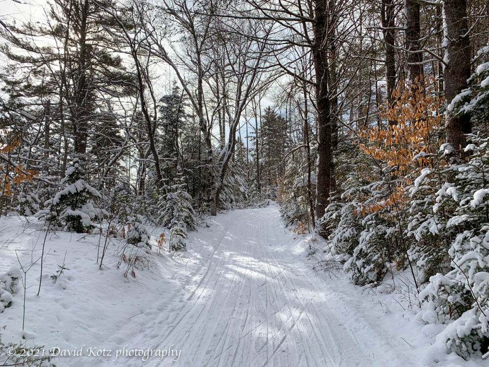
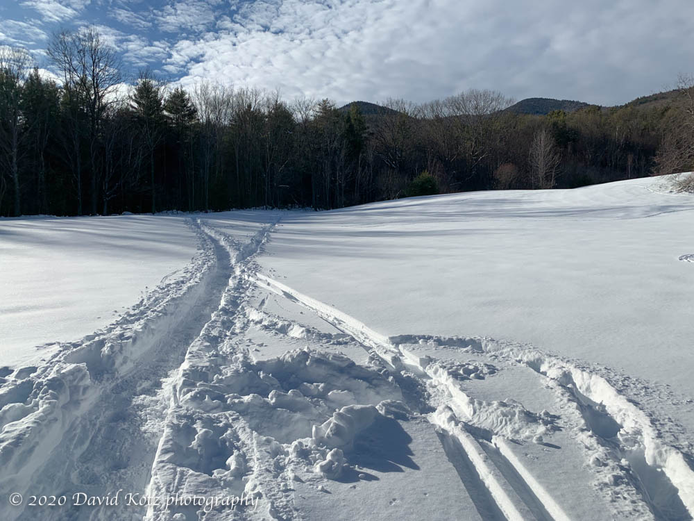
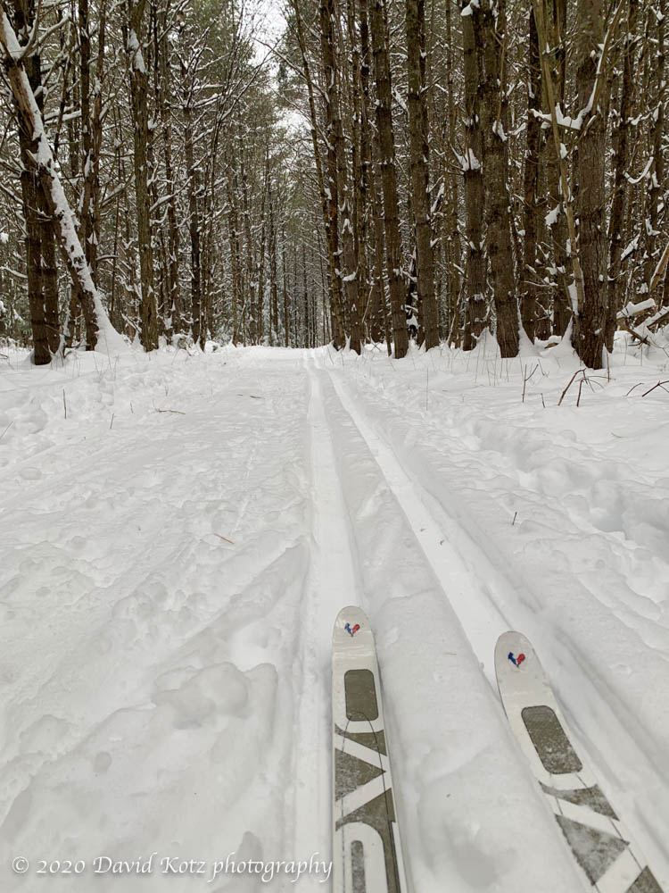
One of the grand things about living here in Lyme is the opportunity to ski on some spectacular terrain, thanks to a local family that opens their land to skiers and snowshoers – and grooms dozens of kilometers of trails. A light powdery snowfall in each of the last few days has added a fresh surface to these trails, making for a delightful skiing opportunity this morning.
ski trail in northeast Lyme.
The weather was chilly, however, with temperatures in the single digits and a light breeze blowing across the three ponds of this area. I stuck to a relatively short loop, due to frozen fingers. The overflowing parking lot was an indication, however, that many other local residents were out enjoying this beautiful day.
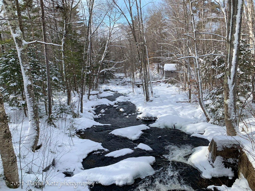
Brook crossing near Cummins Pond in northeast Lyme.
I’m grateful to live in Lyme where this, and another patch of forestland is groomed for public skiing, by volunteers and generous landowners. And, where the Dartmouth Skiway grants free lift access to Lyme schoolchildren. Thank you Lyme!
Black Mountain is one of my favorite places to hike – it has a great view, it’s not a long hike, it’s not a long drive, and it is small enough to stay below the clouds on most cloudy days. Indeed, I was just here last month. Today, however, there was a crunchy base of snow about 2-4″ thick, and a fresh dusting of powder about 1/2″–2″ on top. Read on!
For a few months I’ve been thinking of returning to Lambert Ridge, a ledgy section of the Appalachian Trail up Smarts Mountain, not far from here. The first section is steep, leading up to a series of granite ledges with broad views that belie the relatively low elevation at this point on the trail. The climb to these ledges is a worthwhile dayhike, and brings back memories. Read on!
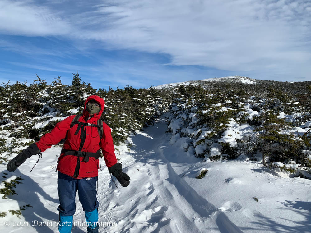
After yesterday’s good news from Georgia and horrific news from Washington, I was grateful to spend a few hours in one place on earth that gives me great peace: Mount Moosilauke. As I drove east out of the Connecticut River valley and over the shoulder of Mount Cube, I could see that Moosilauke’s summits were clouded in – disappointing – but I also enjoyed a deep-red sunrise among the clouds near the eastern horizon. A bright spot in a gray day. Read on, and check out the photo gallery for videos and more pix!
Tim, David, and Kathy, on a hike to Blueberry Mountain.
It has long been a tradition for my Dartmouth friends and me to hike a mountain on New Year’s Day. Today we were fortunate to have outstanding weather: a blue-sky day with moderate temperatures (20-30º), and a fresh (though thin) layer of powder snow at higher elevations. We had eyes for Moosilauke – our traditional destination for New Years – but with weather this nice, we anticipated huge crowds. Instead we headed for Blueberry Mountain, a pretty little (2,663′) bump to the southwest of Mount Moosilauke.
I’d been up here once before, but from the east, and today we came up from the west. The west is a longer approach, but a pretty trail nonetheless. We were the first to travel this trail since the snowfall a few days ago. To be more precise, we were the first humans on the trail since the snowfall – we were following a coyote’s tracks for most of the way up! Indeed, the coyote often provided clues about the route when the trailbed was not so clear.
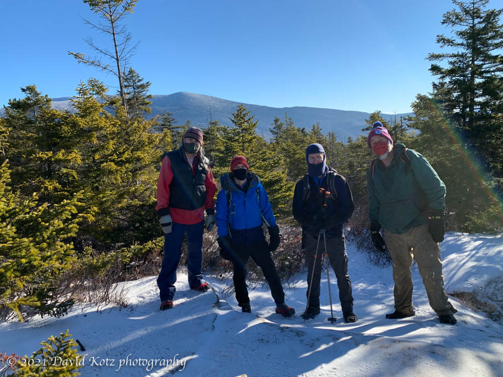
The view from the summit is partly obscured by trees, but Moosilauke was visible and delightfully clear from this close. It must have been a grand day up there! In the photo below, the south peak is most visible.
On the summit of Blueberry Mountain: Kathy, Tim, David, David.
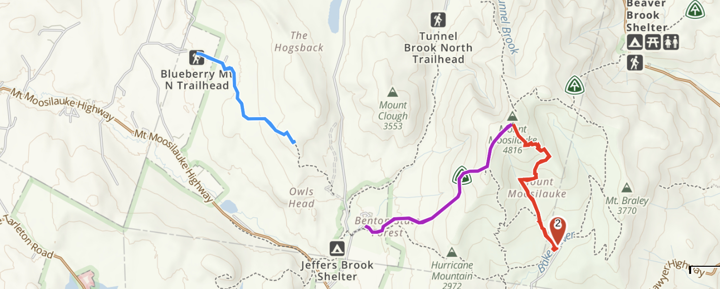
The sign at the trailhead advertised 2.2 miles, but my GPS track shows we walked 8.52km round-trip (5.3 miles, or 2.65 mi each way). Two smartwatches also indicated a distance closer to 2.7 miles for the ascent.
A fresh dusting of snow decorate the trail near the summit of Blueberry Mountain on New Years’ Day.
There’s something magical about gathering with old friends, even after a long absence. It reminds me of the experience of slipping on a well-traveled pair of hiking boots: they fit just right and enable you to walk for miles in comfort. So it was for us today, a group of friends who have been hiking together for more than three decades. We met at the base of the Rivendell Trail on Mt. Cube – a trail that is one of my local favorites, because it gives one a dose of the “White Mountains” without a long drive or a major hike. Standing apart, and forgoing the usual hugs, we donned a layer of warm clothes as the wind whipped through the trees overhead. Read on!
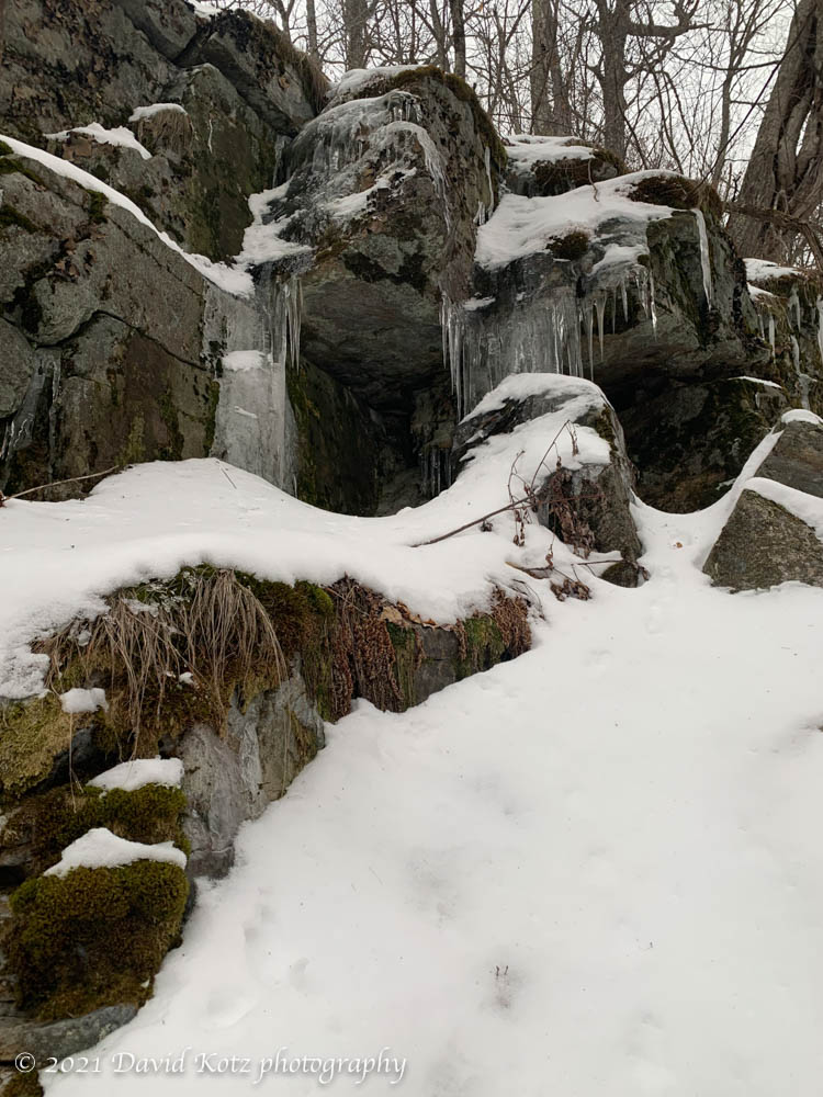
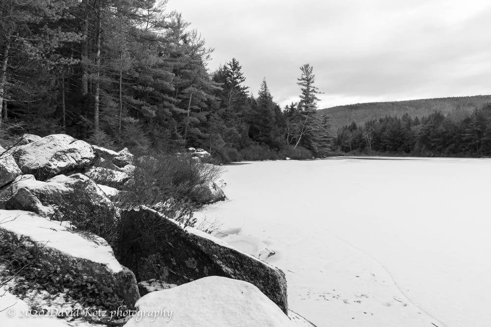
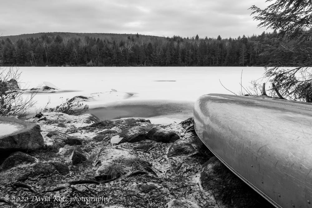
Lyme is home to many hidden natural treasures. Trout Pond is one: nestled in the hills on the north side of town, at the end of a dirt road followed by a forest road and reached by a footpath, this small pond offers quiet respite from the bustling world outside its little valley. It’s not a long hike, nor a difficult climb, barely clocking in at 2 miles round-trip along a fairly level route, but it’s interesting in every season.
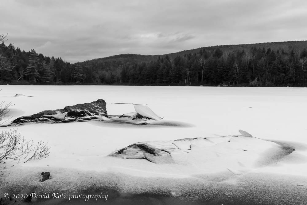
Today, the woods were entirely snow-free after the Christmas rainstorm, but there was a fresh dusting of powder along the exposed rocks and coating the skim of ice across the pond. A canoe and paddles, apparently left for anyone who wishes, rest on the shore where trail meets pond.
As noted by the page on TrailFinder, “The land around Trout Pond has been a working forest for some two centuries, while stone walls, foundations, and barbed wire seemingly swallowed by trees indicate that the western part of the tract had an agricultural history. By 1855, several families homesteaded in the area near the present trailhead. The Piper brothers, who ran a steam-powered sawmill near the outlet of Trout Pond, bought the timber lot in 1891. Two other sawmills on the brook also processed lumber that was probably cut in the Trout Pond Forest. A stack of hemlock bark, found on a ridge south of the pond, suggests this material was gathered for the leather tanning trade. By 1870, the Pliny Allen place had found its future as a cellar hole, and by 1946 so too the Gilbert/Smith place.”
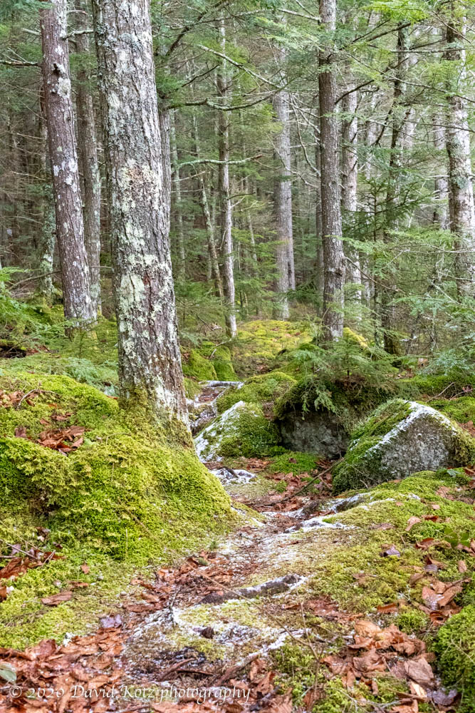
I know little about black & white photography but decided to process these snaps of the pond in black & white because, well, this presentation seemed to fit the monochrome pond, gray sky, and dark forest. In contrast, here’s a photo of the trail along the shoreline:
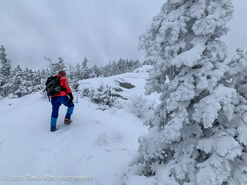
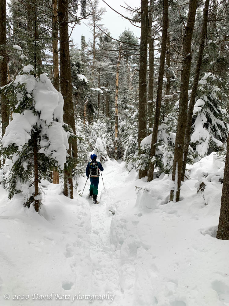
The snowstorm five days ago brought us a sudden beginning for winter, laying down deep powder across the mountains and trails. I’ve been out every day to enjoy the snow, prime conditions for skiing and snowshoeing. With bad weather looming for tomorrow and the next day (Christmas Eve and Christmas Day), Andy and I set out today to make the most of the snow before the rain spoils it.
Tracks in deep snow on Mount Ascutney’s Windsor Trail.
Although we were interested in a return to Moosilauke, the favorite, the forecast showed morning sun with increasing clouds and I feared we’d simply climb into the clouds. So I selected Ascutney; it has lower elevation but 360-degree long-distance views. And heck, it’s been more than four years since I was last there in winter.
The Windsor Trail is very popular, so it was not surprised to see it broken out. Indeed, it had clearly seen a lot of traffic… skiers, snowshoers, and bare-booters. Andy and I made good time in bare boots for the first half of the climb, passing only three other hikers, and then switched to snowshoes as the snow became deeper and softer.
Andy hiking up Mount Ascutney on a snowy winter day.
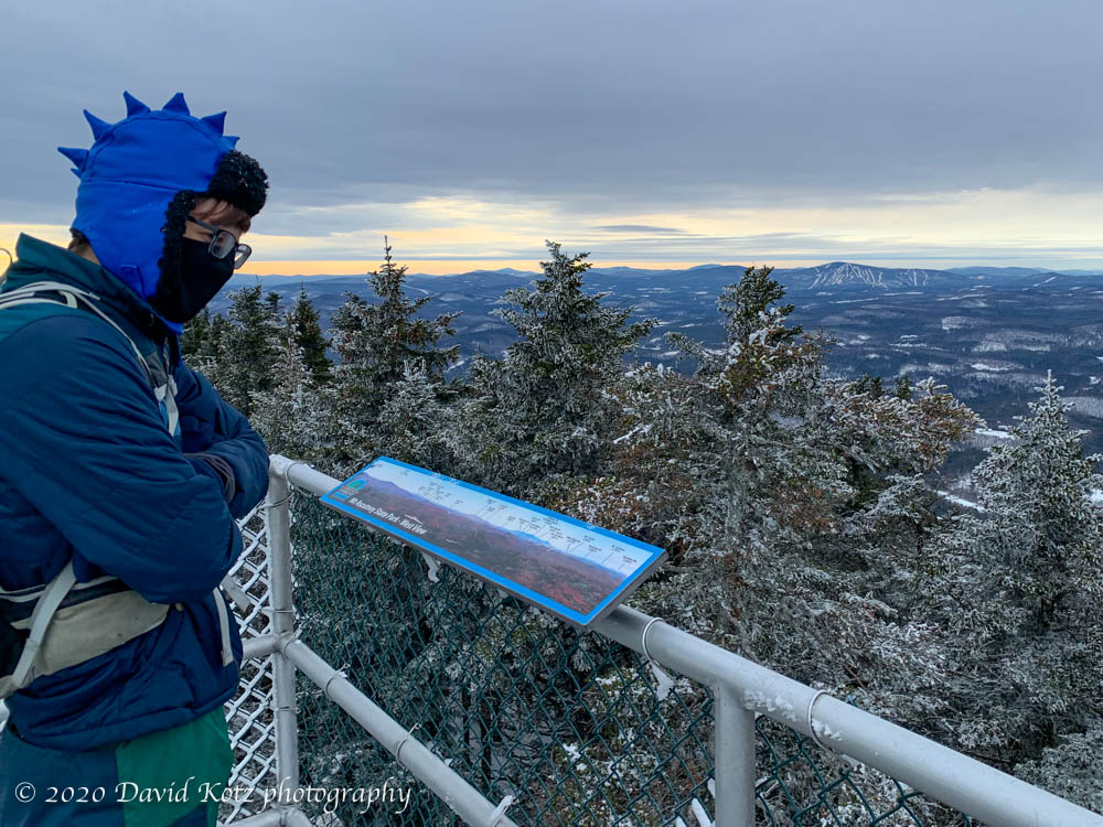
Soon we were at the summit, climbing the observation tower. There’s really no way to capture the scene with a mere smartphone camera, but the 360-degree views span nearly all of Vermont and New Hampshire.
Andy surveys the wintry view from Mount Ascutney.
Clouds were moving in, pulling us under an overcast sky… but to the northeast, the summits of Moosilauke, Franconias, and Presidentials were blindingly white in the afternoon sunshine. (No wonder the range is called the White Mountains.)
Our descent was speedy, boot-skiing down the trail, passing only two other hikers. A fine hike indeed. A few more photos in the gallery.
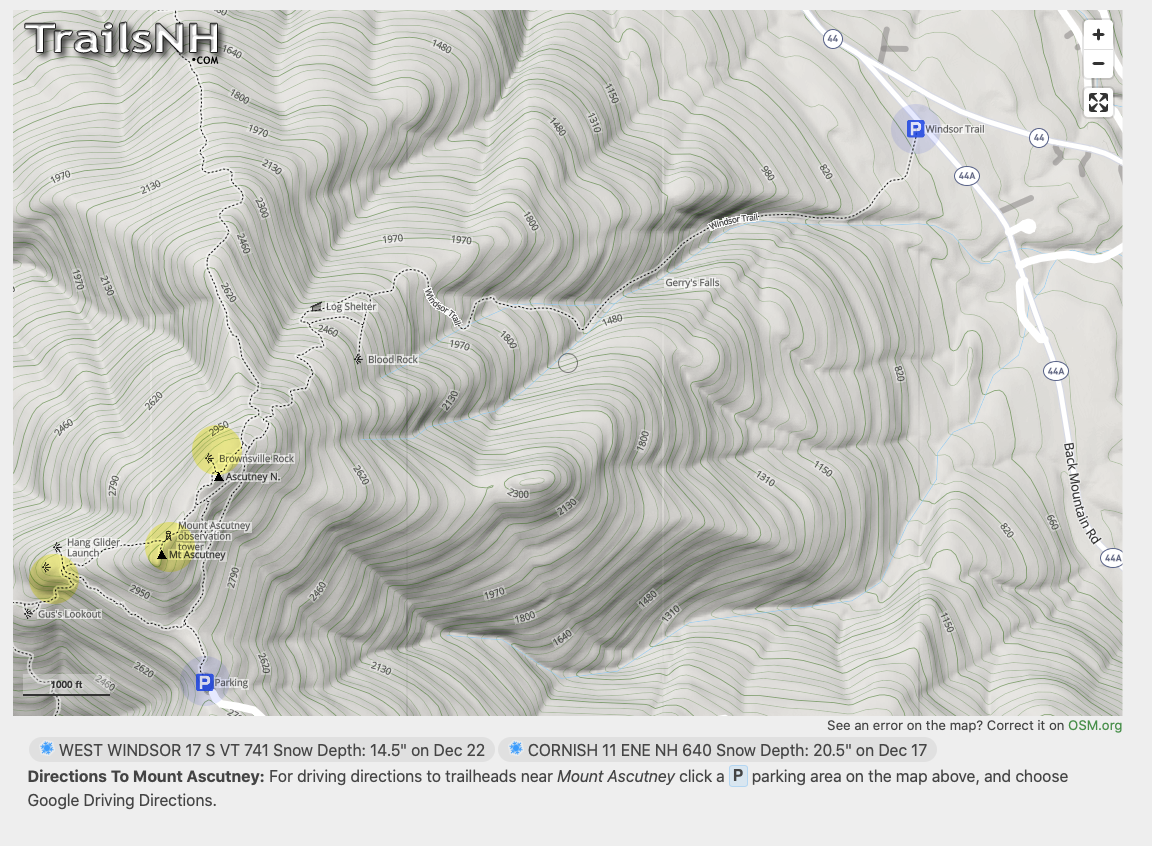
Hike stats: 5.6 miles (per the guidebook), elevation gain 2,800′ (per Apple Watch). 4 hours.
The Windsor Trail begins at Parking in the upper right and ends at the summit (the middle yellow peak).
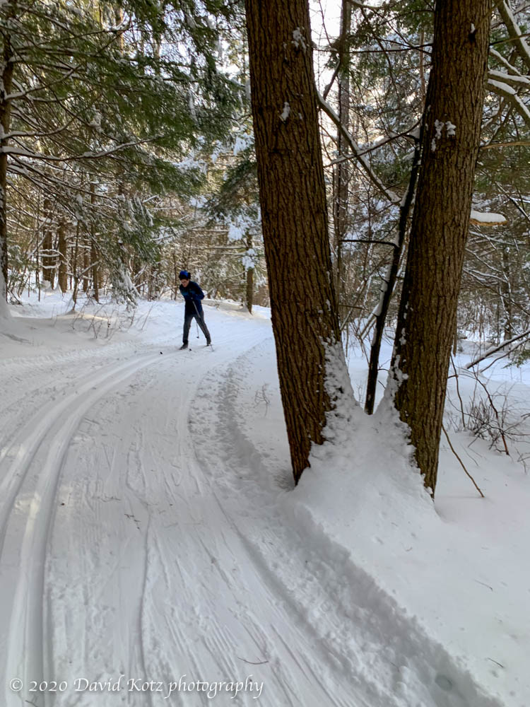
Cross-country skiing on the downtown trails in Lyme.
On Saturday and Monday (today) we went cross-country skiing, right here in Lyme. One of the wonderful things about our little town is that there are miles of beautiful skiing trails available to the public, thanks to the generosity of the landowners and the hard work of volunteers who maintain the trails in summer and groom the tracks all winter. It really is an incredible resource, especially in the covid era when activities outdoors in the fresh air are more important than ever.
I’m especially grateful to Kevin and the crew who maintain the Stone House Farm trails in downtown Lyme (where I skied today), and to Bob and the extensive network out at the Greens (where Andy skied today).
Skiing the Stone House trails in Lyme.
We went from zero snow to a solid base, in this recent storm. The conditions softened today, with temps exceeding 32ºF (gasp!), but were still a joy to ski. Sadly, the rest of the week will bring more warm temperatures and rain on Christmas Day. Let’s hope for little rain and then a new snowstorm to bring back the skiing soon!