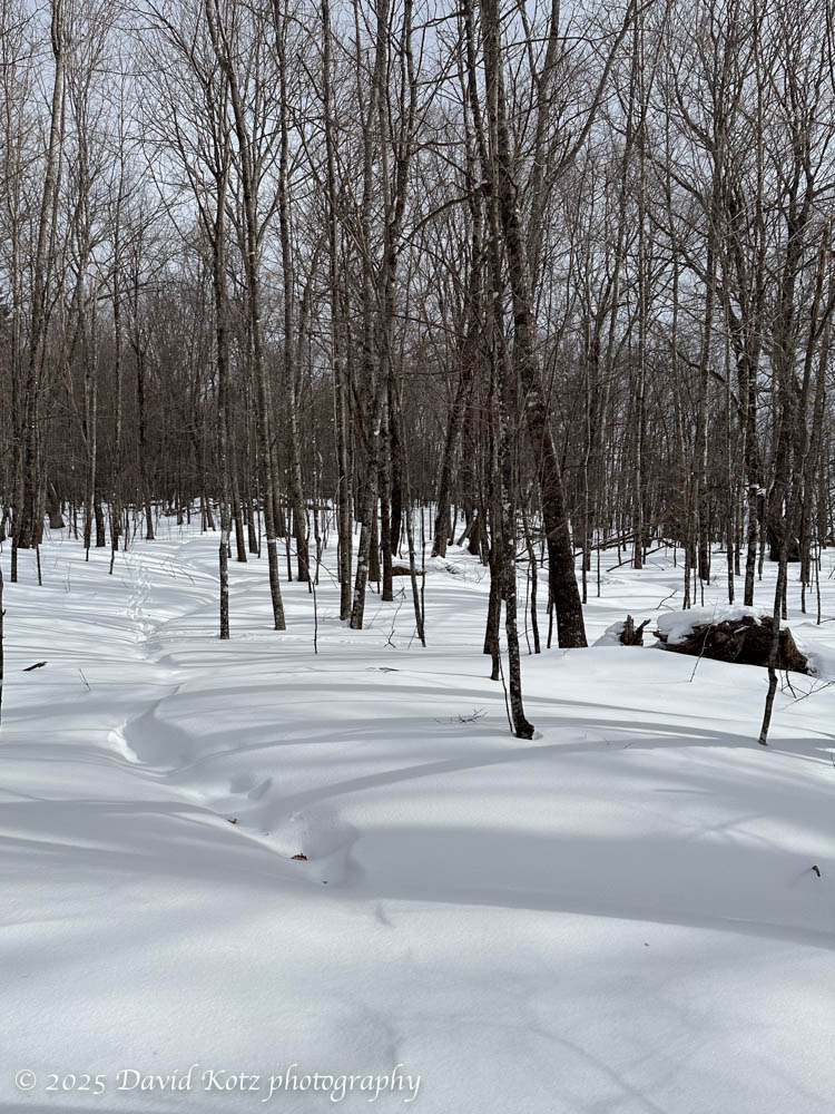
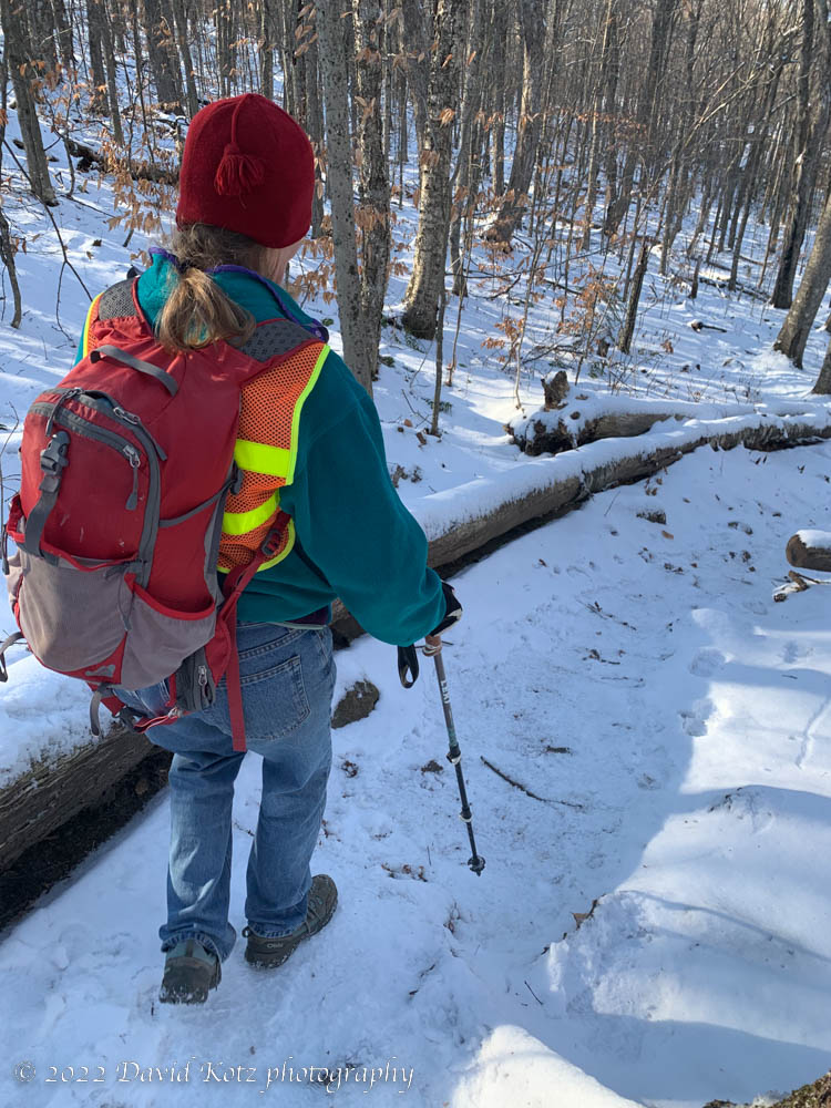
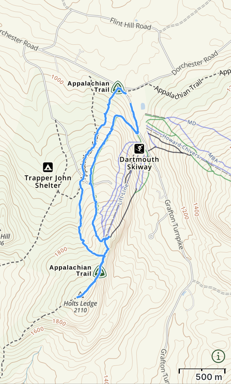
We’ve had cold weather and several beautiful snowfalls, in the past two weeks, so it was time to get outside. Tim and I headed up the Appalachian Trail, northbound from Goose Pond Road here in Lyme. Our target was a viewpoint on Holts Ledge, just past the top of the hill and just before reaching the top of Dartmouth Skiway.
Hiking the Appalachian Trail to Holts Ledge; there is a faint sign of prior hikers’ tracks under the newest snowfall.Continue reading “Backside of Holts”
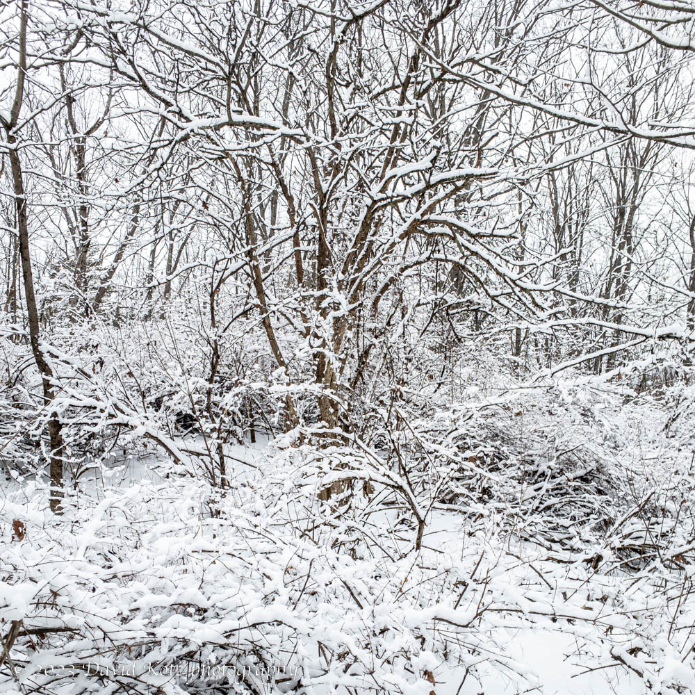
On Friday we had a lovely snowstorm that brought us only a couple of inches of snow… but it was fairly wet snow. It stuck to every twig and leaf, and there has been absolutely no wind… so the forests are now a beautiful palette of white, brown, and green.
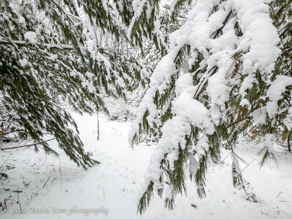
Snow on the bushes and trees of Lyme Hill.Snow on the pine trees of Lyme Hill; deer tracks show recent passage.
Another snowstorm is due tonight… I’m hoping we’ll get a substantial snowfall that will provide deep powder for snowshoeing and skiing!
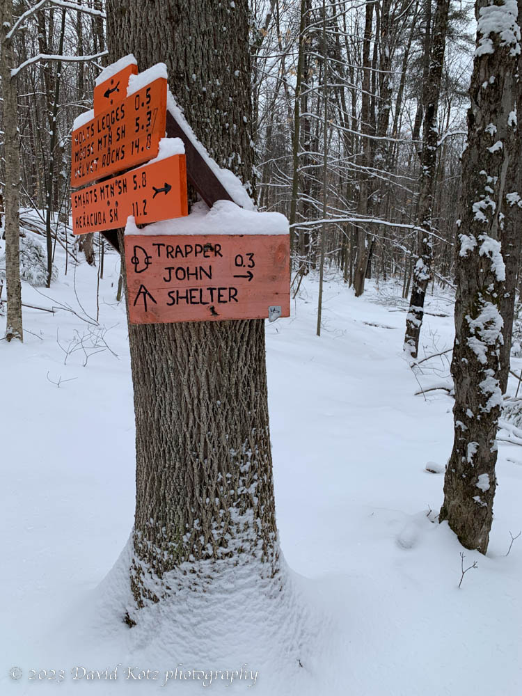
Trail signs along the Appalachian Trail to Holts Ledge, passing Trapper John shelter.
I missed the first snowfall of the season. I left town on Tuesday night for a business trip to Chicago, and missed the 2″ snowfall that arrived on Wednesday morning. So today, back at home and waking to a brilliant blue-sky day, I was eager to get outdoors. Most of the snow had melted close to home, but we chose a short hike along the Appalachian Trail to the top of Holts Ledge – home of the Dartmouth Skiway. (Things looked very different when I visited seven weeks ago!) We didn’t have to climb far before reaching an elevation with consistent snowcover. It was shallow, and crunchy from several melt-freeze cycles, but it was a wonderful taste of the winter hikes to come!
Descending the Appalachian Trail on Holts Ledge. Lyme NH.
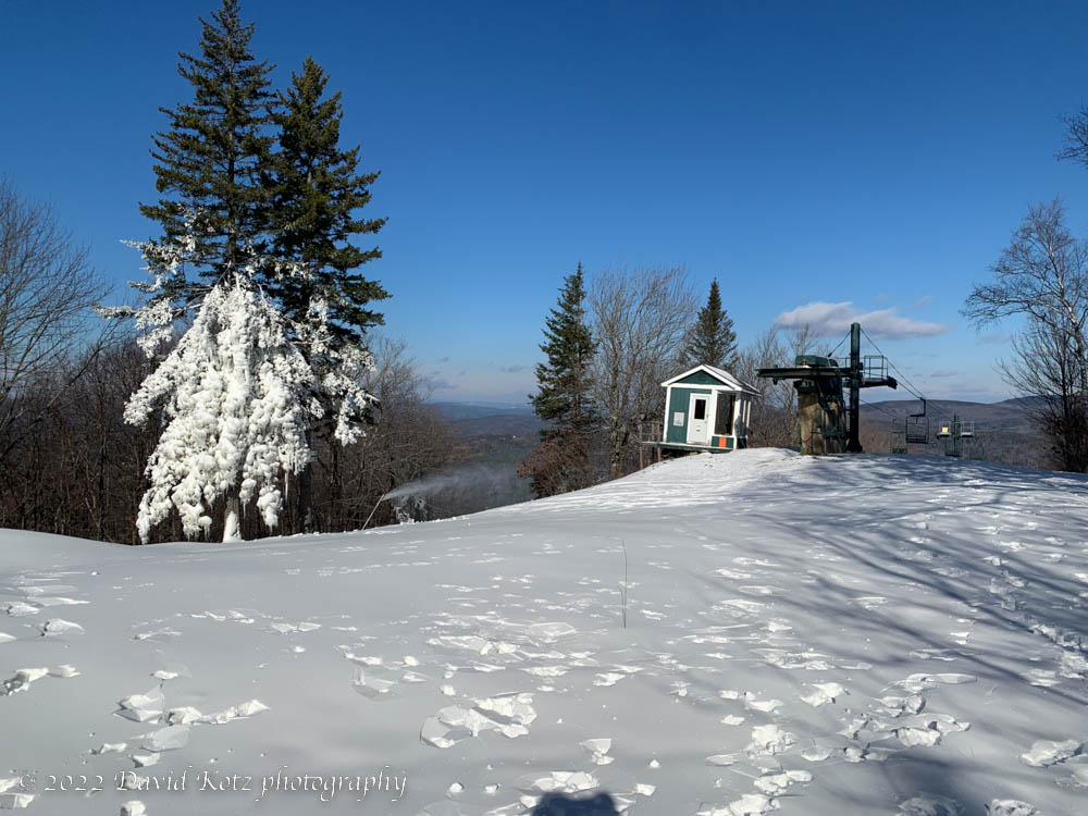
We paused at the top to enjoy the southward views across the Upper Valley and toward Mounts Cardigan and Ascutney. We then strolled over to view the activity at the top of the Dartmouth Skiway, chatting with two fellows who were tinkering with the snowmaking equipment. Only three weeks to opening day!
Snowmaking coats the trees at the top of Dartmouth Skiway. Holts Ledge.
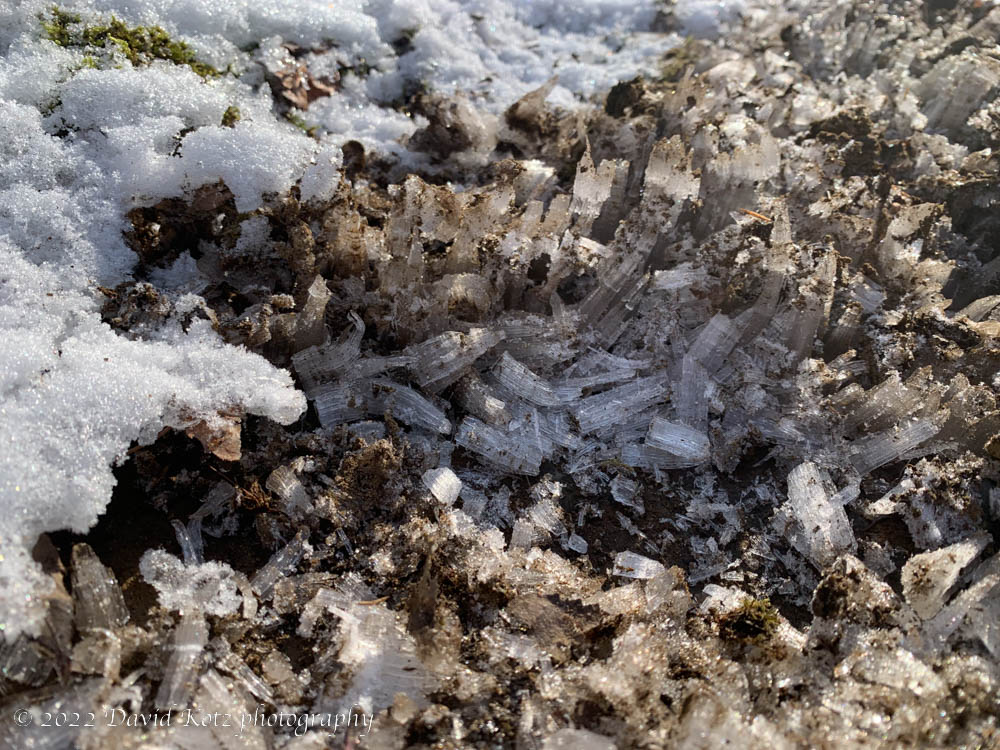
Halfway down the Appalachian Trail we encountered one of those wondrous effects to be seen this time of year: needle ice, where some mud froze, causing the expanding ice to crystallize and push the mud upward into the air.
Crusty ice spires in the mud along the Appalachian Trail on Holts Ledge.
I’ve been meaning to get out hiking, in the high mountains to the north – knowing that the fall colors will arrive several weeks sooner there than here. But somehow the colors snuck up faster than I expected. I went today for one of my favorite nearby hikes – to the top of Holts Ledge, the cliff-faced ridgeline on which the Dartmouth Skiway sits. The Applachian Trail rambles over this hilltop, brushing the tops of the cliffs and providing fantastic views to the south and east.
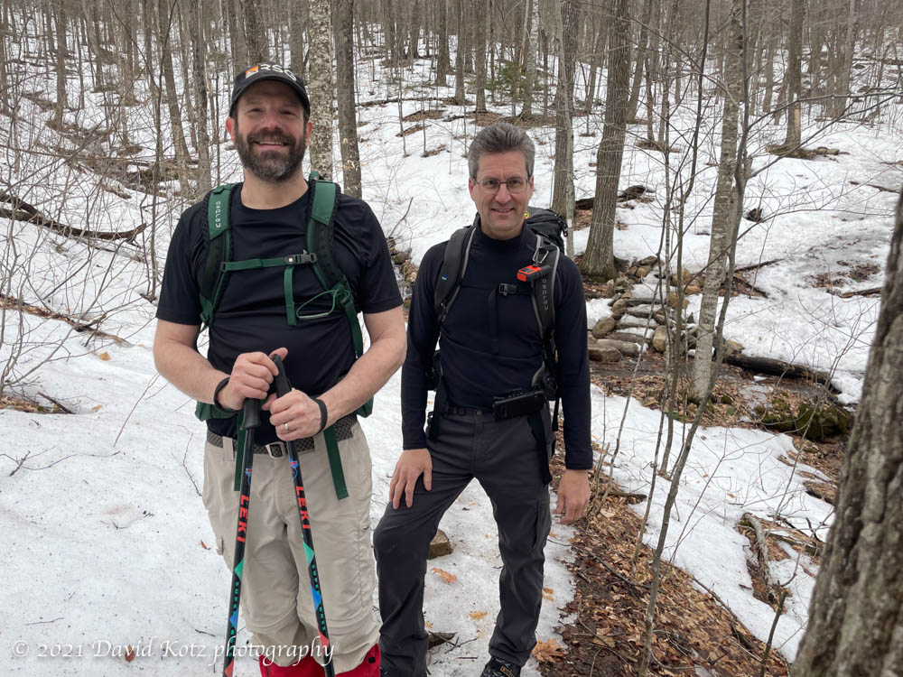
A mere five days after I went snowshoeing through winter’s glorious powder in the Kinsman Range, I went hiking with two friends … in decidedly spring conditions. Granted, Holts Ledge is much lower (elevation ~1069′ rather than 4293′) but there was much more snow at the base of the Kinsmans than there was at the summit of Holts. This week’s rain and unseasonably warm weather (close to 60º during our hike) has turned the low-elevation trails into mud, and (no doubt) the higher elevation trails are packed ice.
Ken and Dave on Appalachian Trail, Holts Ledge. Photo by Tim Burdick.
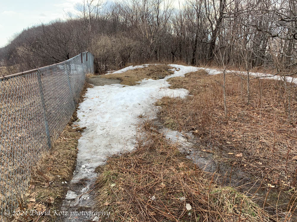
This section (and other low-elevation sections) of the Appalachian Trail is now basically done for the season, and should be avoided until after mud season.
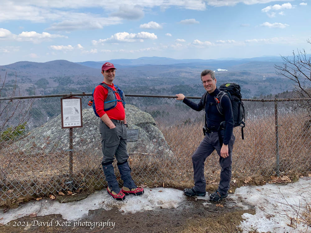
Holts Ledge cliff overlook (near the summit). Snow almost gone!
Ironically, the view above is at the top of the Dartmouth Skiway… fewer than 100m from the top of the slopes. There, skiers were still happily skiing on spring-condition snow. At least there were some views, below.
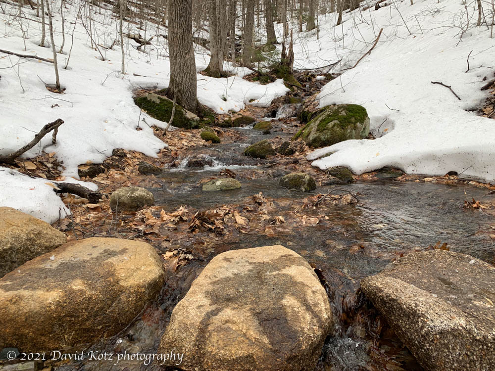
David with Tim Burdick atop Holts Ledge on a late-winter day. Photo by Ken Kaliski.A stream crossing on Holts Ledge, with plenty of meltwater.
Sigh, we haven’t even reached the spring equinox yet.
Today woke with frigid temperatures: -10ºF (-23ºC), which was certainly not inspiring me to get outdoors. But it was a beautifully clear and sunny day, and by mid-afternoon the temperature had risen twenty degrees. So a friend and I climbed nearby Holts Ledge – a hill in Lyme on which the Dartmouth Skiway is located. The snow squeaked under our feet and the stream crossings were smooth and icy. We had a fine view from the top, yes, but my favorite view was a close-up look at the frost feathers atop a puddle of ice.
View from Holts Ledge.Frost feathers on an ice puddle, Appalachian Trail, Holts Ledge.
The Appalachian Trail passes right through the town of Lyme, where we live. It wanders through the forests, across the brooks, and over the hilly terrain of Moose Mountain, Holts Ledge, and Smarts Mountain. Last weekend I had a little time for two quick hikes along the A.T. On Saturday I scrambled up Lambert Ridge, a shoulder of Smarts Mountain, to a ledgy outcrop that has expansive views to the east. Along the way I listened to the acorns dropping from oak trees all around… and startled a chipmunk, holding one of those prized acorns in his little paws. After a brief standoff, he scampered away.
View from Lambert Ridge, Smarts Mountain.
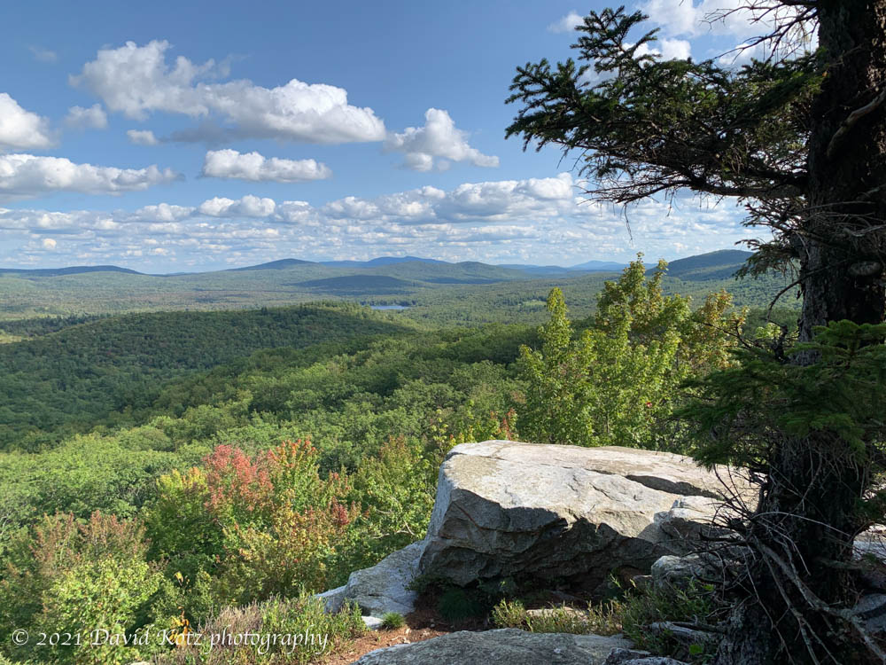
On Sunday, I returned to the area and climbed up to Holts Ledge, which has wide views to the south. Here, a chain-link fence keeps hikers away from the edge, not just for safety but to protect the endangered peregrine falcons who nest on the cliffs. This cliff is at the top of the Dartmouth Skiway, allowing a nice loop hike by strolling down the grassy ski slopes.
View from Holts Ledge.
The amazing thing is that both of these hikes are only 15-20 minute drive from my house, and can be completed in less than an hour of hike time, so they’re a great opportunity for a break from a busy weekend. See the small gallery.
Another local hike, a repeat of a fall-colors hike I did at the end of October. Today it was chilly, as a cold front blew in and the winds whipped through the leafless trees on the slopes of Holts Ledge as I climbed the Appalachian Trail toward its ledgy summit. There was a dusting of fresh snow on the leaf litter, which crunched slightly under my feet, following the footsteps of a few others who ventured up this trail since last night’s snow flurries.
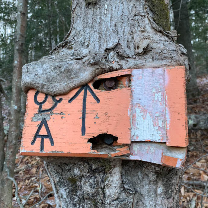
I always smile when I pass the marker at the roadside, spiked into a small tree by some DOC students a decade or more ago, and slowly becoming one with the tree.
DOC trailsign at the A.T. trailhead to Holts Ledge.
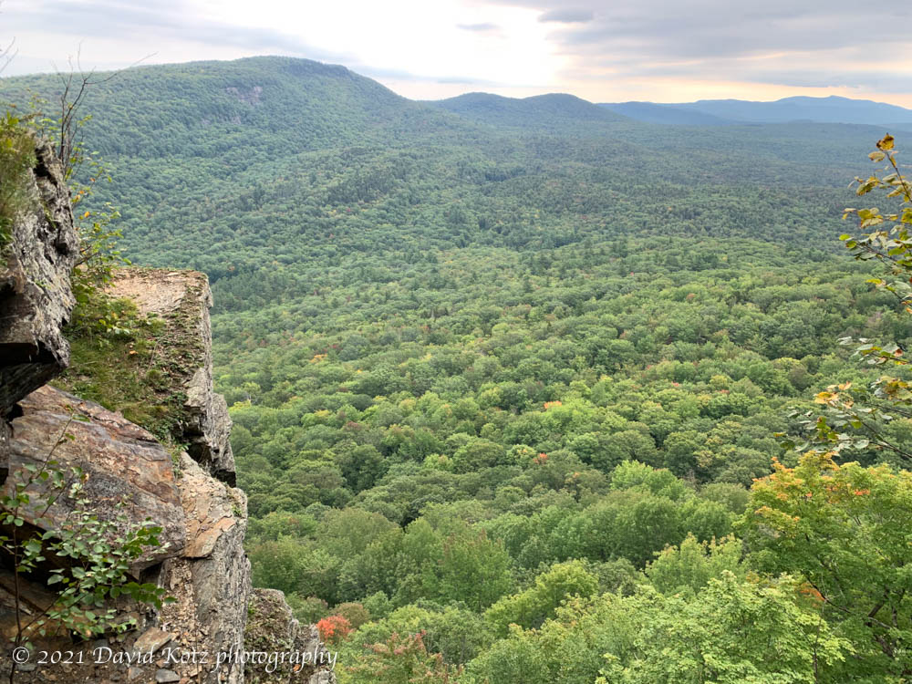
At the top of the ridge – for this is really a ledgy ridge, not a hill with a summit – there were fine views north to Smarts Mountain and southwest to Goose Pond, as the sun nudged close to the horizon around 4pm.
View from Holts Ledge toward Smarts Mountain, with the main ledges in shadow at left..
Some older snow clung to the trail along the ridge, maybe an inch or two surviving the recent warm temperatures. Below you can see some snow in the brush to the right and the rocks below.
View from Holts Ledge toward Mt Cardigan and Goose Pond, with ledges close at right.
I descended via the Dartmouth Skiway “papoose” trail, with barely any snow cover, but as I walked past the base lodge I could see and hear the snow-making apparatus busily coating the trails on the Winslow side of the valley, hoping to be ready for skiers around Christmastime.
Snowmaking at the Skiway
ONE OTHER THING. I’ve been for three walks lately on trails in Hanover or Lyme, and every one of them – every one – has presented me with a disgusting and surprising trailside treat: a modern ‘doggie bag’. Today, it was hanging on a trailside twig; other times it is propped carefully on a tree stump. What is it with dog owners, who think it’s better to leave a plastic-wrapped pile of dogshit in the woods instead of just letting their dog shit in the woods? I mean, what do they think the animals do in the woods? We’re not in a city park here, and there’s not a park staff who might come along and remove this trash. sheesh.
Really folks? It’s far better to just leave the dogshit in the woods, where it will decay with everything else, than to wrap it in plastic that will last for decades.
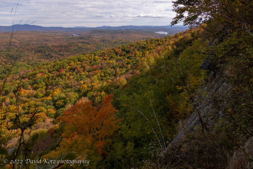
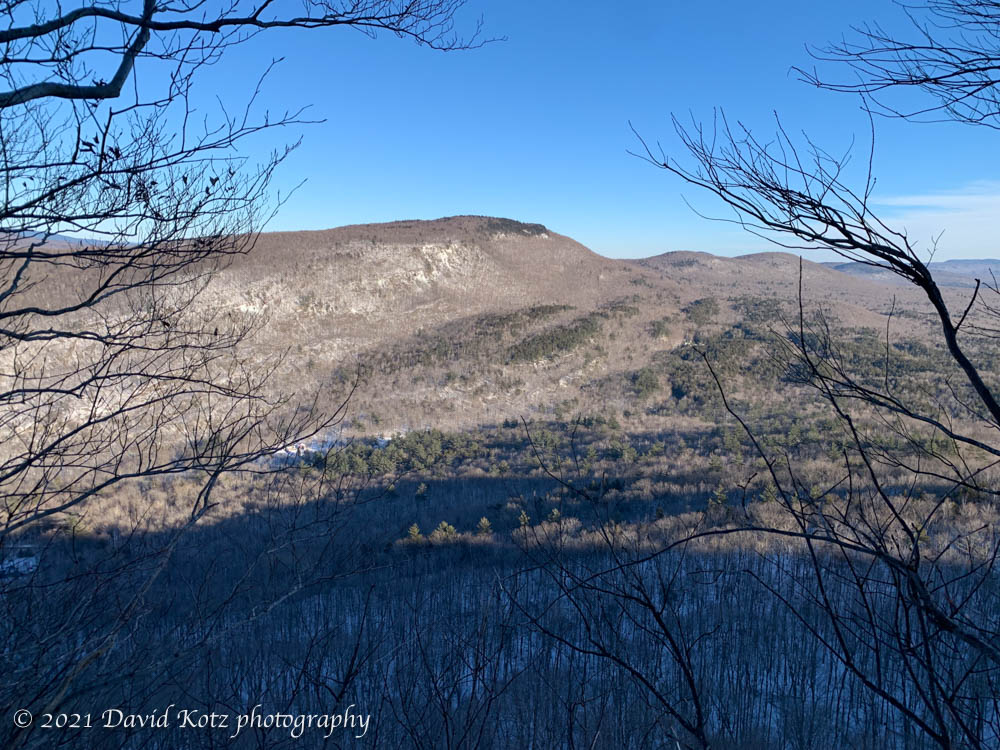
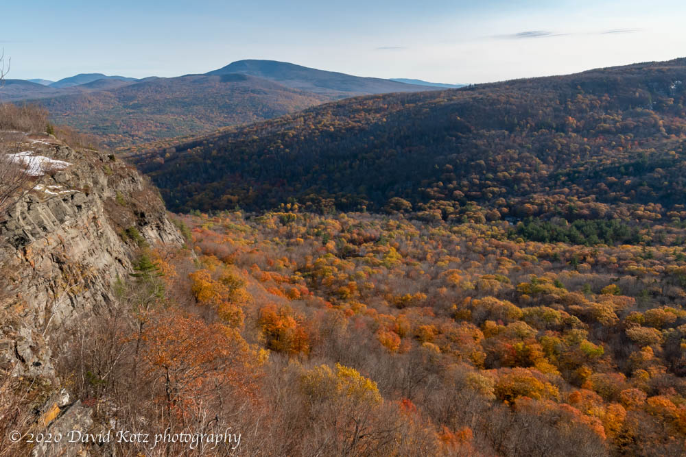
After yesterday’s brief snowfall the weather turned warm and sunny once again, allowing us a beautiful fall afternoon. This morning we woke to dense river-valley fog, so I headed across Lyme to the Dartmouth Skiway and the high point of Holts Ledge. There, well above the fog, I encountered brilliant foliage at the base and an impressive 2″ snowcover on the exposed slopes near the top. Here is one photo from the top, showing Holts Ledge at left and the peaks of Moosilauke, Cube, and Smarts left to right – but don’t miss the gallery for six other full-res photos in brilliant color.
View of Holts Ledge with (L to R) Moosilauke, Cube, and Smarts, with waves of fall foliage below.
Hike stats: distance = 5.9km gain = 353m time = 1h 37m (including photo stops)
Somehow we never got around to our annual late-August family backpacking trip. I was determined to get out, anyway, so we took two short trips. On September 30, Andy and John and I headed directly from school to a trailhead on the west side of Moose Mountain. We hiked up to reach the A.T. where it crosses a col between north and south peak, then pulled into the shelter just as it got dark and began to rain. We poked around in the dark looking for the water supply, and settled in just as a huge thunderstorm struck. Nothing like being in an open shelter, on a ridgeline, in a thunderstorm! We had to leave the next morning, skipping our second night out, because John was feeling ill.
Andy and John backpacking on Moose Mountain.
Two weeks later, Andy and Mara and I headed for Holts Ledge, hiking up to Trapper John shelter late on Saturday afternoon, with just enough daylight to explore a bit and then settle in. It rained overnight, but the next morning we were able to climb up to Holts Ledge for a view of the fall colors.
Mara and Andy can’t wait for ski season, as we visit the top of Holt’s Ledge during the peak of foliage season.
I had only my iPhone, and limited light, but took some photos.
This post was transferred from MobileMe to WordPress in 2021, with an effort to retain the content as close to the original as possible; I recognize that some comments may now seem dated or some links may now be broken.