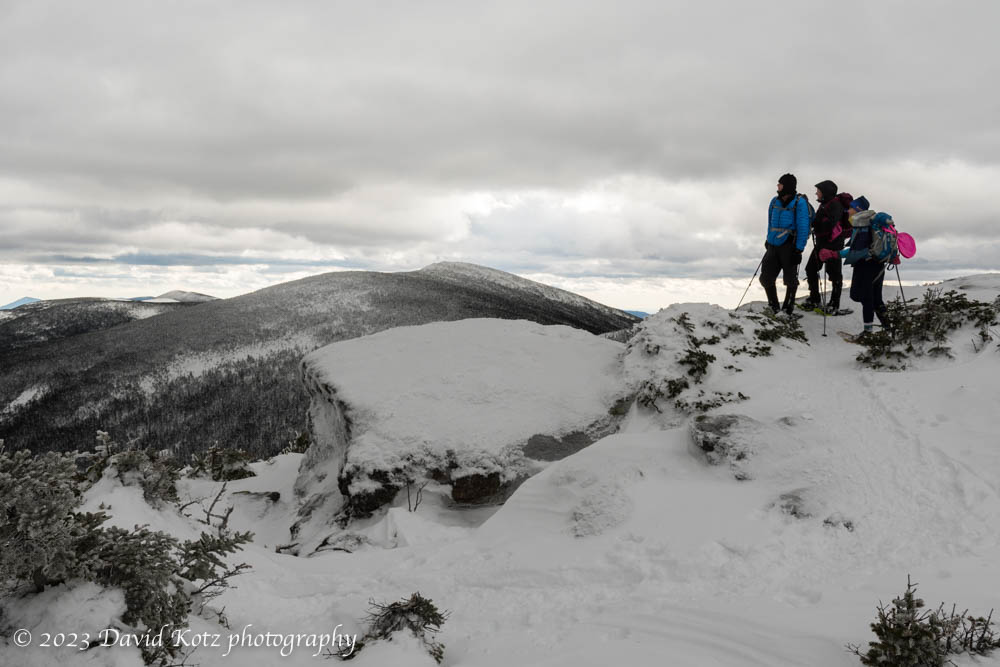
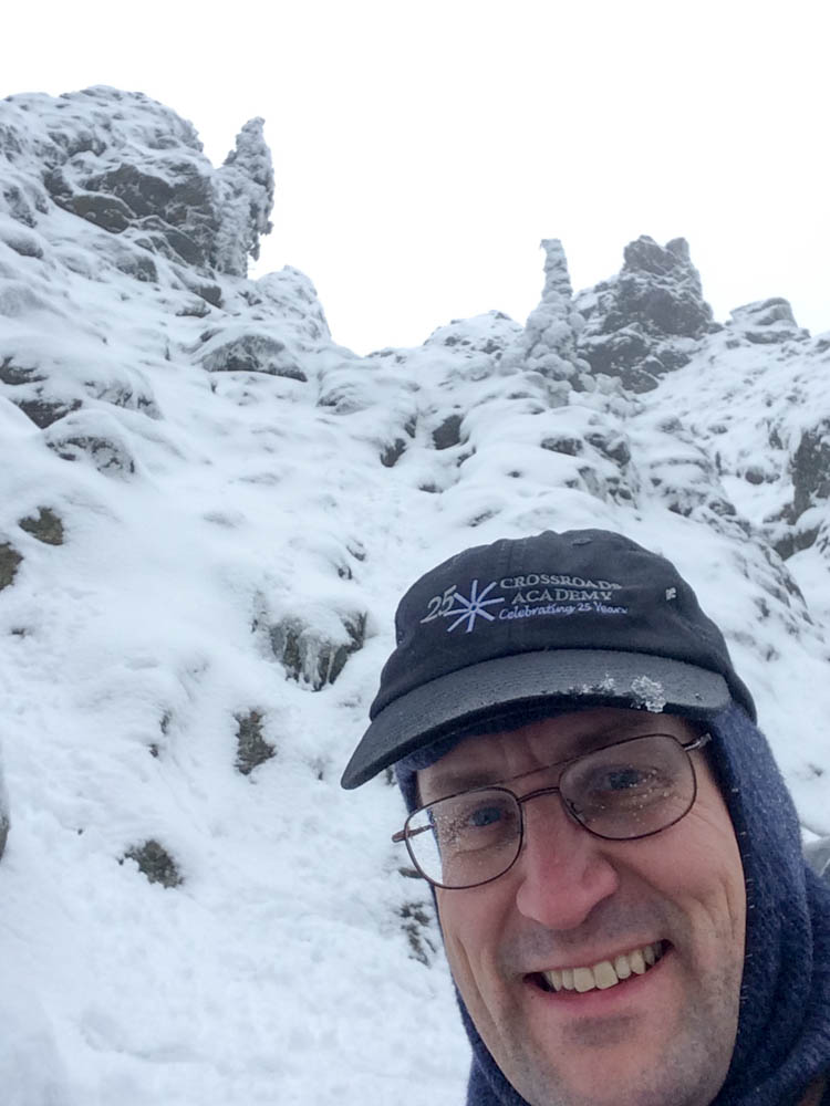
I completed my quest to climb all 46 Adirondack high peaks with an ascent of Whiteface and Esther.
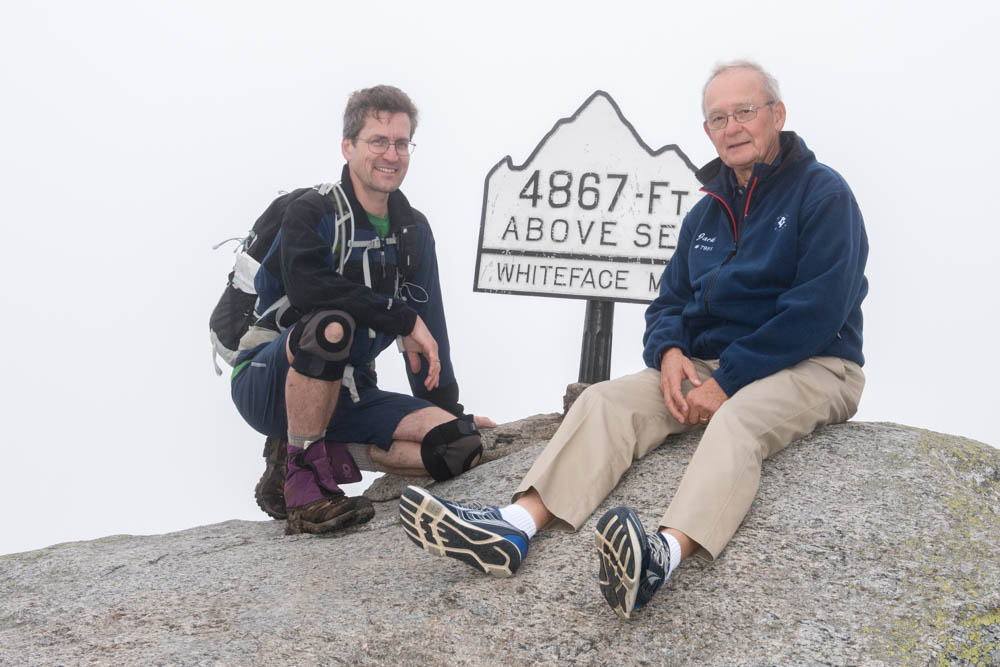
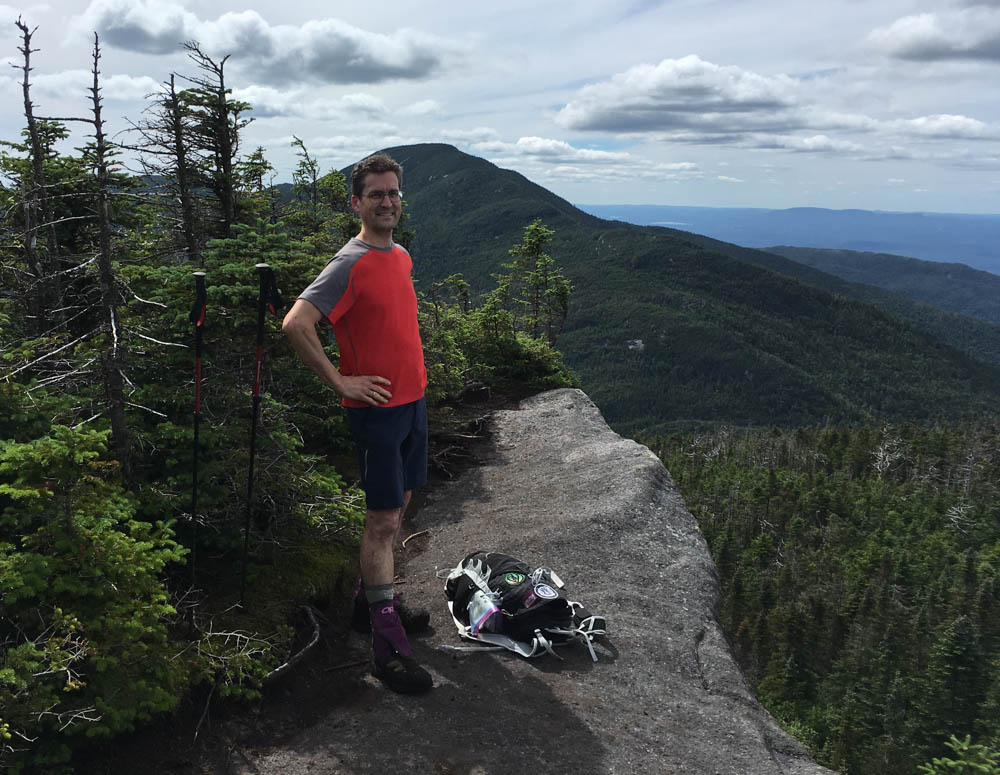
David summits Whiteface Mountain, for the second time, to make it “count” for his 46.
It took 45 years, but I finally completed what I started.
When I was a young boy my family would make frequent trips to the Adirondack Mountains of northern New York state, camping and hiking in this beautiful “forever wild” region of high peaks, beautiful brooks, ample wildlife, and pristine lakes. Inspired by my father’s love for these mountains, and his encouragement, I started racking up the miles and the mountains. I discovered the concept of a 46er – a person who climbs all 46 of the peaks thought to be over 4000′ elevation, at least according to the 19th-century surveyors. I was hooked, and set out to achieve this goal myself. Today I finished – read on, and check out the photos.
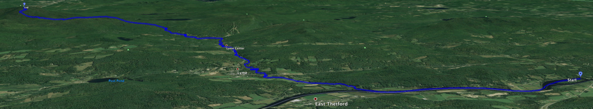
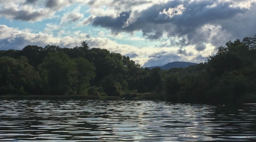
I’ve lived in Lyme, NH for almost 20 years, very close to its lowest point along the Connecticut River. I first climbed to the summit of Smarts Mountain, Lyme’s highest point, 35 years ago this fall. Now, when I row my shell up the river and past the mouth of Grant Brook, I can see Smarts in the distance, looking regal in its oversight of this wonderful town we call home. I knew that Grant Brook’s source lay high on the slopes of Smarts Mountain, so it occurred to me: could I travel from Lyme’s lowest point to its highest point, completely off-road? Yes! Read on, and check out the photos.
The mouth of Grant Brook, with its source, Smarts Mountain, in view at rear.
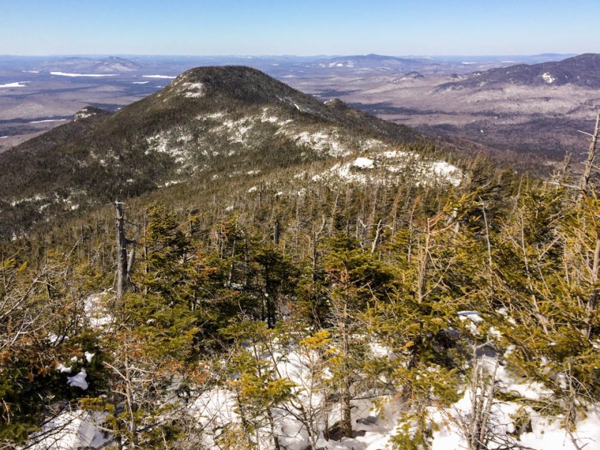
I saw an unusually long sequence of sunny days ahead and leapt at the chance to snag the four peaks of the Seward Range, a rugged and remote section of the Adirondacks High Peaks. The result? Blood, sweat, and tears (pick two).
Emmons, Donaldson, and Seward from Seymour.
The four peaks in this range – Emmons, Donaldson, Seward, and Seymour, from south to north – are each over 4000′ elevation, and thus members of the 46 Adirondack high peaks. (At least they’re an honest 4000′, unlike my recent peaks Couchsachraga, Nye, and Cliff.) When I studied the map last year, I was struck by the remoteness of these peaks – compared the central high peaks region, they are completely trailless, and to reach even the base of these mountains are many miles from the trailhead. I imagined myself crashing through dense spruce forest with a compass and a hope that I’d not wander off into a trackless drainage. Not so. Continue reading “Seward Range”
Mount Allen is another one of those remote, viewless summits that people really only climb because it’s on the 46er list of Adirondack peaks over 4,000′. It’s an 18-mile round-trip day-hike climb from the trailhead, so I decided to break up the hiking (and the driving) over two days. I drove over on Friday afternoon and headed into the woods around 4:30pm, planning to follow the marked trail to the point where the herd path begins, then a bit further to where the map shows it crosses a brook and where I hoped I might find a spot to camp. I queried the outbound hikers for clues about where they may have seen campsites along the way, and got a few tips. I reached my intended location only to find that a pair of other hikers had had the same idea and were camped in exactly that spot.
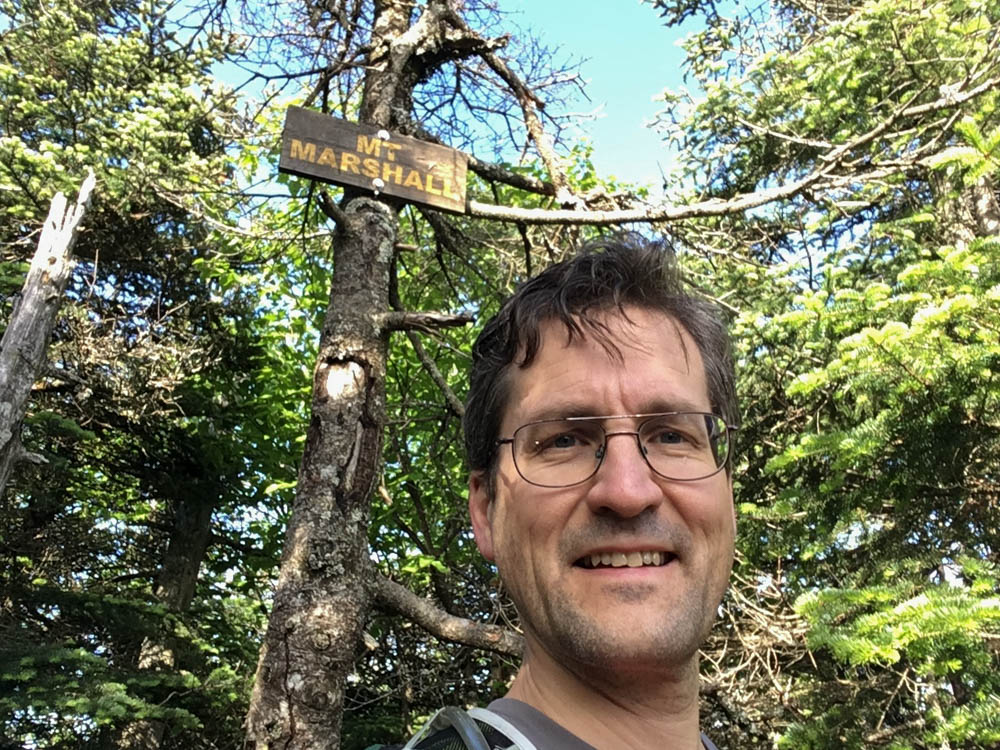
Back to the Adirondacks this weekend, to bag two more 46er peaks: Cliff and Marshall. This trip was more than a peak-bagging trip – it was an opportunity to re-visit some of my favorite campsites and to enjoy the incredible waterfalls and cascades of the Opalescent River in some excellent conditions. Read on, and check out the photo gallery. Continue reading “Cliff and Marshall”
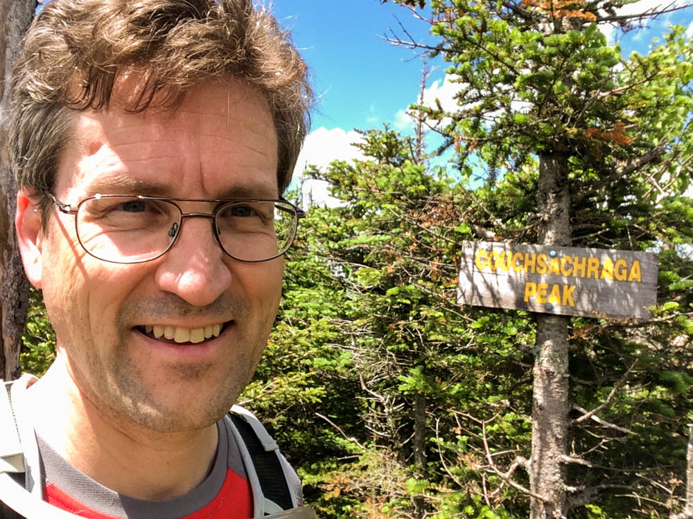
My goal for 2017 is to complete my Adirondack 46 – that is, to climb the 46 peaks of the Adirondack Mountains that are (or were once thought to be) above 4000′. I began this quest some forty-plus years ago, and decided to polish off the list. In March I set off to conquer the remote and entirely uninteresting peak of Couchsachraga, in beautifully perfect winter conditions. Much to my disappointment, I was forced to turn around just a bit short of my goal. Breaking trail through several feet of fresh powder, and following the unmarked informal herd path, turned out to be too much for me that day. This weekend I returned to make another attempt, catching a window of beautiful summer weather. Check the photos, and read on.
It may be 60 degrees in Hanover, with only the vestiges of snowbanks left to remind us of winter, but this morning on the summit of Moosilauke it was clearly still winter.
After my disappointment on Couchsachraga three weeks ago, and no good opportunity to return there this winter, I felt a deep need to get into the mountains – and Moosilauke is always soothing to the soul. Yesterday’s light snowstorm followed by today’s blue skies and strong April sunshine were the cue that today is the day. Read on, and see the photos.
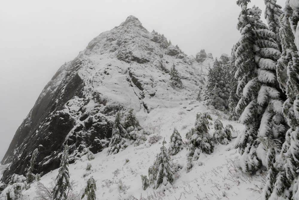
I’ve been waiting all winter for an opportunity to climb a particularly remote mountain in the Adirondacks. Couchsachraga– “an ancient Algonquin name that means Dismal Wilderness,” seems like such an appropriate name for this uninteresting peak on the list of 46 four-thousand-foot mountains in New York’s Adirondack region. Indeed, this peak is not even 4,000 feet high: it was included on the original list of 46, but later re-surveyed and discovered to be a tad shy of that mark. It is the shortest of the 46. I climbed my first 46er peak at age 9 and have been longing to complete the list ever since. The photo below shows a view of Couch from above – not much to look at, but read on to hear about my adventure trying to reach it. (And check out the full photo album.)
Couchsachraga, viewed from the ridge descending from Panther. Long way to go!
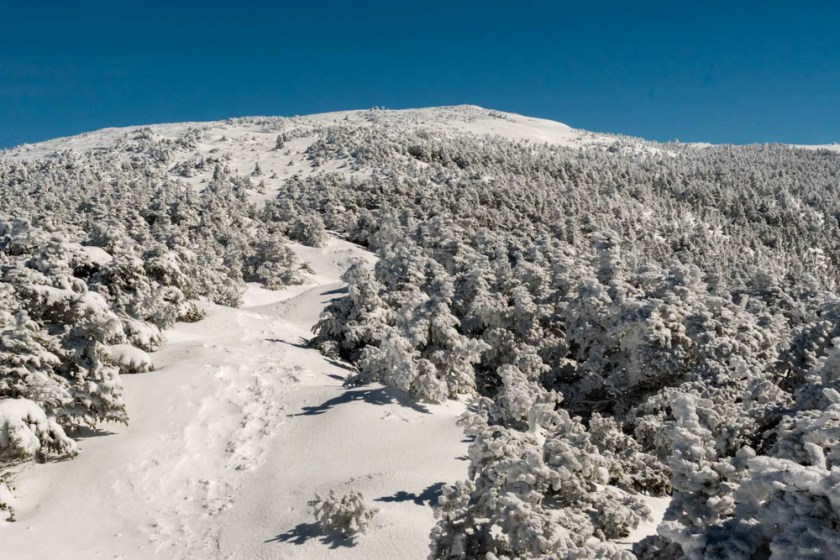
On a cloudy day in mid-winter, we decided to climb North Twin from the north. We wore snowshoes for the climb up and butt-sleds for the ride down. The conditions were excellent for a snowy outing. This brief video gives you a sense of the terrain as we neared treeline. Even the stream crossings were well-covered in snow bridges.
Chatting with other hikers at a viewpoint near the summit of North Twin, with South Twin in background.
I was in Seattle for a visit to the University of Washington, and decided to extend the trip for a day so I could take advantage of the wonderful hiking opportunities nearby. Overwhelmed by the number and variety of hikes in range of Seattle, I settled on a classic choice: Mount Si. According to the statistics on that site, I was probably the 99,999th person to hike the trail this year. Still, on a drizzly Friday in the off season, I figured it couldn’t be too crowded.
I left Seattle before sunrise, drove through a light drizzle (which, I gather, is the norm for Seattle) and reached the trailhead around 8am. With 3,100′ of gain in four miles, this is no little walk in the woods – but it’s actually comparable to my benchmark, the Glencliff trail on Mount Moosilauke. In fact, Mount Si barely tops 4,000′, shorter than Moosilauke.
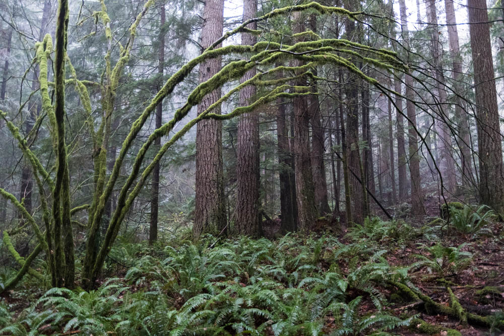
An eery rainforest of moss and epiphytes covers the lower elevations.
In the mist and drizzle, the low-elevation forest was was verdant. Moss and epiphytes covered every branch, and trapped the mist so it could drip on me as I made my way up the trail. The trail is well-built and well-maintained, generally steady going. Numerous switchbacks meant the trail was never very steep.
The air cooled as I climbed and I finally started seeing patches of fresh (though wet) snow at around 3,800′. I popped out into a clearing, where a large black Raven awaited me. Clearly he had been there earlier, when today’s three early hikers paused to snack and turn around, and he was hopeful that I brought more goodies.
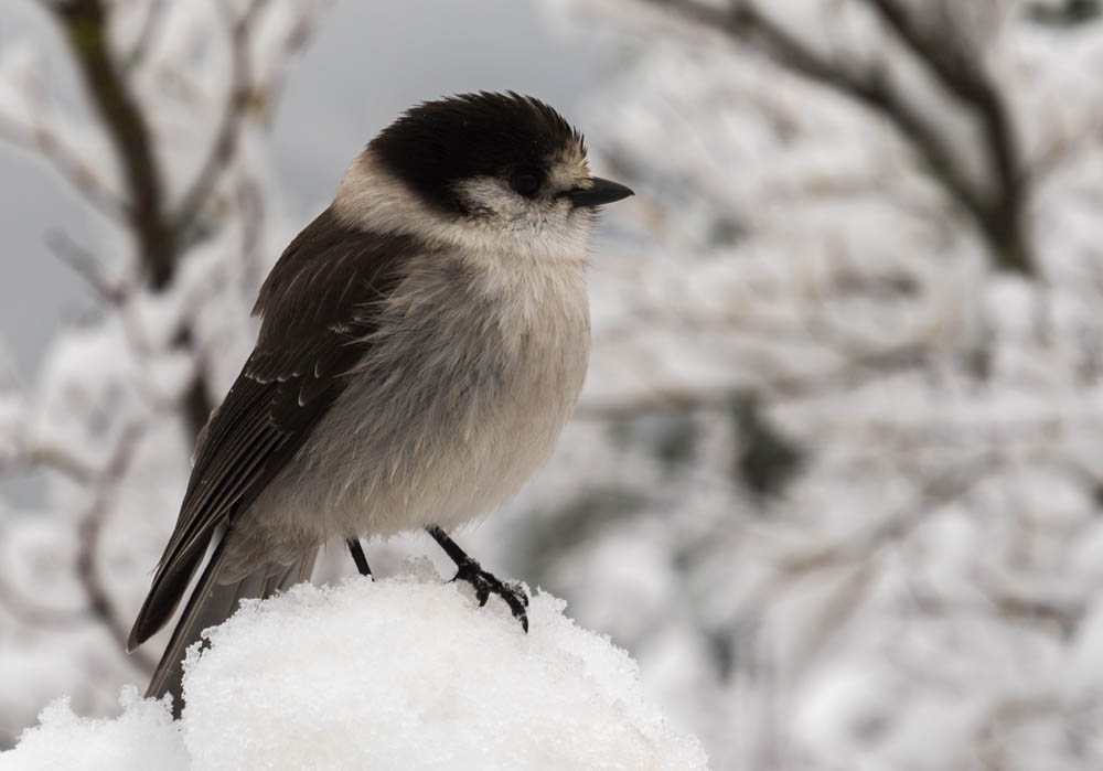
Gray Jays are an ever-present companion at snack stops at higher elevation.
Four or five Gray Jays quickly detected my presence and snuggled together on snow-covered branches, ready at a moment’s notice for a dropped raisin or bagel crumb.
Here there was consistent snow cover, just an inch or two, and rather slushy. In the clouds now, the viewpoint offered me nothing – but at least the precipitation stopped. I pressed on, up and over a rocky outcrop, toward the true summit – a sheer cap called the “haystack” (shown above). Remarkably, though I climbed only another hundred feet, the snow became deeper and more firm, as much as 6-18″ deep in the sheltered spots. The snow line from recent weather must have been close to this elevation.
I turn back from the near-vertical gully filled with snow and ice, and lots of exposure.
I followed old tracks, covered in this morning’s snow, around the base of the Haystack. The footsteps disappeared at the base of a steep gully, where tiny avalanches caused golf-balls of snow to roll down toward me. Gosh, this gully is steep, and extremely exposed. I picked a line and tentatively began to climb, but thought better of it after a dozen yards. I retreated and picked another line. Going upward was easy, kicking steps in the wet snowpack. About halfway up, though, I reconsidered the exposure. A slip here would mean a long slide down the gully, ricocheting off the boulders. Hiking solo, and with few other hikers visiting the Haystack today, I decided it’d be best left for another day.
The trip down was a cruise, back and forth on the switchbacks. I quickly left winter behind, and emerged again into a verdant rain forest, pausing often to attempt to capture this magical place in photographs. I can see why this mountain is so popular, and really need to return when the sky is clear.


 After my disappointment on