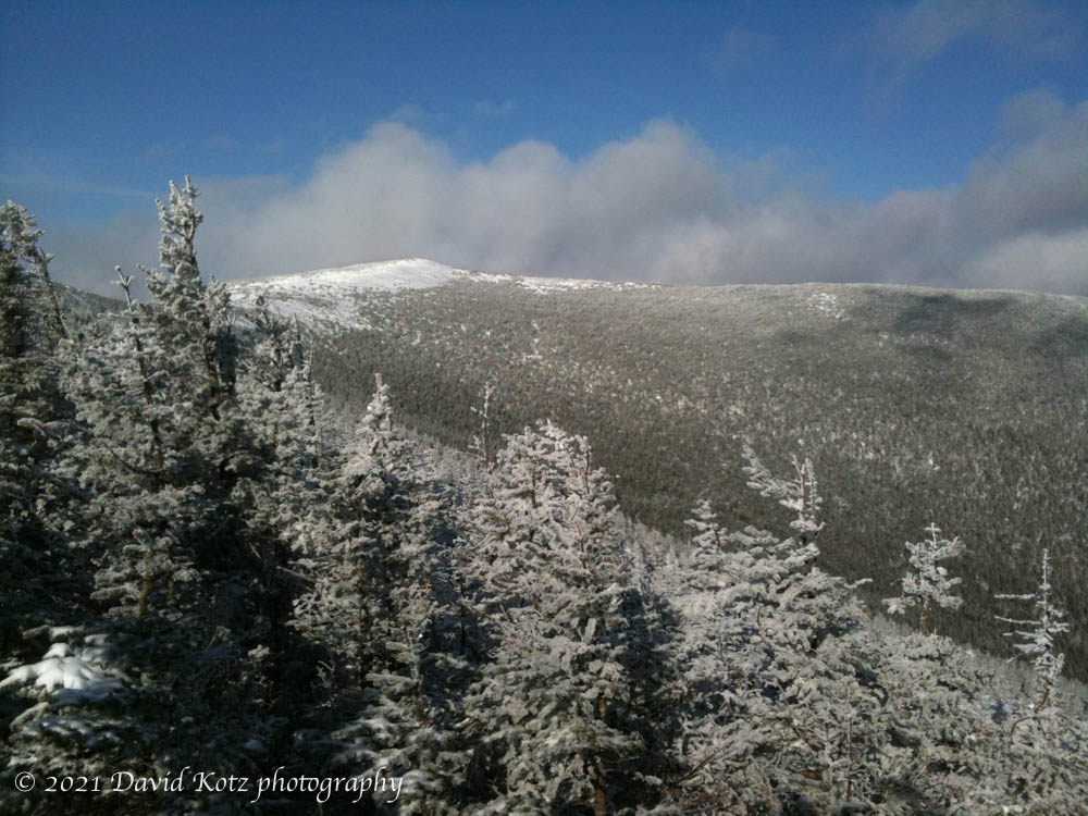
A glorious winter day, right after a big snowstorm.
My friends Kathy and David and I decided to head up Mount Moosilauke, after Friday’s big snowstorm. There was about 6” of new snow on top of several feet of solid base, which made for fantastic conditions. With a group of 4 snowshoers breaking trail a couple of hours ahead of us, we cruised up the Glencliff trail. Read on…
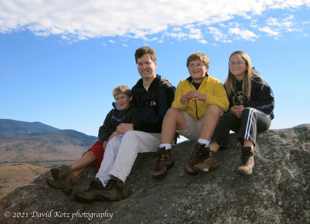
On ten-ten-ten we climbed this mountain near Moosilauke.
Black Mountain is a nice little peak in the midst of a broad valley to the west of Mount Moosilauke. On this special day – 10/10/10 – we scrambled up and were treated with a gorgeous view of the Connecticut River valley and The Mountain and a distant peek at the Franconia Ridge.
Black Mountain. Andy, Daddy, John, and Mara sit atop a glacial erratic on the summit of Black Mountain.
This post was transferred from MobileMe to WordPress in 2021, with an effort to retain the content as close to the original as possible; I recognize that some comments may now seem dated or some links may now be broken.
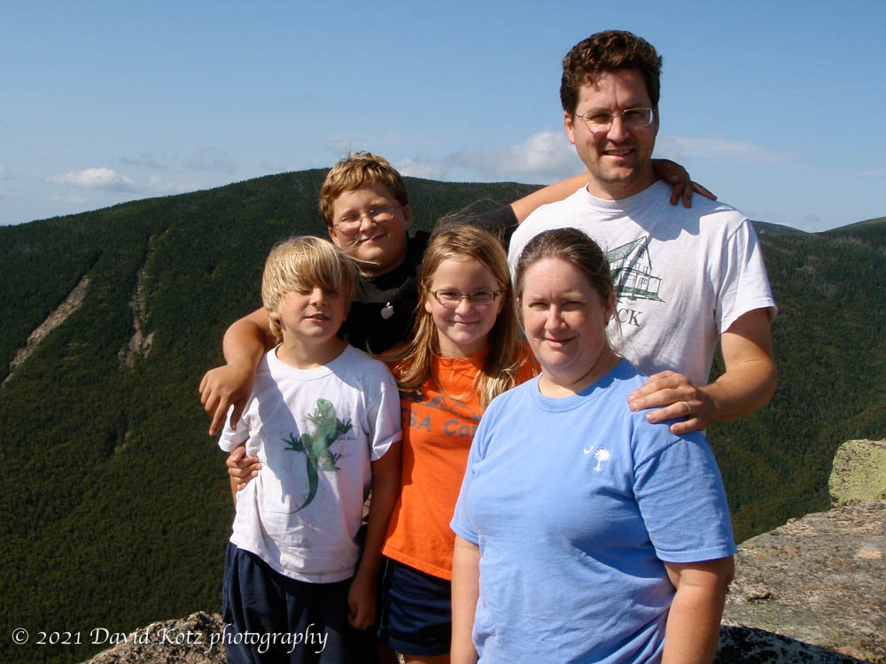
We spent four days and three nights backpacking in the Pemigewasset Wilderness, the central region of the White Mountains National Forest.
Every year at this time we try to get out for an extended camping and hiking trip. The weather this year turned out to be fantastic. We delayed our trip for a day to skip the showers on Wednesday, but other than a brief shower during the hike in on Thursday, we had four days of spectacular sunny, warm weather. Read on!
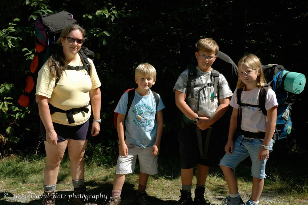
Our first-ever family backpacking trip, through Zealand notch in White Mountain National Forest.
On Labor Day weekend, we took the kids on their first backpacking trip. We hiked in from Zealand road past Zealand hut to Thoreau Falls, within the NH White Mountains. The weather was fantastic, and we found a nice campsite off in the woods away from the falls. We spent two nights there, with a dayhike up to Ethan Pond in between. We had campfires and went swimming under the falls.
We’re ready to head out on our first backpacking trip, at the Zealand trailhead in NH White Mountains.
This post was transferred from MobileMe to WordPress in 2021, with an effort to retain the content as close to the original as possible; I recognize that some comments may now seem dated or some links may now be broken.
We spent our first day in New Zealand, a glorious sunny day, hiking up the harbor volcano called Rangitoto.
Kia ora! We are now in New Zealand, after a pleasant flight from Sydney. We had a fantastic first day, Sunday, with warm weather and sunny skies. We took the ferry out to Rangitoto island, a small volcano which popped up out of the harbor only 600 years ago. Read on!
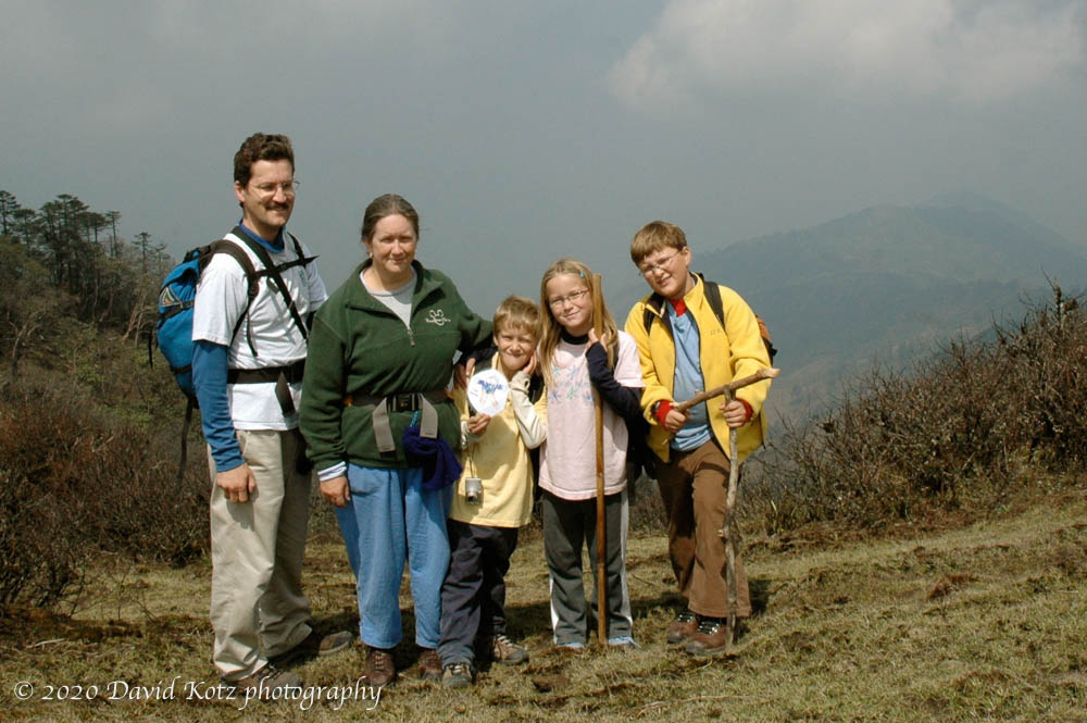
Can you see Mount Everest in the photo below? Neither can I. We spent six days trekking along the Singalila ridge, the border between India and Nepal, but we were in the clouds the whole time. Nonetheless, it was a fantastic trip and a beautiful place. Read on, and check out the photo gallery!
Family photo at a sunny break during the day. On a clear day, one could see Everest in the background. Not today!Continue reading “Himalayan trek”
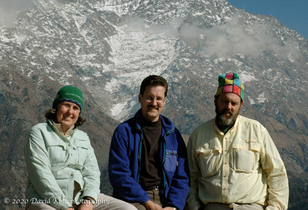
Following our 25-year tradition, I spent New Year’s day hiking with my Dartmouth friends David and Kathy. This year, we have our families along, including Benjamin (age 4). Read on and check out the photo gallery.
Chubbers in the Himalaya! David with Kathy and David in the Triund pass above Dharamsala, India, on New Year’s day.Continue reading “New Year’s day”
Some hiking and sightseeing around a conference in Colorado.
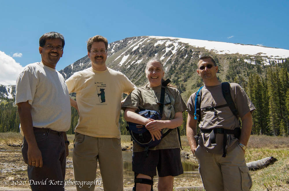
At the MobiSys 2008 conference, which was held at Breckenridge resort in Colorado, a group of us met to celebrate the retirement of Carla Ellis by taking a hike in the beautiful Rocky Mountains. See the trail description and review.
Surendar Chandra, David Kotz, Carla Ellis, and Rick LaRowe.
On the way back, I drove over Loveland Pass to stand on the Continental Divide. Gorgeous!
This post was transferred from MobileMe to WordPress in 2020, with an effort to retain the content as close to the original as possible; I recognize that some comments may now seem dated or some links may now be broken.
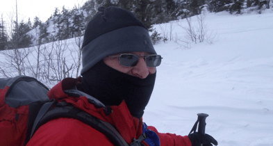
In early January 2008 I met with some friends to ski up (and down) the east side of Mount Cardigan. After a big dump of new snow, it was a popular destination that day.
This post was transferred from MobileMe to WordPress in 2020, with an effort to retain the content as close to the original as possible; I recognize that some comments may now seem dated or some links may now be broken.
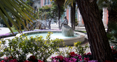
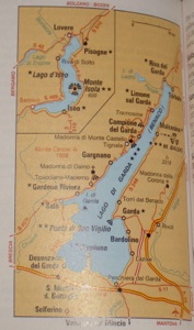
When I attended WiOpt 2005 in Riva del Garda, Italy, I spent some time strolling around this picturesque village, and took a day off to drive around Lago di Garda. Gorgeous place!
On another day off, I walked right out the front door of my hotel; in a few blocks I reached the base of the mountain to the west; enclosed is a sunrise photo of the mountain from my hotel room. I climbed up past the ruins of a small castle, and a beautiful tiny mountainside chapel, to a tiny peak near the summit. The little peak, known as Cima Sat, seems to be the common destination rather than the actual, higher, summit. Although a direct trail offers a lot of exposure and hundred-foot ladders.
Cima Sat is at 1270m; I started my hike at the lake (200m).
This post was transferred from MobileMe to WordPress in 2020, with an effort to retain the content as close to the original as possible; I recognize that some comments may now seem dated or some links may now be broken.