
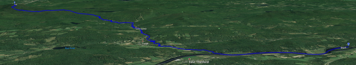
I’ve lived in Lyme, NH for almost 20 years, very close to its lowest point along the Connecticut River. I first climbed to the summit of Smarts Mountain, Lyme’s highest point, 35 years ago this fall. Now, when I row my shell up the river and past the mouth of Grant Brook, I can see Smarts in the distance, looking regal in its oversight of this wonderful town we call home. I knew that Grant Brook’s source lay high on the slopes of Smarts Mountain, so it occurred to me: could I travel from Lyme’s lowest point to its highest point, completely off-road? Yes! Read on, and check out the photos.
Lyme encompasses a wide variety of terrain, with the Connecticut River along its western edge, the Appalachian Trail rolling over the peaks of its eastern edge, with farms and ponds in between. We live along the River about a mile north of Lyme’s southwestern corner, and about a mile south of the point where Grant Brook empties into the river. Grant Brook, a stony and lively brook, begins at Smarts Mountain and flows through Lyme Center and the center of Lyme (got that?), tinkling over cascades and waterfalls, meandering through beaver meadows. It can also be fearsomely powerful, as residents discovered on July 1st when a day of heavy rain turned Grant Brook into a torrent that nearly wiped out bridges and roads along its path.
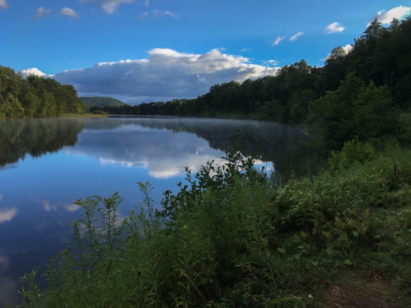

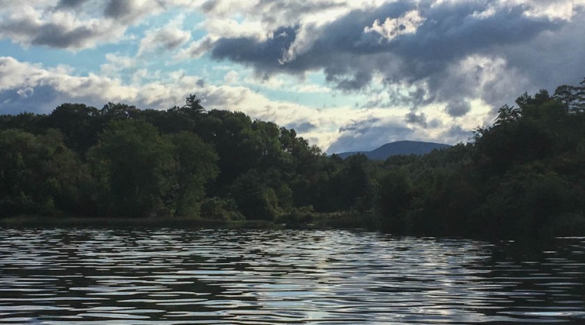
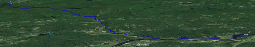
Early yesterday morning I popped my kayak on top of my car and drove along River Road to reach Lyme’s lowest point, at the Hanover border. It was a cool morning, mostly sunny with a few puffy white clouds and the last of the morning fog lifting off the river. I paddled upstream, passing the large Grant’s Island and greeting a beaver out for its morning rounds. Skipping past our home, I arrived at the mouth of Grant Brook and paddled through the wetlands at the brook’s mouth until I reached the free-flowing stream. I stashed my kayak, donned my pack, snugged up my water sandals, and headed upstream. I marveled at the signs of July flooding, throughout the day; the brook had scoured its banks several feet above current levels.

I set myself some ground rules. I would follow the brook, walking on shore or brookside trails when available – always with the brook in sight – but would otherwise rock-hop and wade as needed. I would not set foot on any roads – I found I could walk under every bridge. The first three sections of the brook, from the river to Route 10, then to Market Street, and then to Dorchester Road, are paralleled by trails. I ended up using these trails little, preferring to rock-hop and enjoy the brook.

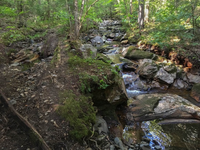
Above the first crossing of Dorchester Road, the road follows the brook tightly as it winds through a narrow pass up to Lyme Center. There was tremendous storm damage here, and I was astonished by the amount of rip-rap needed to repair this road; the photo at left shows one such repair. (Thanks, Lyme road crew!) As I passed through the village of Lyme Center, the brook snugs right behind several homes, and I made my way past these neighbors as quietly and respectfully as possible.
The next section, between Lyme Center and the Dartmouth Skiway, is more level. The brook slows, on a bottom of pebbles and sand. Soon I reach a small beaver dam. I anticipated this – and feared I would be traveling through the muck of a beaver swamp. Fortunately, no swamp here – I skirted the deepest part of the small beaver pond and waded the rest, and was back on my way.

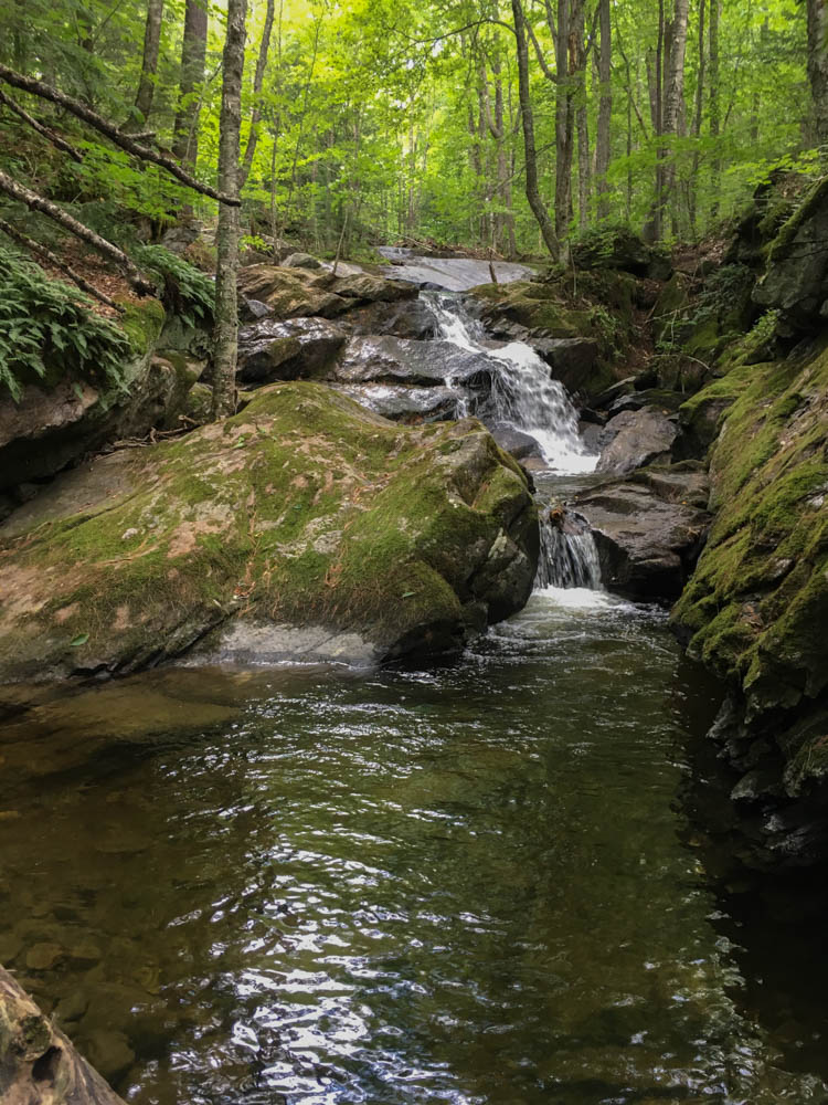
After rounding the corner I crossed under a (severely damaged) bridge on the dirt section of Dorchester Road, and curled around a meadow. Three horses looked up, curious about this unusual sight in their brook. At this point the brook climbs, increasingly steeply, between the road and the Appalachian Trail (A.T.), out of sight to my right. I marveled at the hidden gems along this stretch of the brook – cascade after cascade, some with deep swimming holes. Numerous stone foundations rest alongside the brook – perhaps old bridge abutments, or perhaps a foundation for a mill dam.

Under one last bridge and I reach the trailhead for Smarts Mountain, the true base of the climb. My kind family had moved my car to this parking lot, so I retrieved a set of dry socks, left a note, and returned to the brook. Here’s where I made my first mistake. The brook forks, with a small branch heading left and up along the Ranger Trail – a short and direct route to the summit. The right fork, the main branch, appeared to follow the road toward Reservoir Pond. I took the small left branch – but in retrospect, should have stuck to the main branch. My little stream, perhaps a foot wide, climbed through the forest and crossed the Ranger Trail. Seeing no further need to wade, I switched to (dry!) hiking shoes and followed the weak brook up hill. Soon it dried, and then faded, as I sensed I was pulling away from the Ranger Trail. I encountered signs of the past in this hardwood forest – stone walls, old roads, and even a glass jar. I passed the yellow blazes marking the A.T. corridor boundary and, soon enough, topped out on Lambert Ridge – the southwest flank of Smarts Mountain followed by the A.T. on its way up Smarts. The ridge provides a nice view of the summit, as if to remind you just how much farther you have to go.

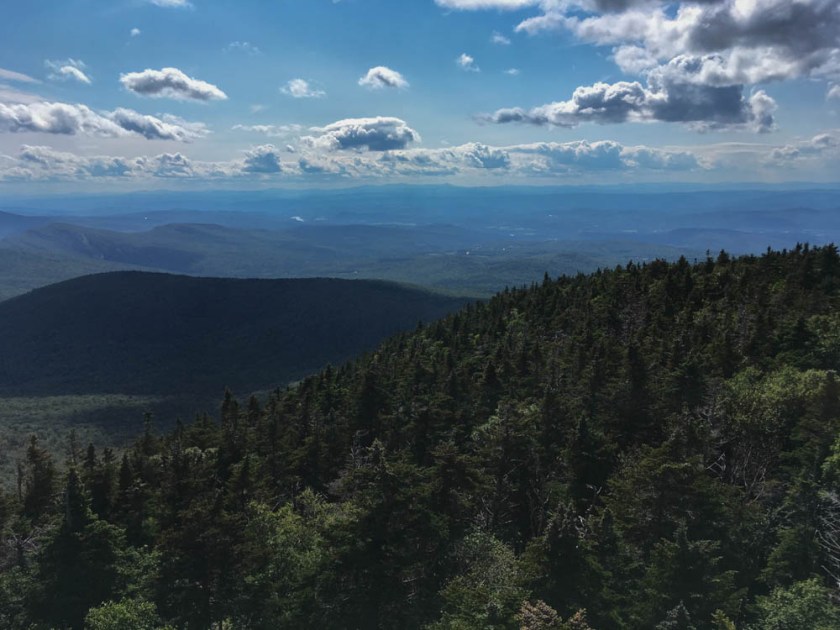
This was good news and bad news. The good news was that I could now follow the A.T. up the ridge to the summit. The bad news is that I had clearly left behind the (shorter) Ranger Trail and the main brook as it climbs the south face of Smarts. Sigh. I made good time along the trail, huffed up the steep approach to the summit ridge, and by 3:30pm I was atop the summit fire tower enjoying a view back toward my starting point on the river. You can see Lambert Ridge, dark in shadow, in the foreground, and a glint of the river in center background.
Whew, 8h13m and 13.82mi to reach here, according to my tracker app. After a snack and a look around the summit area – a quick visit to the Ranger’s cabin and tent site – I wobbled 3.5mi down the Ranger Trail toward my car. As I crossed over pretty, and still substantial, main branch of Grant Brook, I confirmed my earlier mistake. I may need to come back, someday, to follow that branch to the summit.
Overall, a marvelous day. We are lucky to live in the beautiful town of Lyme – and so much of what I saw today is rarely seen by anyone. Nearly all of Grant Brook’s length is in forest, out of sight from roads and homes, and is beautiful at every turn. Check out the full photo gallery, and see if you agree. Meanwhile, I’m off to retrieve that kayak.
Total travel distance: 17.36mi = 13.82 paddle, wade, and hike + 3.54 explore and descend.
Elevation gain 2,831′, from 372′ to 3,203′ (total gain over 3,000′ due to Lambert Ridge).
Please note: although some of this route is on public or conservation land, much of it is on private land; I encourage all to be respectful of landowners when crossing private land.


That is a great adventure you have had! I have done much smaller brook walks and always enjoy it. What kind of shoes did you wear? How deep was the water that you waded in? Did you have to do any swimming?
Martha Cochran
I wore Keen sandals with wool socks. Awesome. I did think about swimming a few times, but wanted to keep my clothes dry because hiking in wet clothes would have been a drag. The water varied in depth, mostly ankle deep… but there were a few places where I had to wade and the water just barely touched my shorts. The deepest spots I encountered (but went around) were perhaps 3 feet deep.