
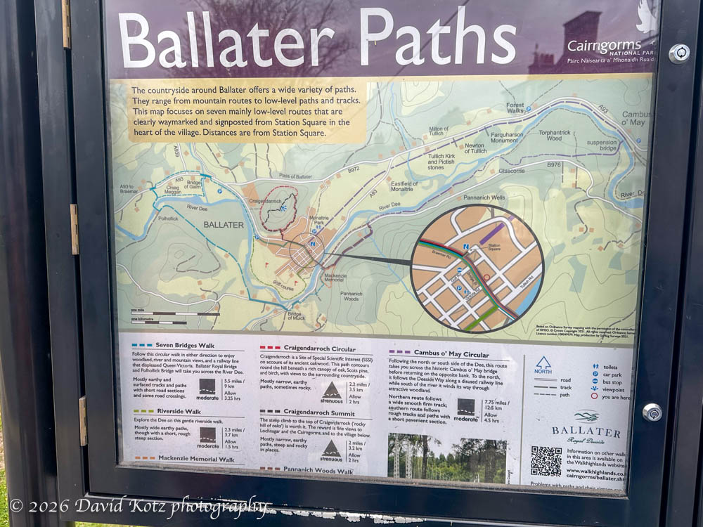
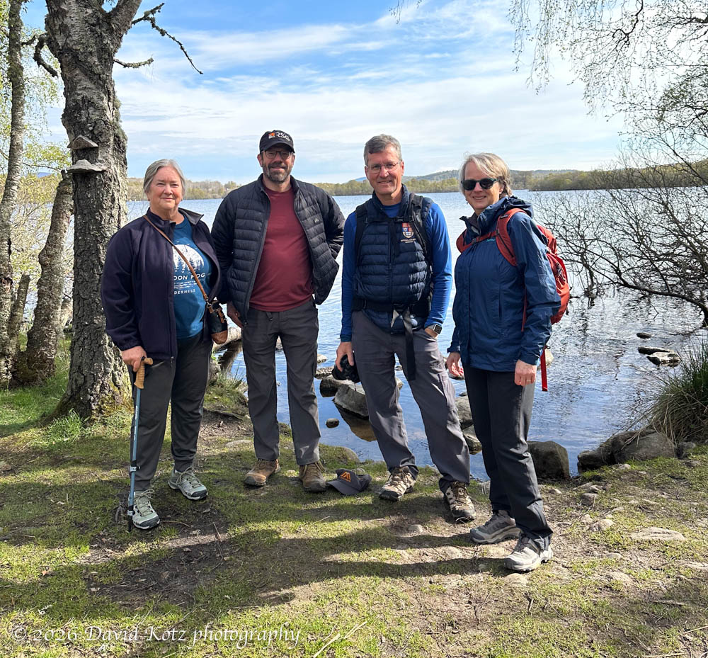
We’re in the midst of a two-week driving tour of Scotland, about which I’ll post later. Meanwhile, a quick report about our hikes this weekend – my 31st consecutive weekend hike – in and around the small town of Ballater in the center of Cairngorm National Park. In addition to the natural beauty of the pastoral landscape surrounding this village on the shores of the River Dee, Ballater is known for the nearby Balmoral Castle (“the Highland home of the Royal Family”), built by Queen Victoria and a favorite retreat for Queen Elizabeth II. This area offers many interesting walks, from 4km to 70km. Given our schedule, I ended up doing four short walks, outlined after the photo.
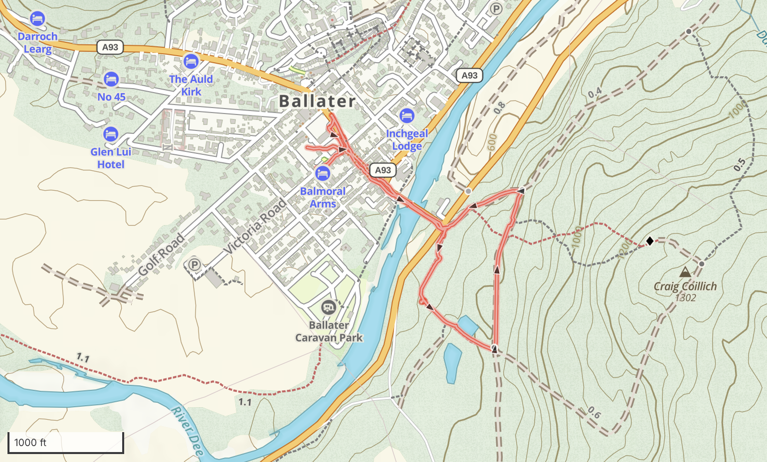
Craig Coillich hillside
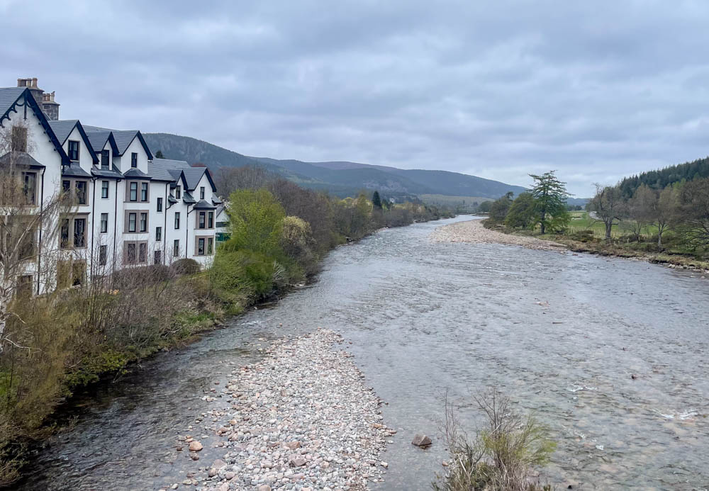
After a late-afternoon arrival, we took a short walk up onto the hillside above town. Some of these trails led to the top of the hill – Craig Coillich – where a large cairn offered views of the valley; we only had time for a stroll along the lower slopes and a view of the River Dee from the bridge to town.
Distance: 1.38 miles
GaiaGPS track
Seven Bridges pre-breakfast loop
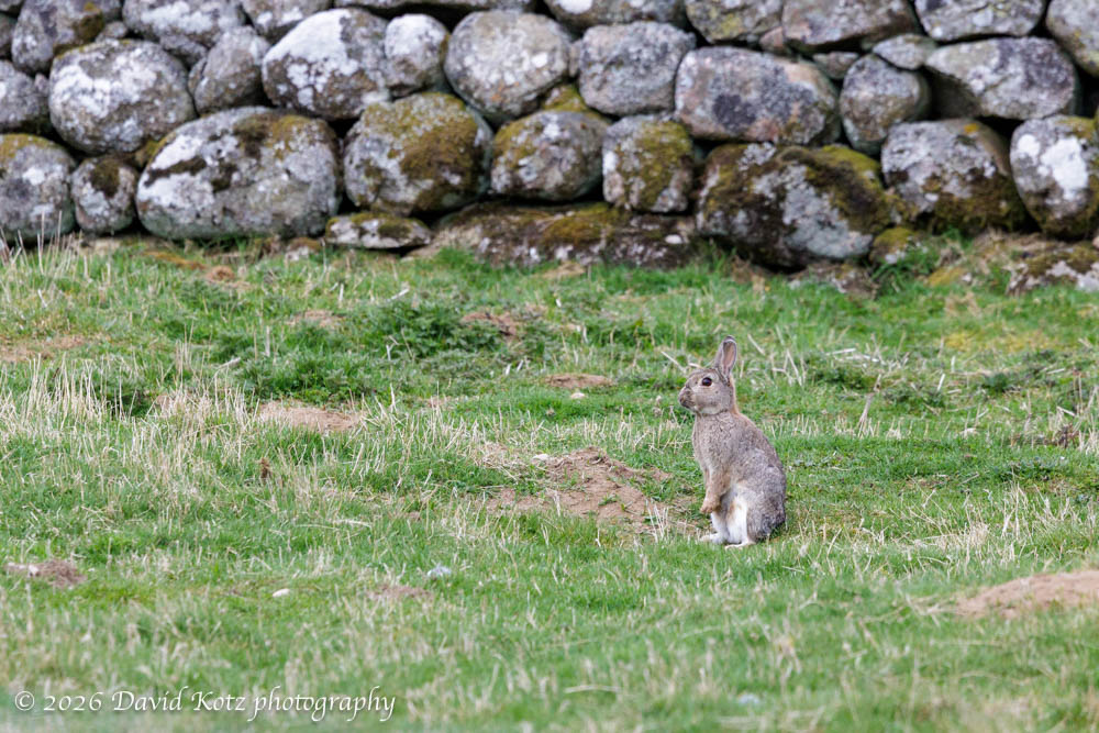
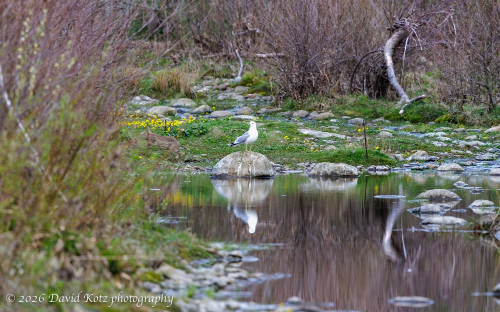
Another advertised route promises walkers they will encounter seven bridges on an extended loop from the center of town, upstream along one side the River Dee and downstream along the opposite side. I had just enough time before breakfast to do a short loop at the far end of this route; my route began in a barnyard and circled around an extensive pasture, with viewpoints along the River Dee. It was a cool and peaceful Sunday morning, with low sunlight dappled by scattered clouds. Wildflowers abounded, as spring is just emerging here. I encountered lots of wildlife – rabbits, pheasants, seagulls, geese, ducks, blue heron, a hawk, and many varieties of waterfowl and songbirds I could not identify.
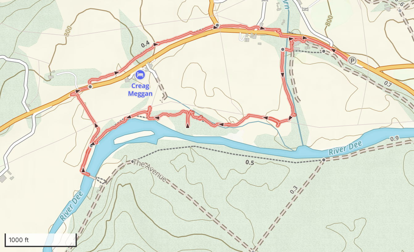
Did I say rabbits? The pasture was full of rabbits – at least a dozen in view at any given time – nibbling the grass, chasing each other, and keeping a keen watchful eye on me.
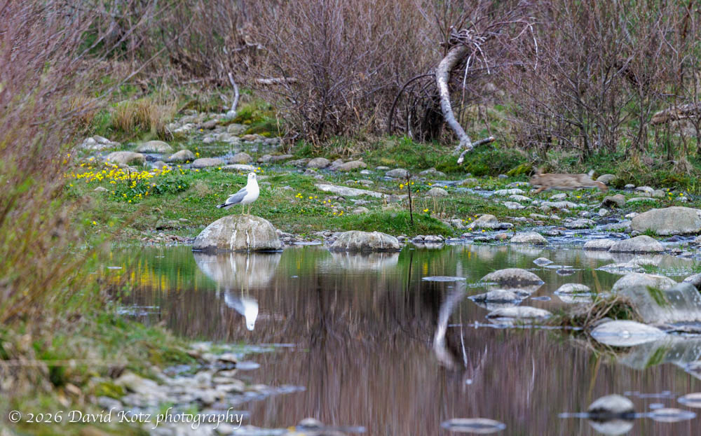
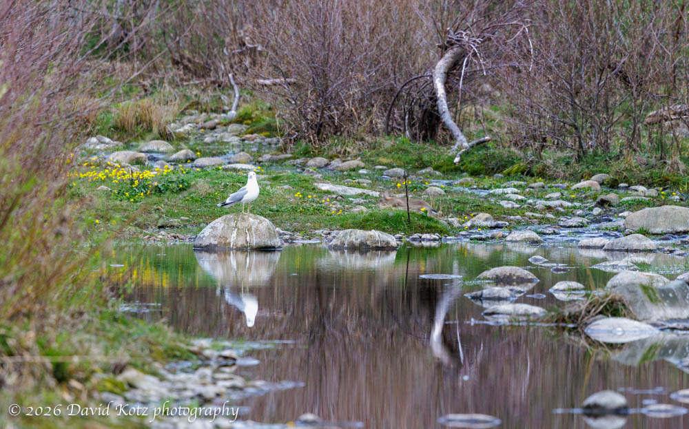
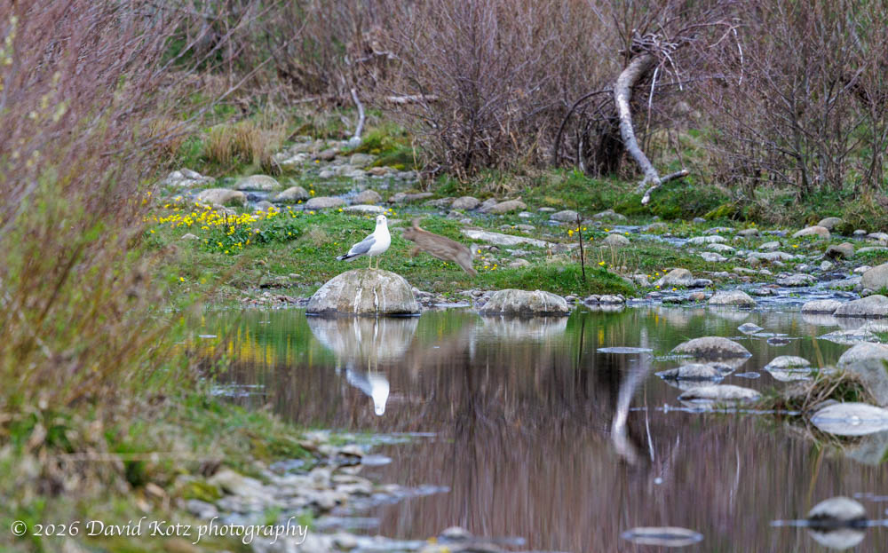
When I tired of watching the rabbits, I walked along small stream. I spotted a seagull perched on a rock upstream, its white body reflecting in the pool below. I decided to snap a photo – it’s just a seagull, I thought, but why not. Just as I clicked the shutter, a rabbit came leaping through the frame, just behind the seagull. See if you can spot him! [click on a photo to zoom in]
Distance: 2.35 miles
GaiaGPS track
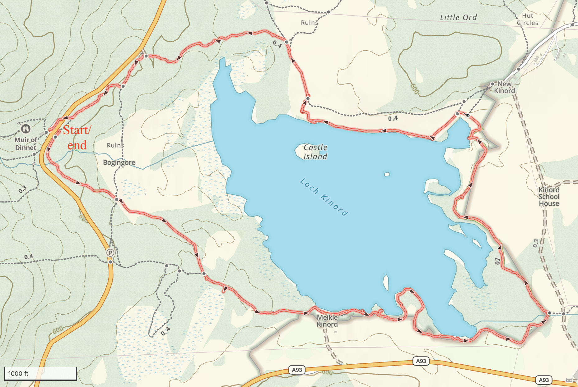
Circuit of Loch Kinord
Our longest hike was a four-mile loop around Loch Kinord, a little ways east of Ballater. This route provided us a chance to ramble through forests of pine and scrub, skirt the edge of pastures, and walk the shoreline of a pretty lake on a sunny morning. A few ducks and swans were busy feeding in the shallows. Oystercatchers – or so they looked – browsed for insects in recently planted fields. I even saw a lapwing, which is a first for me.
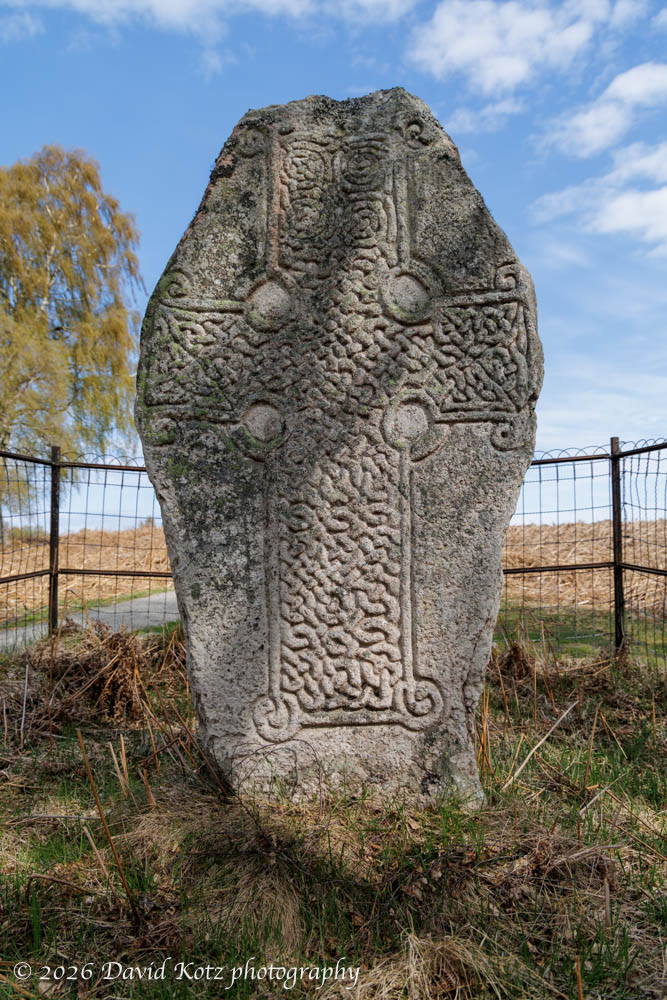
This loch is also rich with history. We stopped at informational signs describing how people had built a Crannog – a fortified island dwelling, on a tiny islet over 2,500 years ago. Later, a castle was built on a larger island, around 1,000CE, and used into the 1600s. Perhaps most interesting, though, was a Pictish stone found buried near here and now erected for viewing. Dating perhaps to 800CE, it stands about 6′ high and its face is carved with a cross filled with knot designs.
Distance: 4.11 miles
GaiaGPS track
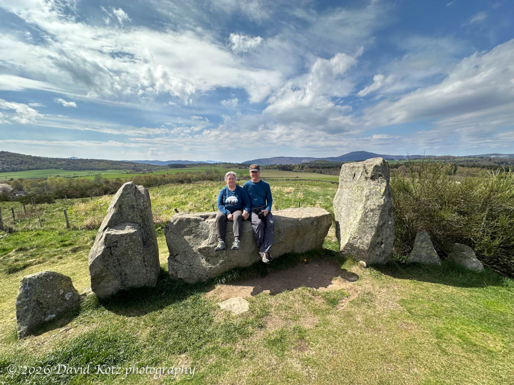
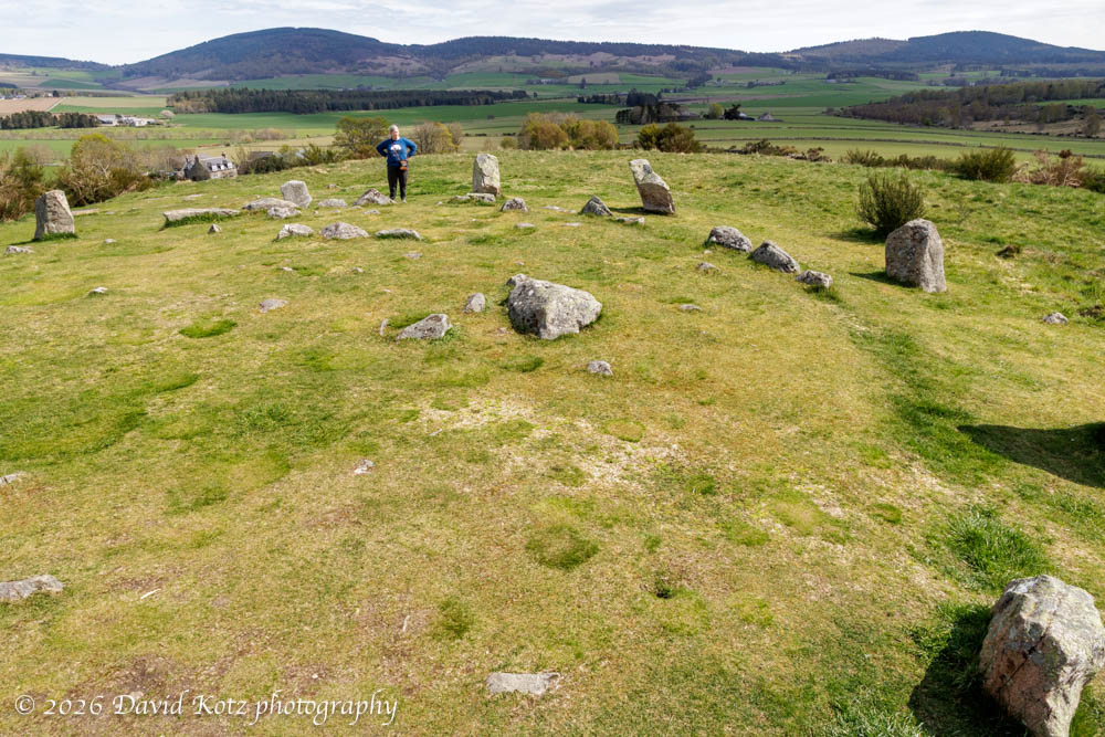
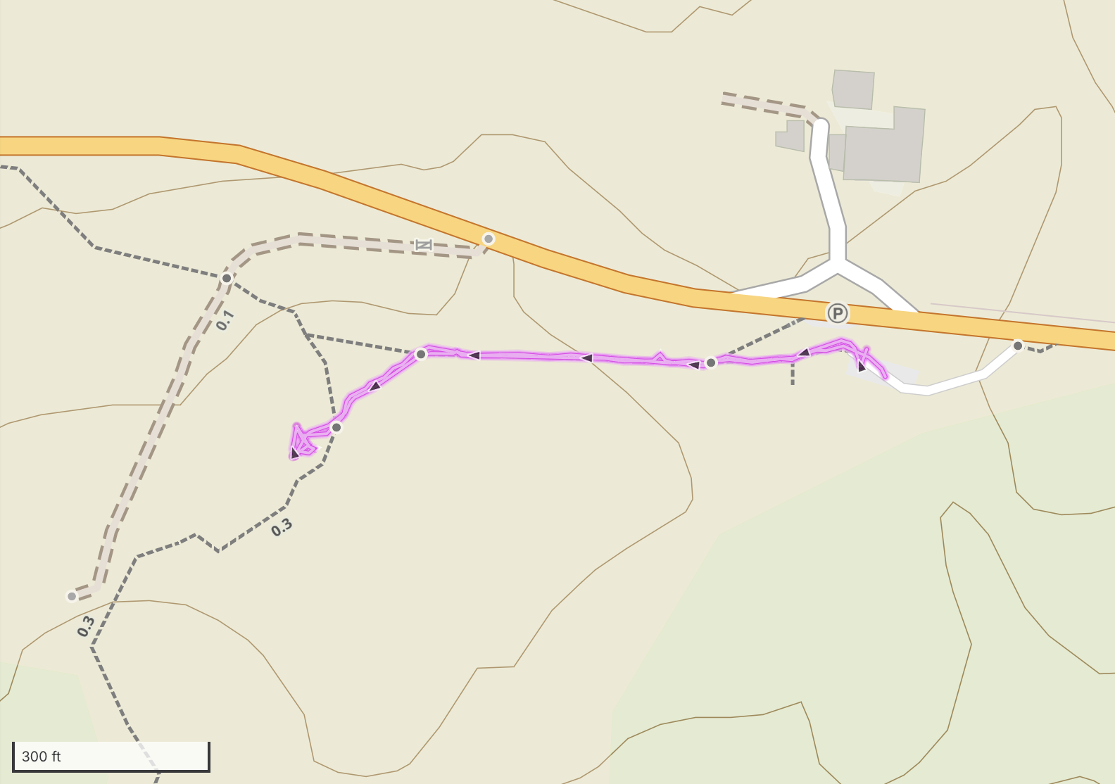
Tomnaverie Stone Circle
Our final ‘hike’ was a short walk to visit Tomnaverie Stone Circle, “a recumbent stone circle, a kind of monument found only in north-eastern Scotland. Their characteristic feature is a large stone on its side, flanked by two upright stones, usually on the south or south-west arc of the circle. The stone circle surrounds a burial cairn dating to about 4,500 years ago. The site appears to have seen use as late as the AD 1600s.” [Wikipedia]
Distance: 0.36 miles
GaiaGPS track
More photos in the gallery!

One thought on “Ballater, Scotland”