About two weeks ago, when down at our dock on the Connecticut River, I was surprised to see three large, gelatinous spheres attached to a rope that ties the dock to the shore. Each was slightly larger than the next. I’d never seen anything like them before, and assumed they were frogs’ eggs.
I have climbed Smarts Mountain many times, by many routes – including some now-abandoned routes and by bushwhacking Grant Brook – but I don’t think I have ever hiked the Daniel Doan Trail.* Finally, today, we did.
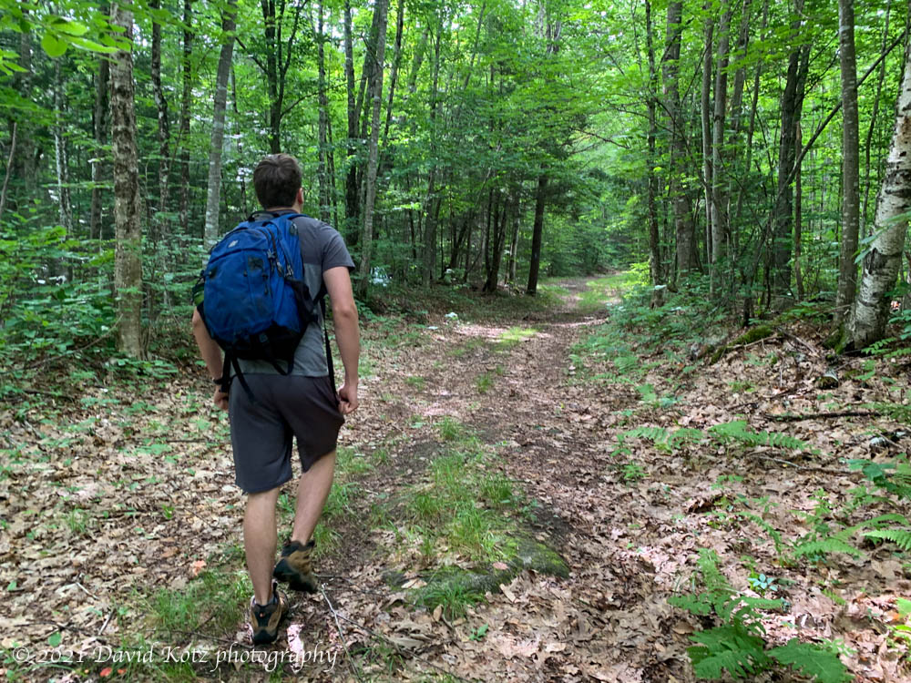
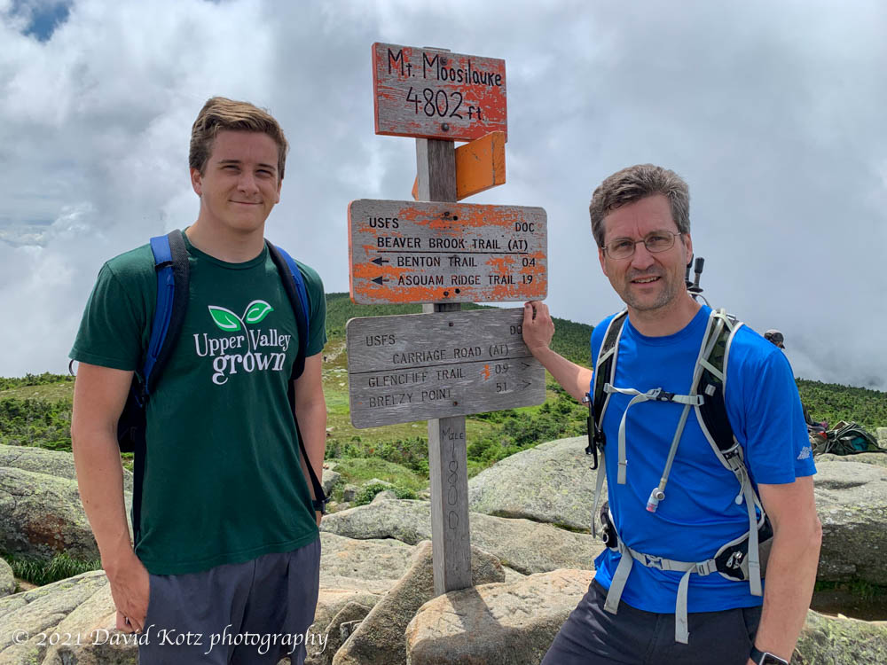
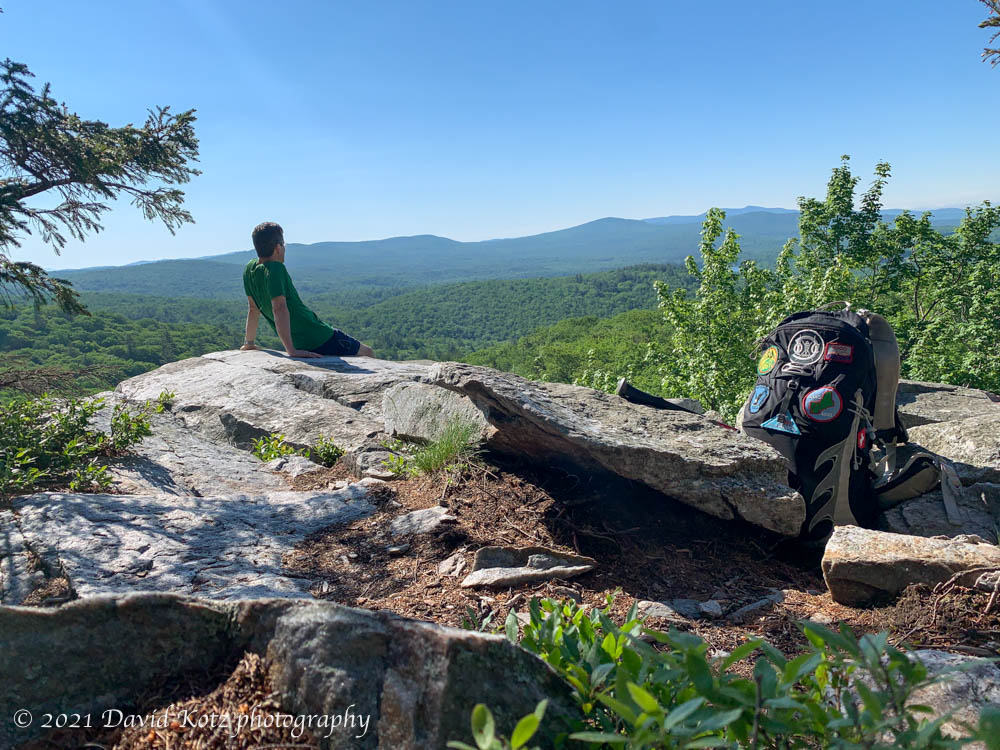
Although today began cloudy, conditions slowly cleared throughout the day. Lelia and Andy and I headed for Moosilauke, climbing Gorge Brook, and then heading down Carriage Road and Snapper.
Andy and David on summit of Mount Moosilauke.
Unfortunately, there were many, many other people out hiking today – a holiday here in the US – because it has rained for the past five days and this was the first (somewhat) nice day for a week. Still, a fine day for a hike! Read on and check the Photo gallery.
On Independence Day it finally stopped raining. It has rained, more or less non-stop, for four days. True, it was a welcome respite from the hot and humid weather at the start of the week, but it the rain was getting a bit tiring. So I was eager to get outdoors, and jumped at the chance to hike Mount Cube with an old friend. The trail was wet – to be expected on Mount Cube under almost any circumstances, but especially now – but the forest was lush green, and the bugs seemingly washed away. Although there were no views – low clouds still clung to the hilltops everywhere – it was a fine day to be out.
Ever since I received my Tesla Model Y at the end of September, I’ve been curious about how it would perform on a long road trip. So when we started planning a visit to family in South Carolina, I decided to drive – the first time we’ve ever made this 1,000-mile road trip.
Last month I wrote a short note about the spring phenomenon of vernal pools, which can often be found in pretty, magical glens in the midst of the forest. Since then I have made repeated visits to that same small, shallow vernal pool located just a ways up the hill behind our house. I’ve photographed it from the same vantage point just to see how it evolves over time. Although these photos were taken at different times of the day, in different lighting, and not on a regular schedule, it’s interesting to see the succession of plant life as the pool dries.
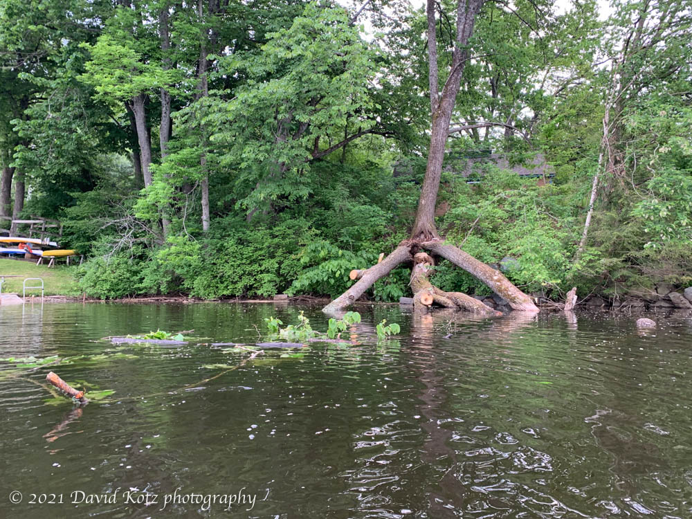
Last fall, two stems of a large basswood tree finally gave up their desperate attempt to cling to our riverbank, and fell into the river. This massive four-stemmed tree was rotting at the base, and the steep riverbank provided little support. The two river-side stems fell toward the river, laying down at a steep angle reflected the depth of the river along our banks. We asked two tree services about removal, but it would have involved heavy equipment and a large fee. We left the trees for the winter ice and spring floods to remove.
Unfortunately, they remained unimpressed by the spring currents, and yet some of their branches impeded boat traffic along our shoreline. So, a few weeks ago, I scrambled out along their trunks and sawed off whatever I could reach, while the others tied ropes and pulled the debris away from the mess, away from our docks, and out to sea. I inspected the two remaining stems, and the now-exposed rot near their base, and forecast that they would follow soon, perhaps within two years.
Trees fallen into the river along our bank.
One only lasted two weeks (above). So this week I was scrambling out along a new trunk, sawing off what I could, while Andy swam around to pull the debris, new and old, out to the stronger current. I don’t have any photos of the action, but the photo below shows what remains.
Trees fallen into the river along our bank.
The fourth and final stem leans inland… right onto the shed. Hmm.
The spruce-grouse hen, startled from her nesting site, squabbled noisily across the trail as I approached. I was equally startled, as I hiked up the Appalachian Trail on a quiet weekend morning in early June. Surprisingly quiet, actually; mine was the only car in the lot at 7:30am, and I had thus far passed only one small group of hikers – southbound thru-hikers, by the looks of them. So I had been strolling easily up the trail, lost in my own thoughts, when this mother hen leapt into action and directly across the trail in front of me. Read on!
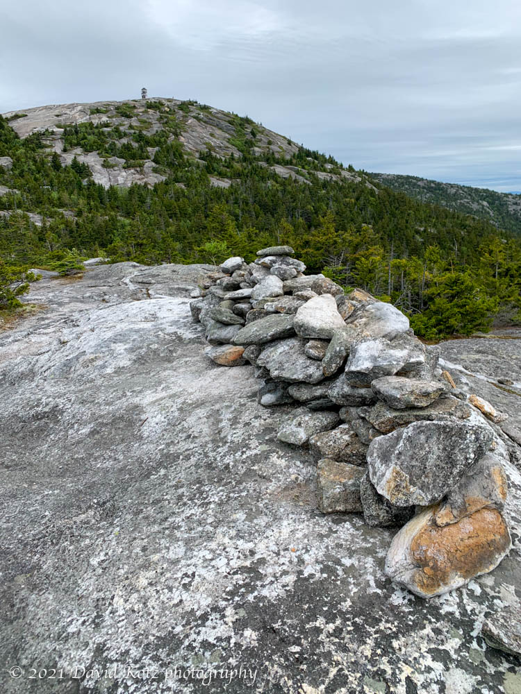
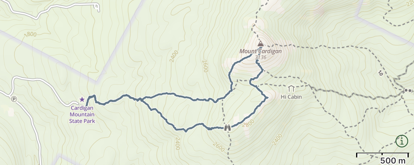
I’ve climbed Mount Cardigan at least a dozen times over nearly four decades… and yet my records show I have not been back since 2016. Its bald granite dome (the result of a wildfire years ago) grants visitors grand views in all directions, so it is a very popular destination for hikers young and old.
A view of Mount Cardigan from its South Peak.
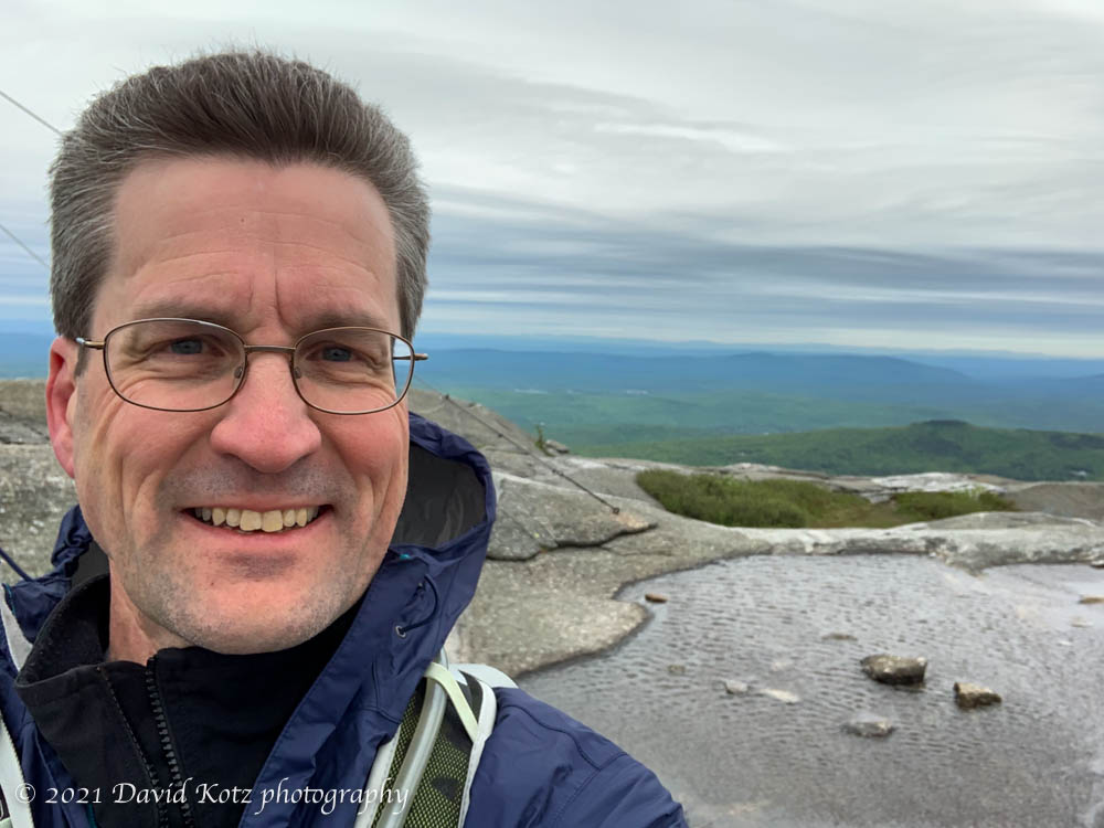
Today was a cool and windy day, as I wound my way up the familiar West Ridge Trail. I arrived early to beat the holiday-weekend crowds and the forecasted rain, and enjoyed a quiet hike through the damp woods to the windy summit.
David on the summit of Mount Cardigan on a very windy day!
And windy it was! After a brief stay in the shadow of the summit firetower, I returned via the South Ridge Trail, which provided some fine views of the peak.
Check out the photo gallery, including a video from the summit.
A visit to the famous Bomber crash site on Mount Moosilauke.
On the afternoon of January 14, 1942, a Douglas B18-A bomber with a crew of seven took off from Westover Air Field, Massachussetts. Hours later, fighting darkness and bad weather on their return to base, the crew became seriously disoriented… thinking they were approaching Westover when in fact they were over central New Hampshire. Moments later, they crashed into the side of Mount Waternomee, one of the peaks on the shoulder of Mount Moosilauke. The crew scrambled out of the wreckage, but the plane caught fire and exploded. Five survived, standing in the dark in the deep snow. The story of the crash – and the mid-night mid-winter rescue – has become the stuff of legend.
More than thirty years ago, as an undergraduate we often heard rumors of the “bomber site” on Moosilauke; it was known to be difficult to find and a challenging bushwhack. I’ve been meaning to visit the site ever since. Today I finally made it. Read on…