On the afternoon of January 14, 1942, a Douglas B18-A bomber with a crew of seven took off from Westover Air Field, Massachussetts. Hours later, fighting darkness and bad weather on their return to base, the crew became seriously disoriented… thinking they were approaching Westover when in fact they were over central New Hampshire. Moments later, they crashed into the side of Mount Waternomee, one of the peaks on the shoulder of Mount Moosilauke. The crew scrambled out of the wreckage, but the plane caught fire and exploded. Five survived, standing in the dark in the deep snow. The story of the crash – and the mid-night mid-winter rescue – has become the stuff of legend.
More than thirty years ago, as an undergraduate we often heard rumors of the “bomber site” on Moosilauke; it was known to be difficult to find and a challenging bushwhack. I’ve been meaning to visit the site ever since. Today I finally made it. Read on…
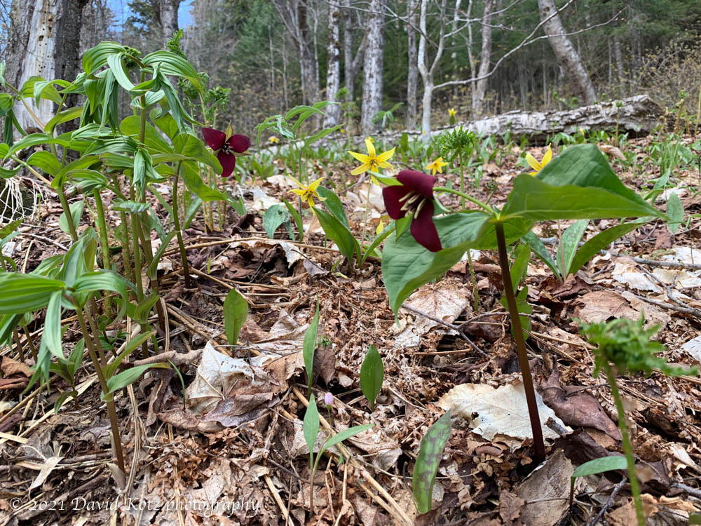
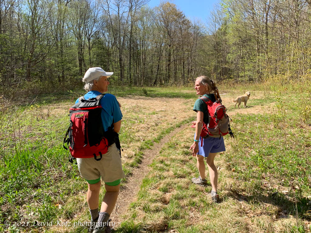
Lelia and I met up with Jen and Lars early on this sunny Sunday morning, the only cars at a remote forest road I’d passed many times without noticing. We followed instructions posted by other hikers, and had a pleasant walk on a gated USFS forest road through the hardwood forests bursting with spring wildflowers.
At the end of that road we expected to begin a ‘bushwhack’ experience, finding our own route through dense undergrowth, we discovered a well-trodden trail with fresh flagging tape marking the way.
The route followed a tributary of the bubbling Walker Brook, passing several pretty cascades along the way. Soon, the trail steepened and left the brookside, heading straight uphill. Suddenly, we came across a battered piece of aluminum, the first of many scattered pieces of this historic wreck.
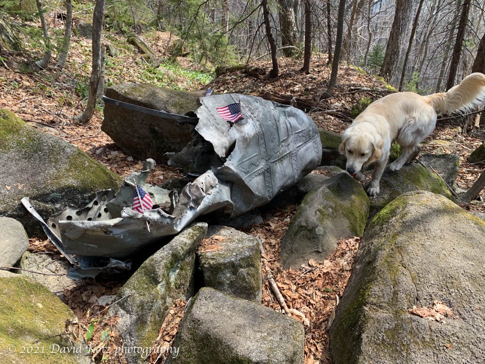
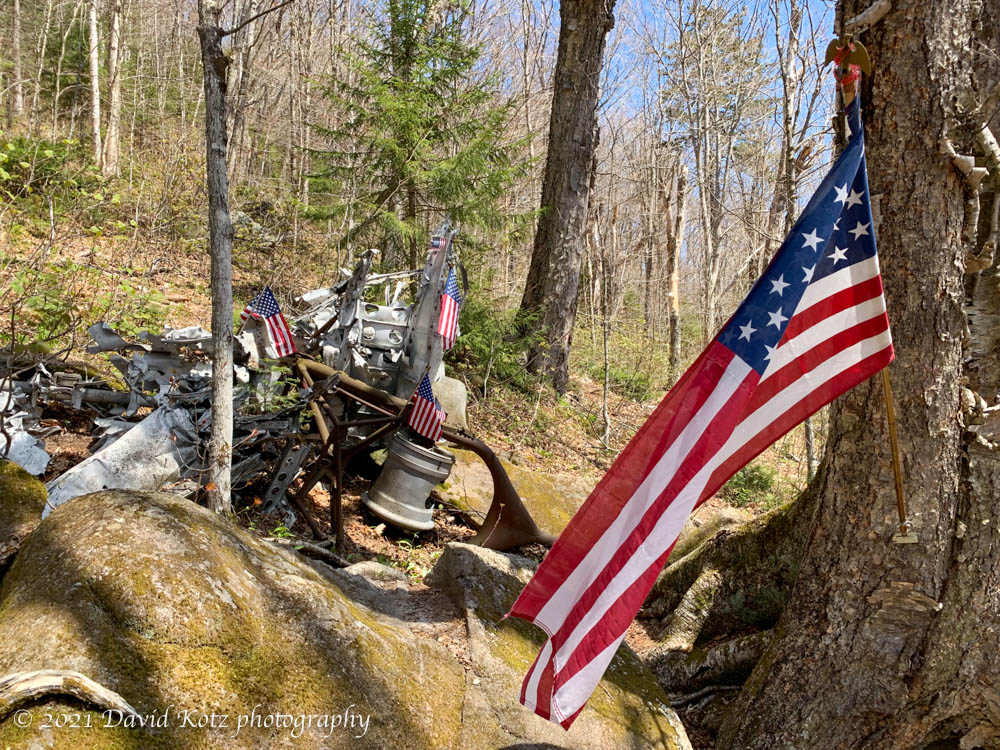
Climbing further, we found the engines, the wings, a piece of fuselage, and countless other pieces, each demonstrating the tremendous violence of a plane crashing through the trees into a hillside – then catching fire and exploding. Countless earlier visitors had placed flags and other honors on and around the wreckage, paying tribute to the brave crew and their rescuers. It was an incredible sight. After taking it all in, we turned to head back down.
We were astonished to pass other people climbing to visit the site today; indeed, we passed perhaps a dozen groups, maybe 30–40 people altogether, visiting today. Clearly this site is far better known than I had realized. Indeed, this time of year is likely the best time to visit, prior to the emergence of summer undergrowth and after the winter snows have receded.
See my photo gallery and I recommend you read the story.
Hike stats:
time: a bit more than 3h25, with many stops
distance: a bit more than 7.7km
gain: 467m