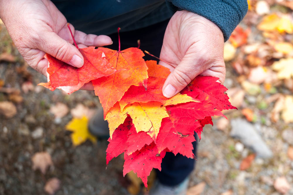
Grand Canyon, days 1-2

The “main event” for our southwest vacation was a rafting trip on the Colorado River through the Grand Canyon. I’d done this trip before, with the same rafting company (Hatch River Expeditions), exactly twenty years ago. It’s such an awe-inspiring experience that I’ve longed for years to share it with Pam and the kids. [Photos]

Our lead boat rounds the Nankoweap peninsula.
Our lead boat (left of center, in the water) rounds the Nankoweap peninsula.

Continue reading “Grand Canyon, days 1-2”

Southwest canyon trip

In stark contrast to my recent posts from the verdant New Hampshire summer (or its recent snowy winter), I’m embarking on a series of posts summarizing our outstanding 17-day trip to the American southwest. After a couple days in the broiling sun and steamy nightlife of Las Vegas, we spent a week rafting the Colorado River through the Grand Canyon, a reprise of a trip with my father and uncle twenty years earlier. We then toured some of the other outstanding parks of the region: Mesa Verde, Grand Canyon North Rim, Zion, and Bryce Canyon, before heading east to celebrate my 50th birthday with family in South Carolina. [I’m back-dating each post to the last date covered by the post.]

Pam and the kids walk along the Strip in Las Vegas.

Thankfully we only had one day in Las Vegas, because the temperature hit 100 degrees and was forecast to reach 112 in the next few days. It’s the nights that matter in Vegas, anyway. We explored the craziness of the Strip – jammed with drunk pedestrians and hawkers of every vice imaginable – and strolled through a few casinos without pausing to play. Vegas represents excess in seemingly every regard, from gambling to its outrageously flagrant waste of water in the middle of a desert. For us, the highlights included a visit to a tasty Brazilian barbecue and an incredible David Copperfield magic show. We jammed everything into a rental car and headed east.

Andy examines the bew bridge bypassing Hoover Dam.
Andy examines the bew bridge, bypassing Hoover Dam.

We were due to meet Hatch River Expeditions on Sunday morning at the Cliff Dweller’s Lodge near Lee’s Ferry, which is the only place to launch boats for a run of the Grand Canyon. So we took the long way ’round the Canyon, over Hoover Dam and its new bypass bridge then through the forested areas south of the Grand Canyon and west of Flagstaff. Pretty drive!

Sunday morning I woke at sunrise to poke around the scrubby desert wash near Cliff Dweller’s, enjoying the opportunity to photograph this radically different terrain in the warm sunrise light. See more photos. In the next post: the Grand Canyon!

A dry and salty wash near Cliff Dweller's Lodge.
A dry and salty wash near Cliff Dweller’s Lodge.

June hikes

trees and green forest
Morning along the trails at Bretton Woods, near the Mount Washington Hotel.

It’s been a wet spring, but last week was nonetheless sunny and beautiful – the woods were verdant and full of wildflowers.  I had a wonderful hike with a dear friend along the Appalachian Trail close to home, and then four beautiful days to trek around the Mount Washington Hotel & Resort, including the opportunity to take 32 colleagues from the MobiSys conference up some of my favorite short hikes in the Whites: North and Middle Sugarloaf Mountains.

Photos:

  • Holts Ledge – hike along the Appalachian Trail
  • MobiSys – walks along the trails of Bretton Woods, and hikes up Sugarloaf Mountains

The early bird gets the balloon

I’m glad I’m an early riser.  At 6am on this beautiful mid-May Sunday morning, therefore, I grabbed a mug of tea and my camera bag and headed west into the cool, slightly foggy Vermont.  A few minutes later I pulled into the tiny Post Mills Airport just as the first balloons were about to launch, as part of the Experimental Balloon and Airship Meet.  What a treat! Deep blue sky, a slight breeze, and happy faces all around as more than two dozen balloons were unfurled, inflated, and launched into the Vermont morning, slowly drifting east.  I topped it all off with a wonderful pancake breakfast from Revels North. Great start to a beautiful day!

For photos visit SmugMug.

Photo of balloons launching

Late winter on Moosilauke

2014-03-29-06188Only two days left in March, but Moosilauke still has 2-3 feet of snow at the base, and 4-5 feet along the ridgeline. Andy (12) and I hiked to the summit via the Glencliff trail today.  With sunny weather in the forties at the trailhead, the snowpack was soft and wet, eager to swallow any foot that strayed from the trail packed by hundreds of hikers before us. The warm March sunshine allowed for a comfortable hike, no hat no gloves. High on the slopes of south peak we finally caught some views to the west; indeed, I had a great view down into the Tunnel Brook valley and even spotted a person standing on Mud Pond where I’d skied just six days ago.

2014-03-29-06200As we reached the Carriage Road trail junction and the ridgeline, we climbed into the clouds. The temperatures were still above freezing, though only barely, and as we crossed the ridge and climbed above treeline the wind picked up and the ambient temperature dropped. We could barely see from one cairn to the next, but Andy was so enthralled by the rime ice that we took our time.  We met six backcountry skiers at the summit, and explored the cloudy terrain for a while before heading for home.

2014-03-29-06258The soft wet snow, four feet deep along the upper reaches of the trail, provided great opportunities for butt-sledding and made for a quick descent. Four hours up, less than two hours down. Great day!

See a few of my favorite photos.

Tunnel Brook

David skis across the ponds along the Tunnel Brook trail.

One of the classic ski tours on Mount Moosilauke is the Tunnel Brook trail, which climbs over a low north-south valley along the west flanks of Mount Moosilauke.  It follows Tunnel Brook upslope for several miles, continuing straight as the brook heads left up into the steep-walled Tunnel Brook Ravine.  (Last summer I completed that classic bushwhack route to the summit, discovering an incredible slide created by Tropical Storm Irene in 2011; see trip report.)  Today I had the good fortune to ski this route under a sunny sky and with fantastic ski conditions. Continue reading “Tunnel Brook”

Lafayette

I decided it was high time I climbed Mount Lafayette, having bracketed it on the previous three Sundays. Three weeks ago I skied the slopes near Moosilauke, to the south; two weeks ago I skied and climbed to the summit of Owl’s Head, to the east; one week ago I hiked to Lonesome Lake, to the west. (Not to mention hiking the Kinsmans last October.) Each time I looked longingly at Lafayette, the queen of Franconia ridge all white with winter splendor, I felt the urge to get back up there before winter ends. Continue reading “Lafayette”

Owl’s Head Mountain

Roundtrip distance: 18 miles. Elevation gain: 2900 feet.  View: none.  Why does anyone hike to the summit of Owl’s Head, deep inside the Pemigewasset Wilderness of the White Mountain National Forest?  Perhaps, as Sir Edmund Hillary once said, “Because it is there.”  More likely, however, because it has resisted millenia of weathering to keep a little piece of itself above 4000′.  Shave off 26′ and nobody would visit this peak. As it is, everyone hoping to “bag” the list of 4000-footers must climb this knob that is encircled by far grander peaks in the Franconia, Twin, and Bond ranges.

Near the summit of Owl's Head
Near the summit of Owl’s Head

Seventeen years ago I set out to climb Owl’s Head in the summer.  Daunted by an 18-mile hike, I made it an overnight, which turned out to be a wonderful adventure (with a mysterious ending, but that’s another story).  As I walked the long 8-mile approach trail, which is largely flat by White Mountain standards, I imagined that it would be far better to do this mountain in the winter when one could ski.

So when my friend Lelia suggested that we attempt Owl’s Head this winter, I recalled those thoughts, considered the recent deep cold that would have frozen up nicely all those the brook-crossings, and the deep snow we’ve had in recent weeks (check out my photos from a ski tour on Moosilauke last week, where we found 4 to 6 feet of base).  Sure, let’s do Owl’s Head. Continue reading “Owl’s Head Mountain”

The greatest survival story ever

image of book cover
Endurance: Shackleton’s Incredible Voyage, by Alfred Lansing.

Although I started this blog as a place to describe my travels, sometimes I enjoy armchair travel as well. I recently had the chance to re-read Endurance: Shackleton’s Incredible Voyage, which has to be one of the world’s most incredible survival stories of all time.  All the more so because it is a true story, chronicling the adventures of Ernest Shackleton and his men in their Antarctic expedition of 1914-1917. Launched almost exactly 100 years ago, their goal was to complete the first trans-continental crossing of the Antarctic from the Weddell Sea to the Ross Sea, just a few years after the first human visit to the South Pole. As it happens, they never landed on Antarctica, being trapped in the ice of the Weddell Sea upon arrival, then over-wintering on the ice while their ship was slowly crushed.  In an astonishing quirk of timing, a modern ship was trapped a few weeks ago by ice in the same sea — requiring its tourist occupants to be evacuated by helicopter to another ship (as of last week, the ship is free but not yet out of trouble).

Continue reading “The greatest survival story ever”