
By David Metsky
A group of friends have gathered at a Dartmouth Outing Club cabin every New Years for since the mid-80’s, when we were undergraduates. This years incarnation took place at John Rand Cabin, near the Moosilauke Ravine Lodge on the east side of Mt Moosilauke. There was a group of 10 of us at the cabin for a thrilling evening of entertainment before going to sleep just after midnight.
The next day we planned a hike up the mountain, via the Gorge Brook trail. The group consisted of Dave M (your scribe), Dave and Kathy Hooke, Dave Kotz, Brenda, Ed, and Ken. We got a late start because we had to pack up the cabin and get all our gear down to MRL, so we didn’t get on the trail until 11:00AM. There were helicopters flying overhead looking for a missing Lear Jet that had disappeared on Christmas Eve.
The lower part of the hike went uneventfully, and we stopped at Last Water, where I told Brenda to leave one of her ski poles because we were coming back down this way. Turns out we didn’t, so if anyone finds a 135CM ski pole at Last Water, contact me. There was a real hard pack of snow on the ground, no need for snowshoes or crampons. Our gear consisted of Sorel pak boots, leather hiking boots, and plastic mountaineering boots. It was cold (2F at the summit) but little wind and good visibility most of the day.
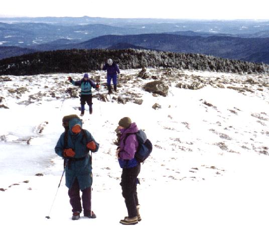
We got to the first views, on the logging road section of the trail where we did a layer break and drank water. Then we pressed on to the second set of views where we took a longer break. There we had some food and water, and geared up a bit more. Then we pushed on to the summit.
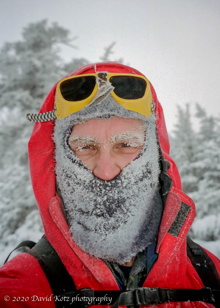
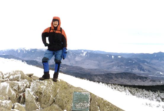
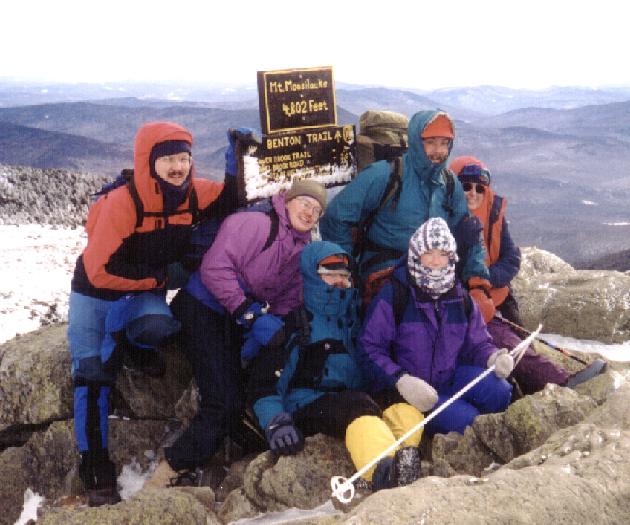
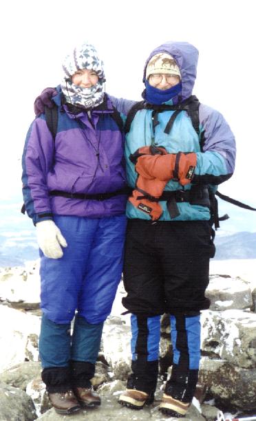
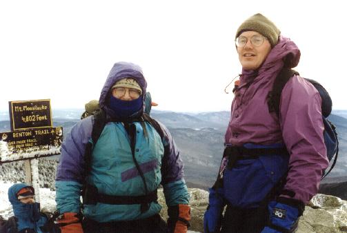
Just before treeline we ducked into the woods to put on our final layers. Then we headed out for the summit. It was pretty calm in the wind shadow of the summit and not bad on the summit itself. Here are pictures of people on the summit:
- DaveK with Franconia Ridge
- Brenda with the infamous Head Sok
- Group Photo #1
- Group Photo #2
- DaveM and Brenda
- DaveM and Ed
- DaveM in the Summit House foundations
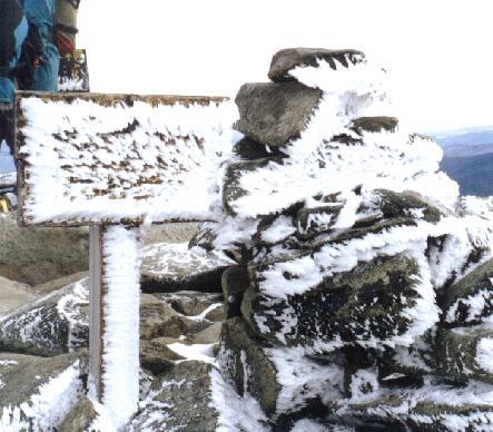
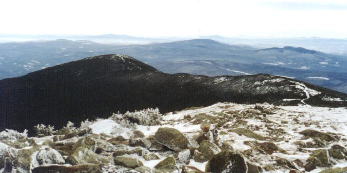
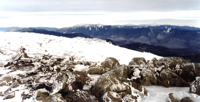
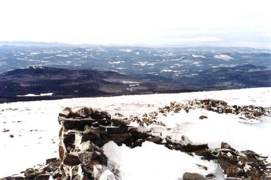
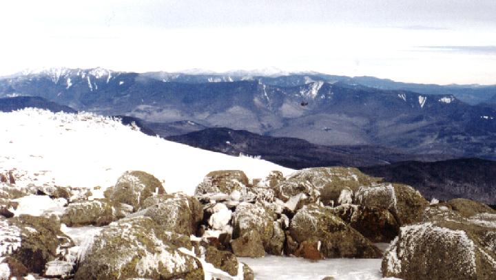
We also took lots of pictures of the summit area:
- Summit sign and cairn
- Closeup of Summit sign
- Summit – Summit House Foundations
- South – into Gorge Brook ravine
- Southwest – The Carriage Road and South Peak
- Southwest – Top of the Carriage Road
- East – Franconia Ridge and the Presidentials
- East – Summit Plaque and Franconia Ridge
- North – Benton Trail and AT north
- Northwest – Tunnel Brook
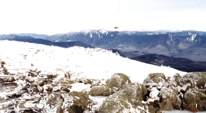
Finally, here are some shots of the search helicopters flying right over our heads:
After a pleasant stay on the summit, we started down the Carriage Road, headed for the Snapper trail back to Gorge Brook and the Lodge. We met a few people headed to the summit via Glencliff, but none headed down Gorge from the summit. This meant that Brenda’s ski pole would remain at Last Water. We stopped at the Glencliff junction to de-layer and rest. Then it was down the Carriage Road, too icy for skiing, past the Moosilauke Permitted Use sign and down to our final stop at the junction of Snapper and Gorge Brook. The icy formations in Gorge Brook kept us occupied in our tired state. Then a final uphill section before reaching the Ravine Lodge. We gathered out collected stuff and hiked/skied out to the cars on Rt 118.
Pictures for this report were provided by Brenda Conaway, Dave Kotz, and Dave Metsky.
See also David Kotz’s photo gallery.
This post was transferred from MobileMe to WordPress in 2020, with an effort to retain the content as close to the original as possible; I recognize that some comments may now seem dated or some links may now be broken.
