
I chose to spend my final week in the U.K. hiking with Dartmouth friends in Snowdonia, the mountainous region in northern Wales. Much of the region is protected land, as part of Eryri National Park. Although the mountains maintained their characteristically cloudy summits throughout most of our four-day visit, we were spared any rain and enjoyed one gorgeous sunny afternoon on Mount Snowdon (Yr Wyddfa), the highest peak in Wales.
Day 1: Capel Curig hilltops
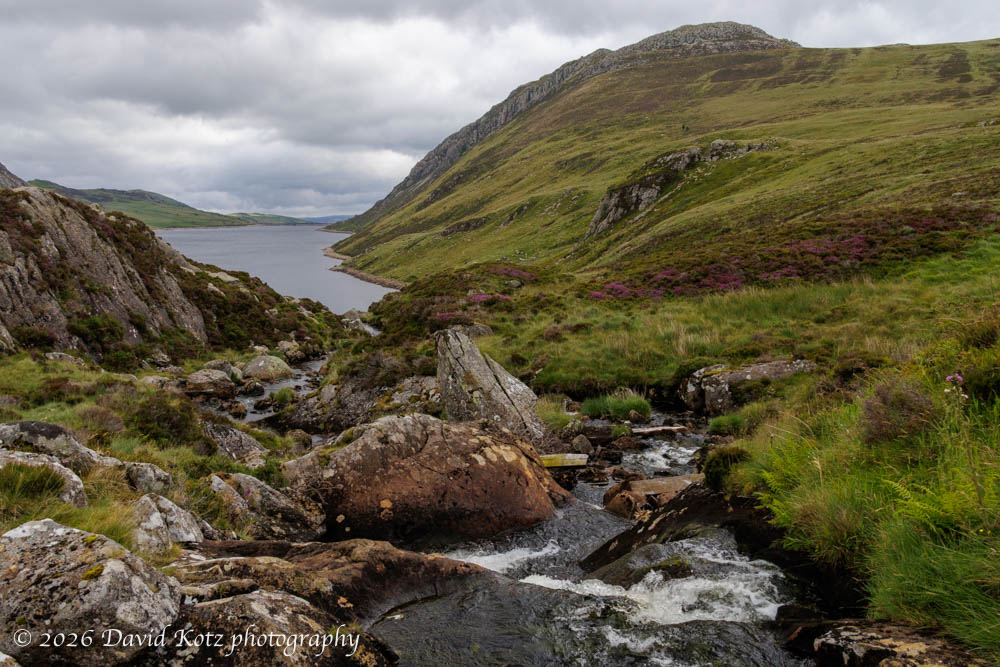
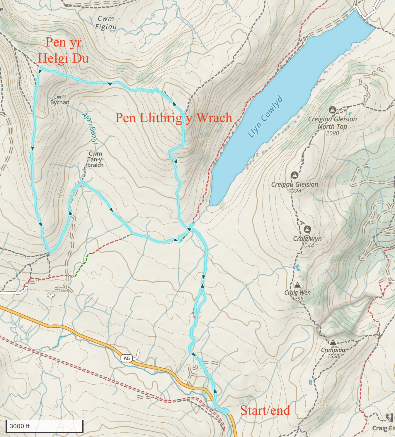
For our first outing, we walked right out the door of the home we rented in the tiny village of Capel Curig, turned right through a farm gate, and headed for the hills. The track, sometimes barely visible, began by crossing a boggy meadow that quickly soaked through our shoes. After slogging through the bog, we finally climbed into higher terrain, past grazing sheep, to the summit of a bump called Pen Llithrig y Wrach (2621′ = 799m elevation).
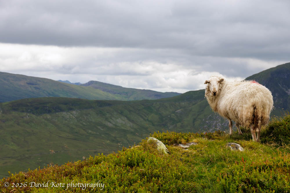
Three of us descended for a loop around the valley reservoir, and two of us went down and up to a second peak, Pen yr Helgi Du (2733′ = 833m). All this terrain was wide open – no trees anywhere – allowing fabulous views throughout the hike. Despite the overcast sky, we enjoyed views of the lush green valleys and – sometimes – the Irish sea beyond.
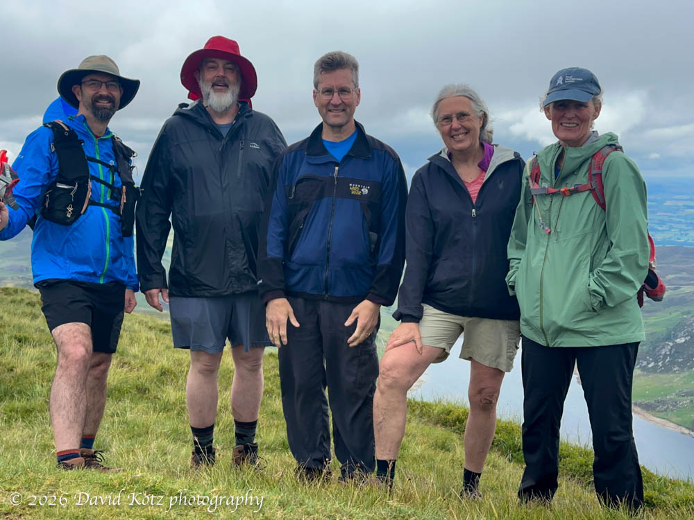
Photo gallery and slideshow
First peak: Pen Llithrig y Wrach (2621′ = 799m)
Second peak: Pen yr Helgi Du (2733′ = 833m)
Distance: 8.64 miles (13.9km)
Gain: 2497 feet (761m)
Time: 5h48m
GaiaGPS track
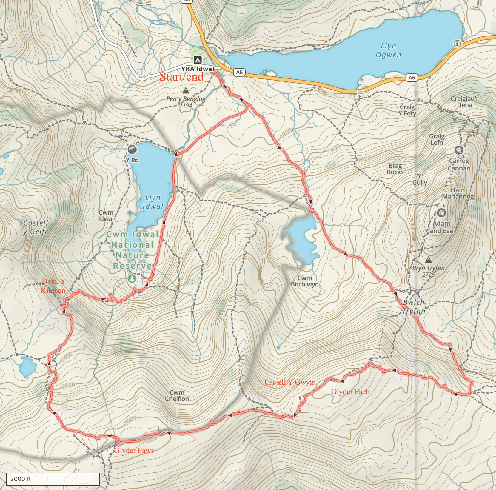
Day 2: Glyder Fach & Glyder Fawr
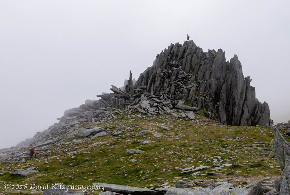
We increased our ambitions for our second outing, doing a long loop over some incredibly rugged terrain. We climbed into to clouds for our first peak, Glyder Fach (3261′ = 994m).
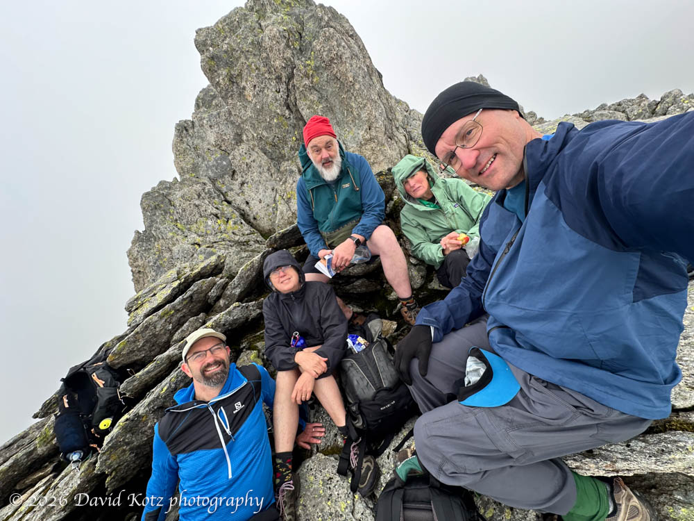
The geology here is fascinating: vertical strata erode into dramatic spires that beg for creative names, like the Castell Y Gwynt, that indeed looks a bit like a castle in the misty clouds.
After our second peak, Glyder Fawr (3283′ = 1001m), we descended steeply on a tricky scree field before descending even more steeply on expertly-built stone steps through a ravine called Devil’s Kitchen.
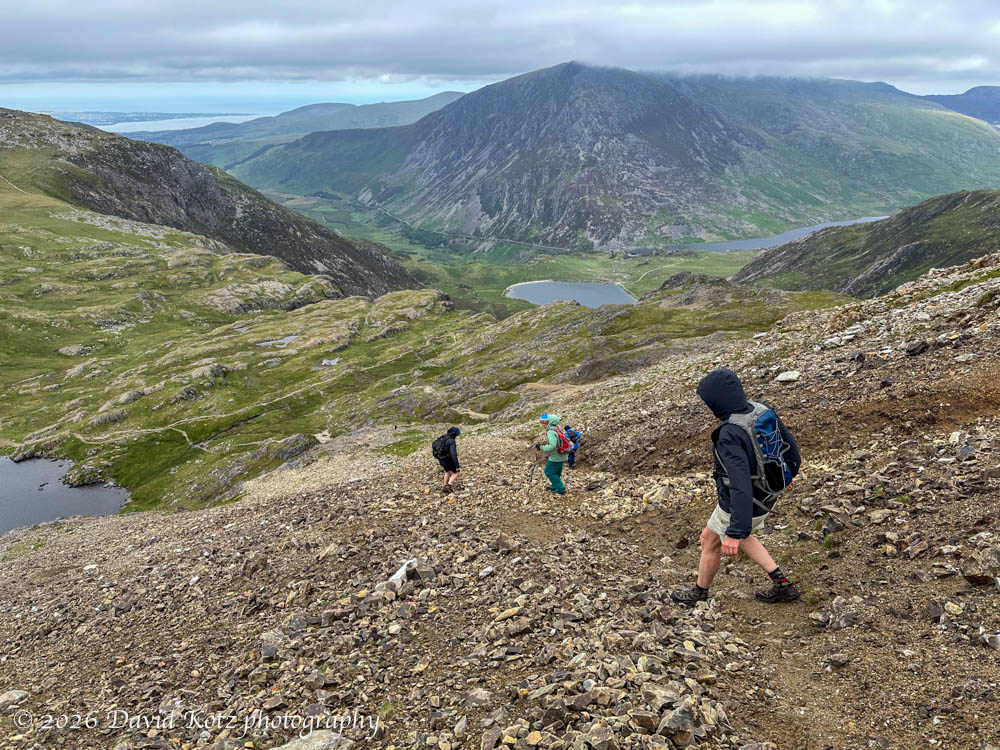
Photo gallery and slideshow
First peak: Glyder Fach (3261′ = 994m)
Second peak: Glyder Fawr (3283′ = 1001m)
Distance: 6.18 miles (10km)
Gain: 2,463 feet (751m)
Time: 6h17m
GaiaGPS track
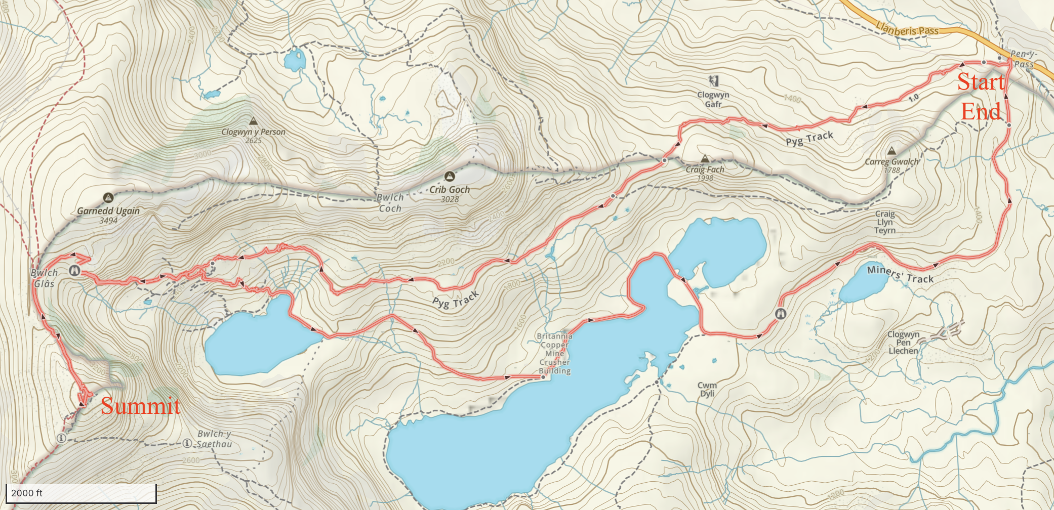
Day 3: Snowdon (Yr Wyddfa)
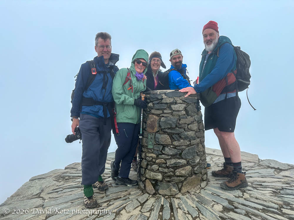
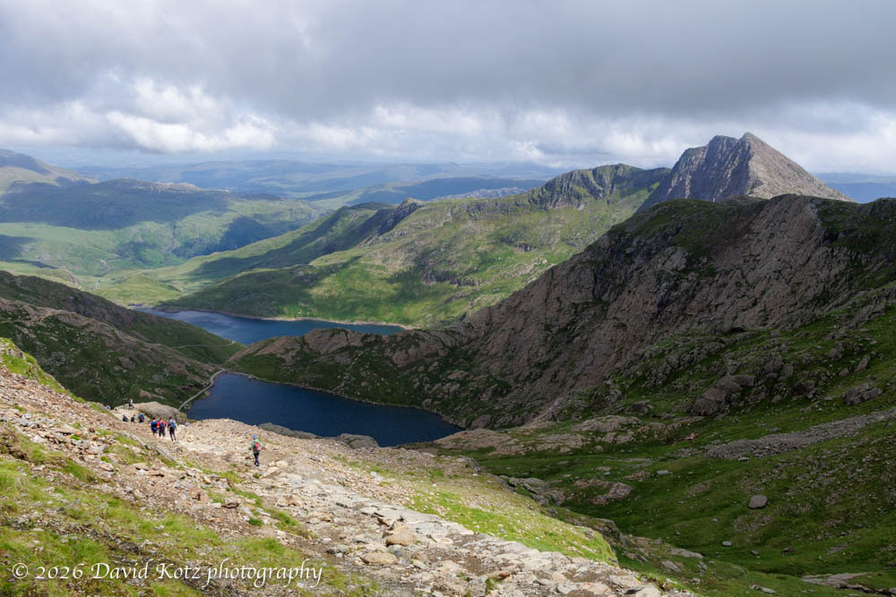
We saved the biggest peak for the day most likely to be sunny: Snowdon (Yr Wyddfa) (3,560′ = 1,085m). As the highest peak in Wales (and higher than anything in England) this peak is very popular and the trails were busy. (A cog railway takes tourists to the summit, where there is a café and gift shop.) Nonetheless, the hike passes through a beautiful, wide-open landscape on the Pyg Track, which is paved two lanes wide with impressive stonework. As we approached the top of the ridge we could see the peak held firmly onto its cloudy cap. In the clouds and wind, we waited ten minutes in a long queue for our turn for a photo at the summit monument.
Although we spent about 50 minutes at the summit, the clouds never parted. But, of course, as we descended the ridge, the clouds dissipated, blue skies appeared, and the summit shone gloriously above. (Sigh. If we’d only arrived an hour later….) Nonetheless, the sunshine allowed a beautiful descent along the Miners’ Track.
My 41st consecutive weekend hike!
Photo gallery and slideshow
Peak: Snowdon (Yr Wyddfa) (3,560′ = 1,085m)
Distance: 7.66 miles
Gain: 2,354 feet (718m)
Time: 6h37m
GaiaGPS track
Day 4: Conwy
For our final day, we took it easy. A short morning walk brought us to the base of Conwy Waterfalls, roaring through a deep gorge carved by Afon Conwy (Conwy River). The water was a deep brown color, tinted by tannin leaching from the forested soils throughout the watershed.
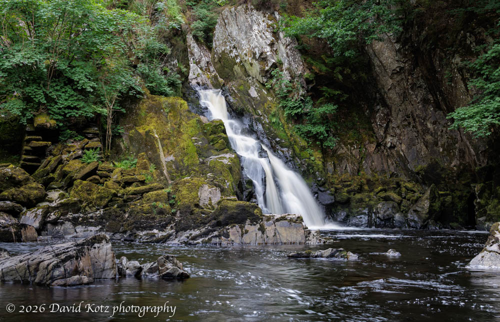
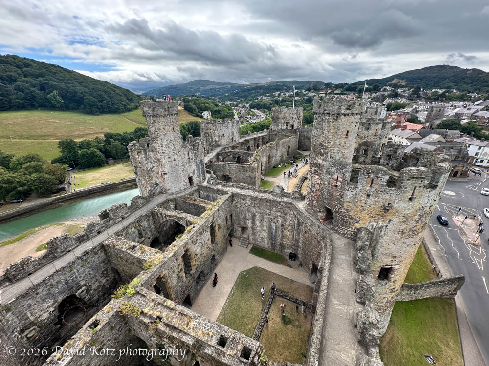
The photo gallery includes this and two other waterfall photos. Afterward, we drove into the city of Conwy to visit the impressive Conwy Castle, completed in 1287 and still one of the most intact (and imposing!) of the 400+ castles in Wales.
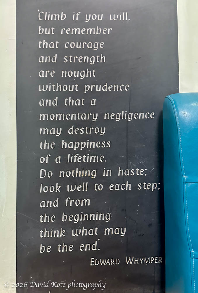
A final thought
A final thought about hiking, from a slate sign seen in the Plas y Brenin Outdoor Center in Capel Curig.

Gorgeous! Thanks for sharing.