
It’s not often I have an opportunity for a mid-week ‘bonus’ hike, but on a day spent driving across Wales, from Conwy on the north coast to Cardiff on the south coast, it’s hard not to stop somewhere in the midst of that magnificent countryside and go for a hike. I selected a small mountain called Ysgyryd Fawr, better known as Skirrid, because the AllTrails description touts its spectacular panoramic scenery. Of course, as I pulled into the trailhead car park, rain started to fall and I found myself sitting in the car, wondering whether it was worth heading out. It was!
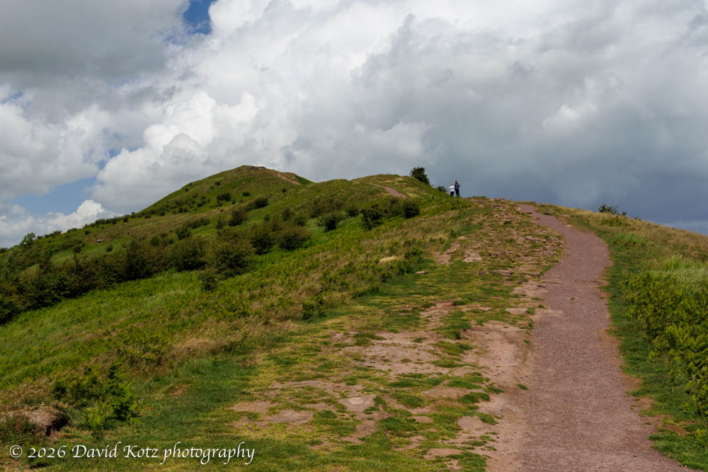
The shower passed quickly, and sunshine returned, interrupted only occasionally by fluffy white clouds zipping by in the stiff breeze. This hike is very popular, gauging by the massive car park and the no-parking signs stretching half a kilometer down the road; even in the middle of a mid-week day there were hikers emerging from other cars in the lot. I chose a circular route, which climbs the long (and mostly open) ridgeline to the summit, then drops precipitously on a grassy slope toward the pastures below, then hangs a hard right and contours back around the side to rejoin the ridgeline trail. (Now I know why AllTrails recommends the opposite direction: it would have been easier to climb that steep slope than to descend.)
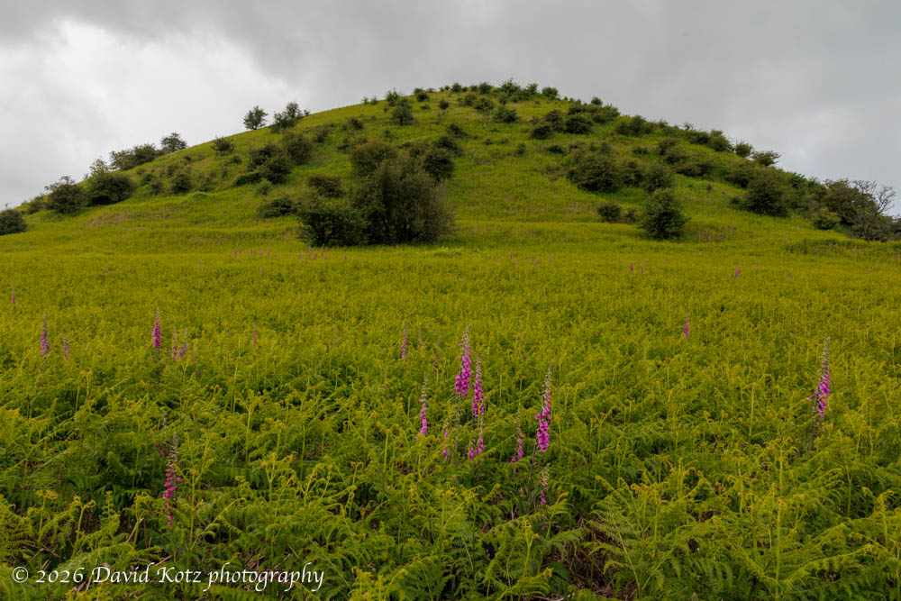
The views from the summit ridge were gorgeous, with verdant green fields and pastures and meadows stretching in polygonal shapes as far as the eye could see, punctuated by other small hills and cut only occasionally by remote rural roads. (Check out the video panorama!) I could see another batch of showers coming my way, so I left the summit and quickly made my way down and around the side of this elongated hill, through vast fields of ferns and foxgloves.
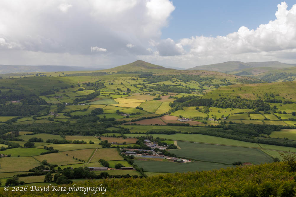
The scenery felt impossibly green; concerned my camera’s screen was somehow oversaturating the images, I looked up at the same scene and saw the same intense colors… especially through polarized sunglasses similar to the polarizing filter on my camera lens. Wales really is that green! Check out the photo gallery for more.
Hike stats:
Distance: 3.18 miles (5.12km)
Time: 1h22m
Gain: 891 feet (272m)
GaiaGPS track
AllTrails description
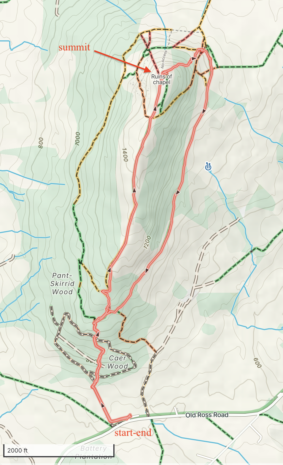
up the ridge, then down and back around the side.
