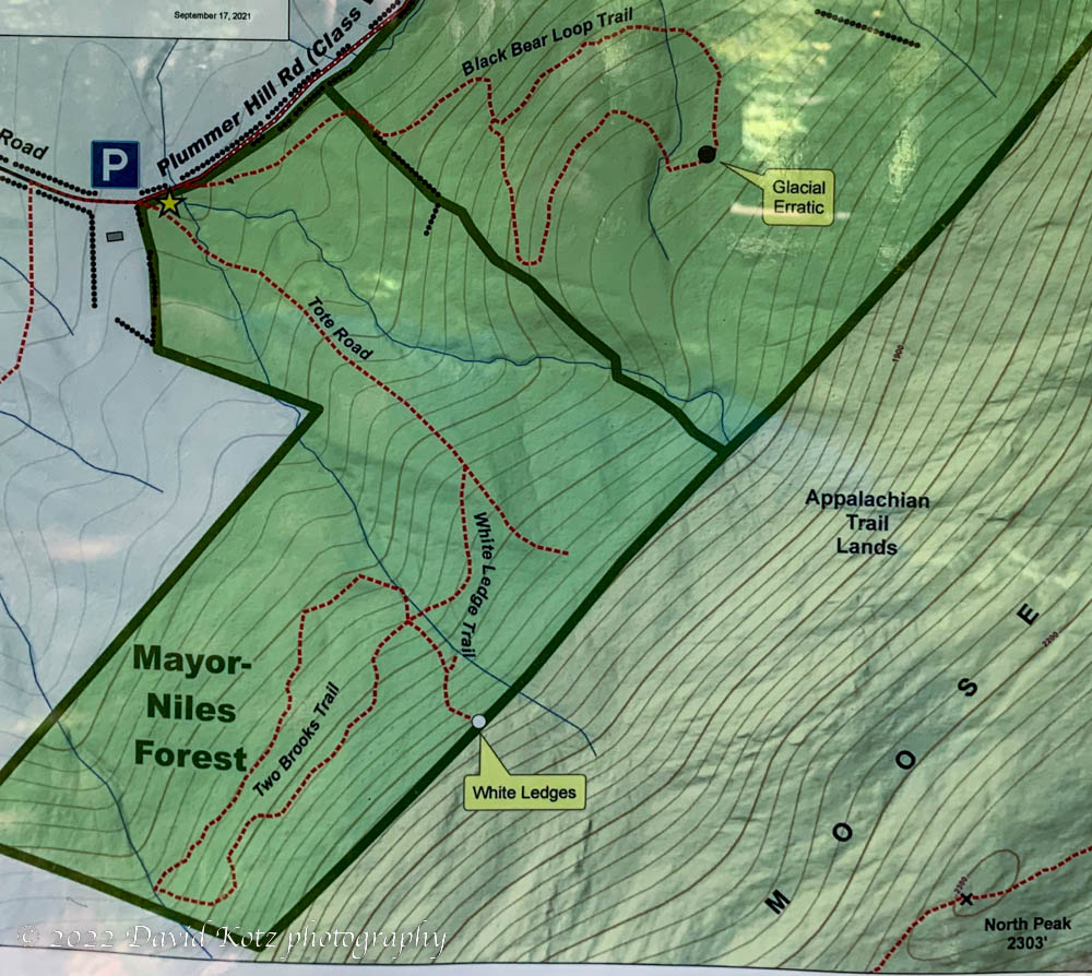
I set off for a quick afternoon hike, eager to get outdoors and stretch my legs, but with limited time available. I was driving the back roads through the forested lands on the east side of Hanover, NH, and was surprised to see a trailhead icon appearing on my car’s navigation map. I decided to change plans and investigate this trailhead – one that is relatively new, and certainly new to me. I learned, on arriving at the cheery trailhead kiosk, that it feeds two short trail loops on the western slopes of Moose Mountain – allowing one to enjoy the conservation lands of Mayor-Niles Forest and Britton Forest.

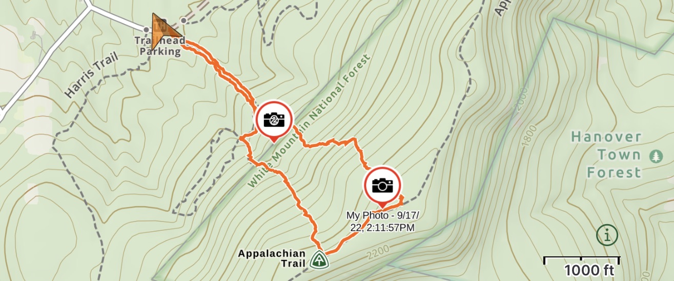
I shouldered my pack and headed up the trail called “Tote road”, which rose steeply and directly up the slope. From the contours I anticipated it would top out on the ridge of North Moose Mountain, presumably to go down the other side. Soon, though, I reached a marker indicating the end of the trail, at the boundary of the conservation area. Knowing from experience (and the map) that the Appalachian Trail followed the ridgeline above, and seeing the shadow of the old tote road continuing upward through the forest, I decided to go off-route and follow my nose uphill.
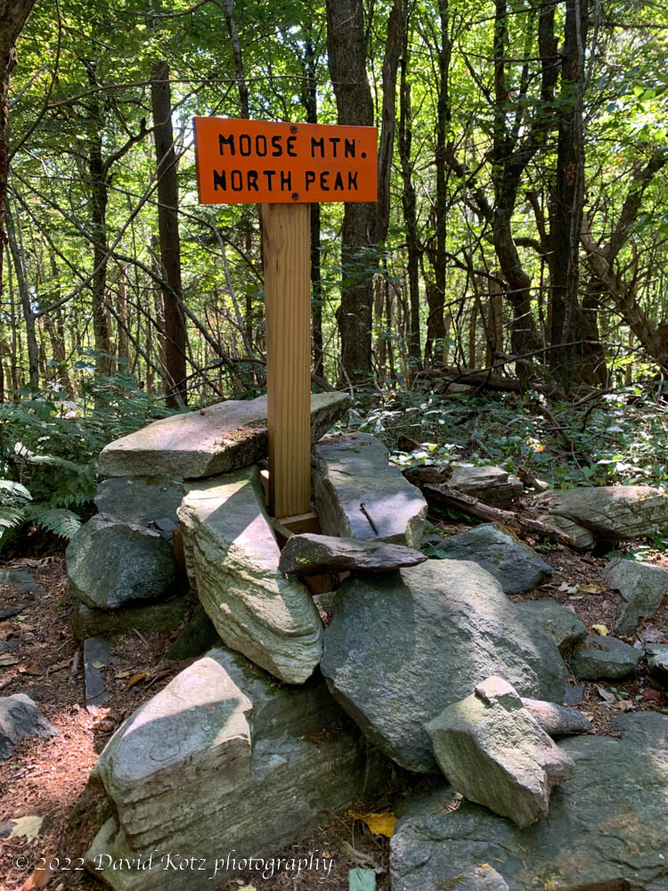
The old tote road soon faded, however, and I was left picking my way through the hardwood forest. It was a sunny day, the forest was mature and the undergrowth thin. Animal tracks littered the muddy areas, and I wondered how many people may have been through this patch of woods – not many, I expect, in the past decade. It was steep, but after gaining several hundred feet the ground leveled off and I intersected the Appalachian Trail where it followed the rambling ridge. I turned south, and soon reached the non-descript north summit of Moose Mountain.
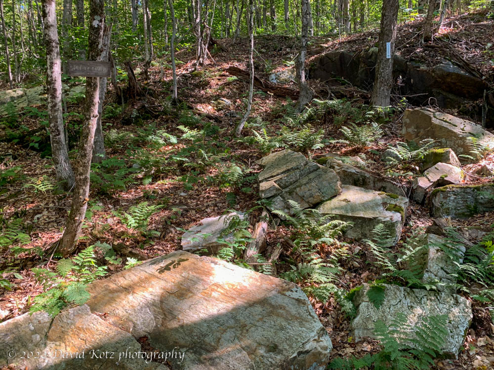
I followed the trail another quarter mile before turning off trail and downhill again, with the aim of intersecting one of the other Mayor-Niles trails, near what the map promised would be “white ledges”. The going was easy now, down down through the open forest land, following a dry streambed, until I encountered the rarely used White Ledges Trail. The White Ledges turned out to be a scattered collection of huge blocks of quartzite – mostly covered in a patina of age and moss, but impressive nonetheless.
From here, I followed the trail back to the trailhead, satisfied at the opportunities brought to one who chooses a trailhead, a trail, and an off-trail excursion, spontaneously. Even on a mountain I’ve scrambled over in many directions, on many trails, spanning four decades, I enjoyed the chance to see it from a new angle.