
Today was a beautiful day so Andy and I decided to do another hike. My preferred location became temporally inconvenient, late in the morning, because the necessary bus apparently does not run during lunch time. So we picked something closer – Mount Rigi. Read on and check out the photo gallery for more.
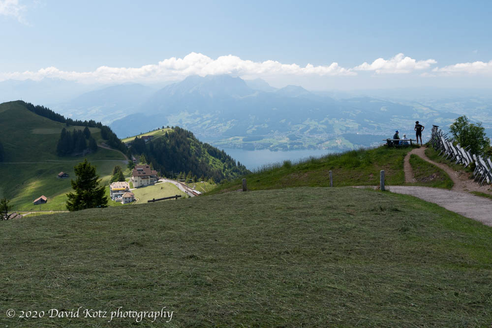
Known as the ‘Queen of the mountains’ and heavily marketed for its summit views and slopeside services year-round, Mount Rigi is particularly accessible due to two mountain railways and several gondolas. It does indeed have a commanding view, standing alone between two major lakes and looking north across the pastoral plains of northern Switzerland and looking south into the Glarus Alps.

We had limited time, so we decided to take the train to one of the stops high on the mountain (Staffelhöhe), hike the rest of the way, and then hike all the way down. The catch: to get to that point requires a train, a bus, another bus, another train, over a total of two hours. We were finally on the trail around 1pm.

I say ‘trail’ loosely because, alongside the train tracks this trail is alternately paved and gravelled, transited on this weekday primarily by retirees or by young families pushing strollers. Still, it was a beautiful day and a good chance to climb high through fresh air and alpine meadows.
We paused for lunch at a trailside café, with a simple repast of cured sausage and bread, while the owner shared a whisky with another customer, an elderly gentleman who seemed to provide endless conversation. Meanwhile, the owner’s cat showed a particular interest in Andy’s lunch.

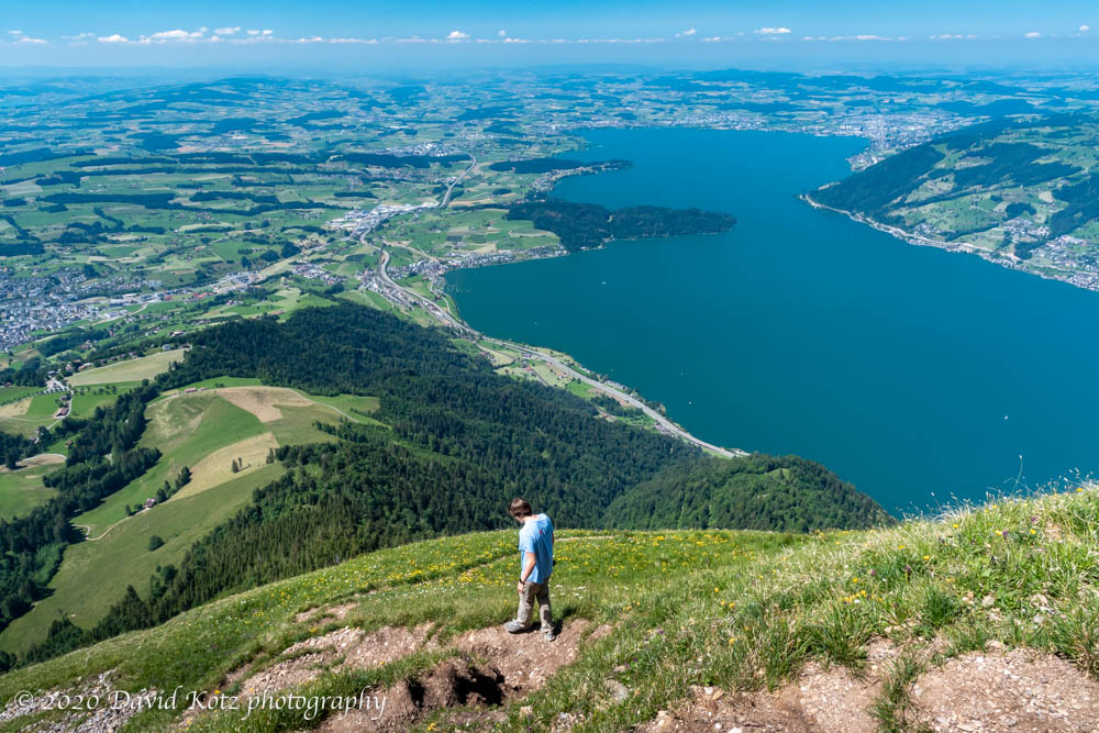
We spent a few minutes at the summit (Rigi Kulm) enjoying the summit views – across lake Zugersee to the north and across Vierwaldstättersee (‘four forest-states lake’) toward Mount Pilatus and the city of Luzern. (We hiked on Pilatus last month.) Also to the south, we had a panoramic view of the Glarus Alps, though afternoon haze and clouds were beginning to diminish that view. I found it interesting that Rigi was used as the keystone of the original Swiss topographic survey, and the original marker is still in place. Also, Rigi has a ‘sister peak’ in China, Mount Emei; there is a boulder from Emei on Rigi, and a boulder from Rigi on Emei.

There are many, many trails on this mountain, and many train and bus stations at its base. Which way down? We looked toward the northeast, and could see the most convenient stations; we saw a trail heading down in that direction. What could go wrong?

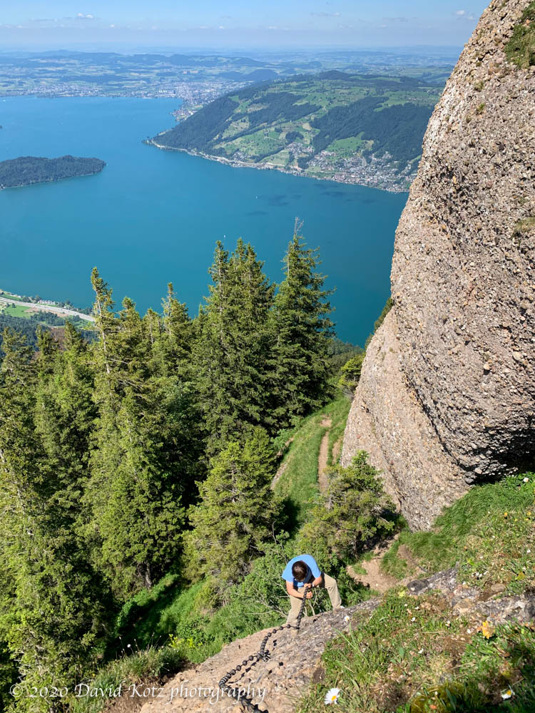
It turns out there is a very good reason not to descend this way. The trail drops hundreds of meters on an unmarked and poorly maintained trail built atop a loose conglomerate. The steepness of the trail – with exposure to long rocky or grassy slides – was enough to unnerve me. But the loose stones littering the trailbed were a real concern. Then, it got worse. Several times the trail disappeared over an edge – albeit a grassy edge decorated with pretty wildflowers – but portending an even steeper descent. Fortunately, at these places the trail maintainers had bolted fixed cables with handholds, so we could lower ourselves hand-over-hand down these near-vertical pitches.
Soon we finished with that mess, and descended through a fir forest that reminded us of New Hampshire. Eventually we popped out of the forest into the pastures and hayfields of the lower slopes. At this point we decided to take the Seebodenalp gondola, shortcutting our descent by a few hundred meters; at its base, we caught a bus back to the train station and were on our way homeward.
Check out the photo gallery for more.
Hike stats: 5.23km, gain 227m, descent 766m, moving time 1h50, pause time 0h58. See maps below.


Wow! Just wow! I can see why you wanted to go hiking …. on a day like that you don’t stay home.
>