
Nearly three years ago, I was in Switzerland for just a few days and was determined to go hiking. As it turns out, early November was not such a great time to visit alpine terrain, and I spent the day wandering through a misty snowstorm, knowing there were grand views – but all were hidden in the low clouds. I enjoyed the hike, though, and it made me more determined to return. This weekend I did – including two spectacular hikes despite some lingering cloud cover. Read on, and check out the gallery; the photos on this page tell the story but don’t capture the beauty of the place or of the day.
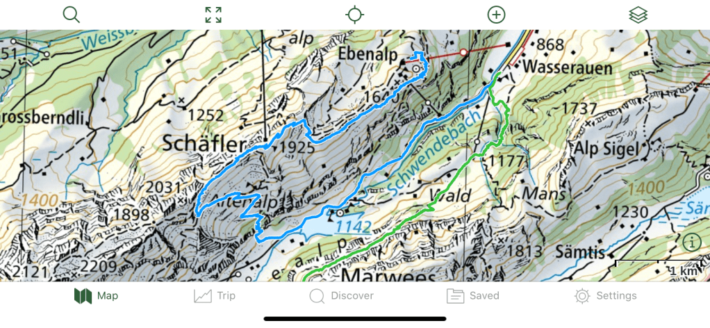
So this weekend, when a colleague suggested climbing either Säntis or Altmann, the two major peaks at the head of that same Seealpsee valley, I jumped at the chance; indeed, Pam and Andy and I decided to go a day early, to visit some of the sights there. We planned to stay overnight in Wasserauen, the village at the end of the train line. We arrived shortly after noon Saturday, dropped our bags at the hotel, and hopped on the gondola for the ride to Ebenalp.
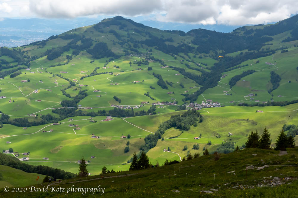
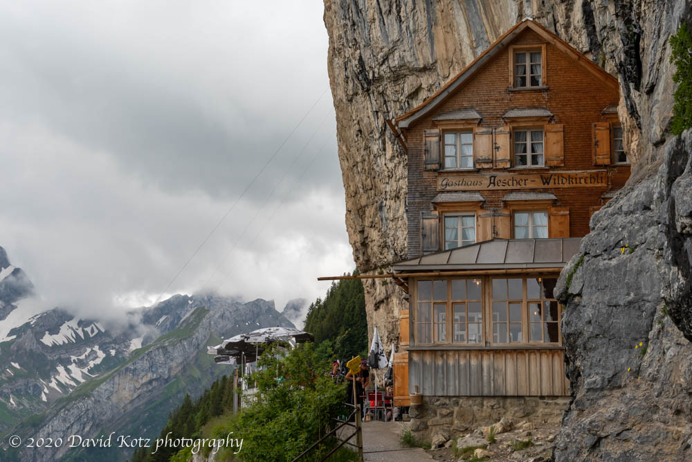
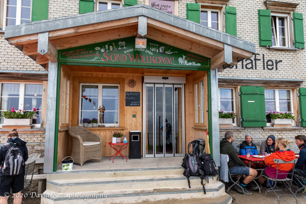
Although there were heavy, high clouds, the sun came and went throughout the afternoon, and the remaining clouds gave the landscape an etherial atmosphere. We enjoyed seeing dozens of paragliders soaring over the pastoral valley landscape, exploring the prehistoric caves and tiny Wildkirchli church on the trail down from Ebenalp to the famous Äsher guesthouse. We managed to immediately get a table on the veranda at Äsher.
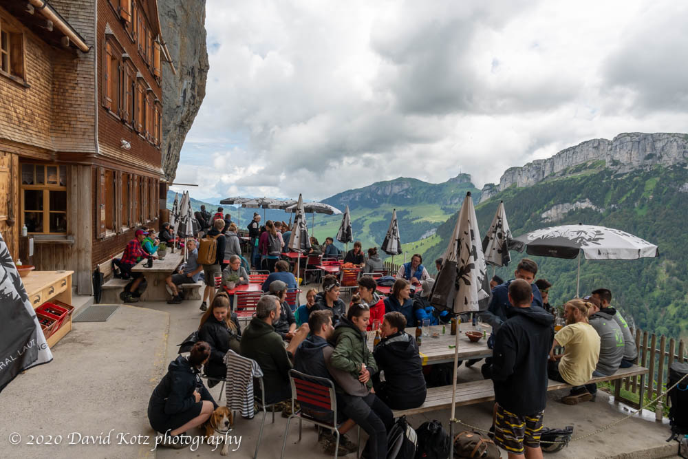
This inn and restaurant is built into the side of the cliff, and was made famous some years ago when it appeared on the cover of a book by National Geographic, Destinations of a Lifetime. My photo, below, doesn’t do it justice; their website is better, and the book even better. This “guesthouse in its present form has existed since 1884 and is one of the oldest mountain guesthouses in Switzerland.”
After lunch, Pam headed back up to Ebenalp, while Andy and I continued onward, up the valley, following a trail at the base of the cliff. (See the map below.) We enjoyed strolling through alpine flowers, filling our bottles with water from cliffside springs, and taking in the vast landscape of the Seealpsee valley ahead and to our left. Soon we were passing through cow pasture – the ring of cowbells being a fixture of the Swiss alpine landscape (video). Soon after, as we approached the hilltop called Schäfler, it began to sprinkle; we hurried toward the summit and ducked inside the cozy hut. We ordered two cups of hot tea; what a wonderful way to wait out a summer shower!
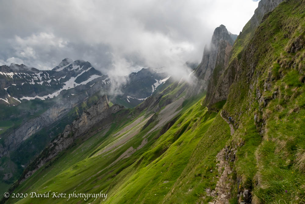
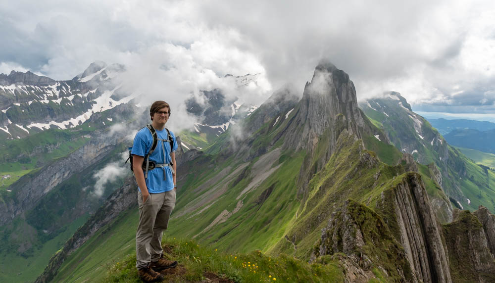
After this rest we continued onward, and were surprised to encounter a knife-edge trail that follows the jagged ridgeline, cables bolted to the rocks as a sort of handrail. The rocky trail, just wet by rain, meant that any little slip exposed us to a deadly fall of several hundred meters to the rocks below, so we clung carefully to these cables!
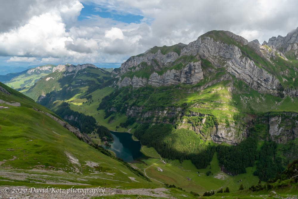
Soon the trail dropped off the knife edge and sloped down into the verdant hillside, switching back through cowpasture, and then steeply through a patch of cliffside forest to the bottom of the valley. Here we met a gravel road, which we followed around Seealpsee (lake) and down the steep ravine that drains down to Wasserauen. We were glad to be here, back at the hotel, for showers and a hearty dinner.
This was my first overnight trip in nearly five months; it was nice to be traveling again! We spent the night in the Alpenrose hotel; an informal and friendly place close to the train station and the trailheads, with clean and refurbished rooms and reasonable rates. We ate lunch in the Berggasthaus Äscher, had tea in Berggasthaus Schäfler, and had dinner at the hotel.
Be sure to check out the gallery!
Hike stats and map (below): From Wasseraun we took the gondola to Ebenalp; followed #7 down to Äscher for lunch; followed #7 up along the base of the cliff to Chlus, then #3 to Schäfler; then #9 along the knife edge and down to Altenalp and SeealpSee; then down the road #8-9-10 back to Wasserauen. Hiking distance: 11km (6.8mi); gain 441m (1,446′), descent 1080m (3,543′); moving time 3h42, stopped time 1h38.
Stay tuned for the report of my climb the next day, in which we ascend to Rotsteinpass – and then had to choose between Mount Altmann or Säntis.


The photos are amazing. Your post has inspired me much to travel when the pandemic ended. Thanks a lot and appreciate.