
Roundtrip distance: 18 miles. Elevation gain: 2900 feet. View: none. Why does anyone hike to the summit of Owl’s Head, deep inside the Pemigewasset Wilderness of the White Mountain National Forest? Perhaps, as Sir Edmund Hillary once said, “Because it is there.” More likely, however, because it has resisted millenia of weathering to keep a little piece of itself above 4000′. Shave off 26′ and nobody would visit this peak. As it is, everyone hoping to “bag” the list of 4000-footers must climb this knob that is encircled by far grander peaks in the Franconia, Twin, and Bond ranges.

Seventeen years ago I set out to climb Owl’s Head in the summer. Daunted by an 18-mile hike, I made it an overnight, which turned out to be a wonderful adventure (with a mysterious ending, but that’s another story). As I walked the long 8-mile approach trail, which is largely flat by White Mountain standards, I imagined that it would be far better to do this mountain in the winter when one could ski.
So when my friend Lelia suggested that we attempt Owl’s Head this winter, I recalled those thoughts, considered the recent deep cold that would have frozen up nicely all those the brook-crossings, and the deep snow we’ve had in recent weeks (check out my photos from a ski tour on Moosilauke last week, where we found 4 to 6 feet of base). Sure, let’s do Owl’s Head.
The pouring rain on Friday would, I knew, put a crust over all that beautiful snow. Breaking trail for 9 miles, the last mile up a steep uphill pitch, was not going to be pretty. On the day of our trip, warm temps (in the mid-30s all day) helped a little. But the real treat was to discover, as we prepared our gear in the parking lot, that a group of 10 had snowshoed to and from Owl’s Head this weekend. We eventually met others; I count at least 16 people who snowshoed out from Owl’s Head on Sunday, packing the trail.
The first stretch, the Lincoln Woods Highway (formerly known as the Wilderness Trail) had been heavily used and was hard-packed and icy. We took the side trail to Black Pond, as had all the others, because in winter it is possible to bushwhack to Lincoln Brook trail and cut off about a mile of travel and two possibly-treacherous stream crossings.
The trail from here on out had been packed so hard by our predecessors that one could even walk it on foot, and was so well-defined that one could perhaps follow it in the dark (more on that later). I managed to ski this trail all the way to the base of Owl’s Head, though Lelia opted to carry her skis because the conditions were still a bit icy and the trail too narrow for herringbone.
The final slog, a mile of bushwhacking straight up from Lincoln Brook to Owl’s Head, burned up a lot of energy. Despite having been broken out, it was a long climb. We reached the summit at 4:20pm, with the sun crawling down toward Franconia Ridge.
Now, you’d think our 50 years of experience (and 30 years of hiking together) would have given us the wisdom to set a turnaround time, one much earlier than 4:30pm, given the 8 mile return trip from the summit. But the summit had beckoned. And the sun sank out of sight as we boot-skied back down to the brook trail.
In the growing twilight I managed to ski down about a mile, but it got increasingly hairy as the icy conditions made for high speeds and the flat light made it hard to see bumps and turns ahead. The ‘canyon’ that was the trailbed had crusty sides 6-12″ high so it was tough to jump out of the track when needed to save life and limb.
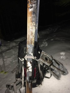
So we carried our skis, under starry skies, for about 3-4 miles, back over the Black Pond bushwhack. Faint shadows marked the edge of the trailbed, so it was easier to feel the trail with our feet, and pushing through overhead tree branches (consider the height of skis mounted on a backpack). The trailbed was hard enough to walk on, but when you stepped off you sank up to your thighs.
At Black Pond we donned headlamps, walked quickly down to the Lincoln Woods ‘highway’, and thence were able to ski out the final few miles. Finish time: 11 hours after our start time. A long day! but worth it.
Check out the photo gallery.

Why is it called Owl’s Head Mountain?
Not sure! The map labels a pointy nubbin on the mountain’s shoulder to the south, “Owl’s Head”, and the summit itself is labeled “Owl’s Head Mountain”. There were many logging operations in the valley a century ago, and I speculate that some of them thought the pointy nubbin looked like an Owl’s Head.
Wow that’s amazing!