Ok, that’s the end of a series of posts about my week in Iceland, including visits to Diamond Beach and its two nearby glaciers, and eleven waterfalls:
Continue reading “Iceland wrap-up”Iceland wrap-up
With a link to a complete gallery.

With a link to a complete gallery.
Ok, that’s the end of a series of posts about my week in Iceland, including visits to Diamond Beach and its two nearby glaciers, and eleven waterfalls:
Continue reading “Iceland wrap-up”Massive glaciers spill ice into a tidal lagoon – ice that washes ashore on a black-sand beach. Spectacular!
Part of a series of posts about my travel in Iceland, including visits to eleven waterfalls.
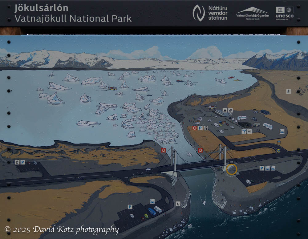
Although the trigger for this visit to Iceland was to board the National Geographic Endurance for an expedition cruise to southern Greenland, photography was the focus of my extended stay in Iceland. This post highlights photos from my first stop in Iceland: Jökulsárlón (aka Glacier Lagoon) and its adjacent Diamond Beach. While I’m at it, Fjallsárlón lagoon is just down the road and offers equally enthralling scene of an adjacent glacier calving bergs and berglets into a tidal lagoon. Read on to see photos!
We took several hikes in the Greenland wilderness.
[part of a series of posts beginning here]
One might imagine becoming stir crazy during ten days aboard ship. Fortunately, the expedition team offered many opportunities to go ashore! Nearly every day they would offer short, medium, and long walks. Some were billed as a ‘photo walk,’ accompanied by the ship’s photo experts; others were focused on interpretation of the ecology or history; still others were pointedly called a ‘strenuous hike’ for which exercise was the goal and there would be no time to stop for photos or natural-history lessons. We were fortunate with good weather – sometimes fantastic weather – so I had the opportunity to hike at Dronning Marie Dal (in Skjoldungensund), at the outlet of the Sermeq glacier (at the head of Tasermiut fjord), around the Hvalsey historic site, around the village of Qassiarsuk, and in the tundra above Neria fjord. The scenery was dramatic, and varied tremendously from place to place. Read on for more!

Up close and personal with glaciers and their offspring.
[part of a series of posts beginning here]
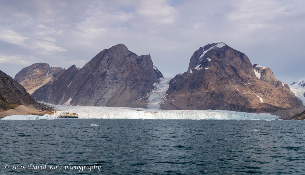
It’s hard to imagine the size of Greenland, or its ice cap. Even those glaciers that flow down to the sea, like the Thryms glacier below, are truly massive. (Notice our ship, the National Geographic Endurance, at lower left!) Read on for more about our outings among the ice, including video…
We spent most of our time in Greenland in the extensive fjord systems that shape its southern tip.
[part of a series of posts beginning here]
Although our route sometimes had the Endurance sailing offshore overnight south along the eastern coast, and sailing north along the western coast, most of our time in Greenland was spent in the extensive fjord systems that shape the southern tip of Greenland. In this landscape, a visitor can understand why the early Norse settlers named this land Grœnland (green land) when the Norse, led by Erik the Red, settled here in 982. Although these fjords have steep walls and deep waters, their shores and (rare) shallow glacial plains are covered in a green, grassy tundra sprinkled with heather, dwarf willow, dwarf birch, crowberries, blueberries, and a variety of wildflowers. Although “Iceland’s landscape is the world’s youngest and most dynamic, the rocks of Greenland are the oldest yet discovered on the planet.” [NatGeo] Read on for more…

First in a series of posts about natural history experienced during our Greenland cruise.
[part of a series of posts beginning here]
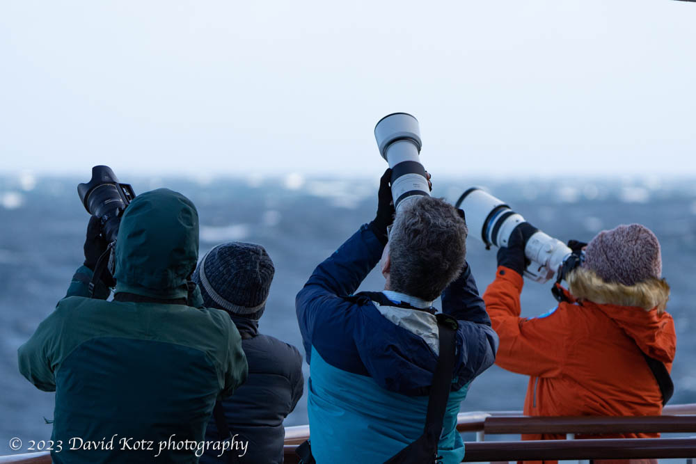
One of the wonderful aspects of a National Geographic expedition is the opportunity to travel to remote places – places only accessible by ship, completely uninhabited – and to explore the tundra, fjords, and deep seas for some of the incredible wildlife that calls this wilderness its home. As part of our ten-day cruise from Iceland to the southern fjords of Greenland, we had ample opportunity to watch whales feeding, trek across treeless tundra, lock eyes with caribou, beachcomb remote shores, boat among the berglets that emerge from tidal glaciers, and even glimpse the aurora borealis. In the next several posts I’ll share a sample of each. Meanwhile, a special tidbit from the last night of the trip!

A ten-day cruise from Iceland to the southern coast of Greenland.
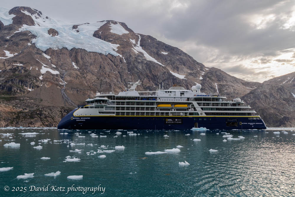
Recent trips to the Antarctic [South Georgia, 2023] and the Arctic [Finland, 2024] whet my appetite for exploring further in the polar regions, so I jumped at the chance to cruise southern Greenland in late summer. Indeed, because this cruise began and ended in Iceland, it gave me a chance to expand on my prior visit to Iceland [2024] to explore its southeast coast. Finally, this cruise was aboard the National Geographic Endurance, the same ship we’d sailed on our cruise of South Georgia and the Falklands in 2023, and which I found to be a terrific experience. Read on!
A morning visit to the highest train station in Europe – and a stroll across the snowfields at 12,000′.
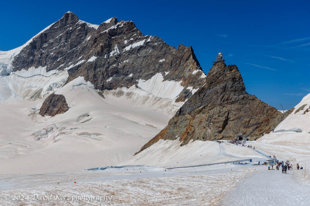
On our fourth day in Grindelwald we took two hikes. We spent the morning visiting Jungfraujoch, which (despite its intensely touristy nature) is an incredible place to visit. It is the highest train station in Europe, serving a structure that perches on a pinnacle at 3571m (11,716′) above sea level, adjacent to the snowfields surrounding the 4000m Alpine mountains of Eiger, Mönch, and Jungfrau. In this post I share a few impressions – and a gallery of photos of our walk across the snowfield to the hut at Mönchsjochütte, on an astonishingly gorgeous day.
Stunning views from our walk toward some glaciers above Grindelwald.
For the second hike of our week-long visit to Grindelwald, we chose the opposite side of the valley, a deep canyon formed by the Ischmeer Glacier, whose remnants cling to the high slopes of 4000-meter peaks like Schreckhorn, Finsteraarhorn, and Feischerhorn. Our primary goal was the Berghaus Bäregg – literally, mountain house at bear corner – which we rightly anticipated would provide a sunny lunch spot with spectacular views of the glacier. Our stretch goal was to continue onward to Schreckhornhütte, another hut far upslope at elevation 2,527m. Although we turned around when we reached 6,000’ (1829m) we enjoyed the sunny meadows strewn with wildflowers; views of glaciers and snowfields spawning massive waterfalls and cascades; and challenging sections of trail where it clung to the cliffside or crossed massive washouts. And, a hearty lunch at the Berghaus! Read on, and check out the gallery.

Wrapping it all up – with the best photos!
Well, that about wraps it up folks. I’ve just finished blogging about our February-March trip to South Georgia Island and the Falkland Islands. (It’s now mid-June, and I’ve been backdating the posts to keep them in chronological sequence with the trip.) If you’ve landed on this post and want to read the whole story in order, start here.
During the trip I snapped over 10,000 photos and videos. I kept about 2,900, and posted about 400 in the galleries associated with this blog. Four percent – not bad. But I have one final gallery for you: my 40 favorite photographs. Enjoy!
