Mount Si

The 'haystack' summit of Mount Si.
The ‘haystack’ summit of Mount Si.

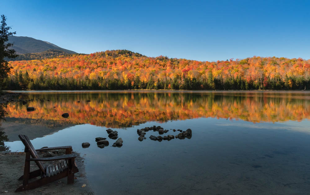
I was in Seattle for a visit to the University of Washington, and decided to extend the trip for a day so I could take advantage of the wonderful hiking opportunities nearby.   Overwhelmed by the number and variety of hikes in range of Seattle, I settled on a classic choice: Mount Si.  According to the statistics on that site, I was probably the 99,999th person to hike the trail this year.  Still, on a drizzly Friday in the off season, I figured it couldn’t be too crowded.

I left Seattle before sunrise, drove through a light drizzle (which, I gather, is the norm for Seattle) and reached the trailhead around 8am.   With 3,100′ of gain in four miles, this is no little walk in the woods – but it’s actually comparable to my benchmark, the Glencliff trail on Mount Moosilauke.  In fact, Mount Si barely tops 4,000′, shorter than Moosilauke.

An eery rainforest of moss and epiphytes covers the lower elevations.

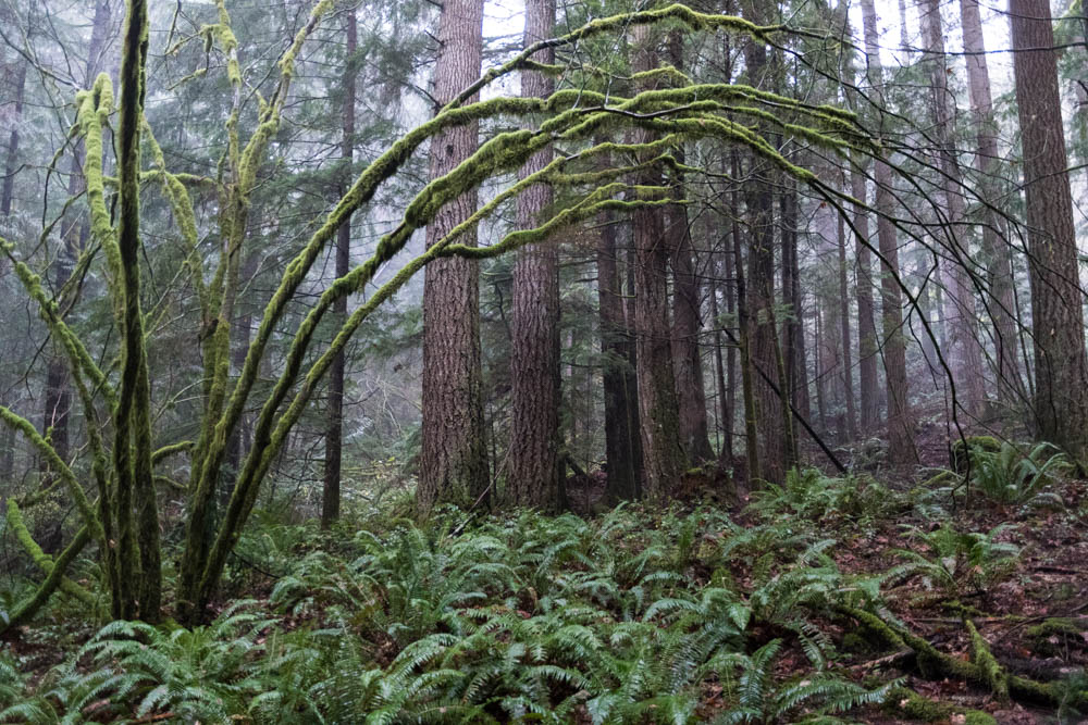
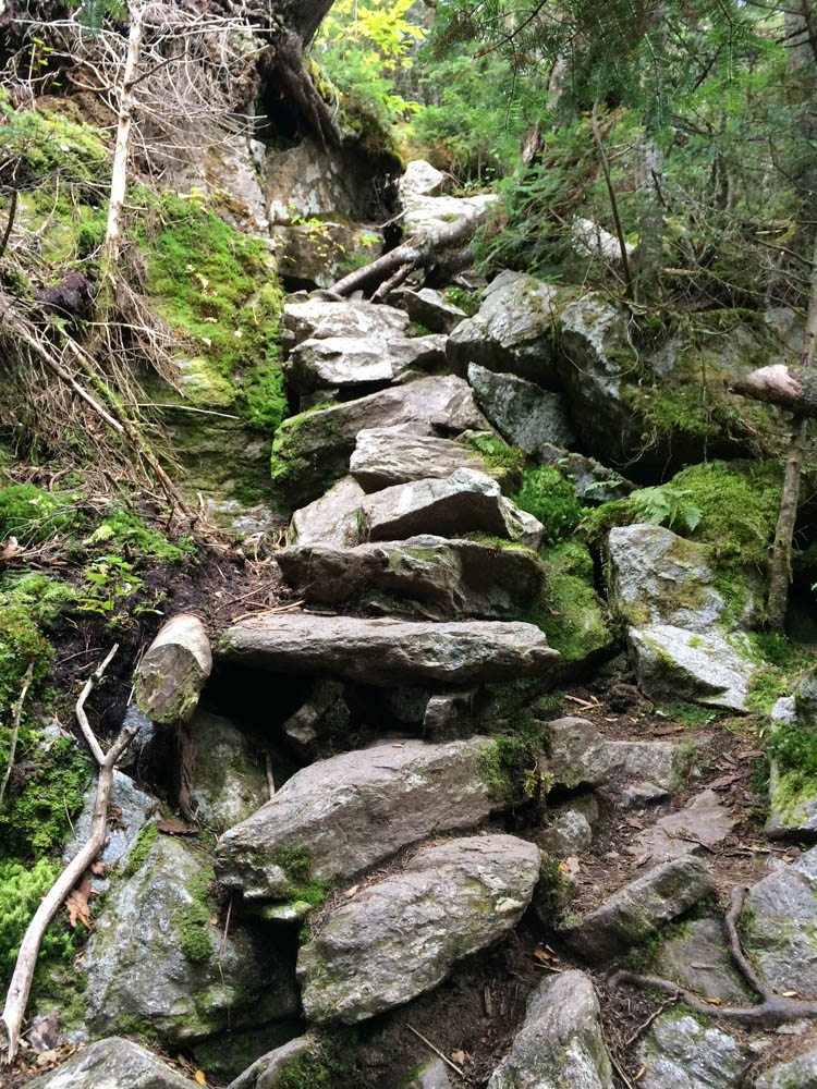
In the mist and drizzle, the low-elevation forest was was verdant.  Moss and epiphytes covered every branch, and trapped the mist so it could drip on me as I made my way up the trail. The trail is well-built and well-maintained, generally steady going.  Numerous switchbacks meant the trail was never very steep.

The air cooled as I climbed and I finally started seeing patches of fresh (though wet) snow at around 3,800′.  I popped out into a clearing, where a large black Raven awaited me.  Clearly he had been there earlier, when today’s three early hikers paused to snack and turn around, and he was hopeful that I brought more goodies.

Gray Jays are an ever-present companion at snack stops at higher elevation.

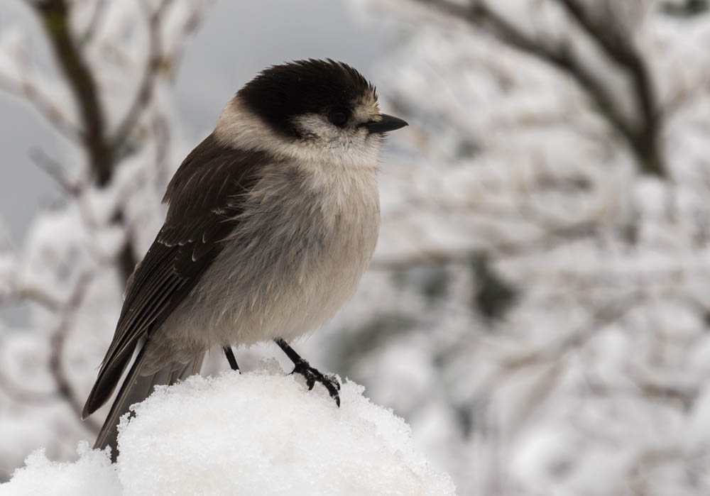
Four or five Gray Jays quickly detected my presence and snuggled together on snow-covered branches, ready at a moment’s notice for a dropped raisin or bagel crumb.

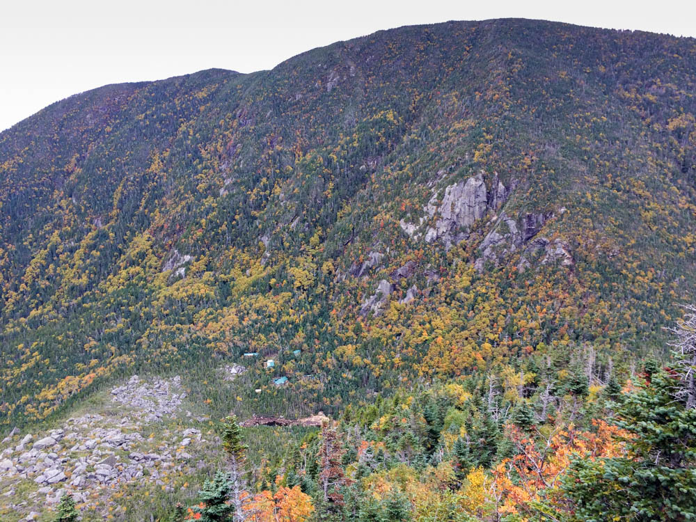
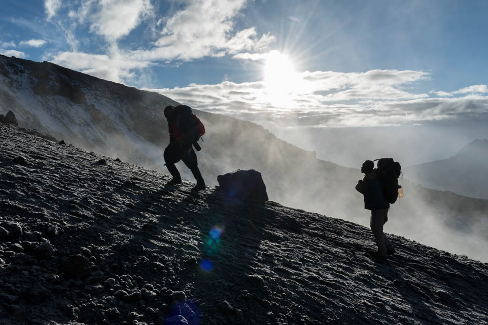
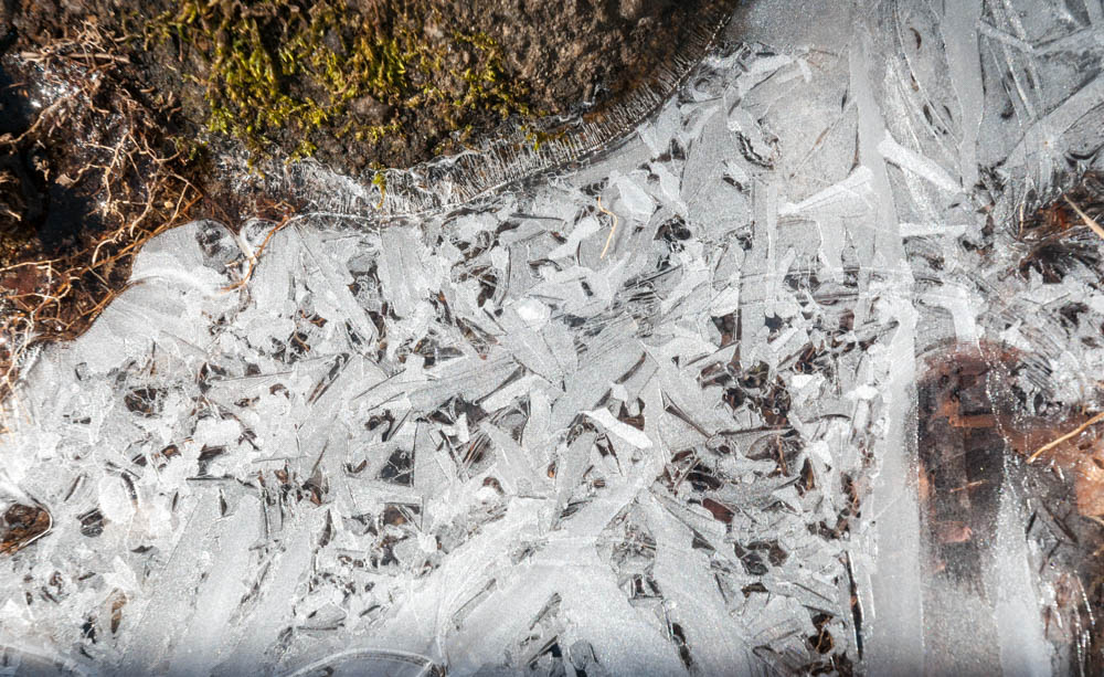
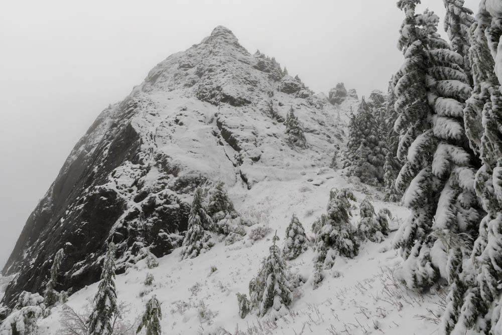
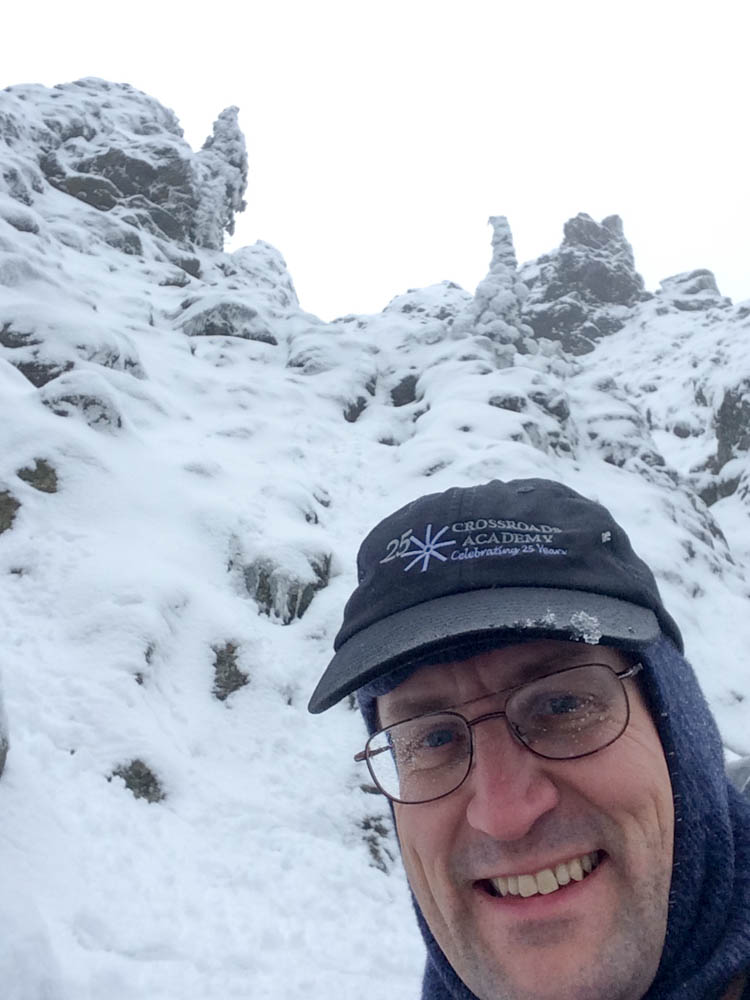
Here there was consistent snow cover, just an inch or two, and rather slushy.  In the clouds now, the viewpoint offered me nothing – but at least the precipitation stopped.  I pressed on, up and over a rocky outcrop, toward the true summit – a sheer cap called the “haystack” (shown above).  Remarkably, though I climbed only another hundred feet, the snow became deeper and more firm, as much as 6-18″ deep in the sheltered spots. The snow line from recent weather must have been close to this elevation.

I turn back from the near-vertical gully filled with snow and ice, and lots of exposure.

I followed old tracks, covered in this morning’s snow, around the base of the Haystack.  The footsteps disappeared at the base of a steep gully, where tiny avalanches caused golf-balls of snow to roll down toward me.  Gosh, this gully is steep, and extremely exposed. I picked a line and tentatively began to climb, but thought better of it after a dozen yards.  I retreated and picked another line.  Going upward was easy, kicking steps in the wet snowpack.  About halfway up, though, I reconsidered the exposure.  A slip here would mean a long slide down the gully, ricocheting off the boulders.  Hiking solo, and with few other hikers visiting the Haystack today, I decided it’d be best left for another day.


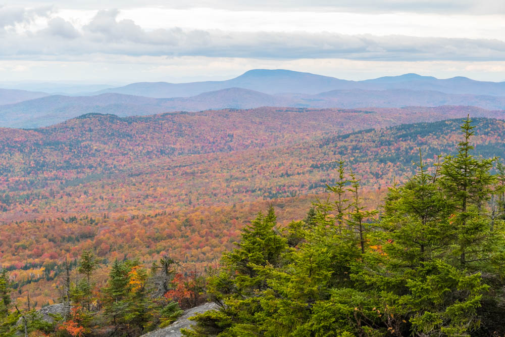
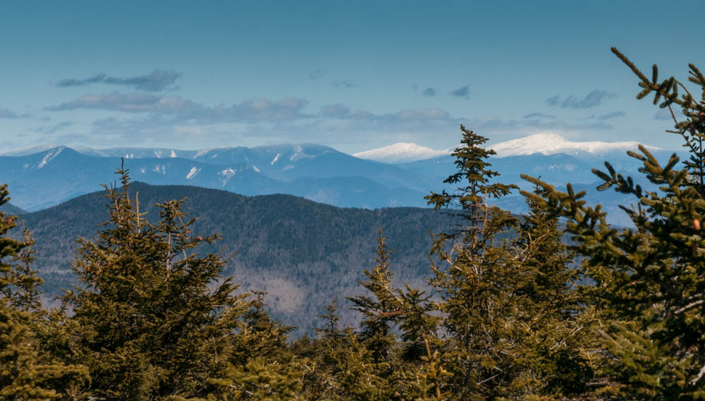
The trip down was a cruise, back and forth on the switchbacks.  I quickly left winter behind, and emerged again into a verdant rain forest, pausing often to attempt to capture this magical place in photographs. I can see why this mountain is so popular, and really need to return when the sky is clear.

Check out the full photo album.

Adirondacks

I’ve been hiking in the Adirondacks for well over forty years – or so I like to think. Actually, I can count on one hand the number of Adirondack peaks I have summited in the past quarter century – all but one of which are small viewpoints outside the classic canon of the ADK 46, the elite group of peaks over four-thousand feet in elevation. (A historical curiosity, three of the peaks on the list of 46 have since been re-surveyed and found to be shy of 4000′ elevation, but remain on the list for ol’ times sake.)  I spent the summers of the 1970s hiking these peaks with my family, and the winters of the 1980s exploring the snowy backcountry with my high-school and college buddies. My last backpacking trip here was in 1990. Recently, I found myself drawn back to these ancient peaks – for they are far older than the Appalachians, and reside deeper in my own past – with an eye toward notching off the final dozen peaks on my own list of 46. I set aside three days on my calendar and struck out at dawn on Friday, with three specific summits in mind, and was rewarded with breathtaking scenery, fond memories of trips long past, a rekindled appreciation for this beautiful wilderness, and lovely photos. More after the break.

Heart Lake near Adirondac Loj.

Continue reading “Adirondacks”

Fall colors, fall hikes

This month is shaping up to be a beautiful example of Fall in New England. This weekend I managed to spend time out in the woods on both Saturday and Sunday.

Fall colors around a meadow in Lyme.

On Saturday I bushwhacked around the property boundary of  a conservation easement in Lyme Center, on behalf of the Upper Valley Land Trust.  This beautiful patch of forest and meadows, a mix of hardwoods with some pine and fir stands, weaves up and down over the rolling terrain between the Connecticut River valley and the steep hills of east Lyme and the Skiway.  The colors of Fall were just beginning to peak in a few species, and the woods were peaceful with the sleepy conditions common to late summer and early fall.  The deep farming history of this region was clear as I scrambled over old stone walls, past barbed wire long absorbed into the border trees, and old blinds used by generations of Lyme hunters. The bluebirds flitted between sugar maples and apple trees on the edges of the meadows overlooking the Grant Brook valley. Not a bad way to spend a Saturday morning.

Fall colors from summit of Cardigan.

On Sunday I led a small group up the western slopes of Mount Cardigan, a bit further south in Canaan.  The colors here were further along, as we climbed toward the bare summit of this popular peak.  Although the sky was cloudy and the wind brisk, the group’s spirits were high as we enjoyed the 360-degree view of multicolored hills rolling off into Vermont, New Hampshire, and beyond.

More photos on SmugMug – watch this gallery for more as the Fall progresses!

Wildcat-Carter range

An example of the rugged trail along Wildcat ridge, and the impressive rockwork needed to support hikers.  It's even steeper than this photo makes it look!
An example of the rugged trail along Wildcat ridge, and the impressive rockwork needed to support hikers. It’s even steeper than this photo makes it look!

I had the honor of accompanying my dear friend Lelia on a two-day backpacking trip across the Wildcat and Carter range, in the eastern part of the White Mountain National Forest, to complete her list of 48 four-thousand-foot peaks. We managed a late start on Friday afternoon, heading steeply out of Pinkham Notch from Glen Ellis Falls to scramble up the Wildcat Ridge. This route fortunately provides some nice views of the Notch, and eventually of the Presidential Range, though it spends most of its length deep in the scrubby trees of a New Hampshire ridgeline.  The ridge is rough, with many ups and downs and scrambles around boulders. We enjoyed the late-afternoon sunshine, and reached the rocky outcrop known as Wildcat D as the light began to fade.  I paused here for a moment to reflect on my own journey to the 48 peaks, which I had completed here – on this very spot – 20 years earlier.

A morning view into Carter Notch, with the hut and ponds visible at bottom, and Wildcat ridge behind, from an outlook on the climb up to Carter Dome.

We could just barely see our destination down into Carter Notch, in the dim light, and began to scramble down the steep and jumbled blocks of the trail into the notch. I finally gave in to the need for headlamps, and we pushed past the creaky door of Carter Notch hut, well after dark, to the warm and relieved smiles of Lelia’s husband and son.

Celebrating Lelia's 48th NH 4000-footer on Middle Carter mountain with the Presidential Range beind; with David, Lelia, Will, Lars, and Bill.
Celebrating Lelia’s 48th NH 4000-footer on Middle Carter mountain with the Presidential Range behind; with David, Lelia, Will, Lars, and Bill.


The next morning broke a bit cloudy.  Concerned about spending a day hiking through drizzle, we clambered up the steep slope of Carter Dome.  Right on schedule, we met another friend – a veteran 4000-footer himself – and continued along the ridge.  On Middle Carter we cheered Lelia’s 48th peak with cheese and crackers and celebratory beverages. Her thirty years of determination and perseverance paid off!  The weather had held out nicely, and we had fine views of the Presidentials to the west and the Maine peaks to the east.  We scampered down the Imp trail into the Notch, enjoying the bright colors of fall, and capped off a fine weekend with a hearty dinner at Pinkham Notch camp.

Cannon Mountain

Cannon Mountain cliffs, viewed from Franconia Notch.

Today was a beautiful fall day for a hike in Franconia Notch.  I scrambled up the Hi-Cannon Trail from Lafayette Place, arriving on the summit of Cannon Mountain by mid-morning.  A stiff breeze and a broad view of the Franconia Range greeted me.  Skipping past the tourists who took the gondola to the summit, I dropped quickly down the Kinsman Ridge Trail and the Lonesome Lake Trail to Lonesome Lake.   I was back at the car by noon.  A selection of photos here.

Connecticut River canoe trip

Four years ago the kids and I visited the Canadian Border at the northern tip of New Hampshire, where the Connecticut River is born.  We hopped through the four Connecticut Lakes and paddled for two days downriver.  Each year, since then, we’ve returned to our stopping point and continued to paddle homeward, eventually reaching home last August.  After that climactic moment, what can be done next?  We decided to keep going.

Continue reading “Connecticut River canoe trip”

Kilimanjaro

Climbers are backlit by the sunrise.

With the rising of the equatorial sun, the undercast clouds climbed the slopes of Kilimanjaro and slowly enveloped us in an eery mist. We had begun our summit push about an hour before dawn, a line of bobbing headlamps weaving through the sleeping camp at Barafu, 15,200′ above sea level.  Now, as we ascended past 17,000′, pole pole (slowly, slowly), I was beginning to really feel the altitude. Despite six days of acclimatization and hiking along the Lemosho Route, all five of us were quietly focused on each slow step along the steep and winding switchbacks up toward the rim of Kilimanjaro’s volcanic crater; step, breathe, step, breathe.  A few trekkers were already descending – those who rose at midnight to make their entire summit push during the moonlit night, jubilant from reaching the summit – and those who looked quite pale and were gingerly being led down by a guide holding each elbow.  The altitude affects everyone differently, and the sick have to descend quickly.  We pushed on, hoping for clear skies at the summit and for weather good enough to stay overnight in the crater as planned.

But I get ahead of myself. This 11-day trip, including 9 days on the mountain, is a long story. As you read the trip description below, be sure to check out the photo galleries of the trek, of our two days pre-trek, of the flora and fauna, and of night skies on the mountain.

Continue reading “Kilimanjaro”

Franconia Ridge traverse

Franconia mapOn a warm day in early June, I joined Aarathi and Shrirang for a traverse of Franconia Ridge from Lincoln Woods to Lafayette Place, summiting Flume, Liberty, Little Haystack, Lincoln, and Lafayette. Total 14.5 miles, 5325′ of vertical gain, 10.5 hours, 258 photos. A beautiful day!  The alpine flowers were blooming, the sun was shining, and the wind was cool. The only downside is that several hundred other hikers also realized it was a great day to hike Franconia Ridge!

Check out the photo gallery on SmugMug.

Pebble Time, Fitbit Flex, and Apple Watch.

I also decided to test four activity trackers on this hike: iPhone 5s (i.e., Apple Health app), Fitbit Flex, Pebble Time, and Apple Watch 42mm.

Test conditions:

  • I left all four devices in their charger overnight.
  • As I left the house, I put all three trackers on my left arm.
  • I did almost no walking until reaching the trailhead.
  • At the trailhead, I put the iPhone in Airplane mode, enabled Bluetooth, and stored it in a shoulder-pad holster (thus attached to torso).
  • All three trackers had Bluetooth enabled.
  • At the end of the hike, I checked status of each device.

Results:

  • Fitbit Flex: 30,572 steps, 14.04 miles, 3394 cals, 5h5m active; battery 100%.
  • Pebble Time: 22,073 steps, 12.4 miles, 2233 cals, 3h35m active; battery 90%.
  • Apple Watch 42mm: 32,449 steps, 14.30 miles, 1156 active cals, battery 7%.
  • Apple Health (iPhone 5s): 32,354 steps, 14.71 miles, battery < 20%.

Summary:
Apple Health (via Watch? I’m not sure) counted more steps, but close to the Fitbit. Watch and Fitbit had the best distance estimate. Fitbit had best battery life, followed by Pebble.

Mount Carr

Ice skims the surface of trailside puddles after a cold March night.

A lovely day for a hike up Mount Carr, an unassuming 3,400′ bump to the southeast of Mount Moosilauke. I had never visited this peak, so when a friend suggested we try it out I was ready to hit the trail.  The lower slopes were bare of snow but it is, after all, still “winter” so none of the trees or undergrowth have started to leaf out.  The overnight cold formed a skim of ice across all the puddles and many of the smaller streams, their fascinating patterns glinting in today’s bright sunshine. (See photos!) The upper slopes held a crusty but shallow snowpack, and rippled ice floes.

The Presidentials, with a fresh coat of white snow, dominate the view from Mount Carr.

At the rocky summit we could climb on the footings of the long-since-removed fire tower and see the white-capped Mount Moosilauke, Franconia Range, and Presidential Range.  I hope to return to the neighborhood and explore the other peaks in the Wentworth-Rumney area!