Yesterday was a brilliant sunny day – a nice late-fall day when it should be an early winter day – so it seemed like another great opportunity to get outside. A short drive brought me to the small town of Benton, just west of Moosilauke, and the steep climb to the rocky ridge known as Black Mountain. From its granite ridgeline there is an expansive view across a nearly roadless wilderness to Mount Moosilauke. In the photo below, Moosilauke’s extended north-south ridge is at center, with the Kinsman range at far left and Mount Lafayette’s white-capped peak peeking out behind the Kinsmans.
Views of Mount Moosilauke from Black Mountain summit.
You’ll see it far better in a full-screen version, in the photo gallery… where I include three or four more photos.
Hike stats: distance: 5.6 km gain: 473m time: 2h 0m
Map of my hike ot the summit of Black Mountain and return. Elevations in feet, distances in meters.
A delightful ascent of Moosilauke in unseasonable conditions.
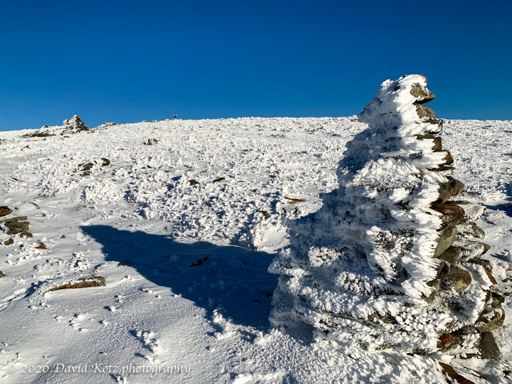
On this day, very nearly the last day of November, the forecast was for a purely sunny day with temperatures well above freezing – weather decidedly un-November-like – so I decided it was high time I went back to Moosilauke. Yesterday it rained much of the day, even at altitude, so I was concerned the Moosilauke summit may have been glazed with ice today. But I was pleasantly surprised, as I climbed the familiar Glencliff trail, to find the muddy conditions of the lower sections giving way to a dusting of snow and, higher up, nearly an inch of fresh snow on the ground and trees decorated with fresh powder and rime ice, backed by a deep blue sky. Read on, and check out the photo gallery.
Today is the first day of winter. Well, I suppose there are many ways to define “the first day of winter”: the first time snow falls, the first time snow falls and sticks, the first time you actually need to plow or shovel snow, or the astronomical date of the Winter Solstice. I’m going with a new definition: the first day the temperature never rises above freezing.
Although the higher NH mountains have already experienced some significant snowfall, and plenty of freezing temperatures, I’ve been staying close to home and enjoying the low-altitude hikes here in the Connecticut River valley – wearing lots of orange clothing, now that deer hunting season is fully underway.
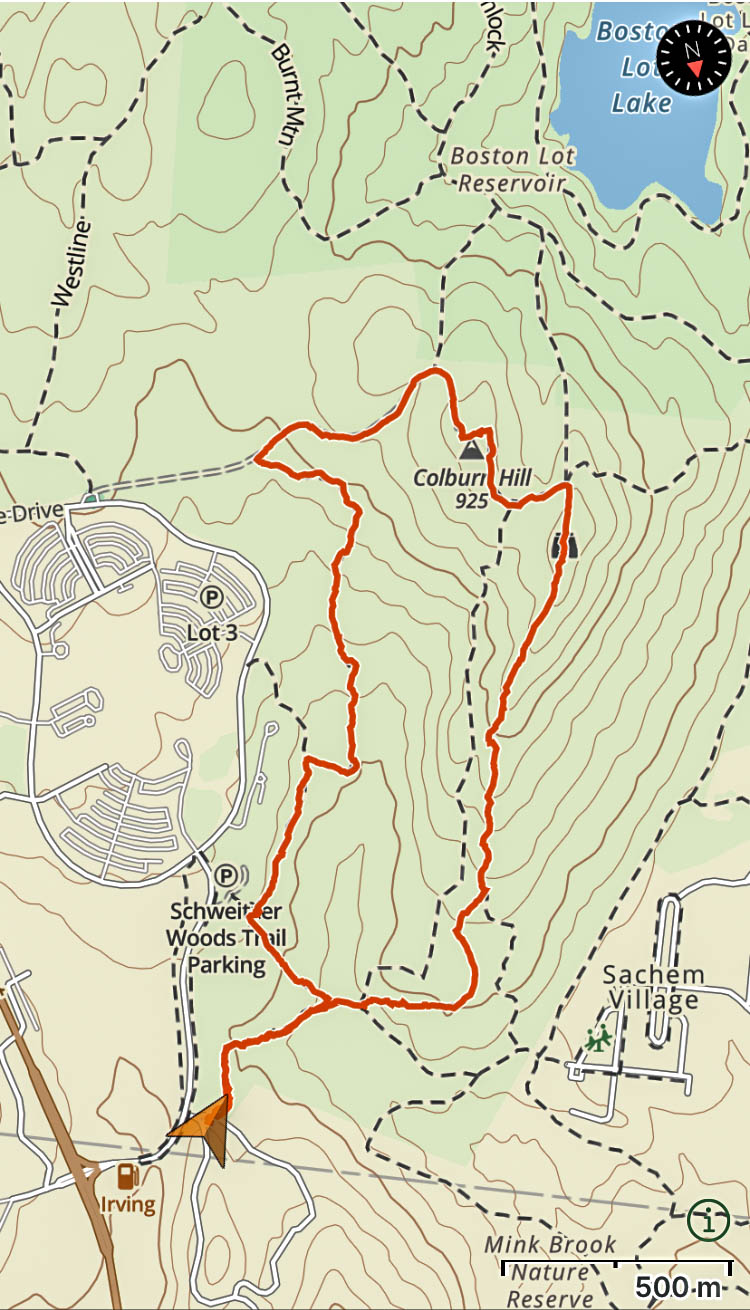
Today I took advantage of a gap in my Zoom schedule to visit a trail network I’d never explored before – between the huge complex of Dartmouth Hitchcock Medical Center and the graduate-student housing over at Sachem Village. This big green spot fills the center of the triangle formed by the towns of Hanover, Lebanon, and West Lebanon. There’s an amazing variety of terrain, and a thorough network of trails used by walkers and mountain bikers.
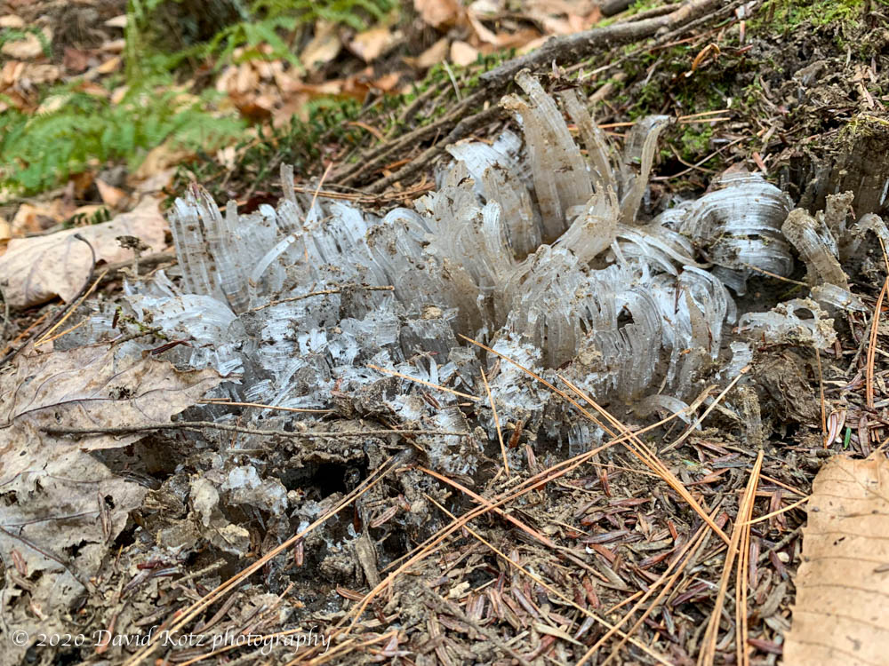
For me it was a pleasant, if chilly, stroll through the quiet post-autumn forest, one that has laid down its blanket of leaves and is awaiting the big snows of winter. I enjoyed the opportunity to snap a few photos of the delightful details like the following. When mud freezes, the water expands and is pushed up through pores in the mud, leaving these fragile towers of crystalline ice. Check out the full-size photo, and three other scenes from the hike, in the photo gallery.
Extruded ice, which happens when mud freezes and the water in the mud expands.
The weather this week has been startlingly warm, almost as if summer has lasted into November. Yesterday’s high temperature here at home was 71ºF! It may have been the last ‘summer’ weather of the year – and also the last day before deer-hunting season fully opens – so I was eager to get out for a hike. I try to hike on weekdays to avoid the weekend crowds.
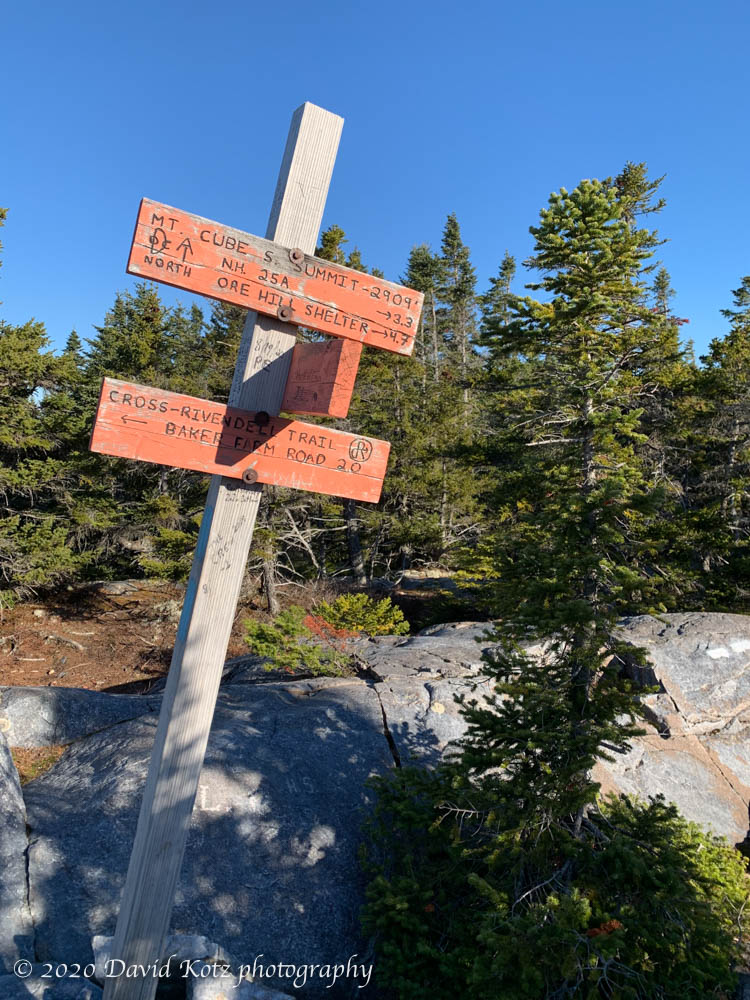
Despite a dense fog clinging to the Connecticut River in the early morning, I hopped into the Tesla for an all-electric drive to one of my favorite trailheads – the Rivendell Trail up Mount Cube, only 30 minutes away. I’ve been up this two-mile route many times, because it gives one all the features of a “real mountain climb” without the temporal overhead of a long drive or a long hike… a stroll through leafy hardwood forests, a scramble up rugged rock-strewn trails, the pungent scent of balsam firs, and distant views from its granite outcrops and 2900′ summit. In the view below, from the summit you can see the foggy Connecticut River valley in the upper right and Smarts Mountain at upper left.
Seen from Mount Cube.
Sadly, the summit has poor views to the northeast, but if you stand on tippy-toes and peer between the firs you can pick out Mount Moosilauke. No photos worth taking, so here’s the summit trail sign, where the Appalachian Trail passes by.
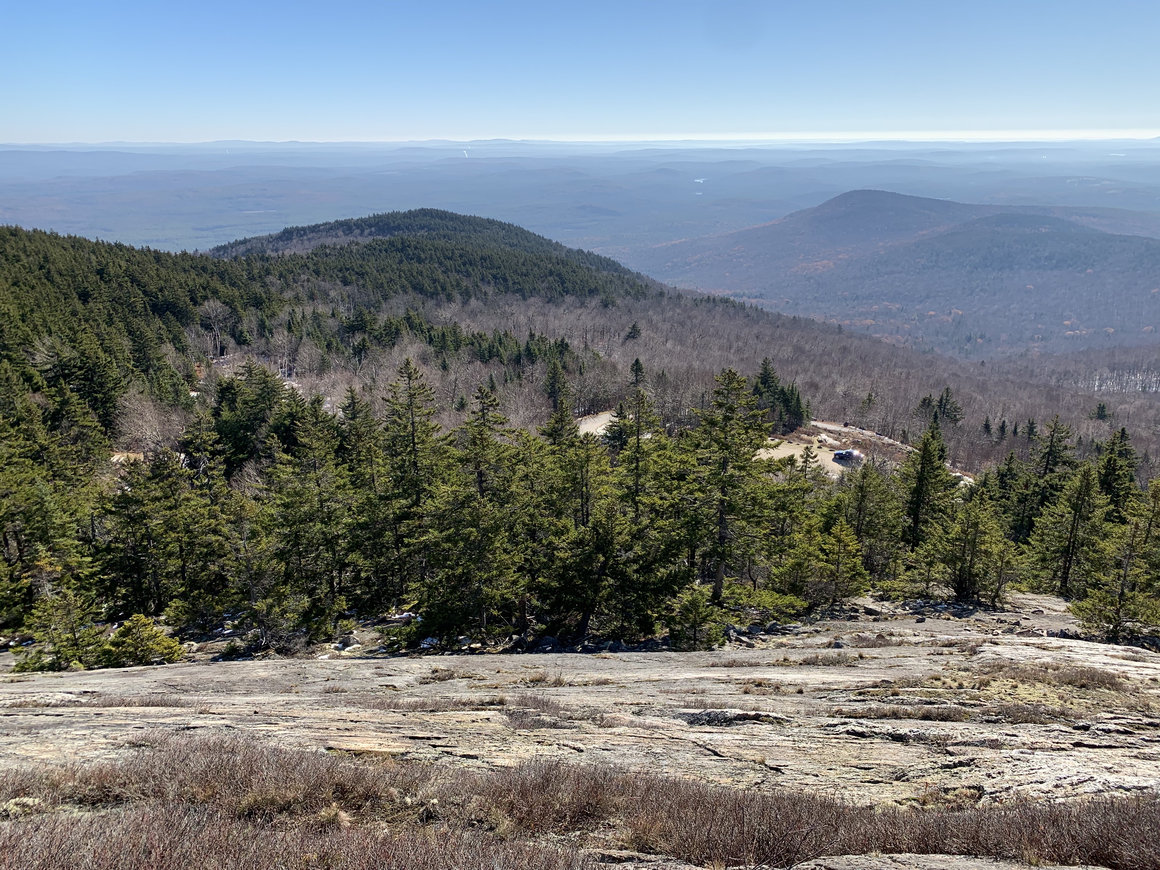
On Thursday morning I took a break from the post-election hubbub and drove down to the far side of Mount Kearsarge. I had only visited this popular peak once before, in November 2014, and recalled that it was a frosty and cloudy experience. Now, on an unseasonably warm sunny November morning, I decided to visit again. Somewhat accidentally (thanks Apple Maps!) I ended up on the far side of the mountain, where an auto-road allows one to park within a half-mile of the summit. I was the only car there, though I did pass a couple walking and an older man running the road.
There was a bit of haze, but otherwise impressive long-distance views to be had as I scrambled up the rocky Lincoln trail to the summit, then down the more gentle (but somewhat icy) Rollins trail back to the parking lot. Great views and I hiked barely more than one mile; it felt like cheating. I’ll have to come back someday and start from the base.
This weekend’s outing was a mild hike across the ridgeline of Farnum Hill, in nearby Lebanon, NH. Its trails stroll along the rolling hilltop on an 820-acre reserve managed by the city as a space for wildlife and recreation. Here at the end of October (Halloween morning!) these hardwood forests were mostly bare, with a colorful carpet of fallen leaves covering the forest floor. I walked out and back along the spine of this ridge, enjoying the sunshine of a late-fall morning and the crisp crunch of barely-frozen leaves along the trail.
A late-October snowfall mingles with the fall foliage along the trail in Lebanon, NH.
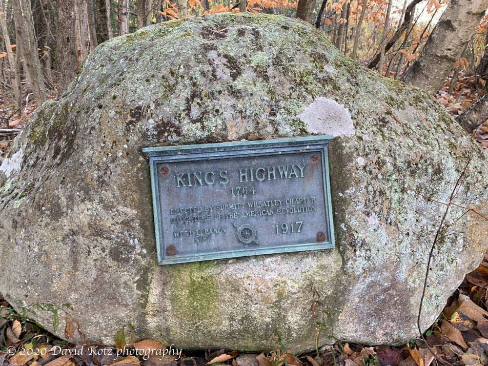
The trail begins at a marker noting the historic King’s Highway, “the first planned colonial road in Lebanon”, and now a class-VI woods-road suitable for walkers and skiers.
The trail begins along the historic King’s Highway in Lebanon, NH.
A light dusting of snow on the fir trees recalled the early snow that drifted through the morning before.
A late-October snowfall dusts the fir trees along the trail in Lebanon, NH.
A small critter walked along top a snowy log, not too long before I did.
A critter had made its way along a snow-covered log.
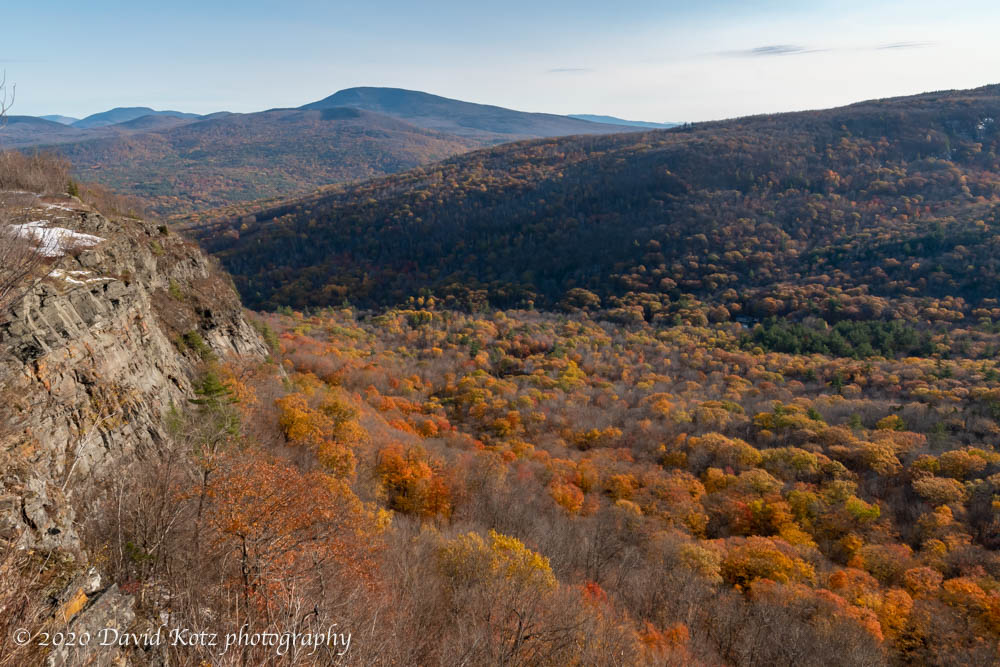
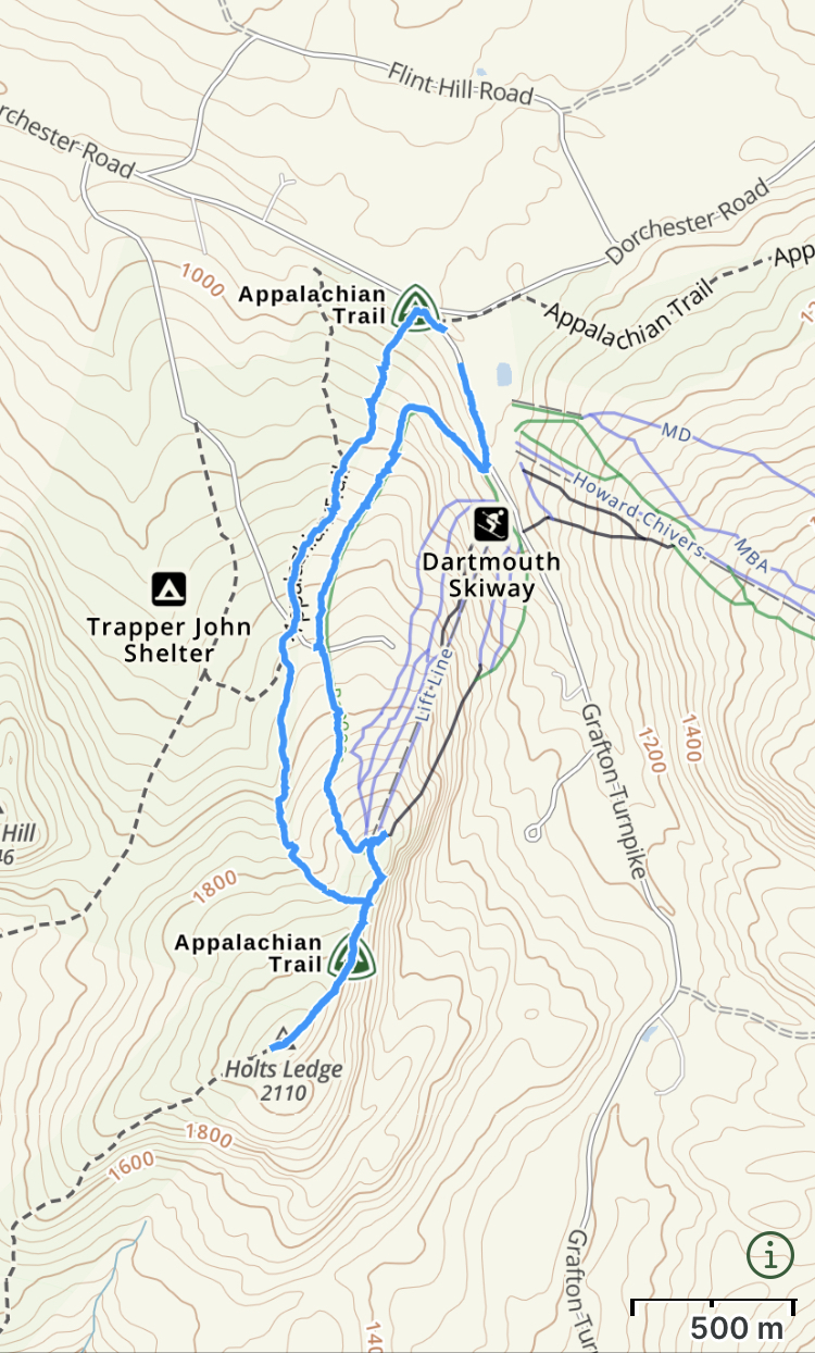
After yesterday’s brief snowfall the weather turned warm and sunny once again, allowing us a beautiful fall afternoon. This morning we woke to dense river-valley fog, so I headed across Lyme to the Dartmouth Skiway and the high point of Holts Ledge. There, well above the fog, I encountered brilliant foliage at the base and an impressive 2″ snowcover on the exposed slopes near the top. Here is one photo from the top, showing Holts Ledge at left and the peaks of Moosilauke, Cube, and Smarts left to right – but don’t miss the gallery for six other full-res photos in brilliant color.
View of Holts Ledge with (L to R) Moosilauke, Cube, and Smarts, with waves of fall foliage below.
Hike stats: distance = 5.9km gain = 353m time = 1h 37m (including photo stops)
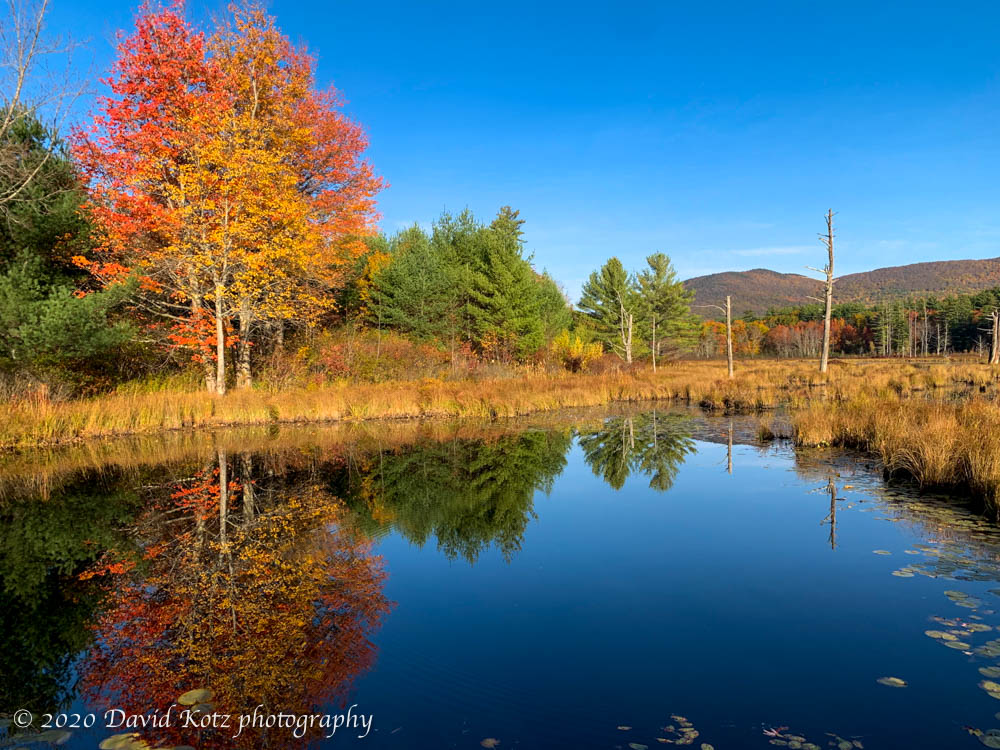
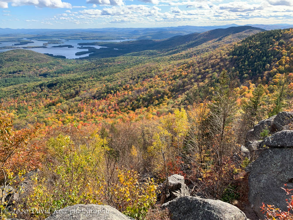
Today was another spectacular fall day in New Hampshire. I enjoyed a lovely early-morning drive across the rolling hills of center-western portion of the state, around Squam Lake, and past the trailhead for my prior Morgan-Percival hike, to the pretty village of Center Sandwich. My destination was Mt. Israel, seen in photo of fall colors above a roadside wetland. Read on and check out the gallery.
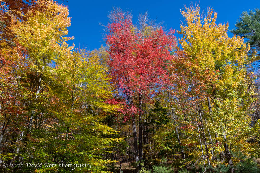
Today I spent a good portion of the morning wandering the woodlands of Lyme. The sun was shining, the skies were blue, the trees were bursting with color, and I was scrambling over moss-covered stone walls in the midst of historic farm country. If there is a better way to spend a Sunday morning, I can’t think of one. Read on and check out the gallery.
A beautiful hike through fall foliage to summits that overlook Squam Lake.
The trail sign gave me two choices to reach the summit – via the caves or via the cliffs. Well, I picked the caves of course! Little did I know that the trail would in one place make me squeeze through a passage so narrow I’d need to remove my pack, and that in another place the trail would actually cross over itself like a corkscrew. Read on and check out the gallery for more photos of Mount Morgan and Mount Percival, during fall-foliage season!