
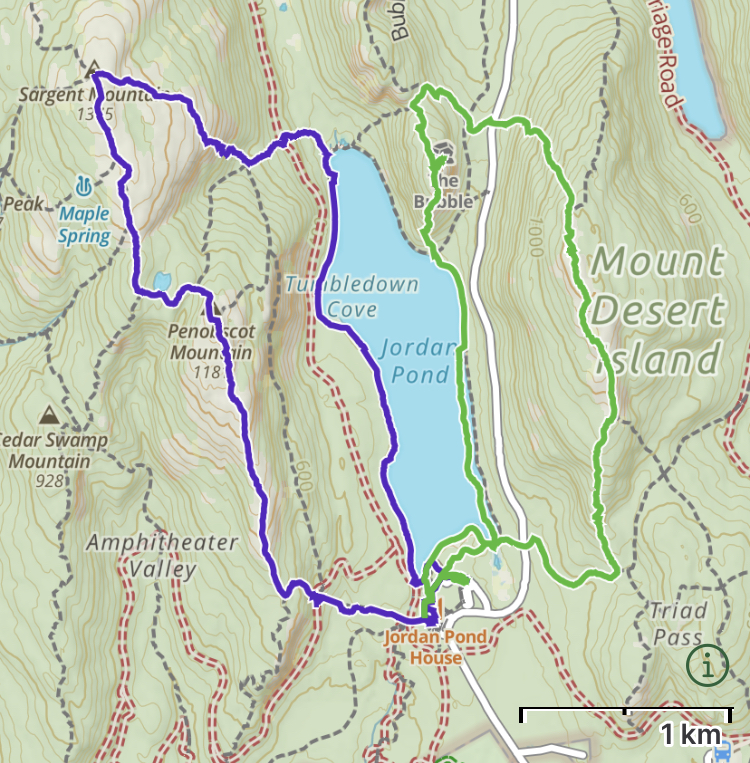
Thursday I had a full day with no real itinerary, so I decided to head to Jordan Pond and climb some of the peaks beside this lovely, deep, clear lake. Arriving at 8am was the trick – although filling fast, the parking lot still had a few spots. I strapped on my trusty pack and headed out for the first of two long loop hikes – with a sweet lunch stop in between. Read on.


I started along the west side of the Jordan Pond Loop Trail. This trail is popular with families because it follows the lake shore all way ’round, is basically flat, and mostly easy going – a gravel sidewalk on the east side, and a kilometer-long boardwalk on the muddy west side. Indeed, the boardwalk cleverly includes periodic ‘pullouts’ where people can pass… I stopped at one to let a stroller roll by. The purpose of these boardwalks is to protect the shallow soils and tree roots.
As soon as I turned left and away from the pond, however, the trail went straight up an ancient boulder field, in what I now know is a classic Acadia trail design. I passed by one of the beautiful stone bridges built during the Rockefeller era (1925), where a carriage road crossed over the trail. Soon I was out in the open, in the hot morning sun, cranking up the steep slopes and past the many false summits of Sargent Mountain.
The summit is bare, with grand 360º views. Only a few other hikers were here, but it was still early. I turned south and down the ridge, into a col, past a tiny pond singing with frogs, and back up to the summit of Penobscot Mountain. From here there are nice views of Jordan Pond and, to the south, the Gulf of Maine.
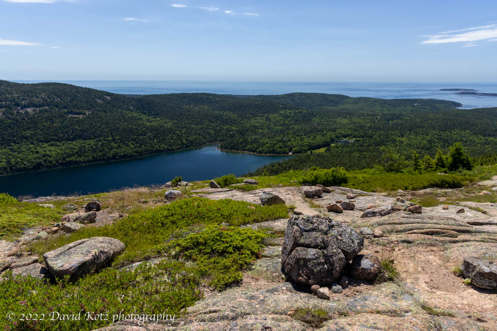
Continuing south down the ridge, then dropping steeply (like, really steeply) down the Spring Trail, to return to Jordan Pond. (I chose the Spring Trail because it was only 0.2 miles whereas the ridge trail, and looping back, would have been 1.2 miles!) Seeing a sign for Jordan Pond House, I thought I’d stroll by to see what its view might bring. Here I discovered, by asking, that it was indeed possible to get a table for lunch, out on their lawn – despite the website earlier indicating a 3-week wait for reservations. It was 11:30am and my tummy urged me not to pass up this opportunity!
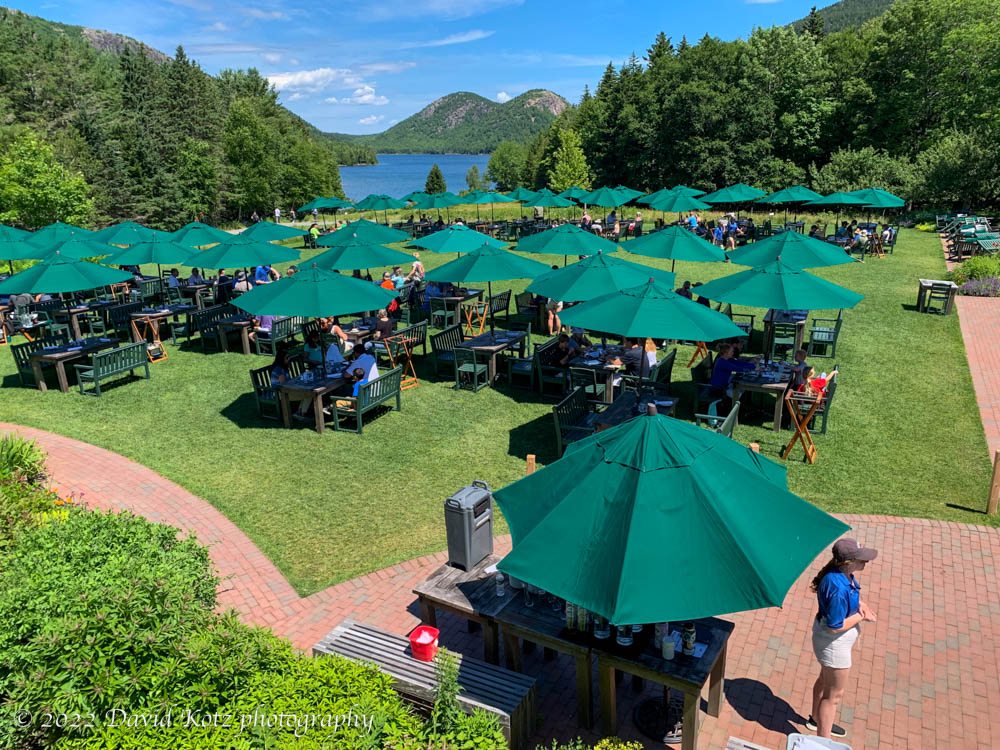
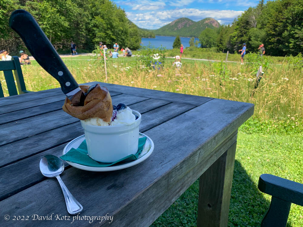
So I took the offer, and ended up at the very best table, closest to the water and the views across the lake. After my lunch I had to order popovers for dessert, of course – Jordan Pond House has been famous for its popovers for over 125 years – and elected the Popover Sunday with blueberry sauce. Maine blueberries are in season, judging by the wild blueberries I’d snacked along my hikes. mmmm.
Sated, it was only 1:00 and the day was young. So I pulled my pack back on and went up the other side of the pond, cranking up the steep, rocky, hot south-facing slopes of Pemetic Mountain. From here I could look across the pond to the mountains of my morning.
a rock and a hard place!
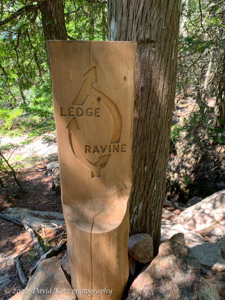
I continued north and down, down a steep trail back to the pond. So steep, in fact, that at one place I was given a choice of “Ledge or Ravine”. I chose the Ravine – it was shady and cool – and found myself climbing down a steep ladder in a narrow crevice.
Not ready to quit now, I crossed the road and scrambled up South Bubble – one of a pair of bumps called The Bubbles – to visit Bubble Rock, a glacial erratic teetering on its slope. From here there were fine views to the south along Jordan Pond, and another precipitously steep descent to the pond.

At this point I could kick it into high gear and cruise along the eastern shore, a trail that is almost a gravel sidewalk, back to parking.
Check out the photo gallery for more.
Hike stats (morning):
Distance: 9.41km
Time: 4h49
Gain: 382m
Hike stats (afternoon):
Distance: 7.88km
Time: 2h45
Gain: 436m
Pemetic Mountain summit is near the words “Mount Desert”
