Middle Sister

Another peak on a hazy day.

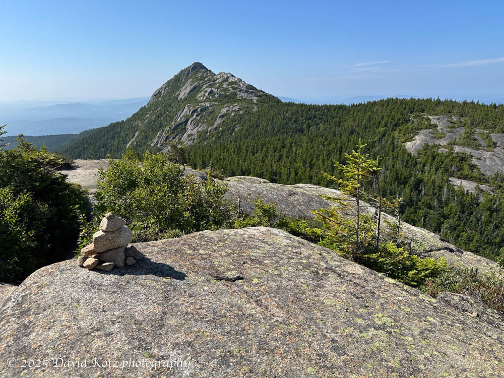
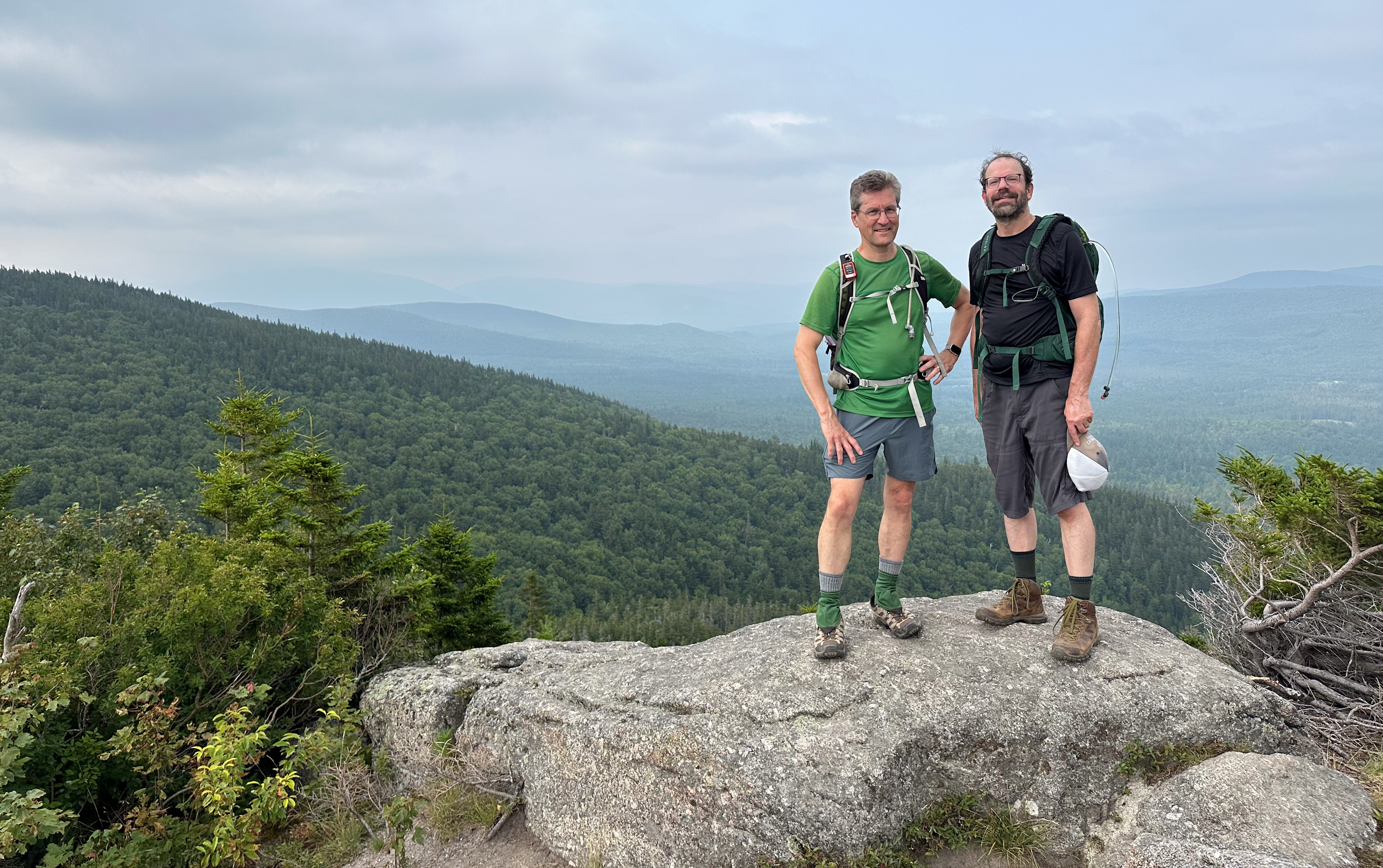
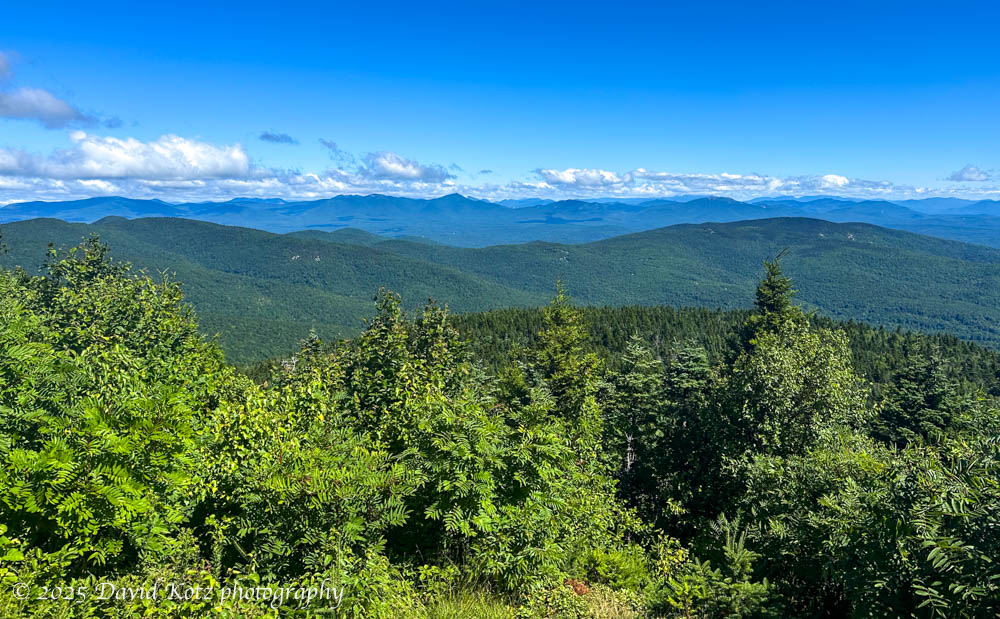
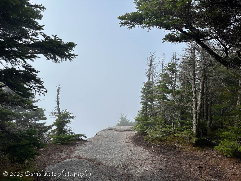
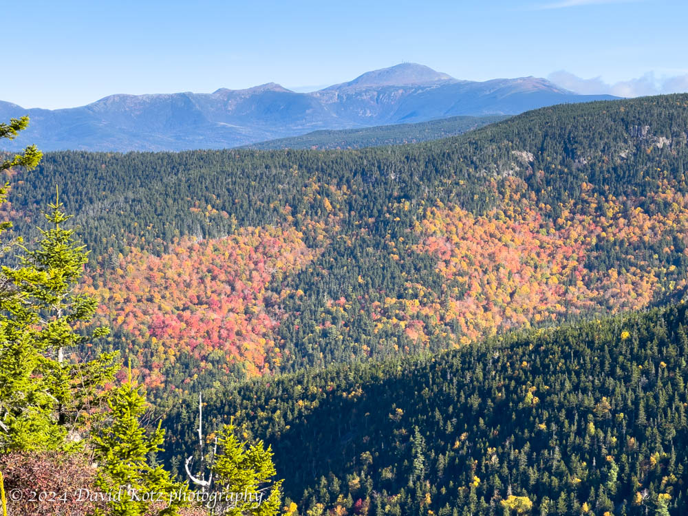
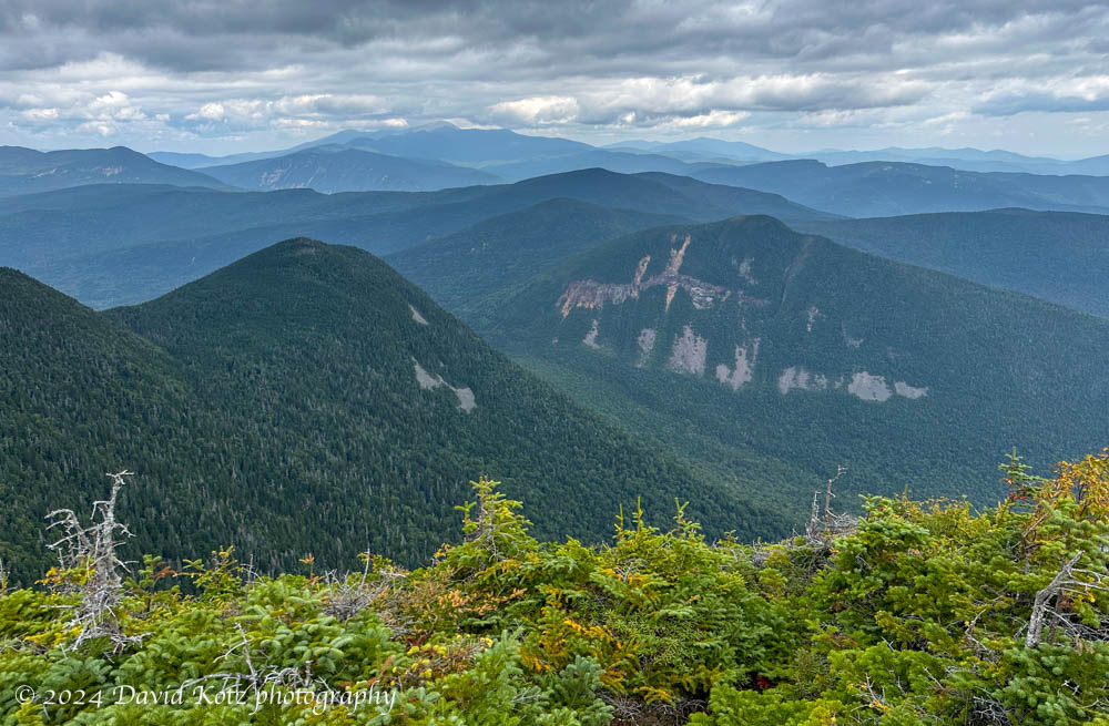
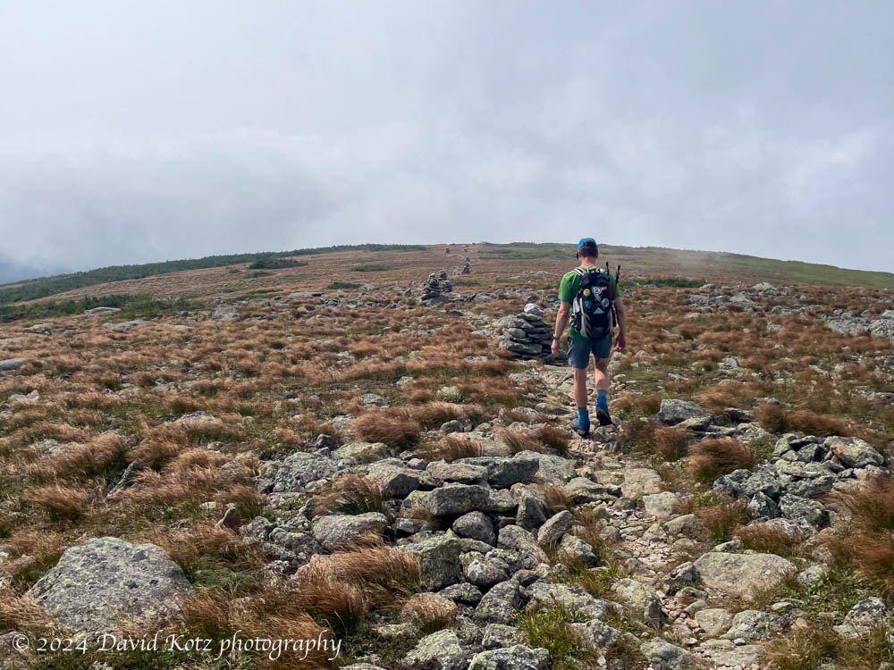
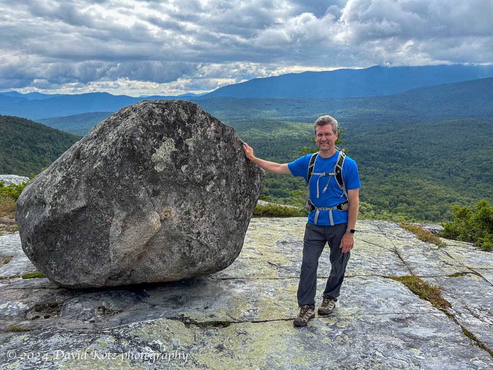
Despite the stagnant weather – which has left us to suffer without rain for two weeks, in hot, hazy, and humid conditions suffused with smoke from distant Canadian wildfires – I was itching to get out for one more hike. Today I scampered up a small peak with an unassuming name but a fantastic view: Middle Sister. This granite-topped peak formerly hosted a stone firetower, offering nearly 360º views of the southern high peaks’ region of what is now White Mountain National Forest. One of three bumps on a ridge connected to their more famous neighbor, Mount Chocorua, the Three Sisters have views nearly as good but with far fewer people. Indeed, it’s possible I was the only visitor to Middle Sister and First Sister today. Read on!

Photo of Mount Chocorua from First Sister peak
Mount Chocorua seen from First Sister peak – White Mountains NH.
Continue reading “Middle Sister”

Bald Peak

Another smoky summit.

A friend and I were eager to get out hiking, today. The forecast showed a risk of thunderstorms in early afternoon, so we opted for a short hike: to Bald Peak. As one of the peaks on the “52 with a view” list, it promised some nice views from the shoulder of the Kinsman Range toward the west. Unfortunately, the lingering smoke from Canadian wildfires left us with a hazy view at best. Still, it was a worthwhile hike to a nice viewpoint.

David and Ken on Bald Peak, with a hazy view.
Mount Moosilauke is high in the haze and clouds in the left distance.
Continue reading “Bald Peak”

Mount Shaw

Another 52WAV peak – this time, with a view!

After two weeks of unusually hot and humid weather, a proper summer’s day finally arrived here in New Hampshire! The forecast was for clear skies and cool-to-moderate temperatures – and my morning calendar was blank – so I headed for Mount Shaw, the highest point in New Hampshire’s Lakes Region. I’d had my eye on this peak for a while, and today was a perfect day for it. I encountered nobody on my 90-minute climb to the summit – no humans, that is… but read on for my encounter with the mountain’s ursine inhabitant!

View of the White Mountains from Mount Shaw.
Continue reading “Mount Shaw”

Sandwich and Jennings

Two peaks with famous views, on a day without views.

As I drove past Mount Cube on NH Route 25A, early this morning, I noted that the cloud deck was low. Very low. Indeed, all the way down to the road! The view of Mount Moosilauke, to which drivers are treated as they round the bend at the height of land on this sector of Route 25A, was simply a wall of white. And the subsequent view of Mount Cube – although it is much closer – was a fuzzy mix of green hillside and puffy white clouds, some of which touched the road in front of me. I was headed for a hike, deeper in the White Mountains, in hopes of summiting two of the peaks on the “52 With a View” list. These steamy morning conditions did not portend well for good views today. Read on to see what happened!

View from Jennings Peak. NOT!
Continue reading “Sandwich and Jennings”

Moosilauke in deep snow

In 42 years on Moosilauke I have *never* seen this much snow.

my 135cm pole disappears in the powder – in places, it went deeper!

I have never seen this much snow on Mount Moosilauke, in 42 years of hiking this mountain. Especially not in February. Well, maybe just once – in late March 2017, the first time I had to actually crawl a section of trail because the snow was so deep it nearly reached the branches of trees overhanging the trail. Today, the snow may have been slightly less deep – but with vastly more snow pillowed on the trees, causing them to bend over the trail. Today’s hike involved a lot more crouching and crawling. On the way up, I met hikers who had turned around, claiming the trail ahead was “impassable.” Read on!

Continue reading “Moosilauke in deep snow”

Autumn 2024

It was a beautiful fall season.

Autumn has ended, and we are now well into what locals call “stick season.” After summer comes the fall, when the hardwood trees turn various shades of yellow, orange, red, and brown, bringing new color to the hilly New Hampshire landscape just before it tucks in for a long winter’s nap. This year we have had a beautiful fall season, with sunny/warm weather and brilliant fall colors. In this quick blog post I want to share a few photos from three of my favorite aspects of autumn at Dartmouth and in New Hampshire: fall foliage, the homecoming bonfire, and Diwali. Read on!

Ginko tree leaves in autumn, Dartmouth.
Continue reading “Autumn 2024”

Mount Crawford in fall foliage

Absolutely spectacular!

It was still dark as I drove north through the dense valley fog, confident I would encounter a brilliant sunny day once I turned east and climbed away from the Connecticut River Valley. My destination was Mount Crawford, a popular peak in the heart of the White Mountains. At 3,128′ it is not one of the 48 ‘high peaks’, the four-thousand-footers that inspire so many people to “bag them all” and earn the AMC’s Four-Thousand-Footer patch. (And for some, like me, to do them all more than once; I finished my second round in August.) But, frankly, Mount Crawford is far better than many of its higher cousins: it has a splendid view – earning it a spot on the list of 52 with a view. Today, in full fall foliage, the view was absolutely stupendous. Read on!

View of Mount Washington and the southern Presidential Range,
along the Davis Path to Mount Crawford.
Continue reading “Mount Crawford in fall foliage”

Carrigain: 48 over 48

Completing my second round of the NH48 – all done over the age of 48.

I saved Mount Carrigain for last.

In 2014, shortly after skiing and snowshoeing to the summit of Owl’s Head – one of the peaks in the NH48 (a list of 48 peaks in the White Mountains of New Hampshire whose elevation exceeds 4,000 feet) – I realized that it might be worth hiking all the mountains on that list again. I could aim to complete what I call the “48 over 48”, that is, to hike all 48 peaks on the NH48 list, over the age of 48. After all, I had just completed the most notoriously inconvenient and unrewarding peaks on the list! So why not do all the rest? Read on!

First views from the Signal Ridge Trail on Mount Carrigan – with Carrigain Notch below, and the Presidential Range in the distance left of center.
Continue reading “Carrigain: 48 over 48”

Mount Isolation

A rugged hike to an isolated member of the NH four-thousand-foot mountains, on a smoky, foggy day.

It seemed odd to climb to an elevation of over 5,200′ in search of a mountain whose elevation is only 4,003′ (1220m), just barely earning it membership in the White Mountains’ fabled set of “four thousand footers.” But Mount Isolation, our diminutive goal for the day, is, well, isolated. There are no direct routes to its summit, a slight prominence along the lengthy Montalban Ridge sloping southeast from the shoulder of Mount Washington. But as we climbed above treeline into the extended alpine landscape surrounding Mount Washington, we were glad to have chosen this route. Read on, and check out the gallery!

David hiikes down the Davis Path toward Mount Isolation. Photo by Jon Kull.
Continue reading “Mount Isolation”

Black Mountain

Sharing a favorite hike with a friend.

After the passage of Tropical Storm Debby (which fortunately only brought us a few hours of heavy rain), the weather turned sunny and dry. Perfect for a hike! I selected Black Mountain, one of my favorite go-to hikes, to share with a friend who is still discovering the many hiking opportunities of the Upper Valley and New Hampshire. Although the sky was partly cloudy, Black Mountain’s relatively low elevation allowed us outstanding views across the Upper Valley (to the west) and into the White Mountains (to the east). And I re-discovered the “tipping rock” I’d seen on my first visit here in October 2010 (10/10/10). Check out the gallery!

The ‘teetering rock’, on Black Mountain, with Mount Moosilauke in the background.

Hike stats:
Distance: 3.75mi (6.0 km), including a side trip to the historic Lime Kiln.
Time: 2h56 (including a long rest on the summit)
Elevation gain: 1,599′ (487m)

Trailhead at lower left, summit at right. Out and back;
on the way out, we made a side-trip to the Lime Kiln on the dirt road