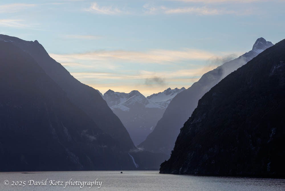
The early morning light was as gentle as the breeze, as we sailed up into Milford Sound before sunrise. With each passing moment, more delicate layers of the scene came into view as the daylight grew and as the Heritage Adventurer made its way up this narrow fjord in the remote southwestern corner of New Zealand.
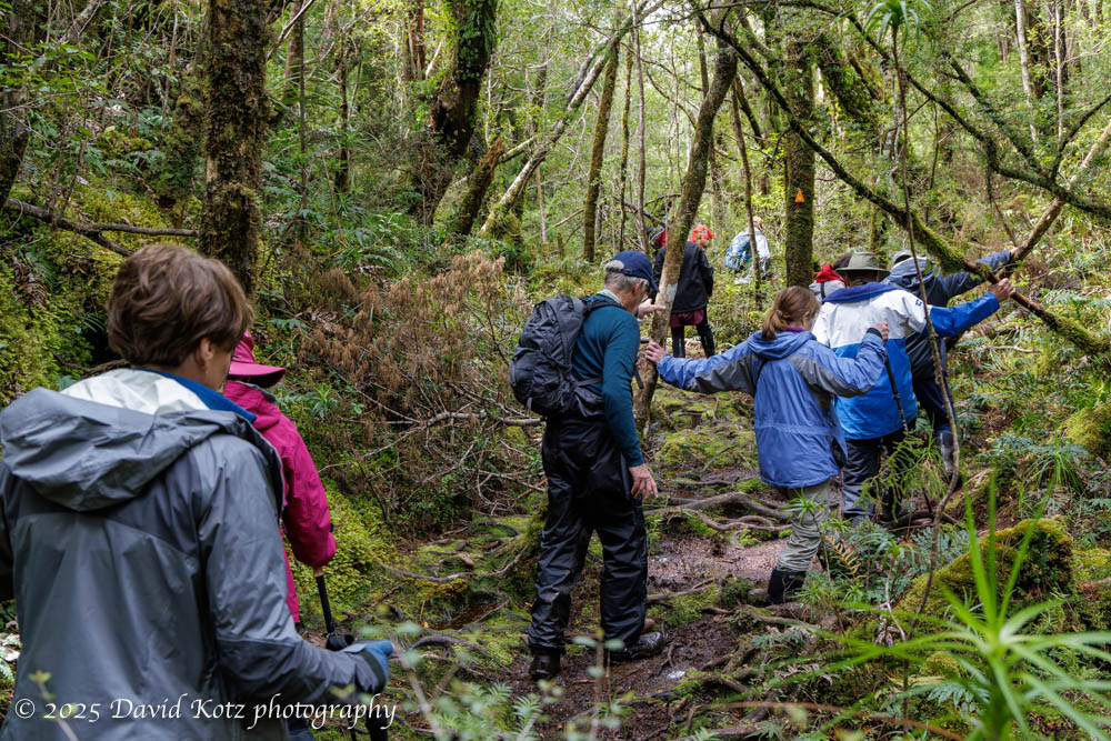
Our group moves slowly through the New Zealand rainforest.
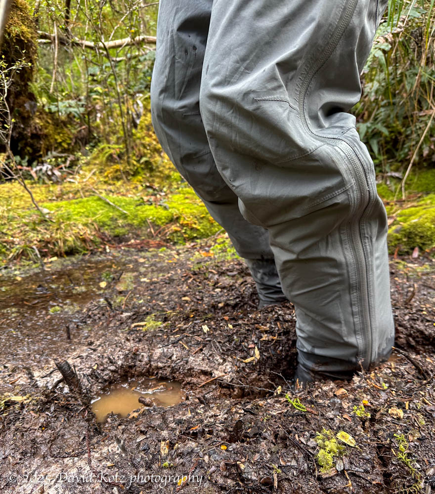
Deep mud along the trail.
My feet plunged into a muddy pool as we scrambled along a crude track through the temperate rainforest, surrounded by huge ferns as tall as trees and other unfamiliar flora and fauna. The guides warned us it would be muddy – after all, they measure annual rainfall in meters, here in the remote fjords of southwestern New Zealand. Fortunately, I was wearing calf-height muck boots with waterproof rainpants over those. I was just happy to be in the forest, my eighth hike in eight consecutive weekends, spread across three continents and four countries.
As we cruised the fjords on the southwest coast of Greenland, we had several opportunities to learn about the cultures of Greenland – historic and contemporary – and to visit archaeological sites, small villages, and busy towns. This post focuses on two historic settlements, each now recognized as a UNESCO world heritage site. Read on for more…
One might imagine becoming stir crazy during ten days aboard ship. Fortunately, the expedition team offered many opportunities to go ashore! Nearly every day they would offer short, medium, and long walks. Some were billed as a ‘photo walk,’ accompanied by the ship’s photo experts; others were focused on interpretation of the ecology or history; still others were pointedly called a ‘strenuous hike’ for which exercise was the goal and there would be no time to stop for photos or natural-history lessons. We were fortunate with good weather – sometimes fantastic weather – so I had the opportunity to hike at Dronning Marie Dal (in Skjoldungensund), at the outlet of the Sermeq glacier (at the head of Tasermiut fjord), around the Hvalsey historic site, around the village of Qassiarsuk, and in the tundra above Neria fjord. The scenery was dramatic, and varied tremendously from place to place. Read on for more!
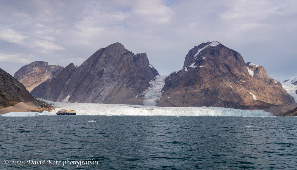
It’s hard to imagine the size of Greenland, or its ice cap. Even those glaciers that flow down to the sea, like the Thryms glacier below, are truly massive. (Notice our ship, the National Geographic Endurance, at lower left!) Read on for more about our outings among the ice, including video…
Although our route sometimes had the Endurance sailing offshore overnight south along the eastern coast, and sailing north along the western coast, most of our time in Greenland was spent in the extensive fjord systems that shape the southern tip of Greenland. In this landscape, a visitor can understand why the early Norse settlers named this land Grœnland (green land) when the Norse, led by Erik the Red, settled here in 982. Although these fjords have steep walls and deep waters, their shores and (rare) shallow glacial plains are covered in a green, grassy tundra sprinkled with heather, dwarf willow, dwarf birch, crowberries, blueberries, and a variety of wildflowers. Although “Iceland’s landscape is the world’s youngest and most dynamic, the rocks of Greenland are the oldest yet discovered on the planet.” [NatGeo] Read on for more…
One of the wonderful aspects of a National Geographic expedition is the opportunity to travel to remote places – places only accessible by ship, completely uninhabited – and to explore the tundra, fjords, and deep seas for some of the incredible wildlife that calls this wilderness its home. As part of our ten-day cruise from Iceland to the southern fjords of Greenland, we had ample opportunity to watch whales feeding, trek across treeless tundra, lock eyes with caribou, beachcomb remote shores, boat among the berglets that emerge from tidal glaciers, and even glimpse the aurora borealis. In the next several posts I’ll share a sample of each. Meanwhile, a special tidbit from the last night of the trip!
A ten-day cruise from Iceland to the southern coast of Greenland.
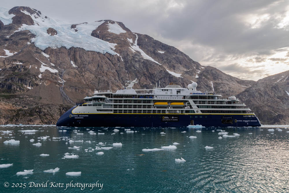
Recent trips to the Antarctic [South Georgia, 2023] and the Arctic [Finland, 2024] whet my appetite for exploring further in the polar regions, so I jumped at the chance to cruise southern Greenland in late summer. Indeed, because this cruise began and ended in Iceland, it gave me a chance to expand on my prior visit to Iceland [2024] to explore its southeast coast. Finally, this cruise was aboard the National Geographic Endurance, the same ship we’d sailed on our cruise of South Georgia and the Falklands in 2023, and which I found to be a terrific experience. Read on!
The Endurance, seen from the icy water near Thryms glacier; Skjoldungensund fjord, Greenland.Continue reading “Greenland”
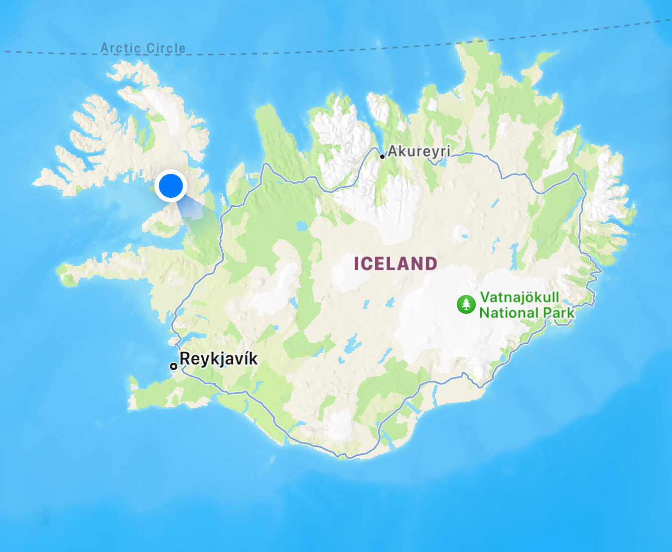
A beautiful two days in the remote northwestern region of Iceland.
After a few days amongst throngs of tourists at the “Golden Circle” of sights near Reyjavik (see my prior post) we headed for the remote northwestern corner of Iceland, the Westfjords. We rented a rural house at the blue dot on the map below, and explored westerly from there – reaching the westernmost tip of Iceland, which is also the westernmost point in Europe. It required driving some remote, dusty, narrow, twisty, and sketchy roads… but also led us to stunningly beautiful landscapes. Read on! and check out the galleries linked below.
As the afternoon waned on 6 March, we sailed deep into a deep fjord at the southern tip of South Georgia, its walls lined with glacier after glacier. As the glaciers have receded – all too fast, in recent years – the fjord has gotten longer, and it took an hour for us to motor slowly “upstream” to the head of the fjord, where the Risting Glacier was actively calving into the tidal bay.
Glacier near the head of Drygalski Fjord, South Georgia.
Visit the gallery for more photos and a video panorama. You’ll note one tiny iceberg, recently broken off the glacier, just large enough to allow a fur seal a spot to rest while it fished for its dinner in the frigid waters of the fjord.