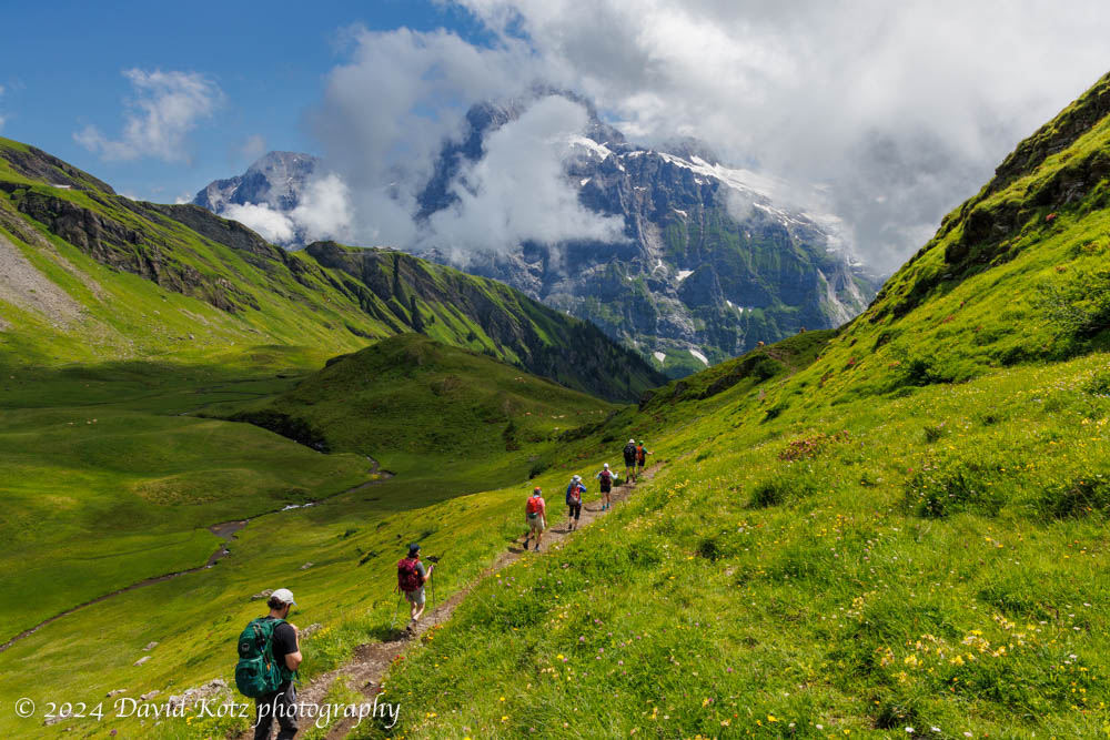
A gentle hike from Gross Scheidegg down to Schwarzwaldalp.
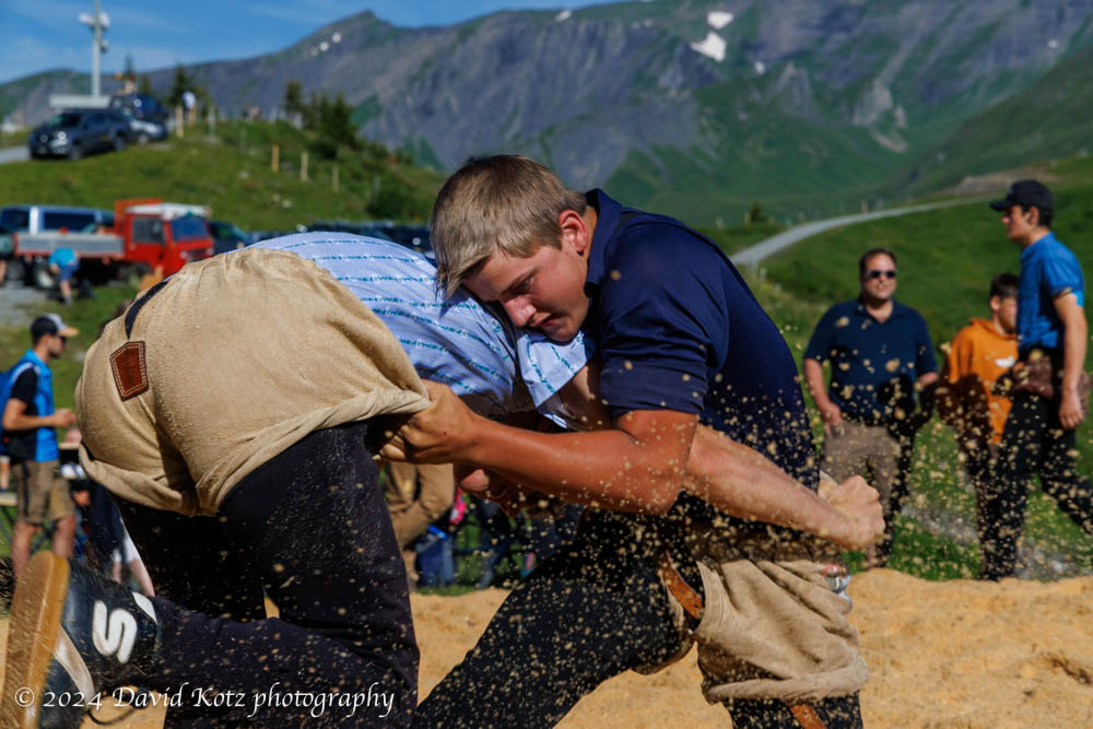
On our final day in Grindelwald, we chose a milder hike. It began with a bus ride up the steep and winding road to a mountain pass, Gross Scheidegg – the taller (eastern) counterpart to Kleine Scheidegg on the western side of Grindelwald. Here we stumbled into a local community festival, which appeared to be an amateur wrestling contest! We stopped to watch for a while, then ambled up the road and along the trail to take us down the other side of the pass. Our goal was the tiny village of Schwarzwaldalp, which we understood to be the site of a historic, water-powered sawmill. Read on!
An afternoon jaunt to a promontory overlooking Grindelwald.
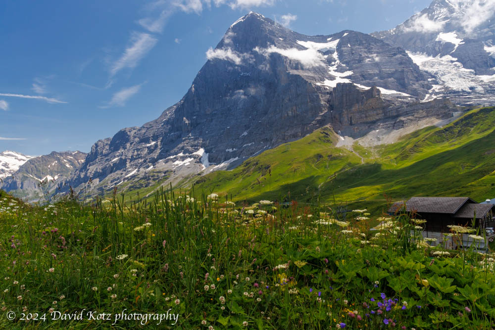
Our fourth day in Grindelwald allowed for a second hike. (In the morning, most of us took the train up to Jungfraujoch, where three of us walked through the sunshine across the snowfields to a hut for tea and cakes.) On return to Kleine Scheidegg, we met up with others in our group for lunch at a cheerful little berghaus nearby. We then struck out along the ridgeline, with the Eiger’s north face dominating the landscape behind us. Read on!
A morning visit to the highest train station in Europe – and a stroll across the snowfields at 12,000′.
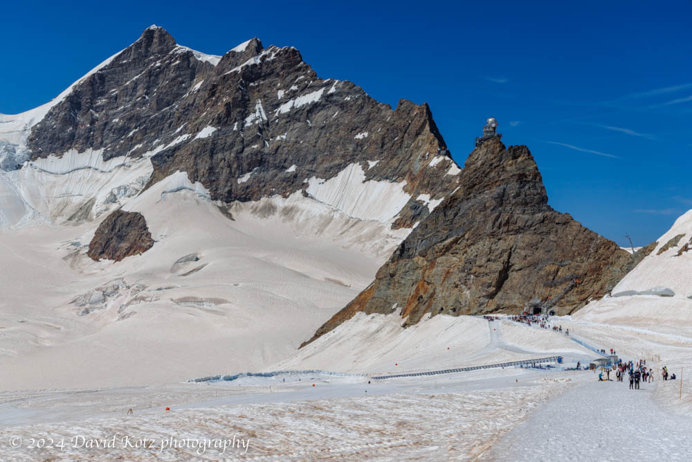
On our fourth day in Grindelwald we took two hikes. We spent the morning visiting Jungfraujoch, which (despite its intensely touristy nature) is an incredible place to visit. It is the highest train station in Europe, serving a structure that perches on a pinnacle at 3571m (11,716′) above sea level, adjacent to the snowfields surrounding the 4000m Alpine mountains of Eiger, Mönch, and Jungfrau. In this post I share a few impressions – and a gallery of photos of our walk across the snowfield to the hut at Mönchsjochütte, on an astonishingly gorgeous day.
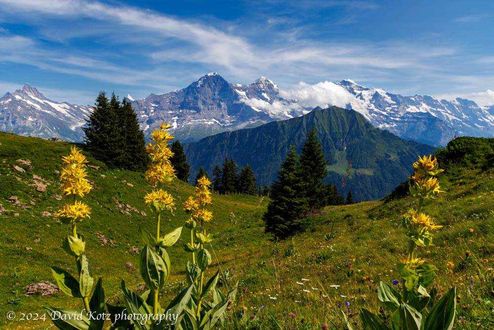
On the third day of our week in Grindelwald we decided to hike one of the most classic routes in the area, from Schynige Platte to First – although in the opposite direction. My hike there in 2019 was one of the most moving hikes I’ve ever experienced, as the Alps emerged out of an undercast sky like so many islands in an endless sea. Today, I was thrilled to share it with friends!
Today, we hiked from First (reached by gondola from downtown Grindelwald) to Schynige Platte (reached by a historic cog railway that climbs into the mountains from a valley close to Interlochen). The weather was perfect, so we were treated to a day full of stunning vistas as we hiked the high country above Grindelwald, over the pointy peak of Faulhorn (with lunch at its summit hotel!), along the rocky ridgeline, through alpine meadows brimming with wildflowers, across a couple of stubborn snowfields, and past another hut at Männdlenen (with a stop for apfel strudel, of course!). Read on, and check out the gallery.
Stunning views from our walk toward some glaciers above Grindelwald.
For the second hike of our week-long visit to Grindelwald, we chose the opposite side of the valley, a deep canyon formed by the Ischmeer Glacier, whose remnants cling to the high slopes of 4000-meter peaks like Schreckhorn, Finsteraarhorn, and Feischerhorn. Our primary goal was the Berghaus Bäregg – literally, mountain house at bear corner – which we rightly anticipated would provide a sunny lunch spot with spectacular views of the glacier. Our stretch goal was to continue onward to Schreckhornhütte, another hut far upslope at elevation 2,527m. Although we turned around when we reached 6,000’ (1829m) we enjoyed the sunny meadows strewn with wildflowers; views of glaciers and snowfields spawning massive waterfalls and cascades; and challenging sections of trail where it clung to the cliffside or crossed massive washouts. And, a hearty lunch at the Berghaus! Read on, and check out the gallery.
Our first hike above Grindelwald brought us out of the clouds and into spectacular scenery.
Our first hike out of Grindelwald was a relatively low-altitude stroll across the high terrain above town, from the end of the bus line at Bussalp to the end of another bus line at Waldspitz. The sky was cloudy as the bus wound up the steep and twisty road from Grindelwald, past the holiday homes and into the farm country high above town. Still, the clouds looked like they were struggling to hold form as the daylight grew stronger, so we headed up the trail in high spirits. Soon we were following a narrow track that meandered among the cows, across streams, and through meadows strewn with wildflowers. The clouds began to dissipate and the incredible peaks of Eiger, Mönch, and Jungfrau peeked out from across the valley. Read on, and check out the photos!
My first visit to Grindelwald was in fall 2019, after an incredible overnight stay at the alpine hut perched on the summit of Faulhorn mountain, with sunset views of the Eiger, Mönch, and Jungfrau. It was so stunning that I brought my family back there in December, to see it in winter – and then again in June 2020, to hike from there up to Kleine Scheidegg in the shadow of the Eiger. Each visit to Grindelwald was magical, surrounded as it is by the stunning beauty of the Alpine peaks and pastoral meadows. So, despite its intense tourism (after all, I am hardly the first person to notice Grindelwald!) I decided Grindelwald would be an excellent base for a week of hiking with college friends. We rented a house on Vrbo, and settled in on Monday evening for a week-long stay.
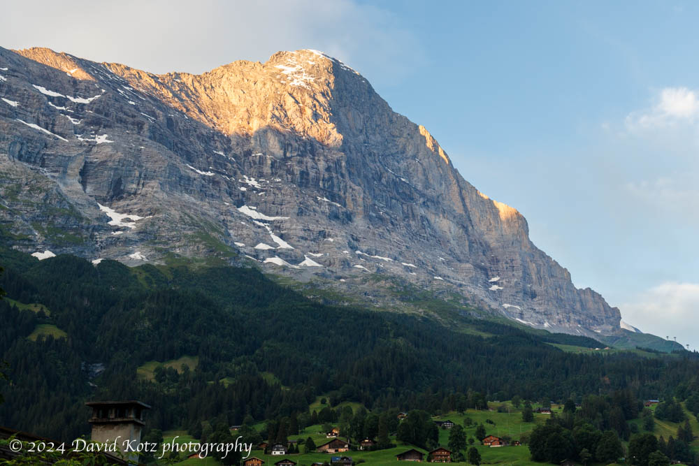
View of the Eiger’s north face, from the bedroom balcony of our rental house.
In subsequent posts I will highlight each of our daily hikes, then wrap-up with a few photos of Grindelwald itself.
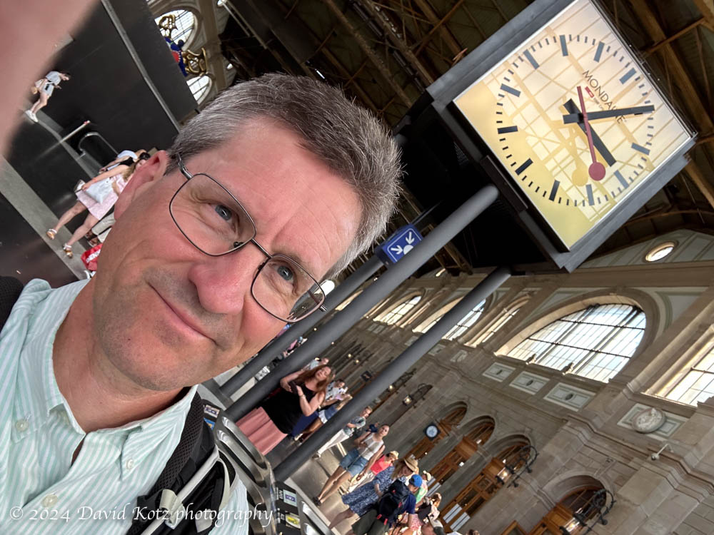
As regular readers recall, I enjoyed the opportunity to live in Zürich for the year 2019-20, including during the first four months of the pandemic. It is a beautiful city, with stupendous opportunities for hiking near and far. I was sad to leave in July 2020, thrilled to return for a week’s visit in December 2021, and dreamt of further visits into the future. So I was excited to find myself walking the streets of Zürich again this weekend, meeting up with friends for a trip to Grindelwald for the rest of the week. I took my usual morning walk to the viewpoint on Zürichberg, rode the train to the view on Uetliberg, explored in Einstein’s footsteps at ETH, strolled Bahnhofstrasse and the Altstadt, sipped hot chocolate at Sprüngli, and dined on wurst and rösti at Zeughauskeller.
David is back in Zürich – here at HB train station.
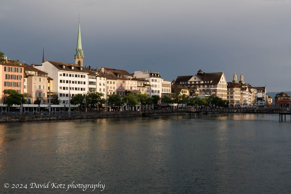
It was hot and muggy both days, so the residents and tourists alike were out in the street cafés, boating on the lake, all trying to beat the heat. We only had a few brief hours in town, so I share a small gallery of photos. Soon to come: alpine hiking in Grindelwald!
View up the Limmat river, from the bridge near HB, Zürich.
A beautiful two days in the remote northwestern region of Iceland.
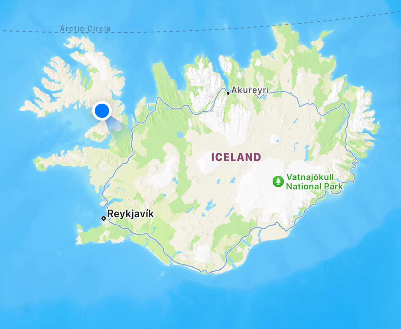
After a few days amongst throngs of tourists at the “Golden Circle” of sights near Reyjavik (see my prior post) we headed for the remote northwestern corner of Iceland, the Westfjords. We rented a rural house at the blue dot on the map below, and explored westerly from there – reaching the westernmost tip of Iceland, which is also the westernmost point in Europe. It required driving some remote, dusty, narrow, twisty, and sketchy roads… but also led us to stunningly beautiful landscapes. Read on! and check out the galleries linked below.
Our week in Iceland began with a tour of some classic sights.
Our extended family loves to travel. We sought an interesting destination to celebrate a graduation and two birthdays, and settled on Iceland. So eleven of us met up in Reykjavik for a busy week of touring this beautiful country. Iceland’s northernmost point just grazes the Arctic Circle, but even at Reykjavik (on the southwest coast) and on our dates (three weeks after solstics) the days were still very long: sunrise at 0342 and sunset at 2325; it was never dark! Although Iceland is a small island, a one-week visit is really only enough to scratch the surface – we focused on the area around the capital of Reykjavik (and the crowded “Golden Circle” of nearby sights) and the remote Westfjords peninsula. This post focuses on the Reykjavik area; see the combined gallery or the location-specific galleries below. Read on!