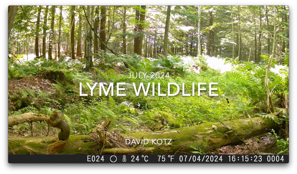
July edition of captures from my wildlife cameras in the forests of Lyme. Squirrel, bear, deer, and raccoons.
July was a quiet month for my wildlife cameras – but resulted in some interesting video captures! Mid-month I shared the fun close-up view of a black bear, who used my camera as a back-scratcher. Now, I share a video compendium… a cute squirrel grooming himself, a busy raccoon moving through the woods overnight, a black bear that gets frighteningly close, a series of deer (including a young buck), and a pair of mischievous raccoons!
A rugged hike to an isolated member of the NH four-thousand-foot mountains, on a smoky, foggy day.
It seemed odd to climb to an elevation of over 5,200′ in search of a mountain whose elevation is only 4,003′ (1220m), just barely earning it membership in the White Mountains’ fabled set of “four thousand footers.” But Mount Isolation, our diminutive goal for the day, is, well, isolated. There are no direct routes to its summit, a slight prominence along the lengthy Montalban Ridge sloping southeast from the shoulder of Mount Washington. But as we climbed above treeline into the extended alpine landscape surrounding Mount Washington, we were glad to have chosen this route. Read on, and check out the gallery!
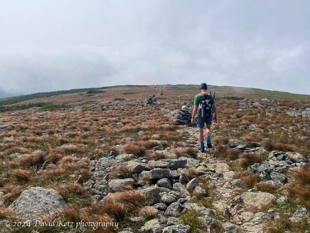
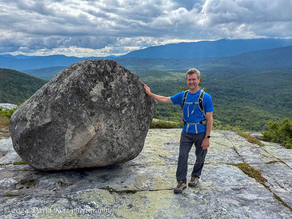
After the passage of Tropical Storm Debby (which fortunately only brought us a few hours of heavy rain), the weather turned sunny and dry. Perfect for a hike! I selected Black Mountain, one of my favorite go-to hikes, to share with a friend who is still discovering the many hiking opportunities of the Upper Valley and New Hampshire. Although the sky was partly cloudy, Black Mountain’s relatively low elevation allowed us outstanding views across the Upper Valley (to the west) and into the White Mountains (to the east). And I re-discovered the “tipping rock” I’d seen on my first visit here in October 2010 (10/10/10). Check out the gallery!
The ‘teetering rock’, on Black Mountain, with Mount Moosilauke in the background.
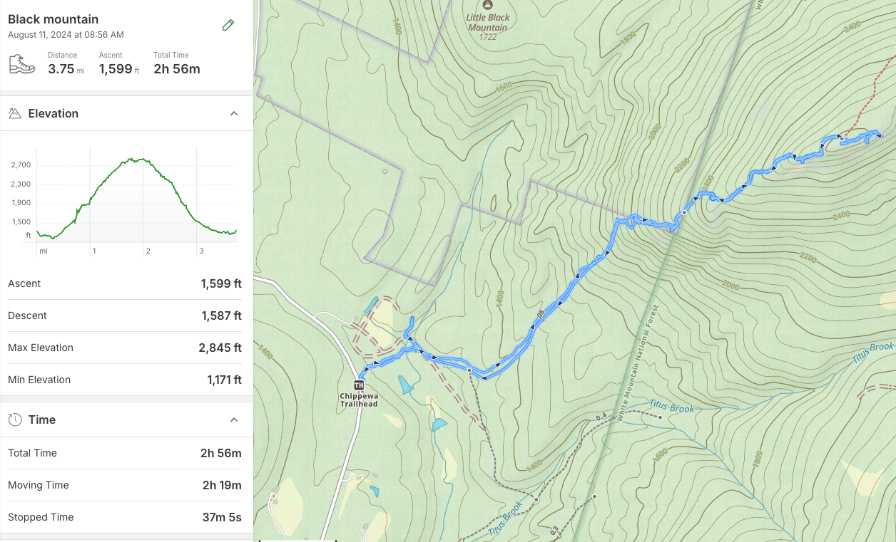
Hike stats: Distance: 3.75mi (6.0 km), including a side trip to the historic Lime Kiln. Time: 2h56 (including a long rest on the summit) Elevation gain: 1,599′ (487m)
Trailhead at lower left, summit at right. Out and back; on the way out, we made a side-trip to the Lime Kiln on the dirt road
What a week! My friends and I rented a house in Grindelwald (Switzerland) and spent the week hiking in the heart of the Swiss Alps. We were incredibly lucky with the weather, with six sunny hikes:
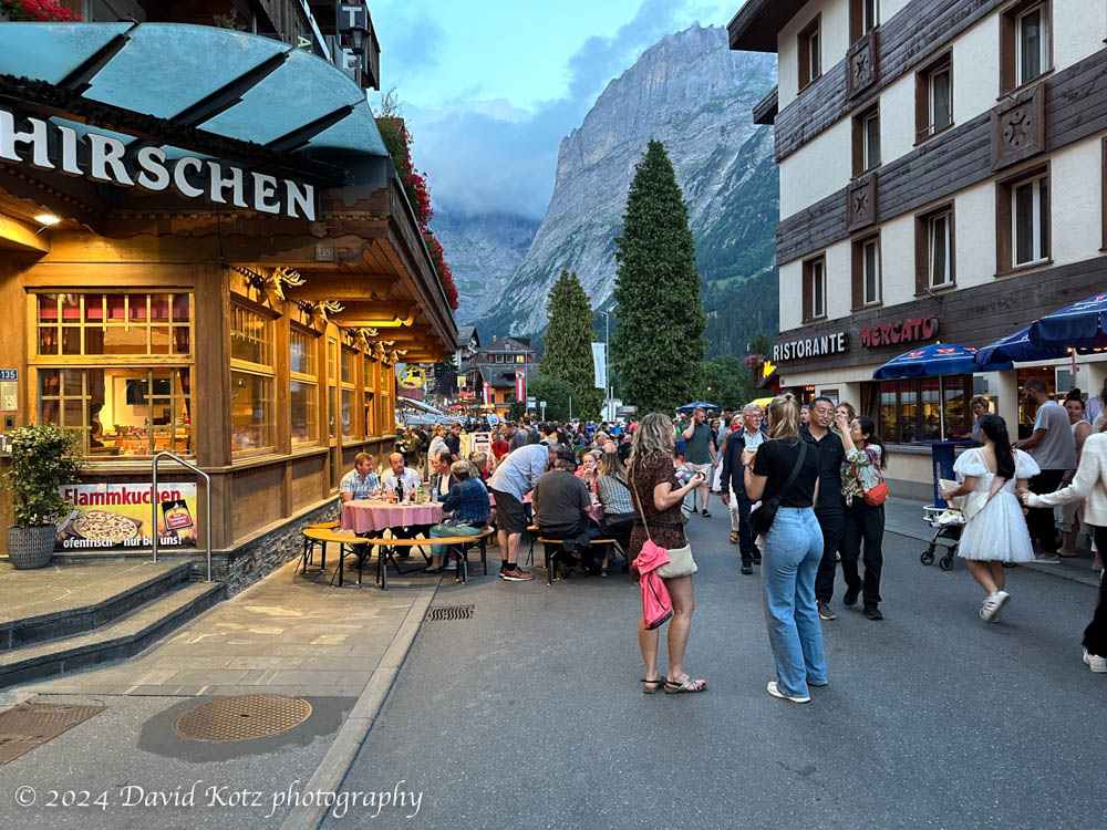
We spent very little time in town – an aprés-hike visit to a pastry shop, a brief tour of the gift shops – but we did enjoy an excellent fondue meal at Hirschen, and the many sights, sounds, and tastes of the Wednesday-evening street festival. More photos in the gallery!
Street party in Grindelwald, with the Alps looming in the background.
Postscript: unfortunately, about 15 days after we left Grindelwald, a massive storm blew through the region and caused terrible flooding. The village of Brienz was devastated, and both Grindelwald and Lauterbrunnen were cut off for several days. I feel horrible for the people and businesses affected.
A gentle hike from Gross Scheidegg down to Schwarzwaldalp.
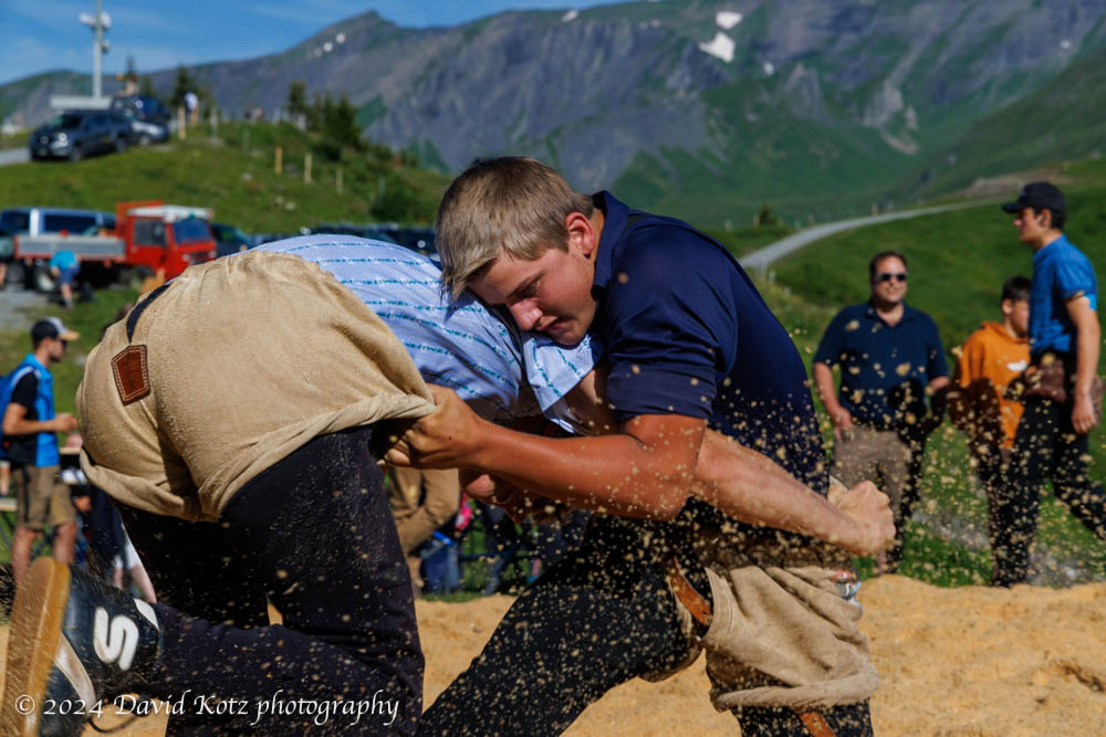
On our final day in Grindelwald, we chose a milder hike. It began with a bus ride up the steep and winding road to a mountain pass, Gross Scheidegg – the taller (eastern) counterpart to Kleine Scheidegg on the western side of Grindelwald. Here we stumbled into a local community festival, which appeared to be an amateur wrestling contest! We stopped to watch for a while, then ambled up the road and along the trail to take us down the other side of the pass. Our goal was the tiny village of Schwarzwaldalp, which we understood to be the site of a historic, water-powered sawmill. Read on!
An afternoon jaunt to a promontory overlooking Grindelwald.
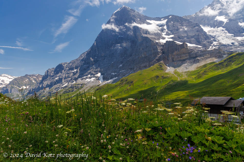
Our fourth day in Grindelwald allowed for a second hike. (In the morning, most of us took the train up to Jungfraujoch, where three of us walked through the sunshine across the snowfields to a hut for tea and cakes.) On return to Kleine Scheidegg, we met up with others in our group for lunch at a cheerful little berghaus nearby. We then struck out along the ridgeline, with the Eiger’s north face dominating the landscape behind us. Read on!
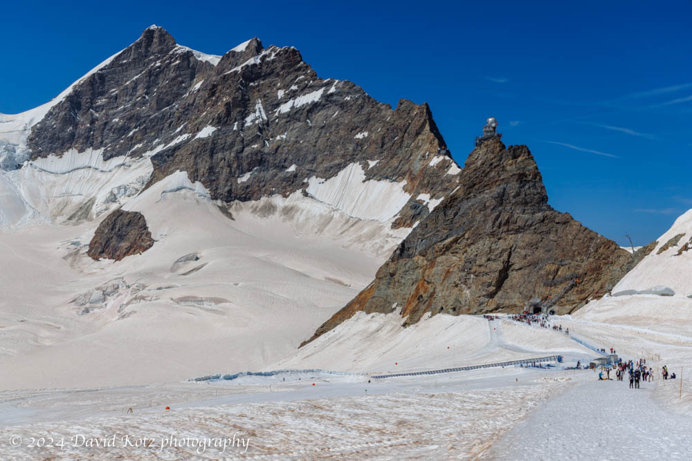
A morning visit to the highest train station in Europe – and a stroll across the snowfields at 12,000′.
On our fourth day in Grindelwald we took two hikes. We spent the morning visiting Jungfraujoch, which (despite its intensely touristy nature) is an incredible place to visit. It is the highest train station in Europe, serving a structure that perches on a pinnacle at 3571m (11,716′) above sea level, adjacent to the snowfields surrounding the 4000m Alpine mountains of Eiger, Mönch, and Jungfrau. In this post I share a few impressions – and a gallery of photos of our walk across the snowfield to the hut at Mönchsjochütte, on an astonishingly gorgeous day.
On the third day of our week in Grindelwald we decided to hike one of the most classic routes in the area, from Schynige Platte to First – although in the opposite direction. My hike there in 2019 was one of the most moving hikes I’ve ever experienced, as the Alps emerged out of an undercast sky like so many islands in an endless sea. Today, I was thrilled to share it with friends!
Today, we hiked from First (reached by gondola from downtown Grindelwald) to Schynige Platte (reached by a historic cog railway that climbs into the mountains from a valley close to Interlochen). The weather was perfect, so we were treated to a day full of stunning vistas as we hiked the high country above Grindelwald, over the pointy peak of Faulhorn (with lunch at its summit hotel!), along the rocky ridgeline, through alpine meadows brimming with wildflowers, across a couple of stubborn snowfields, and past another hut at Männdlenen (with a stop for apfel strudel, of course!). Read on, and check out the gallery.
Stunning views from our walk toward some glaciers above Grindelwald.
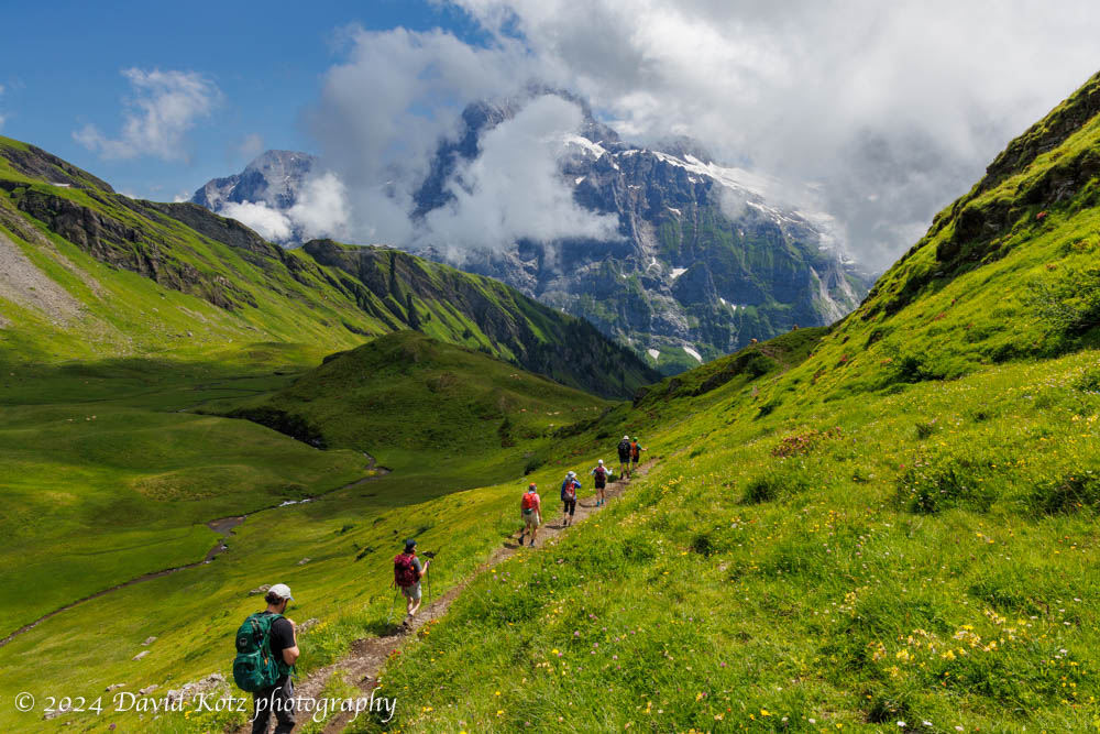
For the second hike of our week-long visit to Grindelwald, we chose the opposite side of the valley, a deep canyon formed by the Ischmeer Glacier, whose remnants cling to the high slopes of 4000-meter peaks like Schreckhorn, Finsteraarhorn, and Feischerhorn. Our primary goal was the Berghaus Bäregg – literally, mountain house at bear corner – which we rightly anticipated would provide a sunny lunch spot with spectacular views of the glacier. Our stretch goal was to continue onward to Schreckhornhütte, another hut far upslope at elevation 2,527m. Although we turned around when we reached 6,000’ (1829m) we enjoyed the sunny meadows strewn with wildflowers; views of glaciers and snowfields spawning massive waterfalls and cascades; and challenging sections of trail where it clung to the cliffside or crossed massive washouts. And, a hearty lunch at the Berghaus! Read on, and check out the gallery.
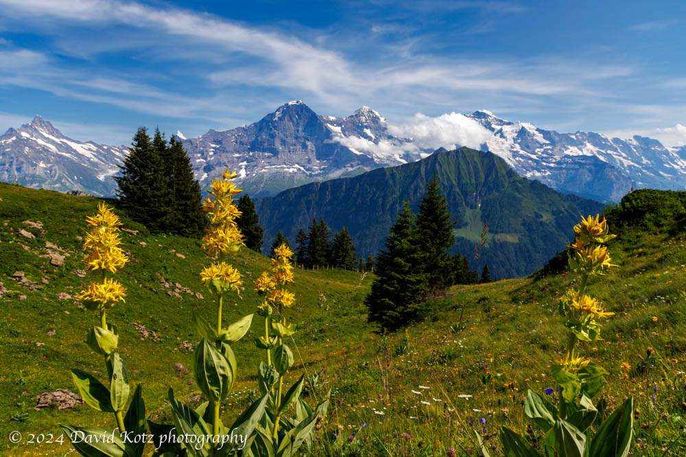
Our first hike above Grindelwald brought us out of the clouds and into spectacular scenery.
Our first hike out of Grindelwald was a relatively low-altitude stroll across the high terrain above town, from the end of the bus line at Bussalp to the end of another bus line at Waldspitz. The sky was cloudy as the bus wound up the steep and twisty road from Grindelwald, past the holiday homes and into the farm country high above town. Still, the clouds looked like they were struggling to hold form as the daylight grew stronger, so we headed up the trail in high spirits. Soon we were following a narrow track that meandered among the cows, across streams, and through meadows strewn with wildflowers. The clouds began to dissipate and the incredible peaks of Eiger, Mönch, and Jungfrau peeked out from across the valley. Read on, and check out the photos!