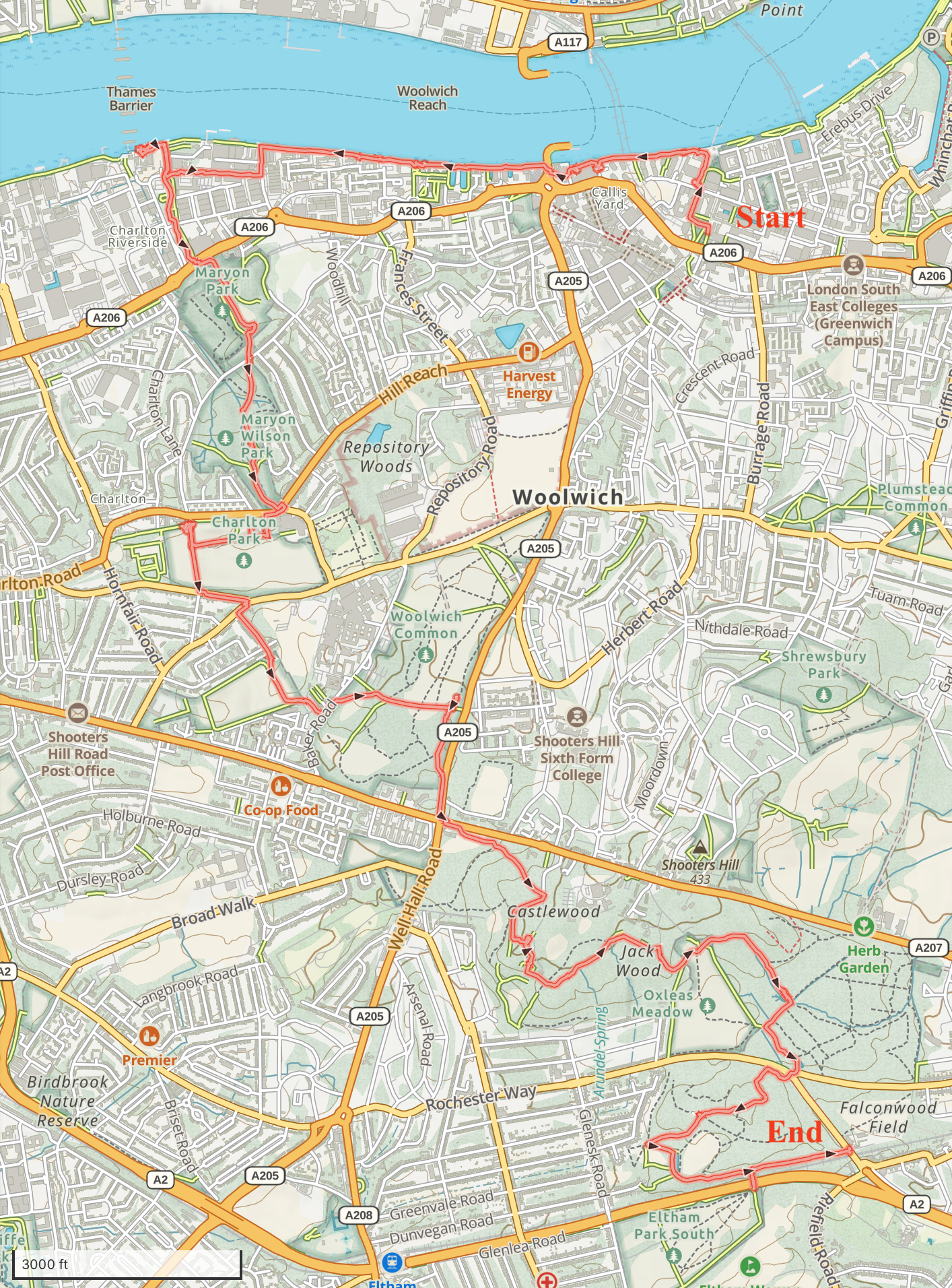
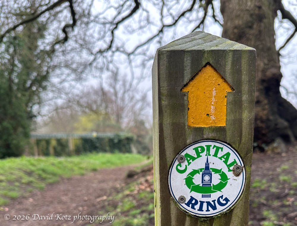
The forecast was for cloudy weather in London, so for this weekend’s hike I decided to explore the Capital Ring Walk. This 15-segment loop encircles London, covering 78 miles of terrain including forests, parks, and historic areas. Today I began at the beginning: Section 1: Woolwich Foot Tunnel to Falconwood. It was a fascinating mix of engineering, nature, and history.
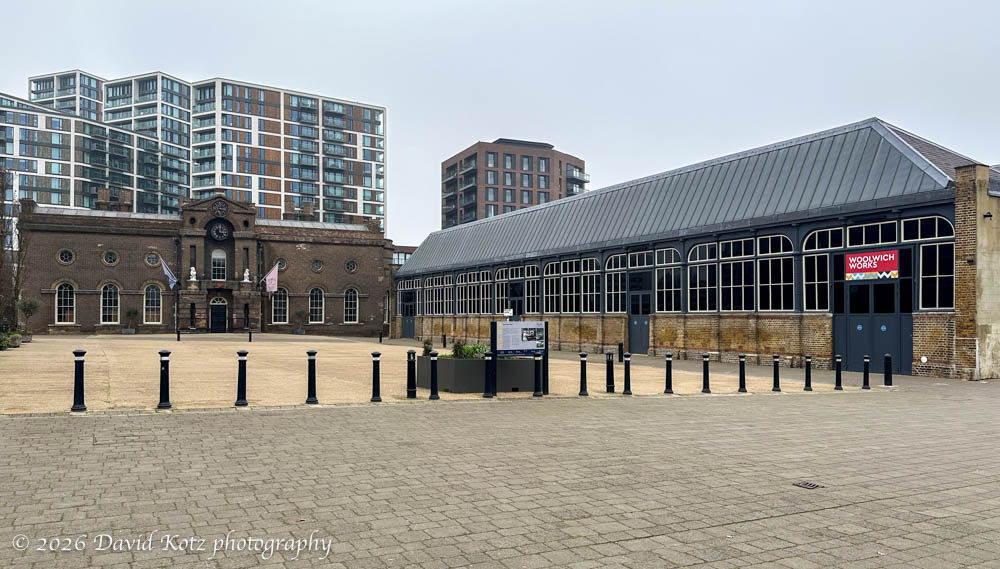
This segment begins in Woolwich, a small suburb east downstream along the Thames River from Greenwich. Although we’d been to Greenwich twice (in September and January), I knew little about London further east. As I left the station I was immediately immersed in the important history of the Woolwich Dockyard, where the Royal Arsenal was based during World War I. The sign explained the importance of the Woolwich Works and surrounding facilities to Britain’s war effort. Around the corner was the Thames River and, as I followed the river upstream, cannon placements emphasized the strategic importance of these shores. For centuries – indeed, two millenia – London needed to defend itself from invaders who sail up the Thames.
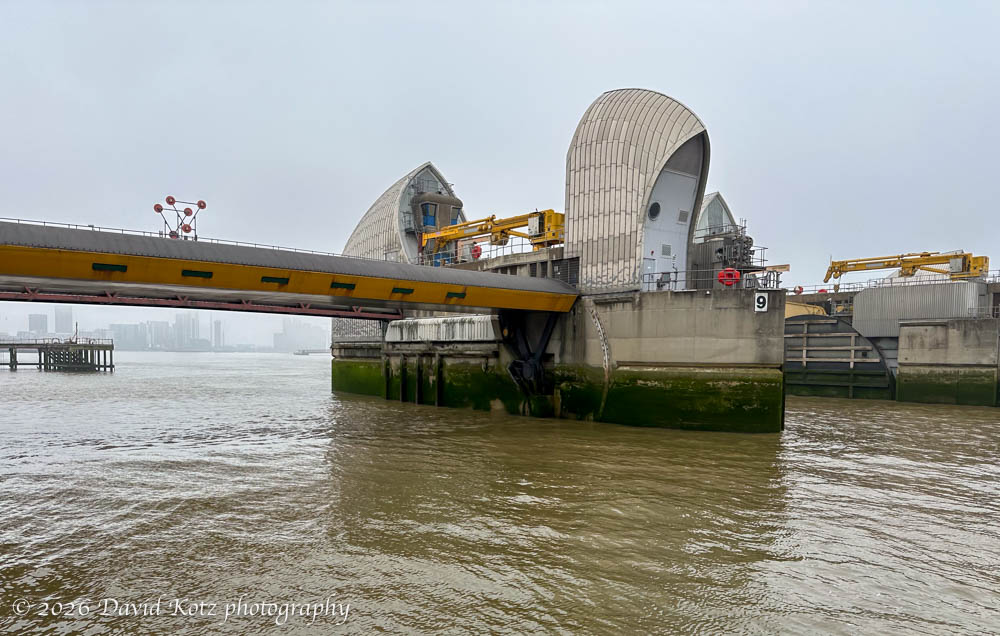
Perhaps the most interesting point along the route, at least to me, was a visit to the Thames Barrier. An incredible piece of engineering, this barrier protects London from dangerously high tides and storm surges, reducing the potential for catastrophic flooding upstream. “It has been operational since 1982. When needed, it is closed (raised) during high tide; at low tide, it can be opened to restore the river’s flow towards the sea. … The planners assessed that in the absence of a barrier, such a surge could inundate 45 square miles (117 sq.km) of land, [and] put hospitals, power stations and the London Underground out of action…” [Wikipedia].
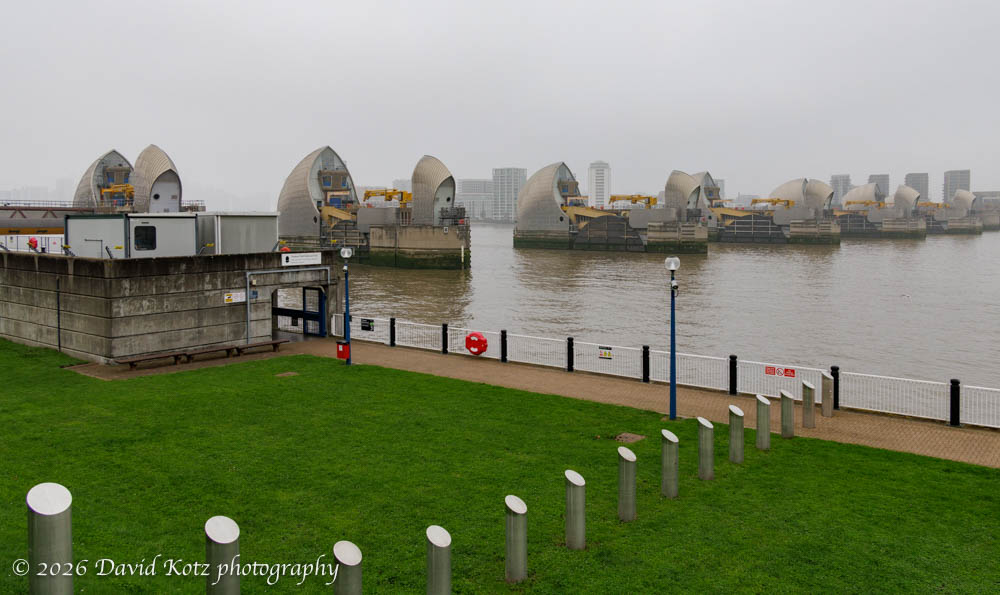
Where I visited it is possible to walk the shoreline to a point nearly adjacent to the south end of the barrier. (Following the tan walkway seen above, into the concrete tunnel.) From there, I could see the nearest barrier segment was raised above water, perhaps for maintenance. The others were hidden below water, parallel to the riverbed, allowing normal river flow and boat passage. Fascinating engineering!
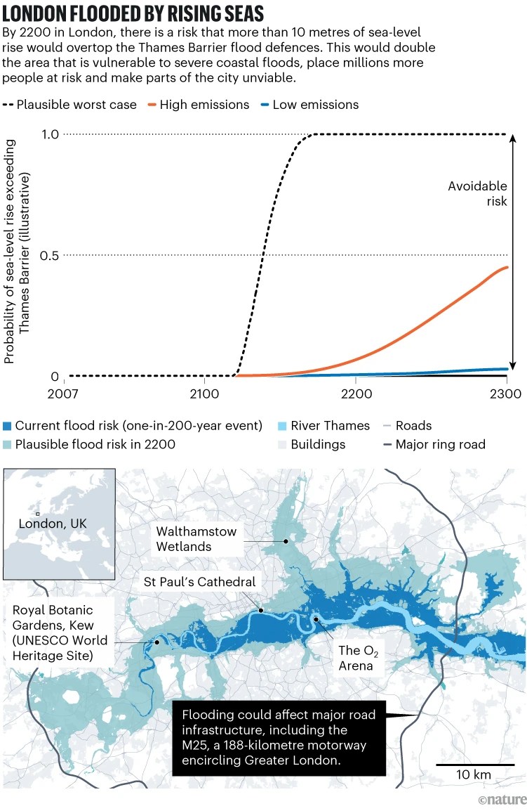
Coincidentally, this morning I read a Nature article, We need a global assessment of avoidable climate-change risks. Although describing the global situation, its first example highlights the potential impact of sea-level rise on London and includes a photograph of the Thames Barrier. The flood map (below) is sobering. Clearly, the Thames Barrier will need to be replaced with something far more aggressive.
doi: https://doi.org/10.1038/d41586-026-00544-6
The Thames Barrier is the downstream terminus of the Thames Path, a 185-mile walking path from the source of the Thames in the Cotswalds, through rural towns and villages, through London, and ending here. Something else to try, on a future hike!
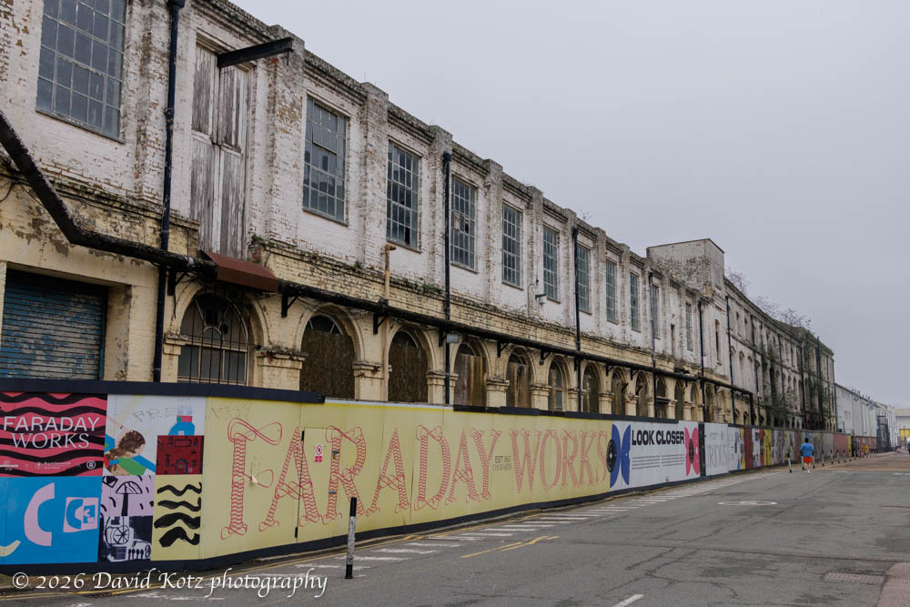
As I left the river I walked through an old industrial area, filled with decaying buildings. Some have been loosely refurbished to house art studios and fitness gyms. One, abandoned and shuttered, is clearly a target for future renewal: Faraday Works. The fence signage explained the fascinating history of this factory. Founded by the Siemens brothers, whose mentor was none other than Michael Faraday (who discovered the principles of electro-magnetism), this is where the first practical dynamos were developed and produced. They also produced and deployed telecom cables. Using their own custom cable-laying ship, the Faraday, they laid the first undersea transatlantic cables from the UK to the US – to New Hampshire, no less! Read the signs starting here.
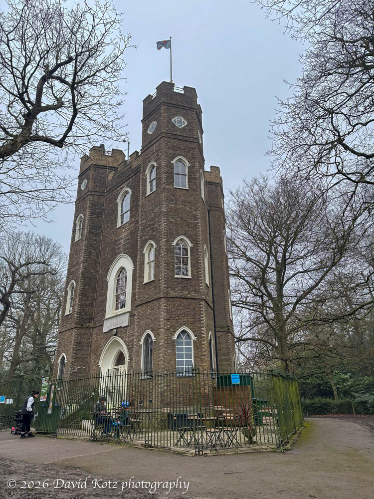
Despite the interesting history and engineering along the river, I was glad the route turned inland and began to wind its way through parks and forests. Several varieties of trees have begun to blossom, bringing a bit of color and cheer to an otherwise gray day. The route crossed parks filled with children playing, through green forests filled with daffodil blooms and chirping birds, and past an odd, triangular castle.
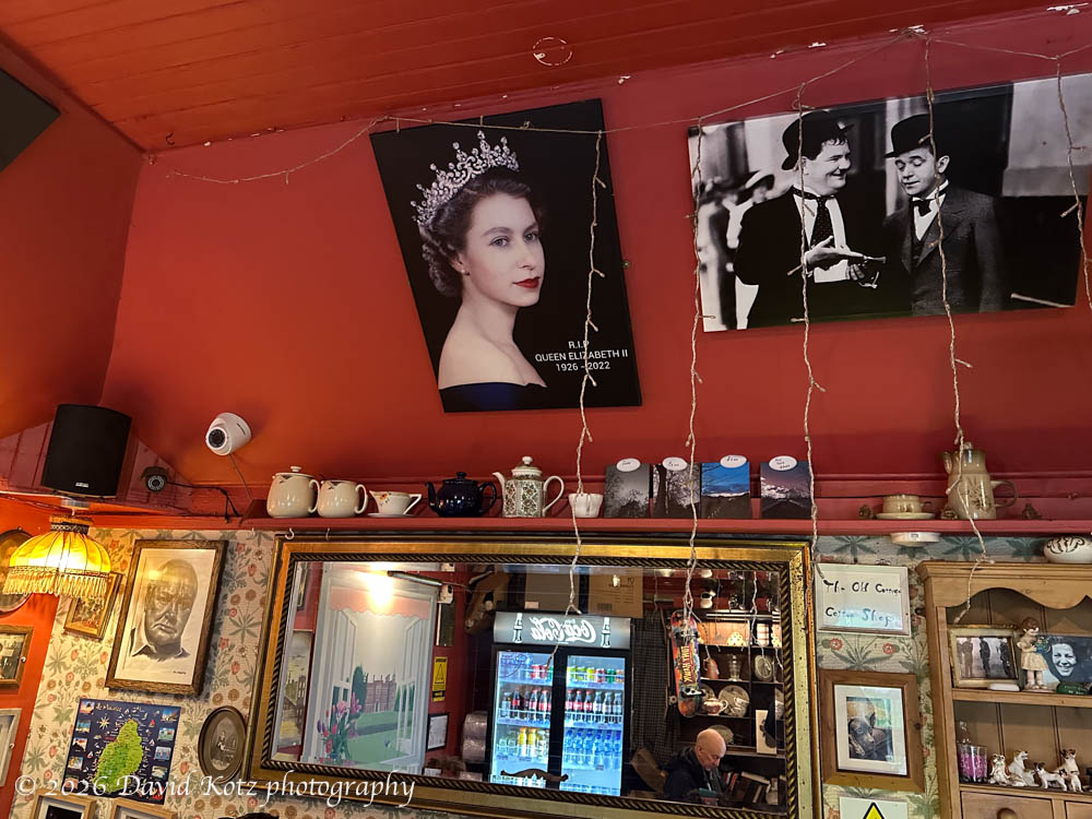
I enjoyed a cup of hot chocolate at a tiny but charming café, run by a Japanese family, in one Charlton park. Its walls and ceilings were filled with curios.
I heard the chatter of parakeets as I passed through Oxleas Wood, and looked up to see two parakeets busy demonstrating the principles of “the birds and the bees”.

All in all, a worthy outing for a foggy, grey day! Check out the gallery for more photos and signage explaining these sights.
Hike stats:
24th consecutive weekend hike
Distance: 8 miles (12.9km)
Gain: 422 feet (129m)
Time: 3h10m
GaiaGPS track