
Some of my friends have, for several years, been interested in locating a long-lost trail on Mount Moosilauke, one dating back to 1880… and that allegedly led down from the summit to a ledge overlooking Jobildunc Ravine, with a fine view of its watery cascades. With the thin information available in old documents and oral histories, we first tried to find the viewpoint – which supposedly had an iron railing to protect guests from the steep cliffs below – in June 2022. Today, after some in our group had carefully studied recent maps (satellite images, aerial photographs, and LIDAR scans), we set out again. It was a glorious fall day to bash about in the woods. Did we find it? Read on!
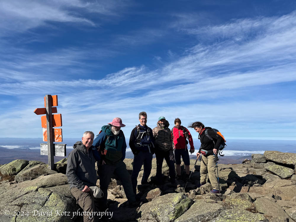
We climbed to the summit of Mount Moosilauke via the Gorge Book Trail. On a day like this, with clear blue skies and warm sunshine, it would have been foolish to skip a visit to one of the best mountain views in New Hampshire! Indeed, we enjoyed the panoramic views into Vermont and across the shoulders of Moosilauke to the Franconia Range and Presidential Range of NH’s White Mountains. Snow was visible on Mount Washington’s massive summit, but here on Moosilauke we saw only patchy snow, melting quickly in today’s unusually warm temperatures.

and (with snow) Mount Washington.

We headed down from the summit and followed the former Ridge Trail –relocated in the 1990s and now quite difficult to follow in its upper reaches. Still, the terrain is beautiful, with a spongy carpet of moss underlaying the short (but dense) fir trees. As we descended, with scattered patches of snow resting on the still-visible treadway of the old trail, we encountered a footprint. A human footprint! From the clues, it appears that two hikers had ascended this trail yesterday, much to our surprise. I assumed this trail was rarely used.
The trail and its surroundings opened up as we descended, and soon we decided it was time to leave the trail and dive into the forest, descending toward the infamous headwall of Jobildunc Ravine. This wet, remote, trailless ravine plunges deeply below the Ridge Trail, squeezed between two shoulders of Moosilauke (East Peak and Mount Blue). We aimed to find a rocky outcrop that might reveal that century-old viewpoint and, if we were really lucky, evidence of a long-lost iron railing.
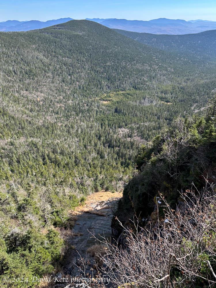
from an outlook at the top of the headwall.
We were aware of contemporaneous accounts, like this snippet from the White Mountain Echo in 1887:
An iron railing has been erected in the Jobildunk Ravine, Mt. Moosilauke, by Prof. Cook, of Dartmouth College. The grandeur of the cascades can now be viewed from the most precipitous rocks in perfect safety.
An oral history from Moosilauke local William Morse, recorded by Bob Averill ’72 in his book A Mix of Years, tells a story from Morse’s early years living on the summit in the 1910s:
While opening [an old trail] that led to Jobildunk Ravine, my dog, who was running ahead of me, suddenly disappeared into thin air! He had gone over the head wall which is practically a sheer drop of over 150 feet. It is another drop of about 300 feet to the floor of the ravine, and I figured that Ted was a goner until I heard him bark. Fortunately, he had landed on a small ledge that protruded in from the side about halfway down. With the aid of my firewood rope I was able to reach him, and found him bruised but unharmed. The only direction we could go to get out of there was up, and we had to fight and claw our way back to the top. I later learned that sometime in the past a lookout with an iron railing had been built there. The old abandoned trail that I had been re-opening once led to it. I found two pieces of the iron railing that had been driven into the ledge, and I suppose they are still there.
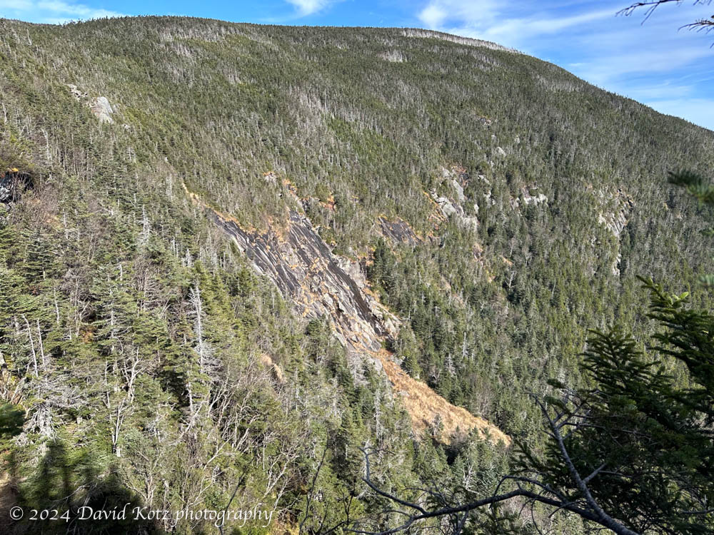
Aware of this century-old story, today we gingerly approached the edge of the headwall, pushing through stiff fir branches while also ensuring we did not take a step off the edge of the cliff. The trees are so dense, here, that one can be five feet from the edge and not see it. We skirted along the edge of the headwall, and found three or four fine viewpoints, but all smaller and narrower than what we expected. No railings. The rocks were so covered with moss and fir trees that, if there were any rusty holes left where a railing once stood, it would be impossible to find them.
After enjoying the view and a quick lunch, we contoured our way back south until we met the Gorge Brook trail. Along this route we encountered both moose poop and coyote scat, reminders of the true residents of this mountain.
A wonderful outing! leaving the mystery unsolved, to explore another day. More photos in the gallery!
Hike stats:
Distance: 7.71 miles (12.41km)
Time: 6h49
Gain: 2,504′ (763m)

Woohoo! Sounds like a fine, enviable day out. Thanks for bringing us along with your narrative!