A rugged hike to an isolated member of the NH four-thousand-foot mountains, on a smoky, foggy day.
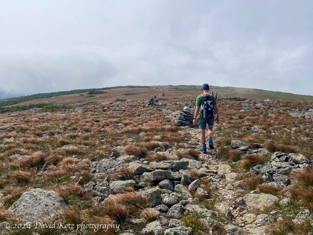
It seemed odd to climb to an elevation of over 5,200′ in search of a mountain whose elevation is only 4,003′ (1220m), just barely earning it membership in the White Mountains’ fabled set of “four thousand footers.” But Mount Isolation, our diminutive goal for the day, is, well, isolated. There are no direct routes to its summit, a slight prominence along the lengthy Montalban Ridge sloping southeast from the shoulder of Mount Washington. But as we climbed above treeline into the extended alpine landscape surrounding Mount Washington, we were glad to have chosen this route. Read on, and check out the gallery!
An hour wading among wildflowers on a summer morning.
A meadow near our home has been planted with wildflowers, bringing smiles to everyone who rides or drives by. One foggy morning I spent a happy hour collecting photographs as the sun rose and started to burn off the fog. Check out the full photo gallery!
Wildflowers along River Road in Lyme.
Many thanks to the Upper Valley Land Trust (UVLT) for conserving this former farm field, and to the landowners for planting beautiful wildflowers!
All images shot with Canon R5 with the RF 100-500 lens.
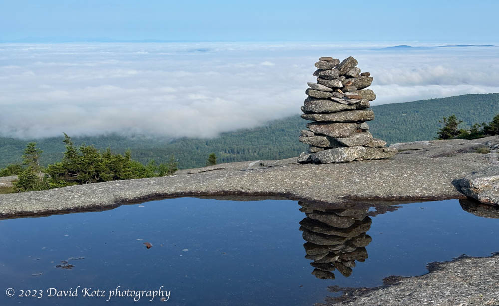
Mount Cardigan is one of my local go-to mountains when I want to get up and out, without a long drive. It is extremely popular because it is a relatively short hike and offers a bare granite summit with long views in all directions. I tend to go early, to beat the crowds, but that was especially important today… at 7am the temperature was already in the high 60s and extremely humid, with thunderstorms possible in late morning and afternoon. Read on!
A rainpuddle and cairn on the summit of Mount Cardigan. Fog swallows Hanover and Lyme and other villages of the Connecticut River Valley.Continue reading “Cardigan”
The weather this week has been startlingly warm, almost as if summer has lasted into November. Yesterday’s high temperature here at home was 71ºF! It may have been the last ‘summer’ weather of the year – and also the last day before deer-hunting season fully opens – so I was eager to get out for a hike. I try to hike on weekdays to avoid the weekend crowds.
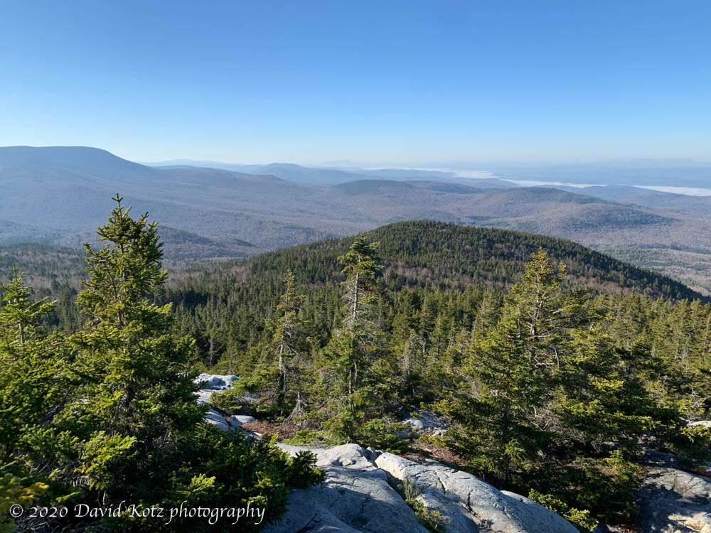
Despite a dense fog clinging to the Connecticut River in the early morning, I hopped into the Tesla for an all-electric drive to one of my favorite trailheads – the Rivendell Trail up Mount Cube, only 30 minutes away. I’ve been up this two-mile route many times, because it gives one all the features of a “real mountain climb” without the temporal overhead of a long drive or a long hike… a stroll through leafy hardwood forests, a scramble up rugged rock-strewn trails, the pungent scent of balsam firs, and distant views from its granite outcrops and 2900′ summit. In the view below, from the summit you can see the foggy Connecticut River valley in the upper right and Smarts Mountain at upper left.
Seen from Mount Cube.
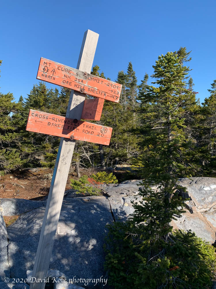
Sadly, the summit has poor views to the northeast, but if you stand on tippy-toes and peer between the firs you can pick out Mount Moosilauke. No photos worth taking, so here’s the summit trail sign, where the Appalachian Trail passes by.