It snowed yesterday – just a couple of inches – and today broke sunny and clear. So I met a few friends for a climb of Blueberry Mountain, a small peak just to the west of Mount Moosilauke. It’s not tall, or with a grand summit, nor does it have expansive views, but it’s a fine place to be on a sunny winter’s day.
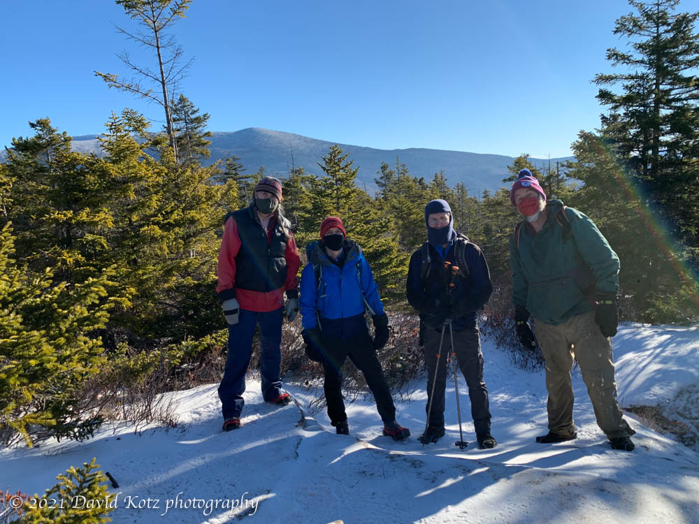
The sun bursts through the snowy forest.Ken, David, Kathy, and Dave on summit of Blueberry Mountain.
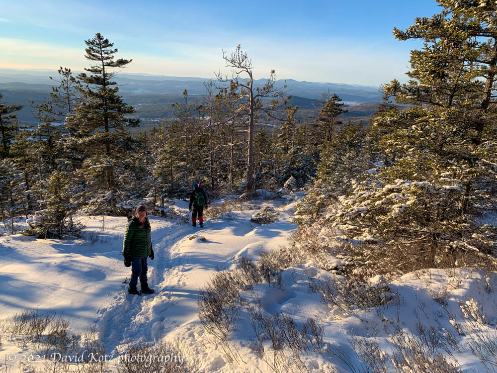
Tim, David, and Kathy, on a hike to Blueberry Mountain.
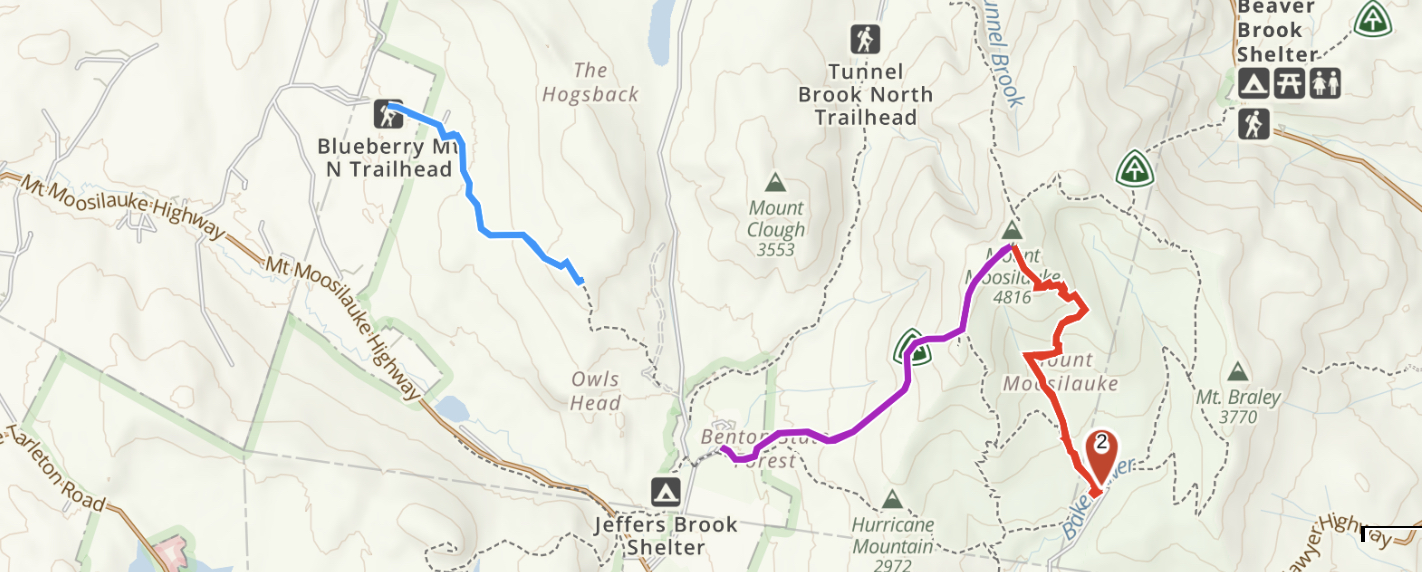
It has long been a tradition for my Dartmouth friends and me to hike a mountain on New Year’s Day. Today we were fortunate to have outstanding weather: a blue-sky day with moderate temperatures (20-30º), and a fresh (though thin) layer of powder snow at higher elevations. We had eyes for Moosilauke – our traditional destination for New Years – but with weather this nice, we anticipated huge crowds. Instead we headed for Blueberry Mountain, a pretty little (2,663′) bump to the southwest of Mount Moosilauke.
I’d been up here once before, but from the east, and today we came up from the west. The west is a longer approach, but a pretty trail nonetheless. We were the first to travel this trail since the snowfall a few days ago. To be more precise, we were the first humans on the trail since the snowfall – we were following a coyote’s tracks for most of the way up! Indeed, the coyote often provided clues about the route when the trailbed was not so clear.
The view from the summit is partly obscured by trees, but Moosilauke was visible and delightfully clear from this close. It must have been a grand day up there! In the photo below, the south peak is most visible.
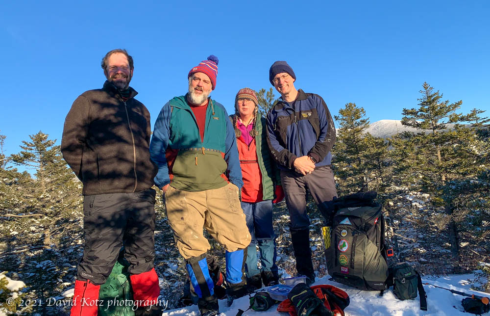
On the summit of Blueberry Mountain: Kathy, Tim, David, David.
The sign at the trailhead advertised 2.2 miles, but my GPS track shows we walked 8.52km round-trip (5.3 miles, or 2.65 mi each way). Two smartwatches also indicated a distance closer to 2.7 miles for the ascent.
A fresh dusting of snow decorate the trail near the summit of Blueberry Mountain on New Years’ Day.