Today was a glorious day – one of those blue-sky days that makes you amazed to be part of this world, especially when you are strolling above treeline along one of the most incredible mountain ranges in the northeastern United States. Three friends and I took advantage of the Memorial Day holiday to head for the Presidential Range of the White Mountains here in New Hampshire. Centered on Mount Washington, the highest peak in the northeast, most of the peaks in this range are named for U.S. Presidents and nearly the entire range is above treeline.
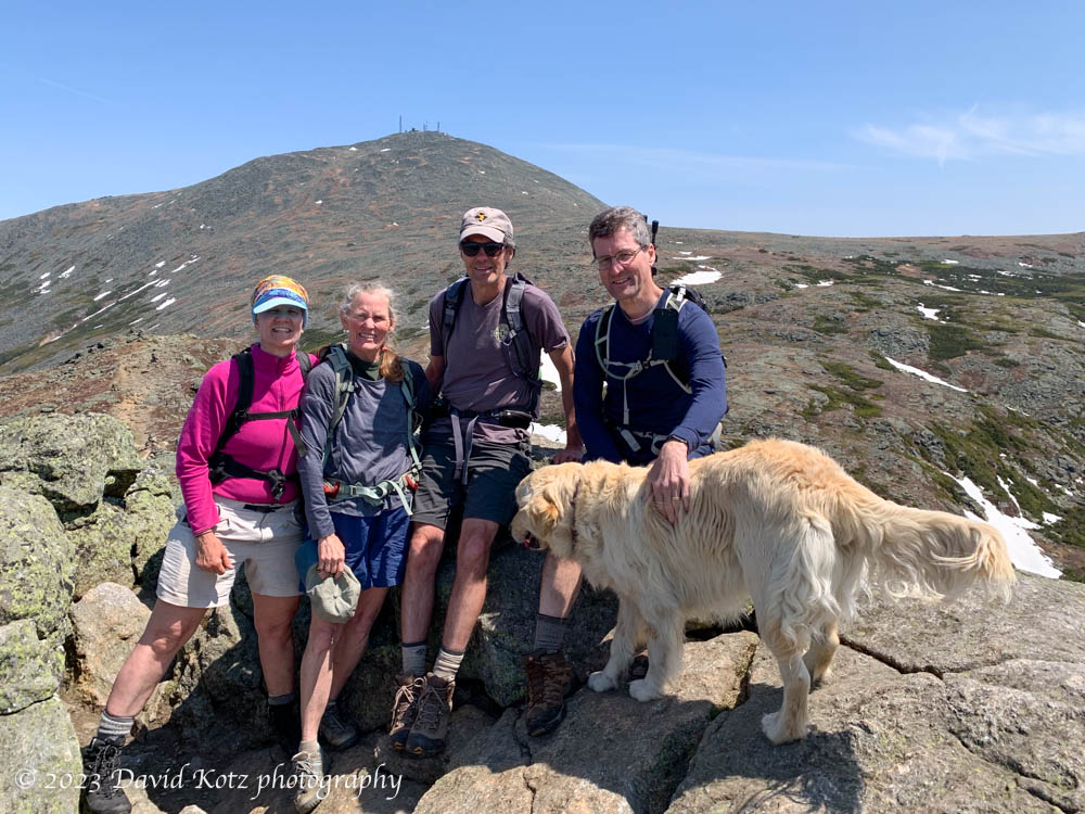
Today, we left one car near the western base of Mount Washington, hiked up the Ammonoosuc Ravine Trail to Lakes of the Clouds, where there is an AMC Hut, then followed the ridgeline south over Mounts Monroe, Eisenhower, and Pierce, before descending the Crawford Path to our second car in Crawford Notch. We were ably led throughout by the indomitable Karhu, who had a knack for sniffing out the right the trail and pausing whenever he reached a trail junction. We often stopped to enjoy the sunshine and nibble a snack.
We had spectacular views and occasionally crossed some of the winter’s remaining patches of snow! Check out the full photo gallery to share the views.
Continue reading “Southern Presies”