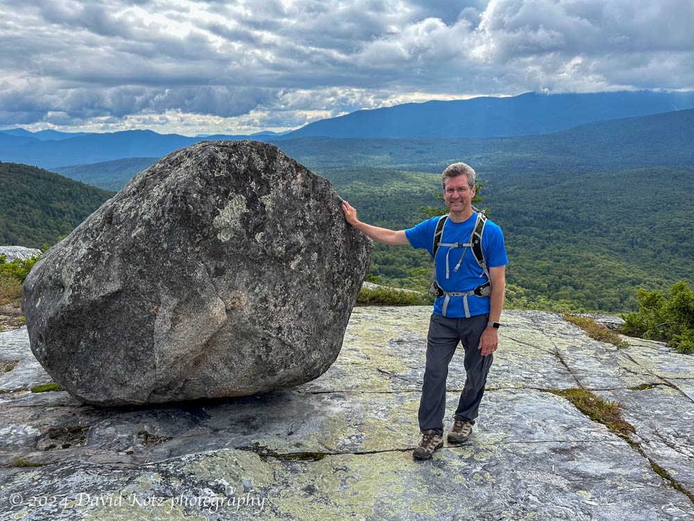
After the passage of Tropical Storm Debby (which fortunately only brought us a few hours of heavy rain), the weather turned sunny and dry. Perfect for a hike! I selected Black Mountain, one of my favorite go-to hikes, to share with a friend who is still discovering the many hiking opportunities of the Upper Valley and New Hampshire. Although the sky was partly cloudy, Black Mountain’s relatively low elevation allowed us outstanding views across the Upper Valley (to the west) and into the White Mountains (to the east). And I re-discovered the “tipping rock” I’d seen on my first visit here in October 2010 (10/10/10). Check out the gallery!
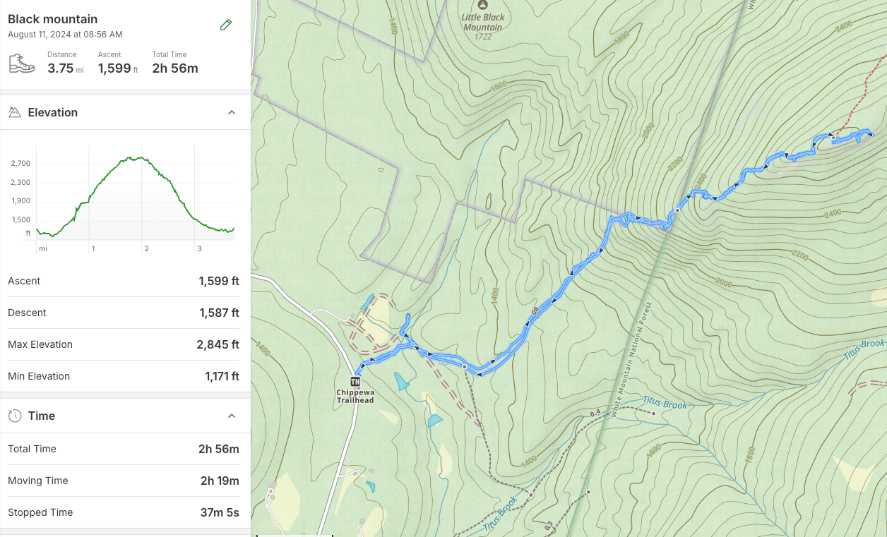
Hike stats:
Distance: 3.75mi (6.0 km), including a side trip to the historic Lime Kiln.
Time: 2h56 (including a long rest on the summit)
Elevation gain: 1,599′ (487m)
on the way out, we made a side-trip to the Lime Kiln on the dirt road