
After two days in Perth and Rottnest Island, we hired a car and headed south for a quick, three-day triangular route along the western coast, through the forests of the southern coast, and back across the inland plains and their vast pastures and fields of grain. In this blog post, I’ll write an even quicker summary of our tour of this beautiful corner of Australia. Read on!
Fortunately, it was early on Sunday morning and the traffic was light as we nervously navigated our hired car through the streets and onto the freeway southward, inwardly chanting “drive on the left, drive on the left….” (I found the right turns to be especially scary, and avoided them at all cost.) The four-lane freeway was an easy cruise for the first hour; later we would discover that roads with names like the “Great Western Highway” or “Great Southern Highway” might sometimes refer to a narrow, curvy, two-lane road with no shoulders and a 100kph speed limit, with massive double-length trucks (“road trains”) zipping by in the opposite direction.
The scenery was as beautiful as it was varied… sometimes passing through a narrow canyon of eucalyptus trees, and other times rolling through vast, open farmland. I was excited saw a total of four kangaroos beside the road. Two were a great distance away, grazing in a pasture. The other two, on the other hand, were roadkill on the shoulder. 😦 I resolved to be extra vigilant.
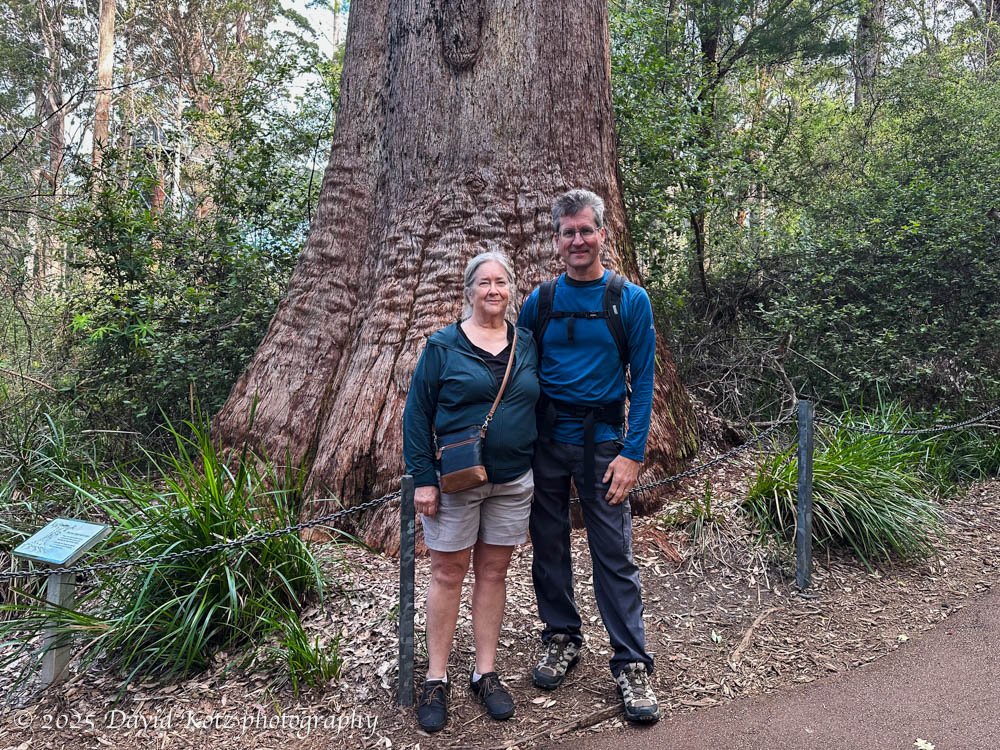
Soon enough we were in wine country, the famed Margaret River region. We drove up and down Caves Road, a scenic byway that snakes by vast vineyards and green forests. We stopped in at two wineries for a curated wine tasting, and then took the self-guided underground tour of Mammoth Cave, marveling at its spectacular stalactites and stalagmites.

Realizing we were close to the shore, we drove out to Redgate Beach to stroll the sand along the Indian Ocean. It turns out to be popular with surfers, as are many of the beaches along this coastline, and we spent some time watching them try to catch some waves.

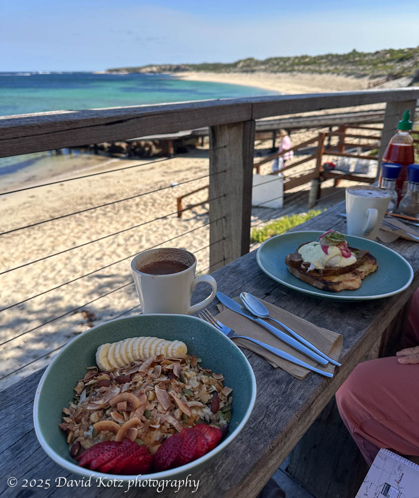
After a night in the village of Margaret River, we returned to the shore for breakfast at a lovely seaside cafe on Gnarbup beach. It was a beautiful day, the water was crystal clear, and the early-morning crowd was out for a swim. I realized I had never swum in the Indian Ocean before, so I donned my suit and went in for a dip. Chilly! but lovely.
Heading south again, we soon arrived at Cape Leeuwen, the pointy tip where the west coast ends and the southern coast heads eastward – and, according to a signpost, the point where the Indian Ocean meets the Southern Ocean. The gatekeeper chatted me up as I purchased our tickets to enter this historic site – a site of many shipwrecks, and the tallest lighthouse on the Australian mainland. When he learned I was from the United States, he dug in his file drawer and pulled out a copy of a twenty-seven-year-old article from the Washington Post, telling me that it was written by a reporter who discovered that a small rock offshore from this cape is the antipode of Washington, D.C. … and decided to go there. It’s a fun read!
We turned east and followed the narrow, curving ‘highway’ that follows the southern coast. Our target was the Tree Top Walk Motel in the tiny town of Walpole. It is so named because it is near the area’s major attraction, a pedestrian bridge 40m in the air among massively tall tingle trees, allowing one to walk in the canopy of this impressive forest. The motel is run by a friendly Indian family and includes a full-service Indian restaurant. (Wow! what a wonderful opportunity for us to enjoy some Indian food while in Australia.)
The Tree Top Walk is as described – a beautiful walk through the canopy of a forest of tingle trees (Eucalyptus jacksonii), although I admit I felt a tingle of vertigo walking on narrow aluminum pathways 40m above the forest floor! These amazing trees can grow 70m tall and over 400 years old.

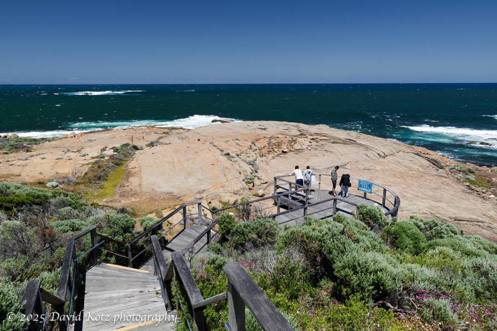
The next morning, after I took a quick dip at Coalmine Beach (much more beautiful than it sounds!) – so I could say I had also swum in the Southern Ocean – we continued east along the coast. We stopped at the aptly-named Peaceful Bay for breakfast in a tiny cafe, then onward to a better-known place called Greens Pool. It’s a tiny inlet where the shallow, clear ocean water is protected from the ocean surf by a circle of rocks, offering a white-sand beach and plentiful opportunity for children to swim and snorkelers to explore the tiny sea life that surround some of the rocks. I stuck my phone down into one of the tidepools, unsure what I might find; be sure to watch the resulting !

I’ve assembled a small gallery with just a few highlights of these three days. (See it in slideshow mode.)
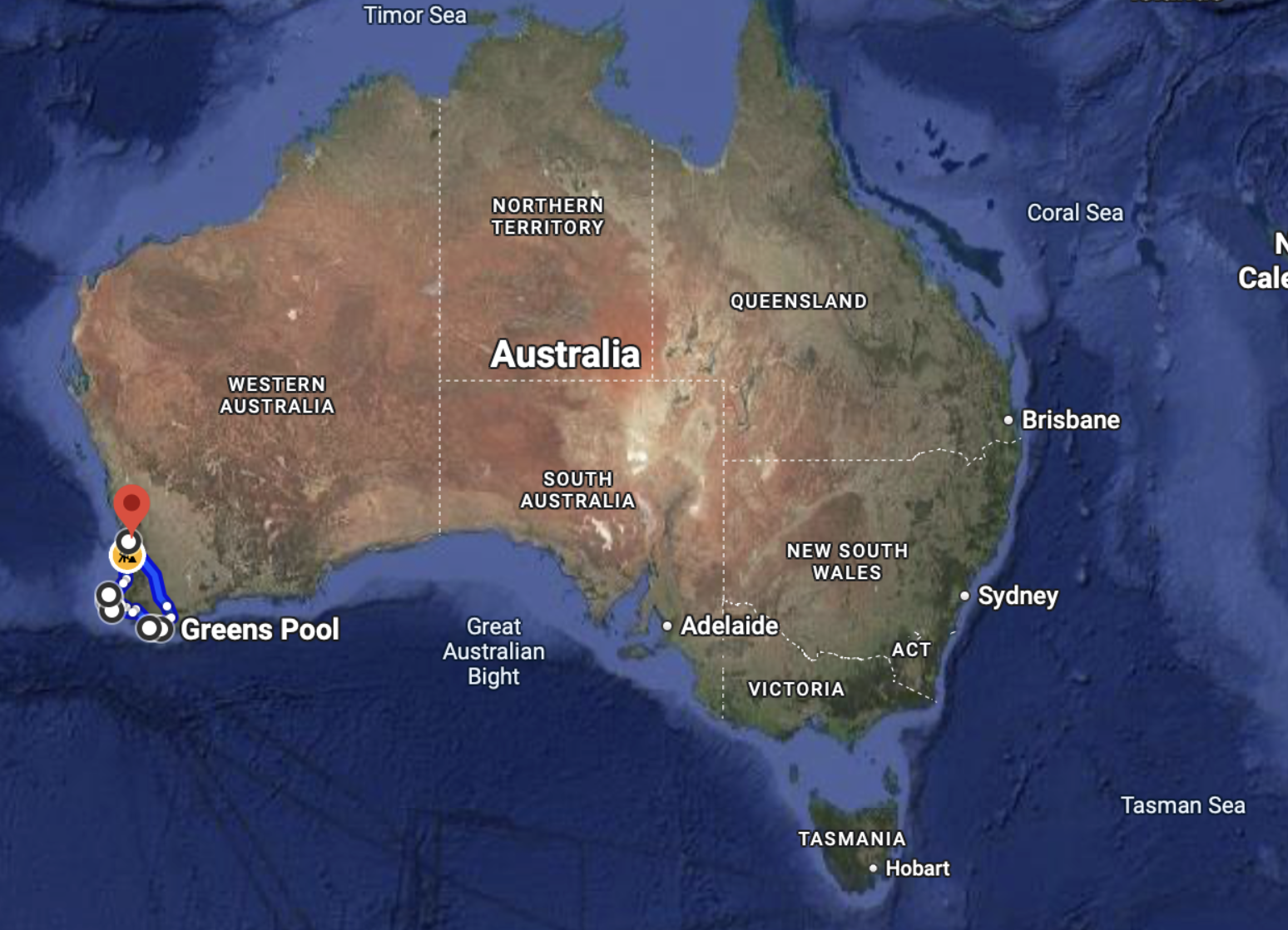
Everywhere we went, the locals were friendly and welcoming. The maps below show our route, counter-clockwise from Perth, south along the west coast to the point where the Indian Ocean and the Southern Ocean meet at Cape Leeuwen, then east along the south coast a little, then back to Perth.
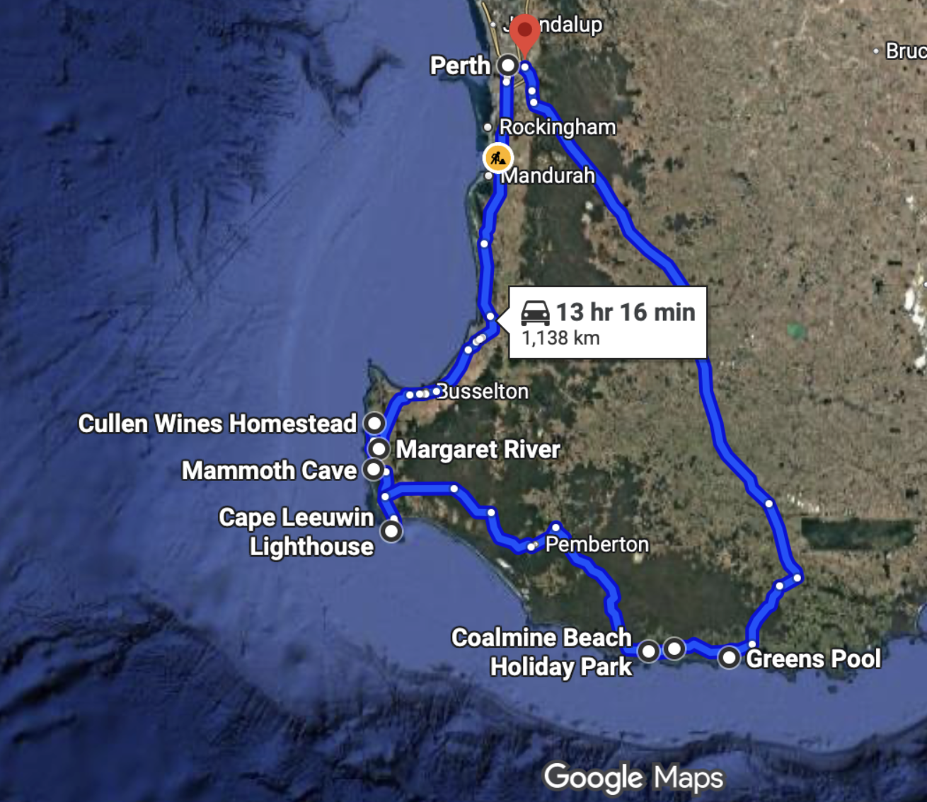
We put over 1,200km on the rental car, but we barely scratched the surface of this massive island:
It’s easy to forget how big Australia is… for reference, here’s Australia superimposed on a map of North America (from thetruesize.com).


Dang are you stirring up a powerful wanderlust! You seem to be hitting all the places on my never-ending wish list. At least, with your photos and lovely narrative, I’m getting a ton of vicarious satisfaction. (May I suggest Albania as your next trip? That’s pretty high on my improbable destinations list.)
good suggestion! However, I just landed in New Zealand… so Albania will have to wait.