
Recent trips to the Antarctic [South Georgia, 2023] and the Arctic [Finland, 2024] whet my appetite for exploring further in the polar regions, so I jumped at the chance to cruise southern Greenland in late summer. Indeed, because this cruise began and ended in Iceland, it gave me a chance to expand on my prior visit to Iceland [2024] to explore its southeast coast. Finally, this cruise was aboard the National Geographic Endurance, the same ship we’d sailed on our cruise of South Georgia and the Falklands in 2023, and which I found to be a terrific experience. Read on!
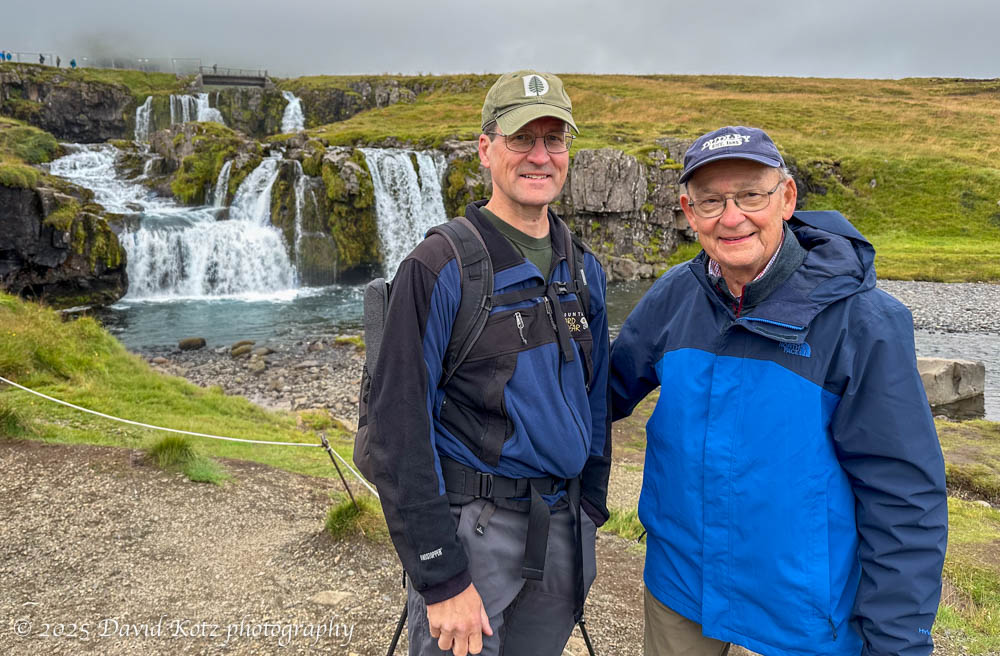
For this trip we met in Reykjavik, capital of Iceland, to board late one sunny afternoon. I had arrived two nights earlier, and my father one night earlier, to protect against any unexpected travel delays. (Good thing, too, because dad’s luggage was offloaded in Newark and caught up to him on the ship about 34 hours later, just before we sailed!) As we cruised off into the sunset, heading west along the coast of Iceland, we spotted an incredible group of whales – a pod of minke whales, and a bubble-feeding humpback whale. (The ship’s crew and expedition staff are always on lookout for interesting wildlife and will pause or divert the ship to avoid disturbing the whales and to allow us time to enjoy them.) More on the whales in a later post!

The next morning we docked at the small town of Grundarfjörur on Iceland’s Snæfellnes Peninsula, where we spent the morning exploring the Kirkjufellfoss waterfall. I’ll write more about this waterfall in a separate round of posts about the Iceland portion of my travels.
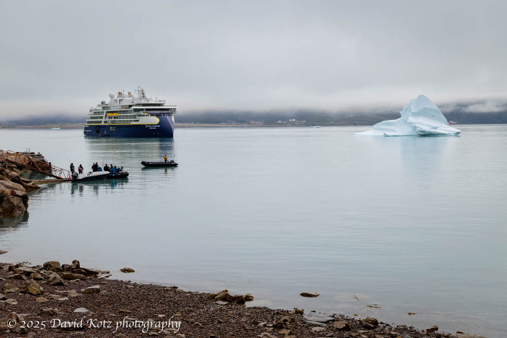
From there, our route crossed the Denmark Strait from Iceland to Greenland – a whole day and two nights at sea, a crossing that is notoriously rough… but for us turned out to be pleasantly mild. On arrival in Greenland, we spent several days dotting in and out of fjords along the southeast and southwest coastline, with opportunities for hikes onshore, visits to small towns and villages, explorations of historic ruins, and boating among the ice emerging from tidal glaciers. I’ll highlight those activities in future posts!

PS. Since we’re looking at maps, it’s important to note that most of us are used to seeing a Mercator projection of the world map, which massively distorts lands near the poles. Greenland is very big, to be sure – the world’s biggest island – but not nearly as big as it seems on a Mercator map. There’s a cool website called thetruesize.com that allows you to drag a country to different places on the world map, and it will shrink (or expand) to its ‘true’ size in relation to that position on the world. Below, I’ve dragged Greenland over the eastern United States. Imagine the climate difference between Montreal and Miami, and you can begin to sense the difference between northern and southern Greenland. Our cruise explored the southern tip of Greenland – it’s as if we cruised the US coast of Florida, but never sailed further north. As far as Greenland goes, we’ve just seen the tip of the iceberg.

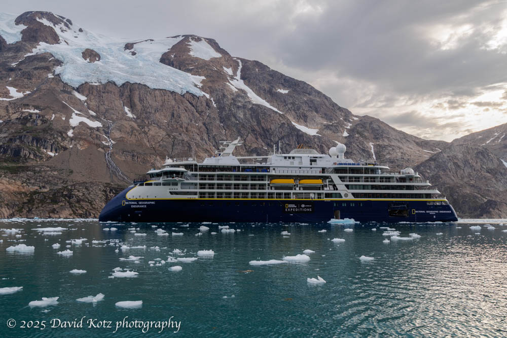
The National Geographic Endurance
These Lindblad National Geographic Expeditions, especially those in remote locations like Greenland or South Georgia, tend to attract an adventurous, curious band of passengers – people who enjoy discovery, learning, and exploration. People who are willing to hop off a Zodiac into the surf along a beach full of penguins or icebergs, with guides who explain that NatGeo has never been to this location before, and begin their visit with an explorer’s mindset. People who gratefully settle in for an hour-long lecture on oceanography, marine ecology, arctic archaeology, indigenous culture, exploration history, or postcolonial politics – by onboard experts who join the passengers in casual conversation during meals or outings on shore. An expedition staff that leads with curiosity and excitement, that manages a flexible schedule, adapting in real time to the opportunities and challenges of location and weather, and with an attention to detail that ensures everyone is prepared and informed every day. My kind of travel!
The National Geographic Endurance is one of Lindblad’s newest ships (sister to the identical National Geographic Resolution, on which we sailed last fall [Japan, 2024]), and is purpose-built for expedition travel in the Arctic and Antarctic. With only 100-120 passengers, 14 expedition staff & experts, and 100 crew, and with spacious cabins and public spaces, this small ship allows a sense of community to form during a ten-day cruise. [See more about this beautiful ship in my 2023 post.] The food is fantastic; a different menu for lunch and dinner every day, with interesting food (often using locally sourced ingredients), beautifully plated. Each night a small group of 12-14 passengers are invited to Charlie Green’s Table for an elaborate tasting menu with eight innovative dishes as beautiful as they are tasty and creative; see my photos from this year’s menu.

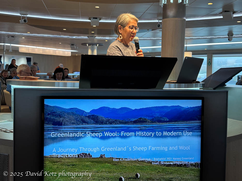
The 14 staff include several naturalists, an arctic archaeologist, two marine biologists (divers), a National Geographic Photographer, and a professional photo instructor. And, two Greenlanders – an Inuk cultural ambassador, and a businesswoman born in Iceland but descended from Greenlandic grandparents and whose career includes service as an elected council member in the capital city of Nuuk. And, two scientists – Chilean oceanographers who were taking measurements in each of the fjords we visited, for comparison with their work in the fjords of Chile. Nearly all of these staff and guests gave a lecture (or two), sharing their expertise and helping to interpret each day’s experiences. As an academic, I enjoy this opportunity to pair incredible travel experiences with expert insights, deepening my knowledge of the places we visit.
It was certainly interesting to visit at this time, in a moment of great geopolitical attention to Greenland, the largest island on the planet. Greenland is a semi-autonomous region under Danish control, with an active independence movement, a complex culture that blends 4,500 years of indigenous traditions with several hundred years of Nordic influence and colonization (some of which, for which Denmark apologized this month, had tragic consequences). During our voyage, US politics were rarely discussed overtly, but their influence was clearly shaping the way Greenlanders think about their future.

Departure (surprise… pivot… bonus!)
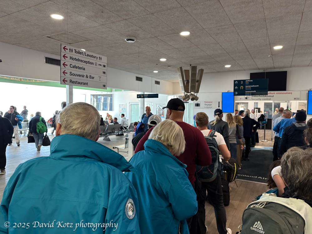
This expedition was meant to begin and end in Iceland: board the ship at the dock in Reykjavik, sail to Greenland and explore its southern regions, then disembark in Nuuk – the capital of Greenland – and fly back to Reykjavik. But, as with all expeditions, unexpected things happen.
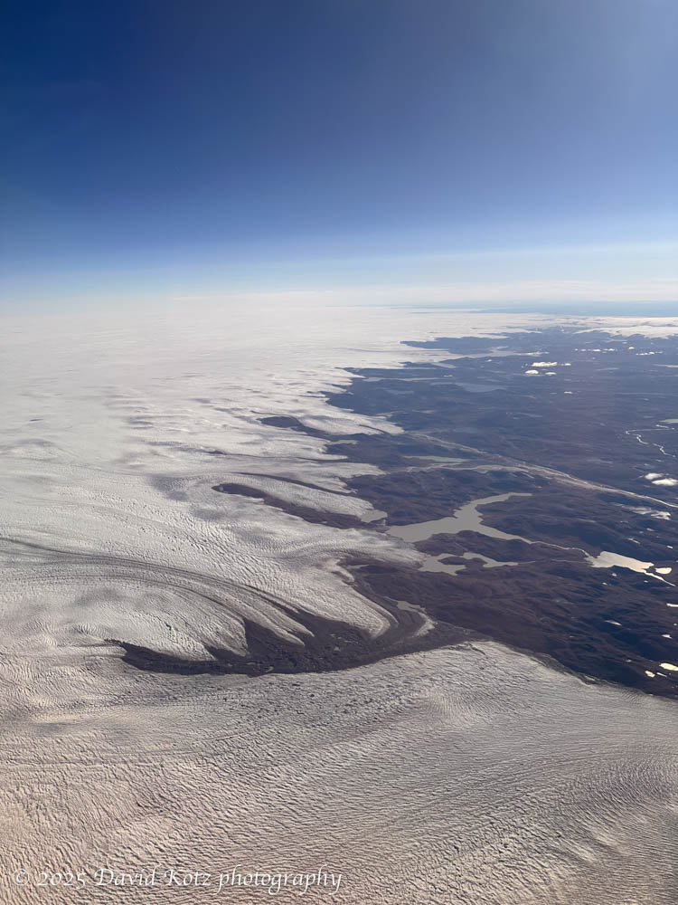
As we sailed toward Nuuk on our penultimate day, with plans to dock overnight and fly back to Iceland the next morning, the expedition team learned – just before dinner – that the Nuuk airport, only recently expanded to enable large planes and international flights, had failed a test of international security standards. International flights could land, but could not depart. United Airlines, which just last month started operating the first-ever US-Greenland commercial flights, turned its plane around in mid-air to avoid landing a plane that may be stranded for an unknown duration. NatGeo, fortunately, charters a plane for its voyages – to import the inbound passengers and supplies and to export the outgoing passengers. With literally zero notice, and over the course of dinner, the expedition team (and their crackerjack support teams in the US, Iceland, Greenland, and beyond) scrambled to develop a creative solution: we would sail right past Nuuk, out of the Nuup Kangerlua fjord, up the west coast overnight, and up the incredibly long Kangerlussuaq Fjord. At the head of that fjord is Kangerlussuaq, a small town that has served as Greenland’s international airport since the US military handed over its former airbase there. NatGeo redirected the inbound charter flight to Kangerlussuaq, so the inbound passengers and supplies could reach the ship, and we outbound passengers could fly to Iceland as planned. It all worked beautifully, and we even had great views of the ice cap as we flew over Greenland. We landed in Iceland only one or two hours after originally planned.


As a bonus, the extra night sailing off the Greenland coast brought us a special gift: the aurora borealis! The expedition team woke the ship at 1am, and we stepped out on our balcony to snap a few photos in the brisk breeze. And another bonus: as we sailed up the Kangerlussuaq fjord, we crossed north of the Arctic circle! at about 66° 34′ N. The ship blasted its horn, apparently a tradition for ships as they cross the Arctic Circle, and people snapped selfies and celebrated what, for many, was their first trip above the Arctic Circle.

Subsequent posts
Follow the “Next” links to subsequent posts about this Greenland trip, or jump directly to each of them here:
- Greenland – natural history
- Greenland – whales
- Greenland – fjords and scenery
- Greenland – glaciers & ice
- Greenland – hiking
- Greenland – historic human settlements
- Greenland – contemporary human settlements
- Greenland wrap-up, with all the photos and videos in one chronological gallery.
Finally, check out this interactive Google Map of our route, prepared by Dave Katz(!), one of the naturalists. For full-res versions of the maps and photos shown above, visit the gallery.

10 thoughts on “Greenland”