
They say the third time’s the charm. Two days ago I hiked to the summit of Sugarloaf Mountain, nestled among the rolling hills and bogs of Nash Stream Forest in northern New Hampshire. Though I had waited out the rainstorm before hiking, the low clouds clung to the nearby peaks and the summit offered limited views. Yesterday, sunny weather with cloudless skies offered better luck for our hike to Mount Magalloway, whose fire tower provides wide views into Canada, Vermont, Maine, and the northern-most tip of New Hampshire… only to be foiled by dense wildfire smoke drifting in from faraway Manitoba.
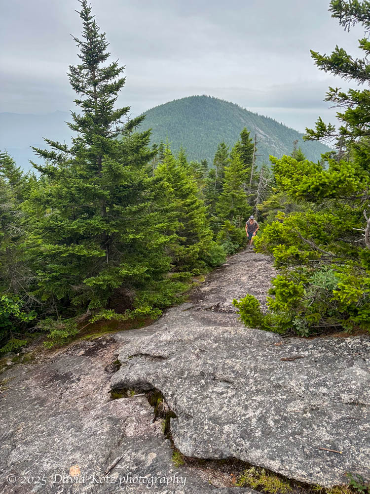
Today we struck out to climb the Percy Peaks, a pair of notable nubbins just downstream from Sugarloaf in the Nash Stream Forest. (I had a view of these paired peaks two days ago.)
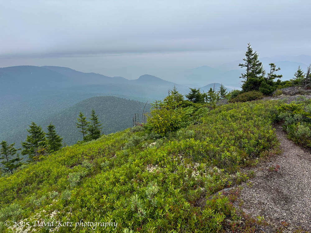
The sky was overcast and becoming darker by the minute as we climbed almost two steep, slick miles to the col between the peaks. We had chosen to skip the side trip to South Percy Peak, to save time and maintain our focus on North Percy Peak – with its taller summit, better trail, better views, and its place on the “52 with a view” list of New Hampshire peaks. As we reached the col I realized we had climbed into the low clouds, and it began to drizzle. I nonetheless pressed on toward the summit of North Percy Peak, grateful for the ability of Vibram boot soles to stick to steep granite slabs.
I spent only a few minutes on top – just enough time to don my rain gear and pull out my hiking poles for the descent. I knew those granite faces, which had been mostly dry on the ascent, were now wet by the ongoing light rain. The descent of these steep, wet slabs was going to be tricky, and the poles’ rubber tips were just what I needed to help maintain my speed and footing.

From the col, we took the Percy Loop trail around to the north. Although longer, it is far more gentle – and frankly, a downright lovely trail. It brought us back to the road, leaving us to stroll one mile down the road to our cars.
Third time’s the charm? no, not for the views. But it was a fine hike through beautiful terrain with good friends, and that’s all that matters. See the gallery for full-res copies of the above photos.
Hike stats:
Distance: 5.72 miles (9.2km)
Time: 3h24m including stops
Gain: 2,115′ (645m)


David- Krusch made the North Percy ascent just last week! Like you, he and his son skipped the South Peak. Unlike you, he had nice weather and enjoyed the panorama.
When I was a kid (11-12 years old) we ascended as a family outing. At that time, the route essentially bee-lined to the peak, I hazily recall starting from the 2400 foot contour line on your attached route map.
This meant one helluva scramble up the south side of all that visible baldness. The trail now bypasses for reasons you described re: your descent. One achieved upward progress by depending on the traction from PF Flyer or Keds high-tops. Assists consisted of grasping tufts of poorly-anchored blueberry shrubs, taking care not to lift and compromise the tenuous mossy anchor patches.
As I recall, we had two full Collies and a Standard Poodle with us. Picture assisting the dawgs whilst attempting handholds. Scritch scritch pant pant, obviating nail trims for a month.
An adjuvant reward was the small but plentiful blueberry crop up there. Krusch reported same, but sparse.
Glad to read of your northern hikes. The Kilkenny Trail folks (Kim Nilsen legacy) have recognized an un-sung alpine area.