
After two weeks of unusually hot and humid weather, a proper summer’s day finally arrived here in New Hampshire! The forecast was for clear skies and cool-to-moderate temperatures – and my morning calendar was blank – so I headed for Mount Shaw, the highest point in New Hampshire’s Lakes Region. I’d had my eye on this peak for a while, and today was a perfect day for it. I encountered nobody on my 90-minute climb to the summit – no humans, that is… but read on for my encounter with the mountain’s ursine inhabitant!
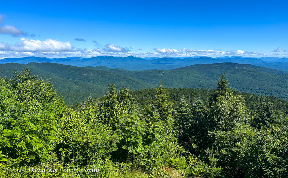
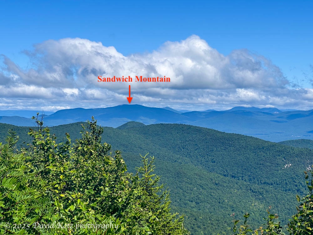
Shaw and its neighboring peaks are part of the Ossipee Range, a low-slung range of rolling peaks around 3,000′ elevation. Although not high, compared to the more famous White Mountains just to their north, they boast some fantastic views and an extensive trail network maintained by the Castle in the Clouds Conservancy. These trails and hills were once part of a private estate, and are now open to the public as a historic site and four-season recreation area. Four years ago, I visited the same trailhead to climb Mount Roberts in late winter. Last weekend, I climbed Sandwich Dome in the Sandwich Range, just across the way. Last weekend I was in the clouds, with no view. Today, I had a great view of Sandwich Dome!
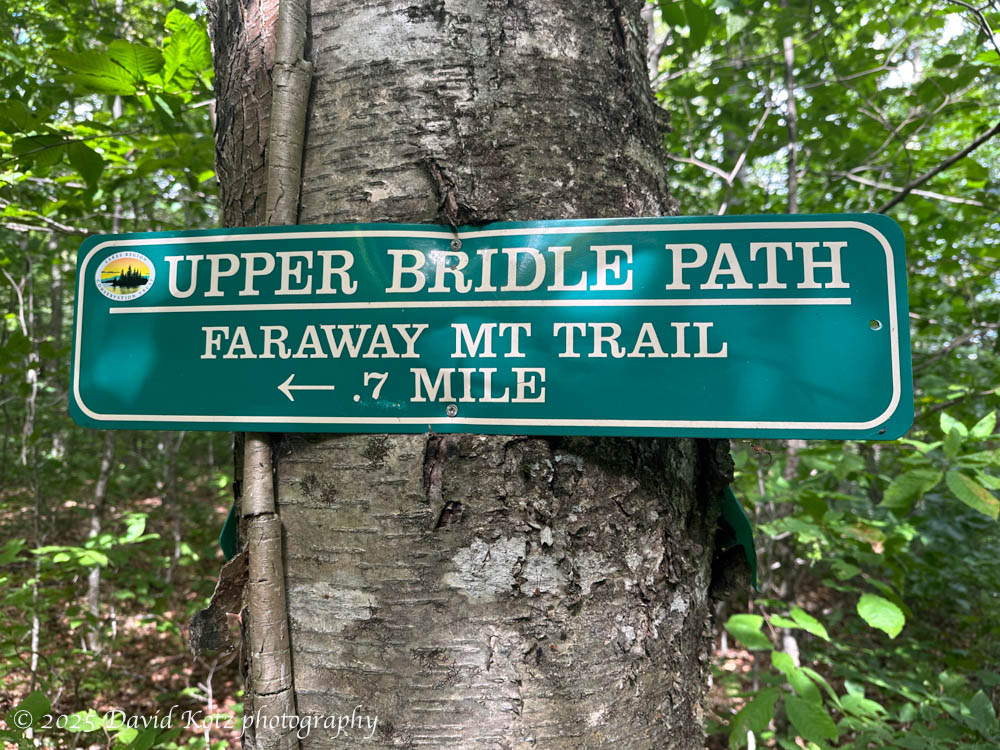
Here, many of the trails were built as carriage roads or bridle paths. Even today, they are broad and smooth, winding gently along the contours of the hillsides to reach rocky outcrops that provide views of the White Mountains to the north and Lake Winnipesaukee to the south. There are dozens of interconnected trails, with names that range from the merely descriptive (“Lower Bridle Path”) to the curious (“Black Snout Trail”) to the mysterious (“Faraway Mountain Trail”).
Along the High Ridge Trail, I was puzzled as the trail passed numerous trailside pits, dug out of the hillside decades ago. I surmised that each was a borrow pit, from which the trailbuilders ‘borrowed’ soil and rocks to construct a wider, flatter, smoother trailbed suitable for horses. Today, even in the summer greenery, I could tell these trails would make fantastic skiing. I’ll need to return in the winter!

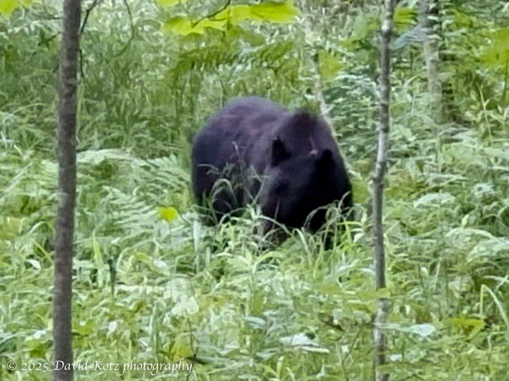
I’m glad I got an early start. Not super early – I hit the trail just after 8:30am – but as a result I saw NO other hikers until after I’d summited two peaks and was well on my way back to the base. The morning was quiet, with little breeze. About a mile into the hike I heard a twig snap, and paused my hike to look and listen. Moments later, I saw the black bear, perhaps 20-30m from me, grazing on the vegetation alongside a brook. I watched the bear for nearly five minutes, pacing quietly back and forth along the trail to get the best view. It never looked up, or even seemed to notice my presence. Check out the video!
My early start – and early summit, in just 90 minutes – encouraged me to “take the long way home”. I didn’t want to retrace my steps, not with such an extensive trail network to choose from. So I descended via the Black Snout trail (with a sidetrip to that summit), and the Turtle Mountain Trail, and over a little hump to reach my car. This route back was almost twice as long as the route I climbed to reach the summit! Check out all the photos in the gallery.
Hike stats:
Distance: 11.1 miles (3.8 miles up, 7.2 miles down) = 17.9km
Time: 4h9m (1h30m up, 2h39m down)
Gain: 1,838′ = 560m
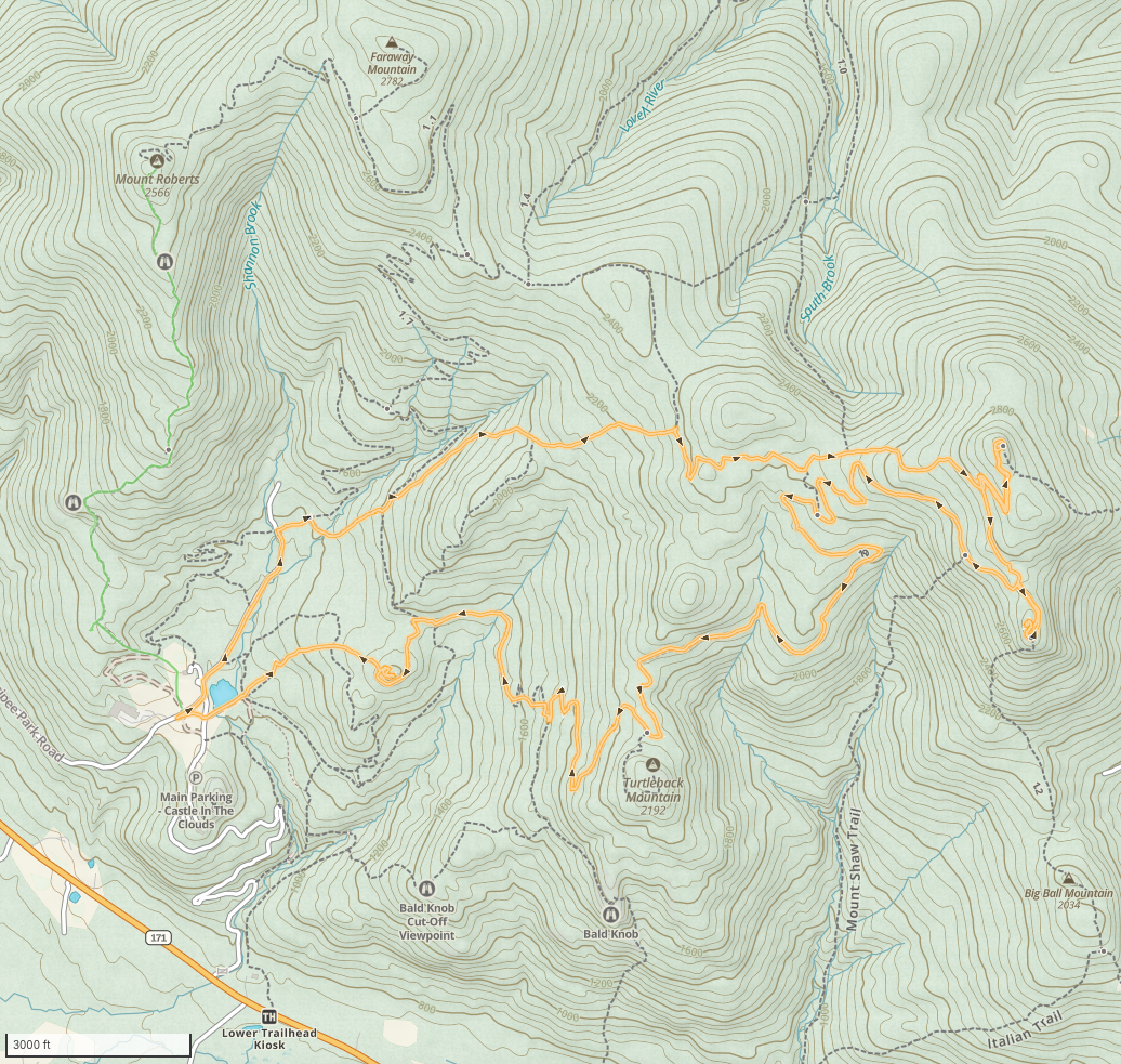
Travel clockwise from the start near the pond at left.
