
On our fourth day in Grindelwald we took two hikes. We spent the morning visiting Jungfraujoch, which (despite its intensely touristy nature) is an incredible place to visit. It is the highest train station in Europe, serving a structure that perches on a pinnacle at 3571m (11,716′) above sea level, adjacent to the snowfields surrounding the 4000m Alpine mountains of Eiger, Mönch, and Jungfrau. In this post I share a few impressions – and a gallery of photos of our walk across the snowfield to the hut at Mönchsjochütte, on an astonishingly gorgeous day.
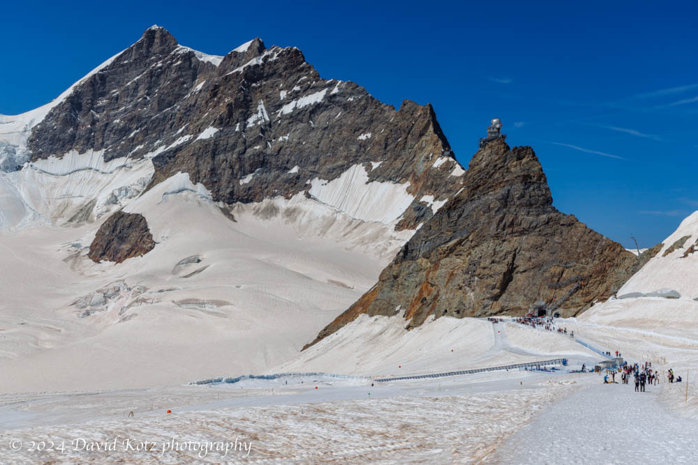
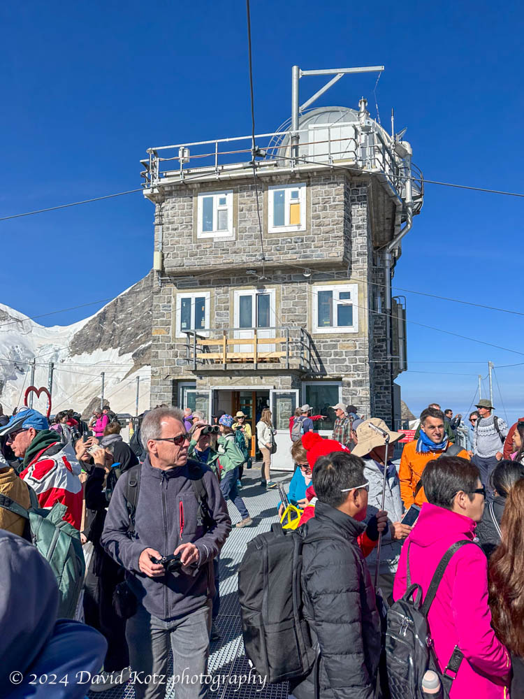
The trip to Jungfraujoch is heavily promoted across Switzerland – so much so, that I deliberately avoided a visit during our year living in Switzerland. On this trip, though, many in our group decided it was worth seeing once. Indeed, on a day like today, it is! We boarded the train at Kleine Scheidegg, a station (at the base of the storied north face of the Eiger) that is already at the rather high altitude of 2061 m (6,762 ft). This mountain train was built between 1896 and 1912; a truly stunning feat of engineering, the line is almost entirely a tunnel inside the mountains of the Eiger and Mönch, terminating inside a rocky mound in the col between Mönch and Jungfrau. Today, it opens into a multi-story structure, partly inside the rock and partly perched on top; part museum, part shopping mall, part research station, it receives hundreds of visitors a day.
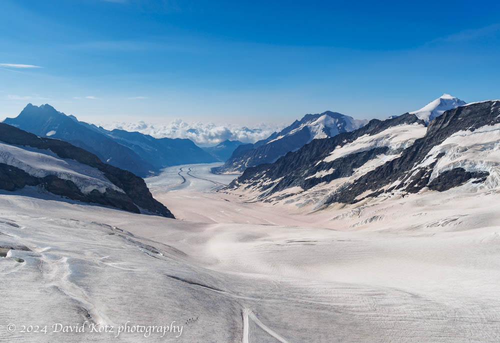
It was fun to be at the head of the Aletsch Glacier – the largest glacier in the Alps – because I had hiked along the foot of that same glacier almost exactly four years earlier, in 2020.
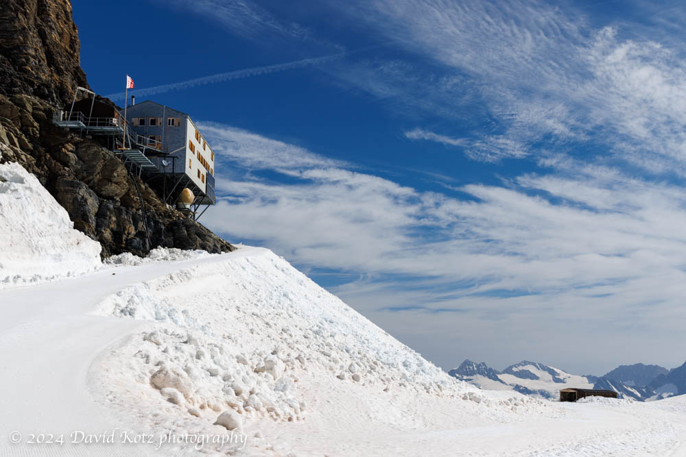
We spent little time inside the Jungfraujoch structure, preferring instead to step out onto the snowfields where freshly-groomed trails led to amusements (like ziplines and snow tubing) or to various climbing routes. We traversed the snowfield to Mönchsjochhütte, an alpine hut perched on the shoulder of Mönch at 12,000′, and stopped inside for a pot of tea and cakes. What a glorious day!
Be sure to check out the gallery of photos! Much more to see there.
Hike stats:
Distance: 7.7km (less, actually, because of GPS glitch)
Time: 3h25m (including exploration of Jungfraijoch, and the hut)
Gain: 475m (less, actually, because of GPS glitch)
(the map below shows a GPS glitch at right, where my phone imagined I had hopped over to the mountainous ridge at right, and back, instantaneously!)
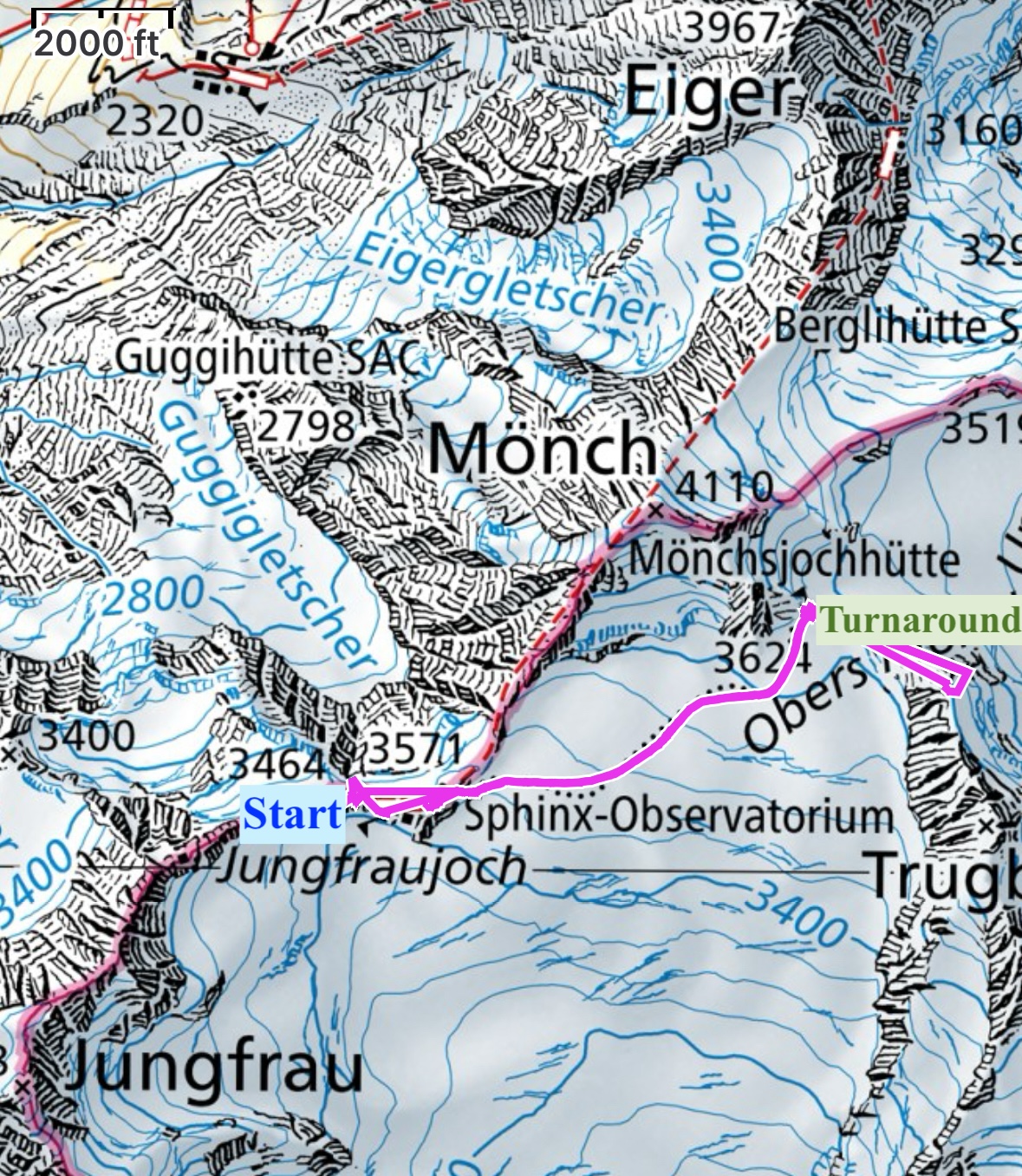
ignore the glitch where it takes a jog to the east of the hut, and back.
Elevations in meters.

2 thoughts on “Grindelwald – Jungfraujoch”