
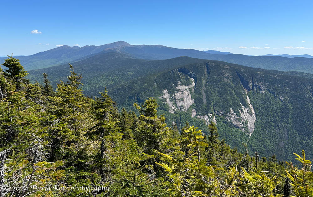
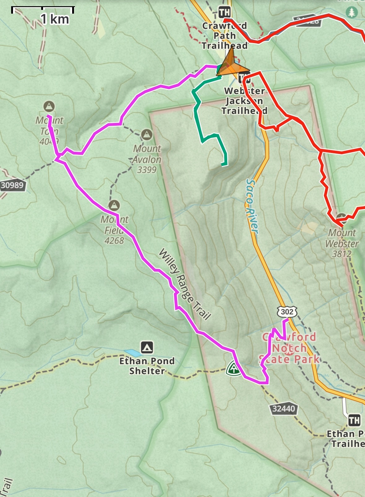
In my continuing effort to re-visit some of New Hampshire’s tallest peaks – those 48 peaks over four thousand feet – I joined two friends today to walk the forested range on the west side of Crawford Notch: Mounts Willey, Field, and Tom. This threesome offers a steep climb, a pleasant up-and-down ridge walk, and a few spectacular views to the east (the southern Presidential Range, including Mount Washington), to the west (the Pemigewasset Wilderness), and to the south (Mount Carrigain and the peaks along the Kancamagus Highway). Check out the photo gallery, and read on!
We had an early start, ensuring us parking at both Crawfords (our endpoint) and at Willey House (our starting point). With two cars we could hike this range end-to-end with minimal backtracking.
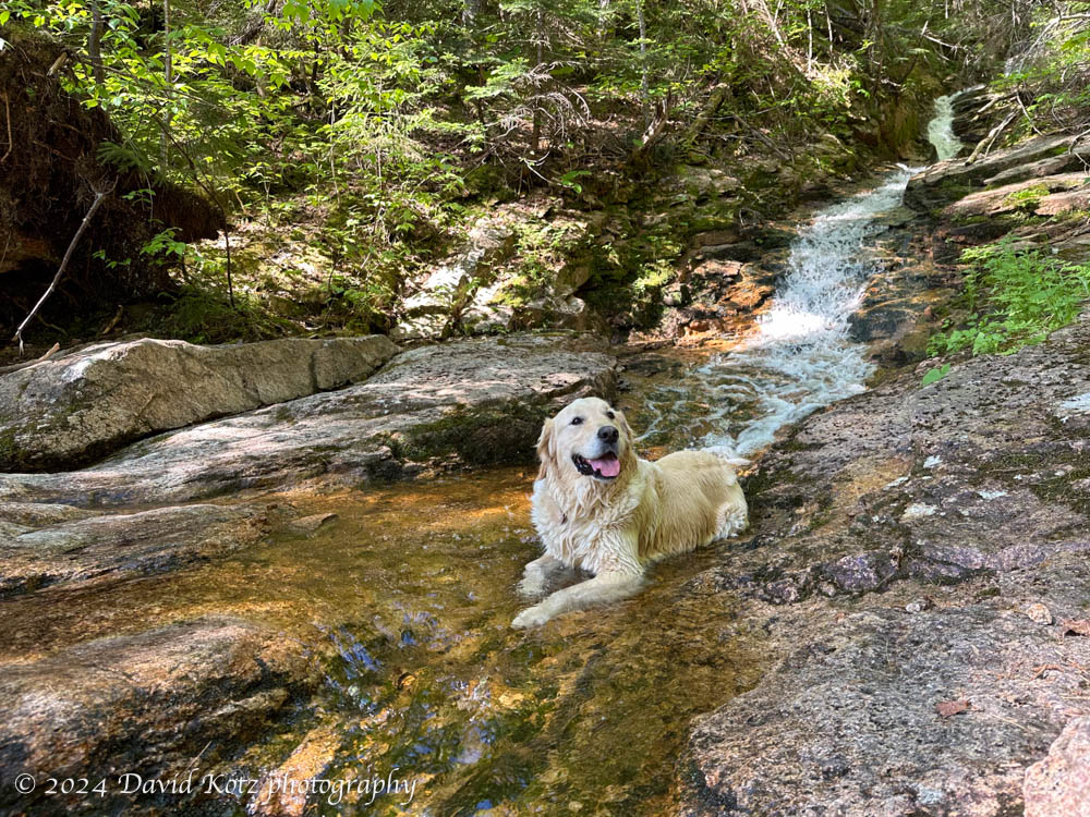
The climb to Mount Willey was steep, especially toward the end. Our canine companion – the friendly and energetic dog named “Karhu” – was always eager to wallow in a stream or mudpuddle, keeping cool as the day grew warmer.
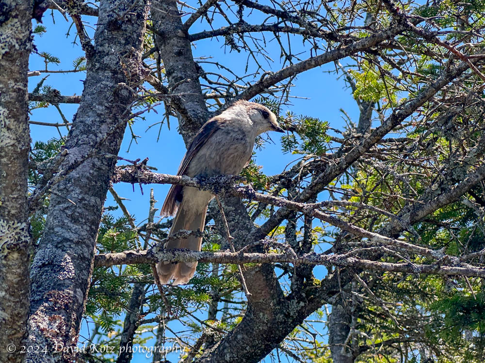
We made good time and soon hit the summit of Mount Willey, with its splendid views across Crawford Notch and into the Presidential Range. From there it was a matter of bumping along the ridgeline to Mount Field (with limited views) and Mount Tom (with no views at all). I first met Gray Jays on these peaks over thirty years ago and was not surprised to see them here still, begging for nuts and snacks from every hiker who passed by.
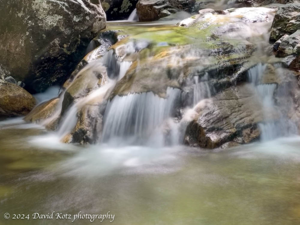
The final leg was 2.3 miles down the A-Z and Avalon trail to Crawford Notch, with opportunities to view pretty cascades along the way.
We capped off the day with ice cream at Willey House. Every trailhead should have an ice-cream shoppe!
Check out the photo gallery for more.
Hike stats:
Distance: 7.74 miles (12.5km)
Gain: 3536 feet (1078m)
Time (with stops): 6h49m

One thought on “Willey, Field, and Tom”