
As I drove north in the early twilight, the few clouds slowly became tinged pink, then bright orange. I turned onto NH Route 25A and headed due east, the road ahead was illuminated in a brilliant orange display as the sun rose into the clouds. A broad smile spread on my face as I realized I had made the right choice; the forecast had indicated a slight chance of snow or (later) rain, but things were looking awfully darn good for an early-morning late-fall hike. Did it hold? read on.
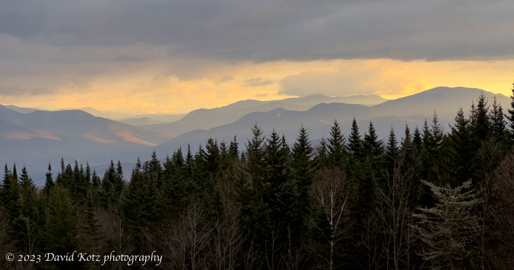
Soon I was winding my way up NH Route 118 and over the shoulder of Mount Moosilauke. I winked at the Ravine Lodge access road as I passed by – the lodge closed last weekend – and gently followed the curve over the pass and down the other side. A light snow had begun to fall, and the road was swirling with dry snow flurries. I pulled over at the viewpoint to enjoy the sunrise over the Franconia and Kancamagus valleys, shown above, and could see the snow flurries sprinkling their magic here and there across the landscape. It could be an interesting day. My goal was in the distance at left-center of the photo above: Potash Mountain, one of the “52 with a view”.
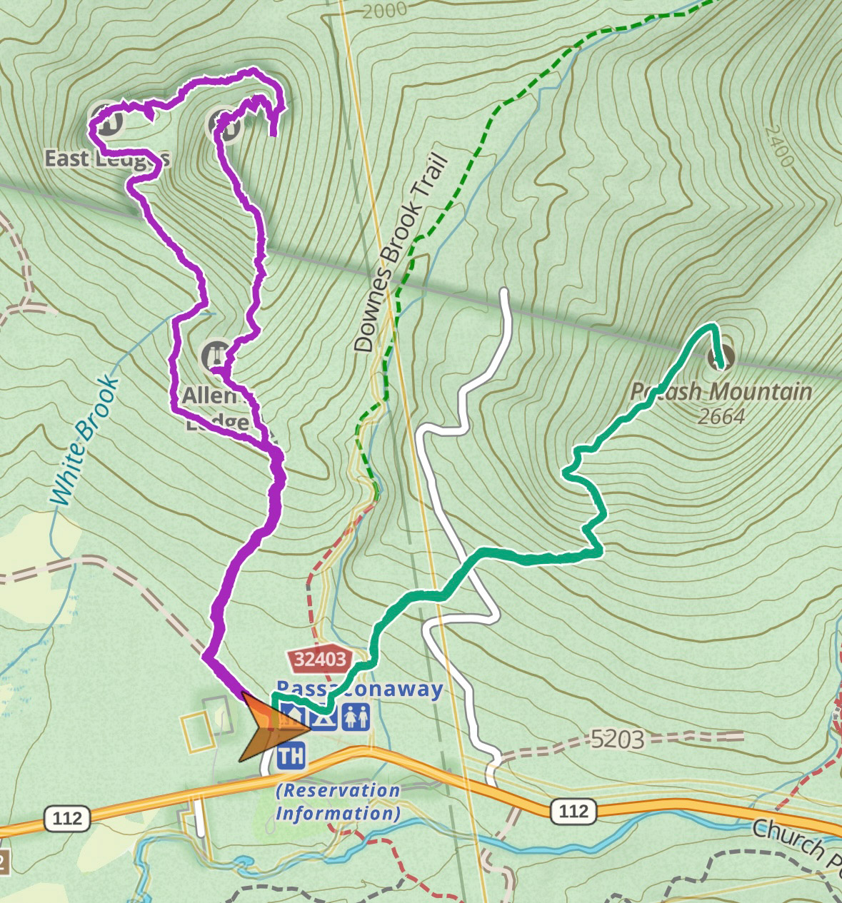
The flurries came and went as I passed through Lincoln and on to the Kancamagus highway. As I pulled into the trailhead the flurries were barely noticeable, and I realized I’d seen this spot before – 26 months earlier, on a hike of Hedgehog Mountain. Today I would turn right instead of left, and head up Potash Mountain – or Mount Potash, it’s never quite clear.
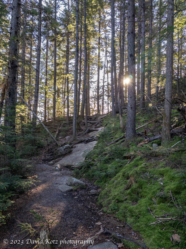
It was a fine morning for a hike, crisp and clear, with the lower section of the trail covered in a heavy blanket of leaves, and the upper section of the trail passing through a grand forest of hemlock and fir. Soon I came to a sunny ledge looking southeast into the Sandwich Range, where Mount Passaconaway (my goal from just a few months ago) loomed large.
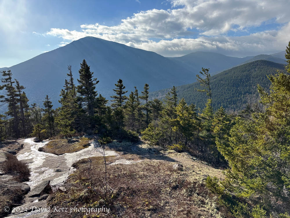
After circling around the east side of the “summit cone”, the Mount Potash trail climbs steeply up the granite slabs – today mostly dry but with thin patches of ice that could have made for a dangerous fall – to the summit. Here there are fine views to the north, across the Kancamagus Highway to Mount Carrigain and the Pemigewasset Wilderness.
Whiteface is a bit in the clouds, getting more snow flurries.
On the summit was a tiny cairn – one that included two small painted rocks, left by previous visitors. I’m not sure how I feel about that. On the one hand, they were pretty rocks, nicely done. On the other hand, they are not natural, spoiling the “leave no trace” ethic. What do you think? Check out the gallery for photos of those rocks, and more: both the tiny up-close views along the trail, and the grand landscapes. Videos too!
Hike stats:
Distance: 6.5km
Time: 2 hours
Elevation gain: 429m

A cairn is not natural, with or without painted rocks. The painted rocks seem harmless.