
Last weekend I was lucky to snag the last parking spot at the trailhead for the Osceola peaks, even at 7:30am on a Sunday morning. Today I could not find any parking near my desired trail, in the heart of the White Mountains of New Hampshire. I found a parking lot –distant but empty – for a roadside waterfall, and studied the map. I could walk back up the road (emphasis on UP!) or I could bushwhack alongside the waterfall and its brook and join the trail further up slope. It was super steep… but the route would avoid a roadwalk and save time, right? I decided to go for it; wow, was I in for a treat! Sometimes a little bad luck turns into an outstanding opportunity. Read on!
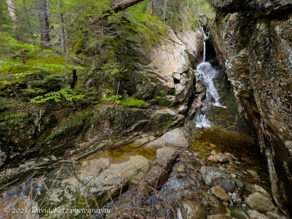
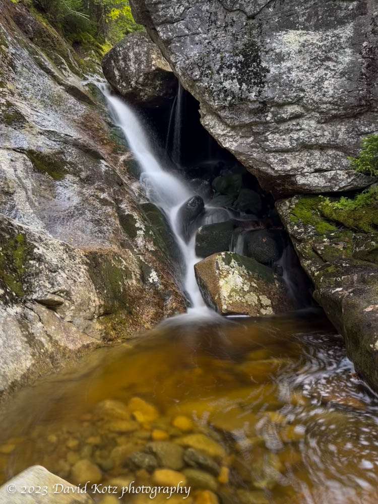
I was in Crawford Notch, at the southern tip of the Presidential Range. I drove through the notchiest part of the Notch, and headed downhill, arriving at a small parking lot opposite Flume Cascades. Most people stop here for less than five minutes, hopping out of their car to photograph the cascades visible from the road. I found a clear herd path leading up the east side of the stream, and was treated to an amazing and seemingly endless series of cascades and waterfalls. It was incredibly steep – 644′ in half a mile – but worth every step. Check out the gallery!
Warning – I do not recommend bushwhacking, especially up a brook like Flume Cascades, except for extremely experienced hikers. It is challenging and dangerous.
Once I reached the trail my pace quickened and I headed up the Webster-Jackson trail. I soon reached the trail junction, then turned right to follow a counter-clockwise loop over the summits of Mount Webster (3910′) and Jackson (4052′). Heading for Webster first, I immediately encountered the beautiful cascade of Silver brook.

I passed dozens of other hikers (gosh, it is getting crowded in the woods!) but enjoyed a few minutes on each summit to take in the views. Webster and Jackson each have a lot to offer, but it was unusually hazy today. Below, we can look north along the route my friends and I followed along the southern Presidentials, on Memorial Day. Today the mountain-top views were not so grand, so I am doubly glad I had so many wonderful waterfall views.

(Mount Washington is the highest point visible.)
Eli Burakian’s excellent guidebook, Climbing New Hampshire’s 48 4,000 Footers, notes that “Mount Jackson is the only official 4,000-foot peak in the [Presidential] range that is not named for a US President,” as one might assume. The mountain is named for “Charles T. Jackson, a geologist who was responsible for the first geological survey of New Hampshire.”
A few of the hardwood trees are starting to turn – I saw an early red maple, and several yellow trees. I also encountered a curious fungus (yellow), countless hobblebush and sumac berries (bright red), and an odd scat filled with berries. More in the Gallery of photos!

All photos were taken with an iPhone 14 Pro. I experimented with waterfalls, snapping “live photos” and then turning them into long-exposure photos to obtain that ‘silky’ look to the water. I learned that it is especially important to hold the camera steady, so only the water will be blurred by the process.
Hike stats:
Distance: 5.9 miles (9.5 km)
Gain: 2341′ (714m)
Time: 4.o hours, including stops


One thought on “Webster & Jackson”