
Finally, on the 5th of March after two days at sea en route from the Falkland Islands, we approached the shores of South Georgia island just as the sun rose over its shoulder. Watch this brief video panorama as the ship approaches Right Whale Bay on the northern shore at the west end of the island.

Where is South Georgia Island – and what makes it such a special place? Read on for an overview of our action-packed five-day visit to this incredible corner of Planet Earth.

My father has been eager to visit South Georgia Island – a wild and remote island in the South Atlantic Ocean – for nearly a quarter century, after his visit to Antarctica in 1999. So, this morning’s first glimpse of the rugged shores and glacier-capped peaks was thus especially exciting.
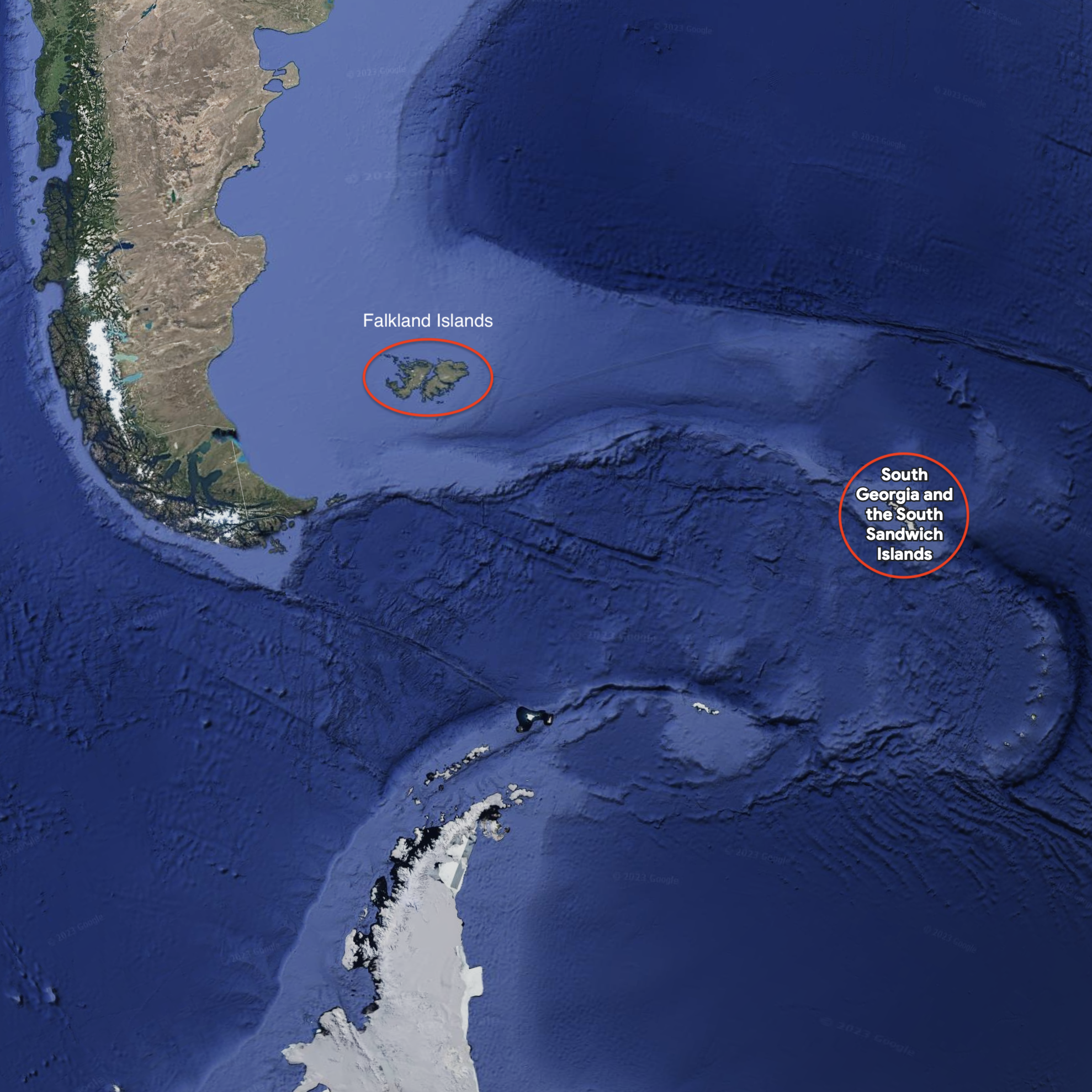
South Georgia is a remote Island far to the east of Tierra del Fuego, located atop the undersea ridge formed where tectonic plates are colliding; in the image below you can clearly see where a plate is pushing eastward and slowly tearing Antarctica from South America. (Here’s a zoomed-out view and a detailed map.) South Georgia, and the South Sandwich Islands (a bit further clockwise around that loop and just barely visible as dots in the center-right of the image below), are a semi-autonomous British Overseas Territory (like the Falkland Islands, but with no permanent inhabitants). “Discovered by Europeans in 1675, South Georgia had no indigenous population due to its harsh climate and remoteness. … The main settlement and the capital today is King Edward Point near Grytviken, a British Antarctic Survey research station, with a population of about 20 people.”
So is South Georgia in the Antarctic? It depends on how you define it. Politically, the Antarctic is the polar region south of 60º south latitude. Astronomically, the Antarctic Circle currently runs 66°33′49.5″ south of the Equator. South Georgia lies between 54-55º south so it is not ‘Antarctic’ by those definitions… but there is a more relevant ecological definition. Oceanographically, the Antarctic is defined by the Antarctic Convergence.
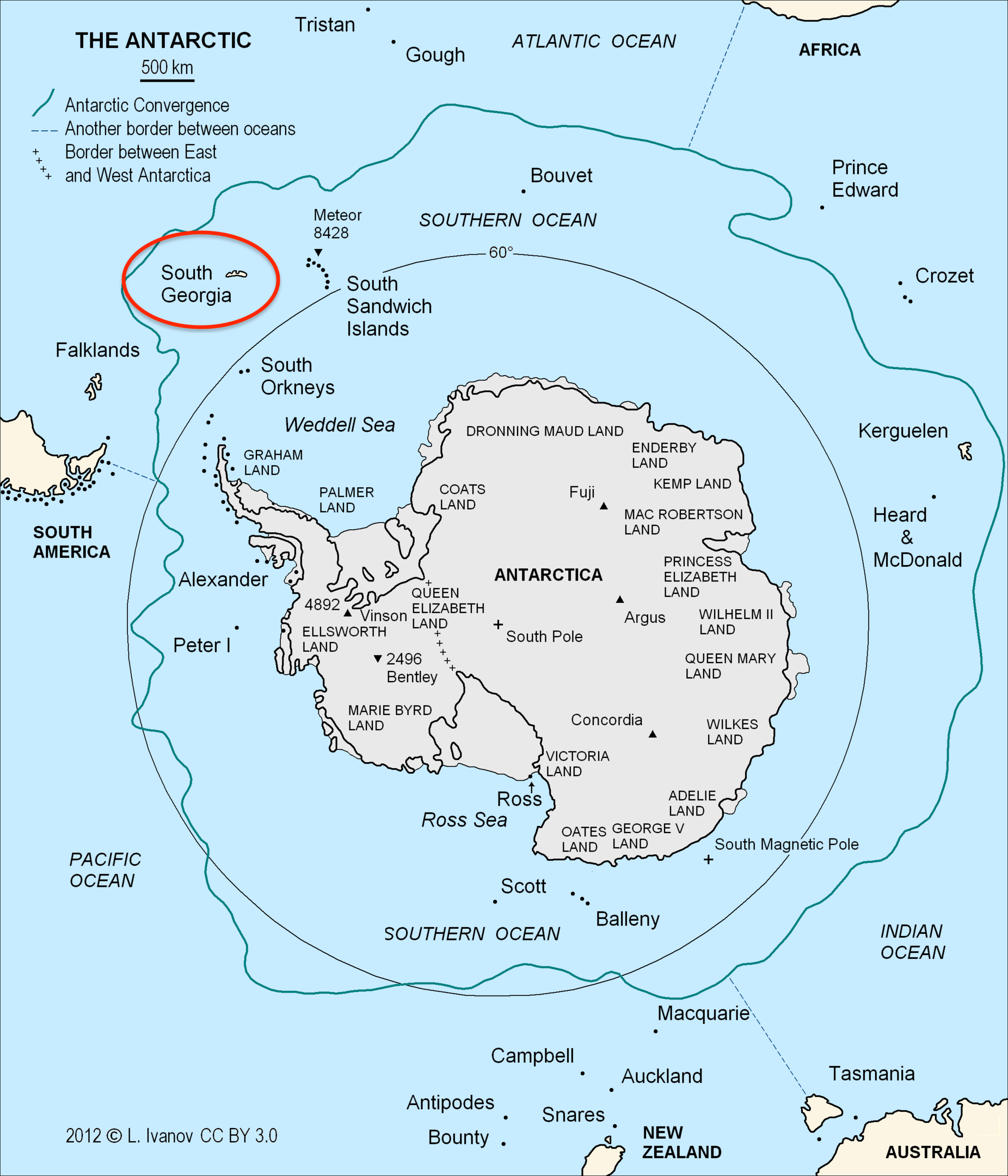
“The Antarctic Convergence or Antarctic Polar Front is a marine belt encircling Antarctica, varying in latitude seasonally, where cold, northward-flowing Antarctic waters meet the relatively warmer waters of the sub-Antarctic. Antarctic waters predominantly sink beneath the warmer subantarctic waters, while associated zones of mixing and upwelling create a zone very high in marine productivity, especially for Antarctic krill.” [Wikipedia]
The map below (also from Wikipedia) shows the approximate boundary of the Antarctic Convergence; South Georgia’s proximate location makes its waters ecologically rich with krill – and thus attractive to penguins, seals, whales, and seabirds, many of which migrate to and from the Antarctic Peninsula.
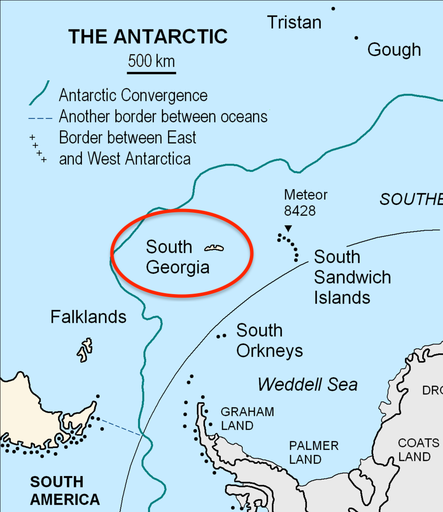
Below is a closer look.
Why South Georgia?
What makes South Georgia such a spectacular place to visit? First, its rugged beauty of rocky shores and glacier-capped peaks; second, its fascinating history of sealing, whaling, and Antarctic exploration; and third, the incredible wildlife. Oh, the wildlife! penguins by the million, seals by the thousand, and whales by the hundred. There is no other place on earth quite like it – not even Antartica itself. In subsequent posts I look forward to sharing our many encounters with its amazing wildlife.
We spent about four and half days cruising the northern and eastern shore of South Georgia. (The western shore bears the full brunt of the circumpolar winds and currents – landing sites are few, and the weather is incredibly rough.) The ship captain and expedition crew did an outstanding job monitoring weather and sea conditions, moving us each night to a new location where the favorable conditions would allow us to land and explore. Later, I learned from the crew that they have been on few – if any – expeditions where the weather was so fine, allowing them to land at every desired location. (More maps in the gallery.)

- Right Whale Bay (5 March)
- Salisbury Plain (5 March)
- Gold Harbor (6 March)
- Cooper Bay (6 March) – zodiac tour
- Drygalski Fjord (6 March) – cruising on the ship
- Maiviken (7 March) – hike to Grytviken
- Grytviken (7 March)
- Godthul (7 March) – kayak tour, and icy swim!
- Ocean Harbor (8 March)
- St Andrews Bay (8 March)
- Fortuna Bay (9 March) – hike to Stromness via Shackleton’s route
- Stromness (9 March)
After departing Stromness at lunchtime, we headed back to the Falkland Islands – half a day cruising along the coast of South Georgia, and two days across the open sea. But first: a series of posts about each of the locations above.

2 thoughts on “South Georgia”